The best traffic-free bike rides in the Coast Range
4.6
(847)
22,282
riders
323
rides
No traffic touring cycling routes in the Coast Range traverse a diverse system of mountain ranges along the Pacific Coast of North America. This region features a dramatic environment, transitioning from open sandy dunes and rocky shorelines to lush temperate rainforests and dense coniferous forests. Cyclists can expect panoramic views of the Pacific Ocean, coastal valleys, and low mountains covered in old-growth forests. The landscape is characterized by steep ravines, moss-lined creeks, and significant elevation changes, offering varied terrain for touring cyclists.
Best no traffic touring cycling routes in the Coast Range
- The most popular no traffic touring cycling route is Mount Diablo via North Gate and Summit Roads, a 10.4 miles (16.8 km) trail that takes 2 hours 6 minutes to complete. This difficult route offers significant climbs and panoramic views from Mount Diablo.
- Another top favourite among local touring cyclists is Palomares Road from Niles Canyon, a moderate 9.7 miles (15.7 km) path. This route winds through scenic canyons with a steady ascent, providing a rewarding experience.
- Local touring cyclists also love the Mount Diablo and Iron Horse Trail Loop, a 33.1 miles (53.2 km) trail leading through varied terrain including paved roads and dedicated trails, often completed in about 3 hours 33 minutes.
- Touring cycling in the Coast Range is defined by rugged coastlines, dense coniferous forests, and scenic rivers. The network offers options for different ability levels, from challenging climbs to more accessible paths.
- The routes in Coast Range are highly rated by the komoot community with an average score of 4.6 stars from more than 700 reviews. More than 21,000 touring cyclists have used komoot to explore Coast Range's varied terrain.
Last updated: August 3, 2026
6
riders
16.8km
02:06
1,000m
50m
Embark on a challenging touring bicycle ride up Mount Diablo via North Gate and Summit Roads. This difficult route spans 10.4 miles (16.8 km) and demands a significant effort, with an elevation gain of 3268 feet (996 metres). As you climb, the paved road winds past ranch buildings and pastures, gradually revealing increasingly spectacular scenic vistas. You can expect to complete this ascent in about 2 hours and 6 minutes, pushing yourself on one of the Bay Area's toughest climbs.
When planning your visit, remember that this route is located within Mount Diablo State Park. Cyclists are exempt from paying park entrance fees, which is a nice bonus. Be prepared for varying temperatures and potential strong winds as you approach the summit. It is crucial to bring plenty of water, as much of the route is exposed to the sun, especially during warmer months. Traffic on North Gate Road is generally light, but always stay alert.
The reward for your strenuous effort is a breathtaking 360-degree panorama from the Mount Diablo Summit. On a clear day, the views extend up to 200 miles in all directions, offering glimpses of the entire Bay Area, the vast Central Valley, and even the snowcapped Sierra Nevada mountains. This unique vantage point makes the climb a truly memorable experience, showcasing the diverse landscapes of California from a single peak.
15.7km
01:09
340m
280m
Cycle the Palomares Road from Niles Canyon, a moderate 9.8-mile touring route through a wooded canyon with rustic homes and green hills.

Sign up for free
5.0
(5)
98
riders
53.2km
03:34
760m
760m
Embark on a challenging touring bicycle adventure with the Mount Diablo and Iron Horse Trail Loop, a route that spans 33.1 miles (53.2 km) and features a significant 2481 feet (756 metres) of elevation gain. This difficult ride, typically completed in about 3 hours and 33 minutes, offers a dramatic contrast in scenery. You will start on the mostly flat, paved Iron Horse Trail, winding through urban and suburban areas shaded by trees, before transitioning to the strenuous mountain climbs of Mount Diablo. As you ascend, you'll be rewarded with increasingly expansive panoramic views, reaching up to 200 miles on a clear day from spots like Curry Point and the summit, encompassing the Sierra Nevada mountains and the entire Bay Area.
When planning your visit, be aware that this route combines the gentle, service-rich sections of the Iron Horse Trail with the more isolated, demanding ascents of Mount Diablo. While towns along the Iron Horse Trail offer convenient amenities, services become very limited once you begin climbing Mount Diablo. Therefore, it is crucial to prepare adequately for hydration, nutrition, and potential weather changes, especially when tackling the mountain portion of your ride. Consider starting early to make the most of daylight and cooler temperatures on the climbs.
This unique loop is notable for its blend of two distinct cycling environments, offering an
3.3
(3)
41
riders
35.7km
02:53
740m
740m
Cycle the East Bay Skyline Trail Loop, a difficult 22.2-mile route with 2431 feet of gain and panoramic Bay Area views.
3.8
(4)
17
riders
32.7km
01:56
130m
130m
The Contra Costa and Ygnatio Canal Trails Loop offers a delightful touring cycling experience, winding through a varied landscape that includes tranquil, tree-lined canal paths and open spaces with distant views of Mount Diablo. You'll cycle past urban parks like Heather Farm Park, where ducks often gather, and alongside the Boundary Oaks golf course on the Ygnacio Canal Trail, even passing through a distinctive, well-lit tunnel under Ygnacio Valley Road. This easy 20.3-mile (32.7 km) route with a gentle 431-foot (131 metres) elevation gain is predominantly paved, making it a smooth ride that takes about 1 hour and 55 minutes.
Planning your ride is straightforward, as the trail is well-maintained and offers convenient amenities. Restrooms and water fountains are available at parks such as Arbolado Park, Heather Farm Park, and Los Juntas Park along the way. Heavily trafficked road crossings are clearly marked and equipped with crosswalk buttons for safety, ensuring a relaxed and accessible journey for all.
This loop is a fantastic option for a leisurely bike ride, suitable for all skill levels, including beginners. It's considered a "whole access" trail, welcoming wheelchairs and strollers, and provides a unique blend of natural and urban environments within the East Bay Regional Park District. Keep an eye out for various bird species attracted to the Contra Costa Canal as you cycle.
Get access to more routes and recommendations from other explorers.
Sign up for free
Already have an account?
Our route recommendations are based on thousands of hikes, rides, and runs completed by other people on komoot.
Start today with a free account
Your next adventure awaits.
Login or Signup
Popular around Coast Range

Bay Area Ridge Trail — Circumnavigating the San Francisco Bay

California Coastal Trail — Following the coastline from Mexico to Oregon

Pacific Crest Trail from Mexico to Canada – 4,200 kilometres of wilderness

Bay Area Ridge Trail — Hiking the backbone of The Bay
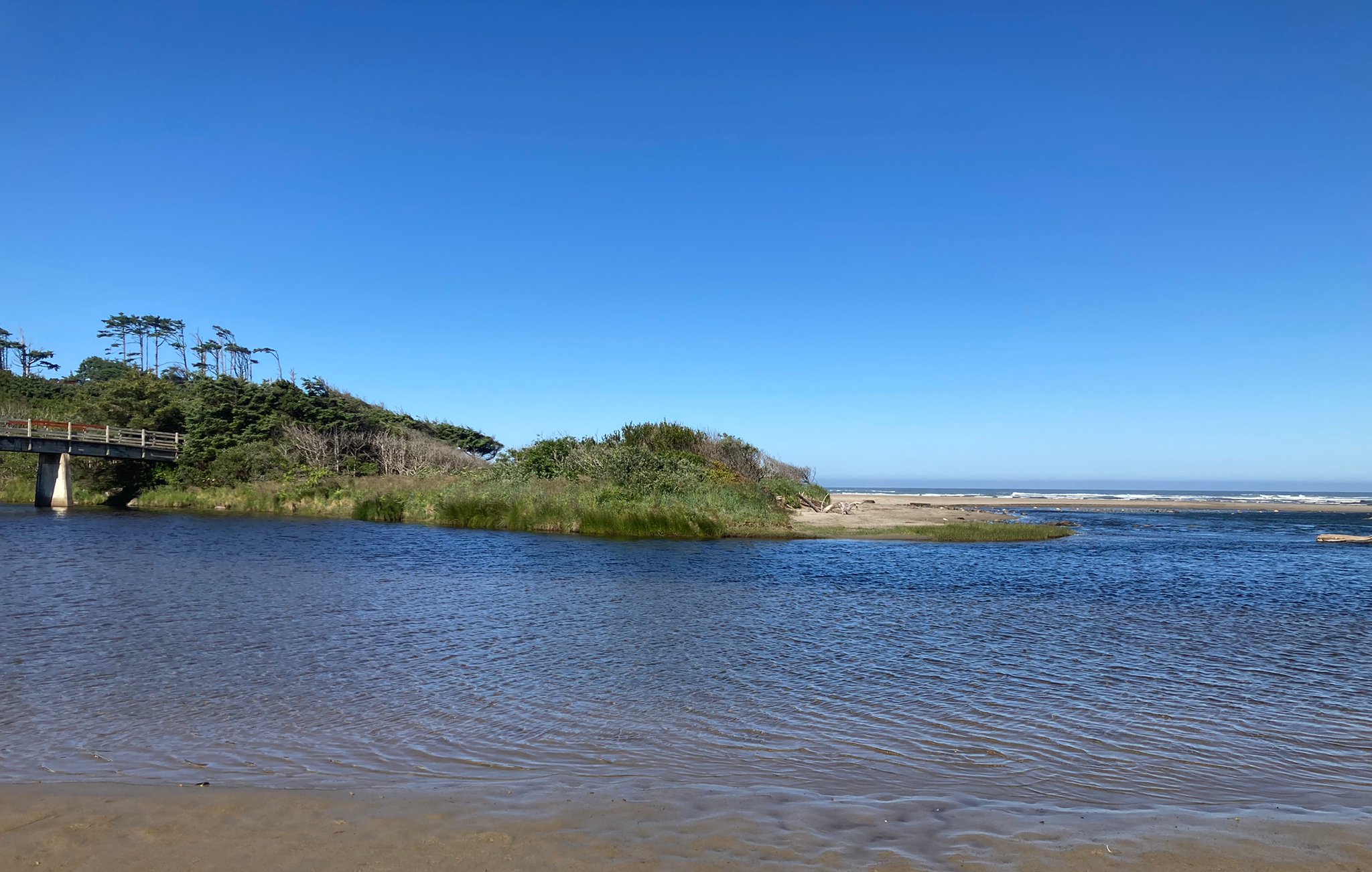
Corvallis-to-the-Sea Trail — Walk through wild Oregon

Bigfoot Trail — Exploring the remote Klamath Mountains
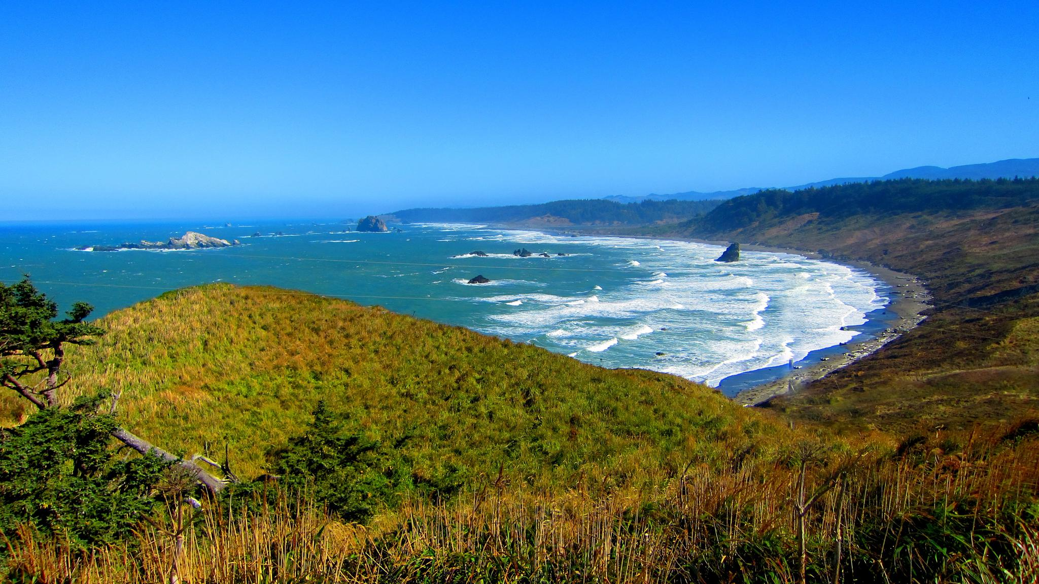
Oregon Coast Trail — An unforgettable walk along the Pacific's edge

Hiking treasures in the Bay Area

Traffic-free bike rides in the Coast Range
Traffic-free bike rides in the Coast Range
Other adventures in the Coast Range


Tips from the Community

Mount Diablo, is the Bay Area second-highest peak at 1173m (3849ft). The challenging climb features constantly fluctuating gradients averaging 8%, with tough sections up to 18% and a brutal 23% finish in the last 200m. The equally demanding descent requires good bike handling due to tight corners, potholes, and strong winds. The road to the top is open daily from 8 AM till sunset.
0
0

The Museum of the San Ramon Valley was established in 1985 and sits in a restored 1891 Southern Pacific Railroad Depot with the Victorian-era “Combination Station No. 22” listed on the National Register of Historic Places. The Official Visitor Information Center offers maps, guides, and knowledgeable staff, along with free parking and restrooms located in the caboose.
1
0

The Iron Horse Trail is a 32-mile multi-path that connects the towns of Concord and Pleasanton. It follows the route of the abandoned Southern Pacific Railroad. With its access to schools, business centers, and parks, the path is popular with commuters and recreationalists.
1
0
The Contra Costa Canal Trail stretches for several miles through the Concord Metro Area. The trail is mostly flat and paved, running alongside the Contra Costa Canal, passing through urban parks and open areas. It’s a great option for a leisurely stroll or bike ride.
1
0


One of the few working water spigots on Diablo. Always tastes cold and fresh.
0
0
One of the fiercest peaks in the Bay. Always worth the effort. It’s often much cooler on the summit than the rest of the trails — there is a water spigot up there to fill up bottles. Also a store is open at some times. Don’t bank on it.
0
0
A pedestrian bridge to cross over Ygnacio Valley Road.
1
0
Frequently Asked Questions
How many no traffic touring cycling routes are available in the Coast Range?
The Coast Range offers over 300 dedicated no traffic touring cycling routes. These include a wide variety of options, with approximately 100 easy routes, around 90 moderate routes, and over 120 challenging routes, ensuring there's something for every skill level.
Are there easy, family-friendly no traffic touring routes in the Coast Range?
Yes, the Coast Range features several easy and family-friendly options. For example, the Banks-Vernonia State Trail is a 21-mile car-free, paved rail-to-trail path, ideal for families. Many routes traverse lush temperate rainforests and offer gentle gradients, perfect for a relaxed ride. Look for routes marked as 'easy' in the guide, which make up nearly a third of all available tours.
What are some challenging no traffic touring routes for experienced cyclists?
For experienced cyclists seeking a challenge, the Coast Range delivers. Routes like the difficult Mount Diablo via North Gate and Summit Roads offer significant elevation gain over 16 km. Another demanding option is the Grizzly Peak Loop, which covers over 37 km with substantial climbing. The region is known for bona fide climber's challenges, rewarding riders with panoramic views from higher elevations.
What kind of natural attractions can I expect to see along these routes?
The Coast Range is rich in natural beauty. You can expect to cycle through majestic redwood forests, especially in areas like Redwood National Park, and enjoy breathtaking coastal vistas with craggy pines and rock formations. Many routes pass by scenic rivers, and you might even encounter picturesque waterfalls like those near Florence or Little Yosemite. Other highlights include tranquil lakes and reservoirs, and diverse forests of Douglas fir and hemlock.
Are there any historical sites or cultural points of interest along the no traffic routes?
Yes, the Coast Range offers cultural and historical points of interest. Cyclists can explore areas with historical significance, such as the Museum of the San Ramon Valley, housed in an 1891 Southern Pacific Railroad Depot. The region also features remnants of century-old railroad tracks, adding a historical layer to your ride. For specific natural history, consider visiting Bear Gulch Cave or the Wheeler Gorge Tunnels and Bridge.
What is the best season for touring cycling in the Coast Range?
The Coast Range offers enjoyable cycling experiences throughout much of the year, but spring and fall generally provide the most pleasant conditions with mild temperatures and less precipitation. Summer can be excellent, especially along the coast, though inland areas might experience warmer temperatures. Winter cycling is possible, particularly on lower elevation routes, but requires checking weather forecasts for rain and potential colder conditions.
Can I find circular no traffic touring routes in the Coast Range?
Absolutely. Many no traffic touring routes in the Coast Range are designed as loops, allowing you to start and end at the same point. A notable example is the Mount Diablo and Iron Horse Trail Loop, offering a diverse ride. The region also features loops around natural features like the Briones and San Pablo Reservoirs, providing varied terrain and scenic views.
How can I access these no traffic touring routes using public transport?
Access to no traffic touring routes via public transport varies by specific location within the Coast Range. Some trailheads, especially those closer to urban centers or state parks, may be accessible by local bus services or regional transit. It's recommended to research specific route starting points and check local public transport schedules and bicycle carriage policies for the most accurate information.
Where can I find parking for no traffic touring cycling routes in the Coast Range?
Parking is generally available at designated trailheads, state parks, and regional open space preserves throughout the Coast Range. Many popular no traffic routes, especially those that are part of larger park systems, offer dedicated parking lots. Always check the specific route details or park websites for information on parking availability and any associated fees before your ride.
What do other cyclists say about the no traffic touring routes in the Coast Range?
The no traffic touring routes in the Coast Range are highly rated by the komoot community, with an average score of 4.59 out of 5 stars from over 750 reviews. Reviewers often praise the stunning natural beauty, the tranquility of car-free paths, and the diverse landscapes ranging from coastal views to deep redwood forests. Many highlight the rewarding climbs and the sense of immersion in nature.
Are there any routes that feature waterfalls or significant water bodies?
Yes, the Coast Range is home to numerous scenic water features. You can find routes that pass by picturesque waterfalls, such as those near Florence, or explore areas like Little Yosemite. Additionally, many routes offer views of tranquil lakes and reservoirs, including Henry Hagg Lake, Battle Lake, and the Briones and San Pablo Reservoirs, providing serene settings for your ride.
Are there any hidden gems or less-known no traffic routes worth exploring?
While specific 'hidden gems' can be subjective, the Coast Range has many less-trafficked areas that offer unique experiences. Exploring routes within the vast Siuslaw National Forest or venturing into the Tualatin Valley can reveal quieter paths connecting vineyards, breweries, and natural scenery away from the more popular coastal trails. Look for routes with fewer reviews on komoot to discover your own secluded adventure.
Most popular routes in the Coast Range
Most popular attractions in the Coast Range

Get inspired with the komoot mobile app


Explore more
Browse the best Cycling routes in other regions.
