The best hikes from bus stations around Schleusegrund
4.6
(15430)
51,621
hikers
97
hikes
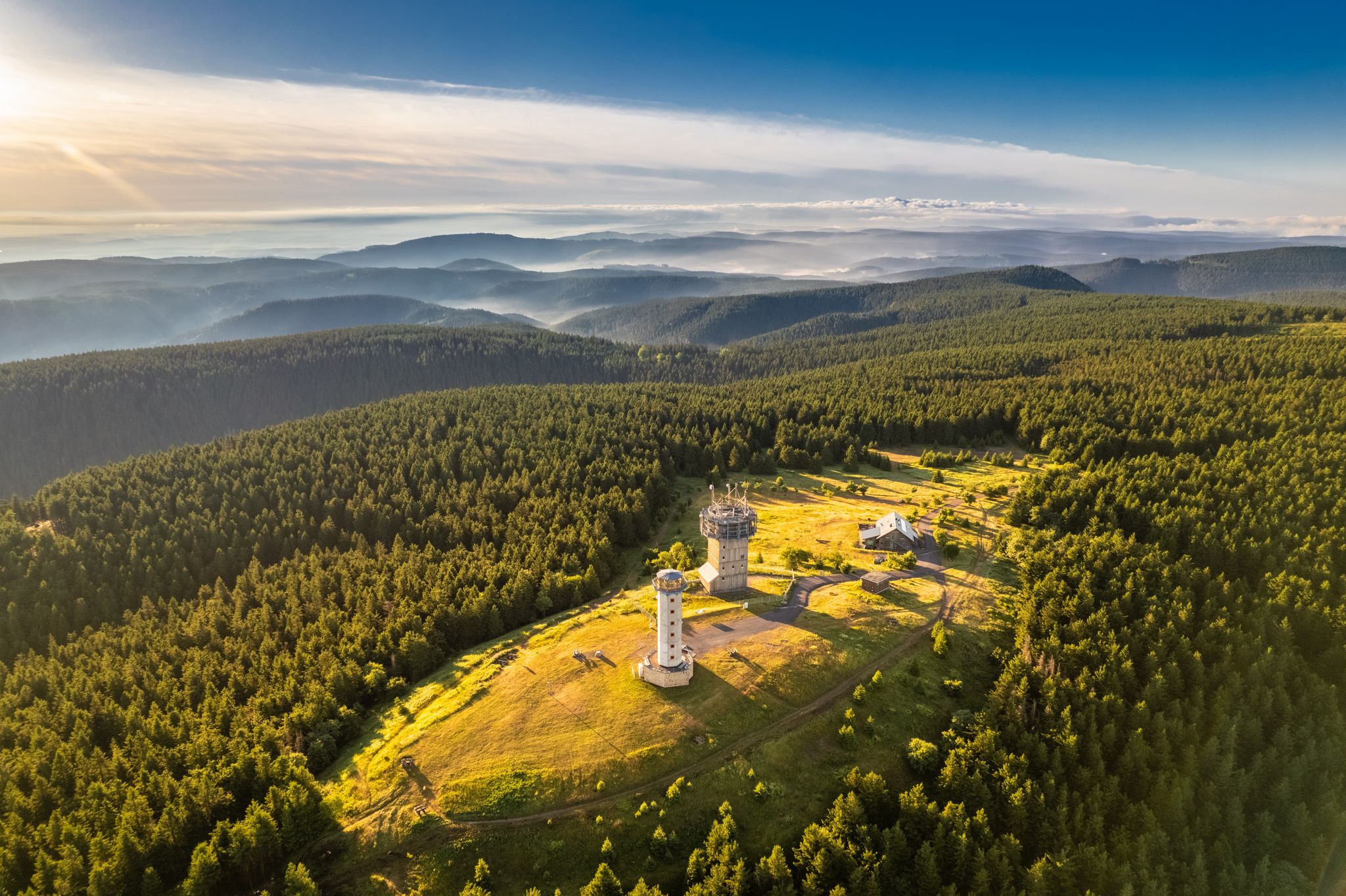
Bus station hiking trails around Schleusegrund are situated on the southwestern slope of the Rennsteig, within the side valleys of the Thuringian Forest. The region is characterized by large, contiguous forest areas, wild streams, and blooming mountain meadows. A notable feature is the Schönbrunn drinking water reservoir, offering a significant circular route. The historic Rennsteig ridge trail also traverses the area, providing diverse hiking opportunities.
Best bus station hiking trails around Schleusegrund
- The most popular bus station hiking route is View of the Schönbrunn Reservoir – Schönbrunn Reservoir loop from Schleusegrund, a 11.6 miles (18.6 km) trail that takes 5 hours 10 minutes to complete. This difficult route offers extensive views of the Schönbrunn Reservoir.
- Another top favourite among local hikers is Breitengrunder Pond – Helms Waterfall loop from Dreiherrenstein, a moderate 4.8 miles (7.7 km) path. This trail leads past the Breitengrunder Pond and the Helms Waterfall, offering varied natural scenery.
- Local hikers also love the Langertfelsen – Fehrenbacher Grund loop from Gießübel, a 9.9 miles (16.0 km) trail leading through the Fehrenbacher Grund valley and past the Langertfelsen, often completed in about 5 hours.
- Hiking around Schleusegrund is defined by large forest areas, wild streams, and the Schönbrunn drinking water reservoir. The network offers options for different ability levels, from easy strolls to more challenging routes.
- The routes in Schleusegrund are highly rated by the komoot community with an average score of 4.5 stars from over 1,100 reviews. More than 4,500 hikers have used komoot to explore Schleusegrund's varied terrain.
Last updated: November 11, 2026
4.7
(413)
1,184
hikers
Hard hike. Very good fitness required. Easily walkable paths.
4.8
(42)
159
hikers
7.72km
02:10
150m
150m
Moderate hike. Good fitness required. Easily walkable paths.

3.9
(48)
174
hikers
Easy hike. Easily walkable paths.
4.5
(8)
36
hikers
16.4km
05:07
530m
530m
Hard hike. Very good fitness required. Mostly walkable paths. Sure-footedness required.
4.8
(17)
44
hikers
13.6km
03:48
260m
260m
Moderate hike. Good fitness required. Easily walkable paths.
Get access to more routes and recommendations from other explorers.
Already have an account?
Our route recommendations are based on thousands of hikes, rides, and runs completed by other people on komoot.
Start today with a free account
Your next adventure awaits.
Popular around Schleusegrund

Tips from the Community

A truly original sculpture in the shape of a chair located directly on the Rennsteig.
4
0
The Große Dreiherrenstein (808 m) is a prominent historical border point and a central junction on the Rennsteig in the Thuringian Forest. The stone marks the historical border between the former lordships of Saxe-Weimar-Eisenach, Schwarzburg-Sondershausen, and Henneberg/Prussia.
5
0

The loop around the Schönbrunn reservoir is about 14 km. There are enough resting places and views to enjoy are included anyway.
0
0
Always relaxing and beautiful around the reservoir!
0
0

Top location on the Rennsteig: The proximity to the famous ridge trail allows for a combination of forest descents and ridge tours. Varied topography: Steep ascents from the Tannengrund or Reuscheltal demand stamina, but reward with brisk descents. Nature experience: The reservoir, with its bays, is reminiscent of a small fjord landscape in the middle of the dense low mountain forest. Tour combinations: Perfect as a stopover or turning point for larger loops, which often start in Schleusingen or Masserberg.
3
0
The Schönbrunn dam is located in the southern Thuringian Forest in the municipality of Schleusegrund (Hildburghausen district, Thuringia). It was commissioned in 1977. The dam is located about 20 kilometers south of Ilmenau and 15 kilometers northeast of Schleusingen. The river Schleuse is dammed. Source: https://de.wikipedia.org/wiki/Talsperre_Sch%C3%B6nbrunn#:~:text=Die%20Talsperre%20Sch%C3%B6nbrunn%20liegt%20im,Gestaut%20wird%20der%20Fluss%20Schleuse.
3
0
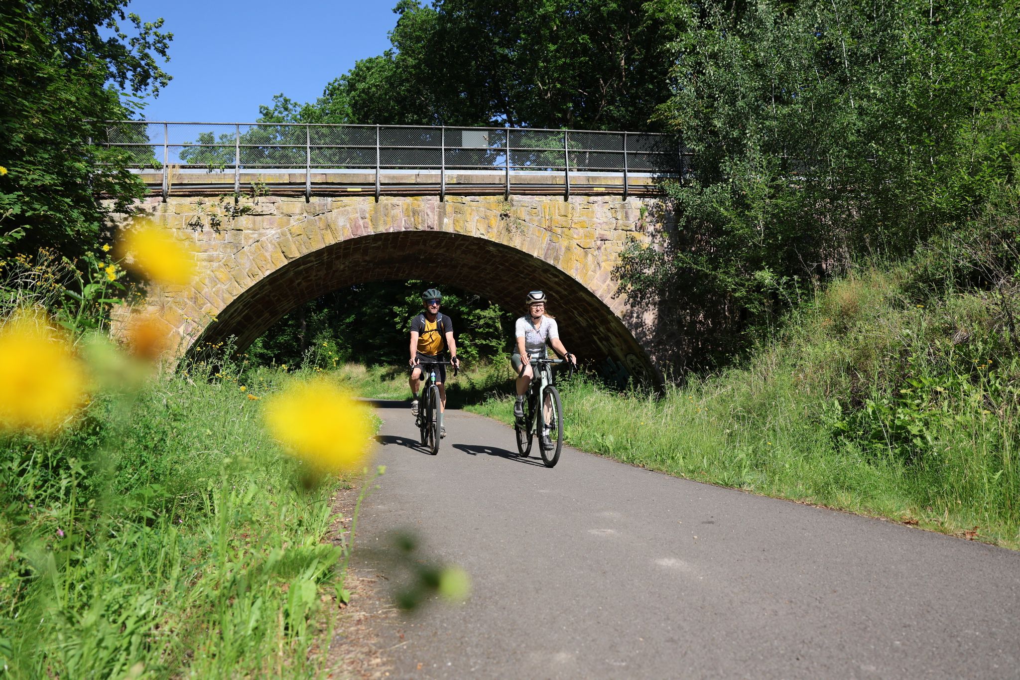
The Schönbrunn dam in the Thuringian Forest is attractive for mountain biking due to its charming combination of idyllic, flat shore paths and challenging, hilly ascents in the surrounding mountainous terrain around the Rennsteig. The circuit offers constant views of the blue water of the reservoir and the forest-rich heights of the Thuringian Forest.
3
0

The tour and the highlights are very beautiful. To note are the very narrow paths in places, very large fallen trees over these paths, which can only be bypassed or climbed over. I was out with a dog and it was beautiful due to the prickly blackberry bushes over the paths.
0
0
Frequently Asked Questions
How many bus station hiking trails are available in Schleusegrund?
There are over 90 hiking trails around Schleusegrund that are easily accessible from bus stations. These routes offer a variety of experiences, from leisurely strolls to more challenging treks through the Thuringian Forest.
Are there easy hiking trails accessible by bus in Schleusegrund?
Yes, Schleusegrund offers a good selection of easy hiking trails reachable by bus. With 21 routes rated as easy, you can find gentle paths perfect for a relaxed outing. These often lead through charming valleys or along the Schönbrunn Reservoir.
Can I find circular hiking routes starting from bus stations in Schleusegrund?
Absolutely. Many of the trails accessible by bus in Schleusegrund are circular routes, allowing you to start and end your hike at the same bus stop. For example, the Schönbrunn Reservoir loop from Schleusegrund offers a scenic, longer option. Another great choice is the Ochsenbacher Pond – Center of the Rennsteig loop from Dreiherrenstein, which is a moderate circular hike.
What kind of natural attractions can I see along these bus-accessible trails?
The bus-accessible trails in Schleusegrund often lead through diverse landscapes featuring large forests, wild streams, and blooming mountain meadows. You can discover beautiful viewpoints like the Kickelhahn Tower or the Rennsteigwarte on Eselsberg, offering expansive views. The region is also home to several waterfalls, such as the Helms Waterfall, which you can experience on routes like the Breitengrunder Pond – Helms Waterfall loop from Dreiherrenstein.
Are there any trails that pass by water features like reservoirs or springs?
Yes, the region is known for its water features. The Schönbrunn drinking water reservoir is a prominent natural landmark, with a 15 km circular route around it. You can explore parts of this on the View of the Schönbrunn Reservoir – Schönbrunn Reservoir loop from Schleusegrund. Additionally, the Werra Spring Fehrenbach, one of the sources of the Werra River, is a scenic spot within the area.
What do other hikers enjoy most about hiking in Schleusegrund?
The komoot community highly rates the hiking experience in Schleusegrund, with an average score of 4.5 out of 5 stars from over 1,100 ratings. Hikers often praise the region's diverse and picturesque landscape, the well-marked trails, and the opportunity to explore the UNESCO Thuringian Forest Biosphere Reserve.
Are there any challenging bus-accessible hikes for experienced hikers?
For experienced hikers, Schleusegrund offers several challenging routes accessible by bus. There are 6 difficult trails, including longer options that traverse more varied terrain and elevation. An example is the Langertfelsen – Fehrenbacher Grund loop from Gießübel, which provides a demanding yet rewarding experience.
What is the best time of year to hike in Schleusegrund using public transport?
Schleusegrund is beautiful year-round. Spring brings blooming mountain meadows, while summer offers lush forests. Autumn is particularly scenic with vibrant fall foliage. Even in winter, the area transforms into a destination for ski hiking through snowy forests, though trail conditions might vary. Public transport generally operates consistently, but it's always wise to check schedules, especially during off-peak seasons or holidays.
Are there any specific cultural or historical points of interest along the bus station trails?
Yes, Schleusegrund's trails often weave through a rich natural and cultural landscape. The Kickelhahn Tower, for instance, has connections to Goethe. The region also features the historic Rennsteig, a ridge trail with deep roots in Thuringian history. You might also find local history trails in villages like Schönbrunn.
Where can I find more information about the Schleusegrund region for planning my trip?
For general information about the Schleusegrund region and its offerings, you can visit the official tourism website: schleusegrund-tourismus.de. This can be helpful for understanding local amenities and events that might complement your hiking plans.
Are there any trails suitable for families with children, accessible by bus?
Many of the easy and moderate trails are suitable for families. The region's well-marked paths and diverse scenery, including wild streams and meadows, provide engaging experiences for children. Look for shorter, less strenuous circular routes, and consider trails that pass by attractions like the Adlersberg Observation Tower, which has a playground nearby.
Most popular routes around Schleusegrund
Most popular attractions around Schleusegrund

Get inspired with the komoot mobile app


Explore more
Browse the best Hikes in other regions.
