The best MTB trails around Schleusegrund
4.6
(1561)
3,780
riders
21
rides
Mountain biking around Schleusegrund offers diverse terrain within the UNESCO Thuringian Forest Biosphere Reserve. The region features extensive, contiguous forest areas, wild streams, and blooming mountain meadows, with altitudes ranging from 450 to 800 meters. This varied topography includes both challenging ascents and more gentle paths, making it suitable for different skill levels. The prominent Schönbrunn Reservoir also provides scenic routes and a central natural attraction for mountain bikers.
Best mountain bike trails around Schleusegrund
- The most popular mountain bike…
Last updated: September 29, 2026
4.3
(27)
59
riders
42.5km
03:50
880m
880m
Moderate mountain bike ride. Good fitness required. Advanced riding skills necessary.
4.8
(63)
137
riders
31.1km
02:14
590m
590m
Moderate mountain bike ride. Good fitness required. Suitable for all skill levels.

4.8
(14)
31
riders
37.3km
02:21
370m
370m
Moderate mountain bike ride. Good fitness required. Suitable for all skill levels.
4.8
(11)
18
riders
23.9km
01:55
530m
530m
Moderate mountain bike ride. Good fitness required. Advanced riding skills necessary.
5.0
(3)
8
riders
49.7km
04:19
1,060m
1,060m
Hard mountain bike ride. Very good fitness required. Advanced riding skills necessary.
Get access to more routes and recommendations from other explorers.
Already have an account?
Our route recommendations are based on thousands of hikes, rides, and runs completed by other people on komoot.
Start today with a free account
Your next adventure awaits.



Other adventures around Schleusegrund

Tips from the Community

The summit cross on the 978-meter-high Schneekopf was erected in 2018.
0
0

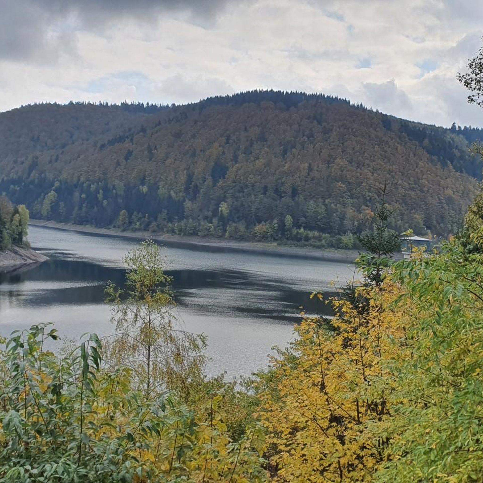
The loop around the Schönbrunn reservoir is about 14 km. There are enough resting places and views to enjoy are included anyway.
0
0

Top location on the Rennsteig: The proximity to the famous ridge trail allows for a combination of forest descents and ridge tours. Varied topography: Steep ascents from the Tannengrund or Reuscheltal demand stamina, but reward with brisk descents. Nature experience: The reservoir, with its bays, is reminiscent of a small fjord landscape in the middle of the dense low mountain forest. Tour combinations: Perfect as a stopover or turning point for larger loops, which often start in Schleusingen or Masserberg.
3
0
The Schönbrunn dam is located in the southern Thuringian Forest in the municipality of Schleusegrund (Hildburghausen district, Thuringia). It was commissioned in 1977. The dam is located about 20 kilometers south of Ilmenau and 15 kilometers northeast of Schleusingen. The river Schleuse is dammed. Source: https://de.wikipedia.org/wiki/Talsperre_Sch%C3%B6nbrunn#:~:text=Die%20Talsperre%20Sch%C3%B6nbrunn%20liegt%20im,Gestaut%20wird%20der%20Fluss%20Schleuse.
3
0
The Schönbrunn dam in the Thuringian Forest is attractive for mountain biking due to its charming combination of idyllic, flat shore paths and challenging, hilly ascents in the surrounding mountainous terrain around the Rennsteig. The circuit offers constant views of the blue water of the reservoir and the forest-rich heights of the Thuringian Forest.
3
0

Those who push ahead from Masserberg towards Langertfelsen and Neustadt on the Rennsteig will be rewarded with distant views and plenty of mountain air.
1
0

Large intersection with many small roads.
2
0

Frequently Asked Questions
What kind of terrain can I expect on mountain bike trails in Schleusegrund?
Mountain biking in Schleusegrund offers a diverse range of terrain. You'll encounter a mix of natural surfaces, including asphalt, gravel, and natural forest paths. The region's varied topography, with altitudes ranging from 450 to 800 meters, means you can expect both challenging ascents and more gentle sections. Some trails, particularly those with roots and gravel, are more suited for experienced mountain bikers, while others are quite accessible.
Are there mountain bike trails suitable for beginners or families in Schleusegrund?
Yes, Schleusegrund offers trails suitable for various skill levels, including options for beginners and families. While some routes feature challenging sections with roots and gravel, the overall network is designed to be enjoyable for a wide range of cyclists. For example, the Schönbrunn Reservoir – View of the Schönbrunn Reservoir loop from Schleusegrund is a moderate route that offers scenic views without extreme difficulty. The Rennsteig Cycle Path, which connects to Schleusegrund, also has sections accessible for families, often diverging from the steeper hiking trail.
What natural features or landmarks can I see along the mountain bike trails in Schleusegrund?
The trails in Schleusegrund are rich with natural beauty and interesting landmarks. You'll often ride through extensive forest areas, alongside wild streams, and across blooming mountain meadows within the UNESCO Thuringian Forest Biosphere Reserve. A prominent feature is the Schönbrunn Reservoir, which many routes circle, offering beautiful views. You might also encounter historical sites like Bertholdsburg Castle, Schleusingen, or natural points of interest such as the Werra Spring Fehrenbach. Viewpoints like the Rennsteigwarte on Eselsberg also offer panoramic vistas.
Are there any circular mountain bike routes in Schleusegrund?
Yes, many mountain bike routes in Schleusegrund are designed as loops, allowing you to start and end at the same point. Popular circular routes include the Schönbrunn Reservoir – View of the Schönbrunn Reservoir loop from Schleusegrund, a moderate 31.1 km path, and the more challenging Schönbrunn Reservoir – View of the Schönbrunn Reservoir loop from Oberneubrunn, which covers 48.2 km. These loops are excellent for exploring the region's diverse landscapes.
What do other mountain bikers enjoy most about mountain biking in Schleusegrund?
The mountain biking experience in Schleusegrund is highly rated by the komoot community, with an average score of 4.7 stars from over 1,400 reviews. More than 3,800 mountain bikers have explored the area using komoot. Reviewers often praise the region's dense forests, wild streams, and the scenic Schönbrunn Reservoir, highlighting the mix of natural surfaces and varied terrain that caters to different ability levels.
Can I bring my dog on the mountain bike trails in Schleusegrund?
Generally, dogs are welcome on trails in the Thuringian Forest Biosphere Reserve, which includes Schleusegrund. However, it's always recommended to keep your dog on a leash, especially in forested areas to protect wildlife and ensure the safety of other trail users. Be mindful of local regulations and signage, particularly around nature reserves or protected areas.
What is the best time of year to go mountain biking in Schleusegrund?
The best time for mountain biking in Schleusegrund is typically from spring through autumn. During these seasons, the weather is generally mild, and the trails are in good condition. Spring brings blooming mountain meadows, while autumn offers vibrant foliage. Summer is also popular, but be prepared for potentially warmer temperatures. Always check local weather forecasts before heading out.
Are there any specific regulations or permits required for mountain biking in Schleusegrund?
Mountain biking in Schleusegrund, located within the UNESCO Thuringian Forest Biosphere Reserve, generally follows standard trail etiquette. While specific permits are not typically required for general trail use, it's essential to respect nature, stay on marked paths, and avoid disturbing wildlife. For more detailed information on local regulations, you can visit the official tourism website for the region: Schleusegrund Tourism.
How long are the mountain bike trails around Schleusegrund?
The mountain bike trails around Schleusegrund vary significantly in length. You can find routes ranging from shorter, more accessible rides to longer, more challenging tours. For instance, the Werra Spring Fehrenbach – Scheibe-Alsbach Dam loop from Gießübel is a substantial 42.9 km (26.6 miles) route, while other trails might be shorter. The region offers a total of 24 mountain bike tours, ensuring options for different time commitments.
Is there public transport access to the mountain bike trails in Schleusegrund?
Schleusegrund is integrated into the regional transport network, and while direct public transport to every trailhead might be limited, there are options to reach the area. The region supports cycling, and some routes, like the Schleuse Valley Cycle Path, are accessible from various points. It's advisable to check local bus schedules or regional train connections to nearby towns and plan your route accordingly. For general information on getting around, you can consult the local tourism office.
Are there facilities for bike repairs or rentals in Schleusegrund?
Yes, the Schleusegrund region supports cycling with local infrastructure. Services such as repairs for bicycles, e-bikes, and mountain bikes are available locally. While specific rental locations are not detailed, the presence of repair services indicates a cycling-friendly environment. It's always a good idea to check with local tourism information or accommodation providers for the most current details on rentals.
Where can I find parking for mountain biking in Schleusegrund?
Parking is generally available in and around the villages within Schleusegrund, as well as at popular starting points for trails. Many routes, especially circular ones, often have designated parking areas near their start. For example, if you're starting a loop from Gießübel or Oberneubrunn, you'll typically find parking facilities. Always look for marked parking spaces to ensure you're not obstructing local residents or natural areas.
Are there any challenging mountain bike trails in Schleusegrund for experienced riders?
Yes, experienced mountain bikers will find challenging trails in Schleusegrund. The region's varied topography includes significant elevation changes, with some routes featuring over 1000 meters of ascent. For instance, the Schönbrunn Reservoir – View of the Schönbrunn Reservoir loop from Oberneubrunn is a difficult 48.2 km trail with 1079 meters of elevation gain. These trails often include sections with roots, gravel, and steeper inclines, providing a good test for skilled riders.
Most popular routes around Schleusegrund
Most popular attractions around Schleusegrund

Get inspired with the komoot mobile app


Explore more
Browse the best MTB trails in other regions.
