The best running trails around Schleusegrund
4.5
(638)
6,504
runners
307
runs
Jogging routes around Schleusegrund offer diverse landscapes within the Hildburghausen district of Thuringia, Germany. The region is characterized by its hilly terrain, extensive forests, and the presence of the Schleuse River and Schönbrunn Dam. Situated at the southern edge of the Thuringian Forest, the area provides varied topography, including sections of the renowned Rennsteig trail, suitable for different fitness levels.
Best jogging routes around Schleusegrund
- The most popular jogging route is Schönbrunn Reservoir – Schönbrunn Reservoir loop from Schleusegrund,…
Last updated: October 5, 2026
4.9
(8)
80
runners
19.3km
02:08
410m
410m
Hard run. Very good fitness required. Mostly paved surfaces. Suitable for all skill levels.
4.9
(7)
79
runners
19.0km
02:04
340m
340m
Hard run. Very good fitness required. Mostly paved surfaces. Suitable for all skill levels.

3.2
(6)
30
runners
Moderate run. Good fitness required. Mostly paved surfaces. Suitable for all skill levels.
5.0
(1)
15
runners
6.99km
00:46
140m
140m
Moderate run. Good fitness required. Mostly paved surfaces. Suitable for all skill levels.
11
runners
Moderate run. Good fitness required. Mostly accessible paths. Some sure footedness required.
Get access to more routes and recommendations from other explorers.
Already have an account?
Our route recommendations are based on thousands of hikes, rides, and runs completed by other people on komoot.
Start today with a free account
Your next adventure awaits.
Popular around Schleusegrund




Tips from the Community

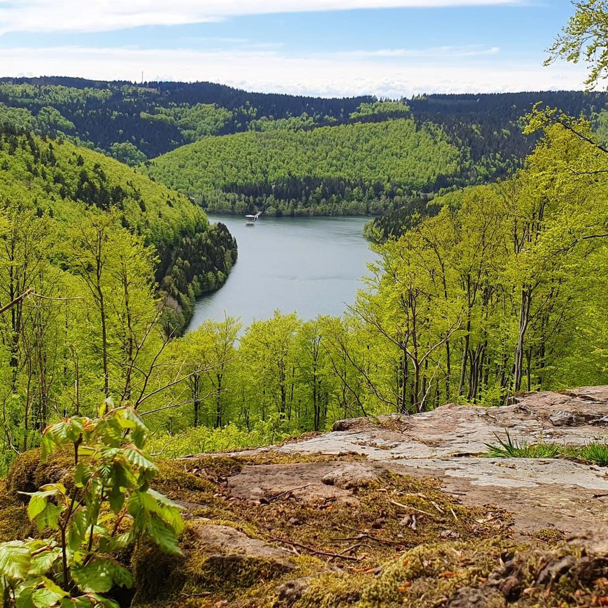
Top location on the Rennsteig: The proximity to the famous ridge trail allows for a combination of forest descents and ridge tours. Varied topography: Steep ascents from the Tannengrund or Reuscheltal demand stamina, but reward with brisk descents. Nature experience: The reservoir, with its bays, is reminiscent of a small fjord landscape in the middle of the dense low mountain forest. Tour combinations: Perfect as a stopover or turning point for larger loops, which often start in Schleusingen or Masserberg.
3
0
The Schönbrunn dam is located in the southern Thuringian Forest in the municipality of Schleusegrund (Hildburghausen district, Thuringia). It was commissioned in 1977. The dam is located about 20 kilometers south of Ilmenau and 15 kilometers northeast of Schleusingen. The river Schleuse is dammed. Source: https://de.wikipedia.org/wiki/Talsperre_Sch%C3%B6nbrunn#:~:text=Die%20Talsperre%20Sch%C3%B6nbrunn%20liegt%20im,Gestaut%20wird%20der%20Fluss%20Schleuse.
3
0
The Schönbrunn dam in the Thuringian Forest is attractive for mountain biking due to its charming combination of idyllic, flat shore paths and challenging, hilly ascents in the surrounding mountainous terrain around the Rennsteig. The circuit offers constant views of the blue water of the reservoir and the forest-rich heights of the Thuringian Forest.
3
0

The children's hiking trail „Zwergenpfad Frauenwald“ in the Thuringian Forest is an approximately 4-kilometer circular route, specially designed for families and starts directly at the Frauenwald Tourist Information. Small wooden and clay gnomes on the trees show the children the way through the forest.
1
0
Log cabin style shelter on a large meadow at the Rennsteig near Tannental and Ochsenbacher Teich.
6
0
The well-known "Monument at Bohrstuhl" is a central landmark at the entrance to Frauenwald am Rennsteig. It depicts an impressive, magnificent red deer, accompanied by smaller animals (capercaillie, owl, bird of prey). Often mistakenly referred to as a "chamois", the monument sits enthroned on a stone base depicting the village's history from 1218 to 1918, and was consecrated in 1937.
5
0

A hike around the place is simply not possible without a stop.
0
0

Frequently Asked Questions
How many running routes are available in Schleusegrund?
Komoot lists over 10 running routes around Schleusegrund, offering a variety of options for different fitness levels. These routes explore the diverse landscapes of the Thuringian Forest, the Schleuse River, and the Schönbrunn Dam area.
Are there any running routes suitable for beginners or those seeking an easier run?
While many routes in Schleusegrund involve varied terrain, there are moderate options available. For example, the Running loop from Schleusegrund is a moderate 3.7-mile (6.0 km) trail that takes about 38 minutes to complete, leading through local valleys and forests.
What kind of terrain can I expect on the jogging trails in Schleusegrund?
The terrain in Schleusegrund is quite varied, ranging from gentle valley runs along the Schleuse and Neubrunn rivers to more challenging ascents within the Thuringian Forest. You'll encounter extensive forested areas, hilly sections, and paths around bodies of water like the Schönbrunn Dam.
Are there any running routes that offer scenic views or pass by notable landmarks?
Absolutely! Many routes provide picturesque views. The Schönbrunn Reservoir – Schönbrunn Reservoir loop from Schleusegrund offers scenic views around the reservoir. For panoramic vistas, you might consider routes that lead towards highlights like the Kickelhahn Tower or the Observation tower on Großer Finsterberg, which are accessible from the wider region.
Can I find circular running routes in the Schleusegrund area?
Yes, many of the running routes in Schleusegrund are designed as loops, allowing you to start and end at the same point. A popular example is the Schönbrunn Reservoir – Schönbrunn Reservoir loop from Schleusegrund, which is a challenging 11.2-mile (18.0 km) circular trail.
Are there any running trails that are part of the famous Rennsteig?
Yes, Schleusegrund is close to the renowned Rennsteig trail. You can experience a section of this historic path on the Center of the Rennsteig – Refuge on the Rennsteig loop from Dreiherrenstein, a moderate 5.8-mile (9.4 km) route known for its well-maintained paths and immersive forest experience.
What do other runners say about the trails in Schleusegrund?
The running routes in Schleusegrund are highly rated by the komoot community, with an average score of 4.5 stars from over 400 reviews. Runners often praise the diverse landscapes, the well-maintained paths, and the refreshing views, especially around the Schönbrunn Reservoir and within the Thuringian Forest.
Are there any specific attractions or natural features to look out for while running?
Beyond the scenic Thuringian Forest and the Schönbrunn Dam, you might encounter natural monuments like the Werra Spring Fehrenbach or various lakes such as Ten Ponds and Knöpfelstaler Pond, which add to the beauty of the routes.
Is it possible to access the running trails using public transport?
Schleusegrund is a municipality in Thuringia, Germany. While specific public transport connections to every trailhead might vary, the state-approved resorts of Schönbrunn and Gießübel within the municipality often have better public transport access, which could serve as starting points for nearby trails.
Are there any longer, more challenging running routes for experienced runners?
Yes, experienced runners will find challenging options. The View of the Schönbrunn Reservoir – Schönbrunn Reservoir loop from Dreiherrenstein is a difficult 16.8-mile (27.0 km) route with significant elevation gain, offering a substantial workout and stunning views.
What is the best time of year to go running in Schleusegrund?
The Thuringian Forest provides shaded routes, making spring, summer, and autumn excellent times for running. During warmer months, the extensive forests offer a refreshing escape. Autumn brings beautiful foliage, while spring offers lush greenery. Winter running is also possible, though conditions may vary with snow and ice.
Are there any running routes suitable for families with children?
While many routes have varied difficulty, the region offers a 'Gießübler Switzerland nature trail' which is an 8.46 km route with moderate elevation. For families, look for routes with gentler gradients, especially those in the valleys of the Schleuse and Neubrunn rivers, which might offer a more accessible experience.
Most popular routes around Schleusegrund
Most popular attractions around Schleusegrund

Get inspired with the komoot mobile app


Explore more
Browse the best Running Trails & Routes in other regions.
