The best traffic-free bike rides around Unterweißenbach
4.4
(11)
246
riders
21
rides
No traffic touring cycling routes around Unterweißenbach traverse a landscape characterized by its undulating hills, dense forests, and impressive granite formations. The region, part of the Mühlviertler Alm in Upper Austria, features high plateaus reaching over 800 meters and deeply incised valleys. Touring cyclists can expect varied terrain, from well-paved paths through "rushing forests" to routes offering significant elevation gains. This diverse topography provides a scenic backdrop for exploring the area on two wheels.
Best no traffic touring cycling routes…
Last updated: July 24, 2026
4.5
(4)
88
riders
54.7km
04:48
1,460m
1,460m
Hard bike ride. Very good fitness required. You may need to push your bike for some segments of this route.
3.8
(4)
47
riders
40.7km
03:46
1,300m
1,300m
Hard bike ride. Very good fitness required. Mostly paved surfaces. Suitable for all skill levels.

Sign up for free
7
riders
18.8km
01:28
470m
470m
Hard bike ride. Very good fitness required. Mostly paved surfaces. Suitable for all skill levels.
3.0
(1)
9
riders
28.1km
02:19
610m
610m
Hard bike ride. Very good fitness required. Mostly paved surfaces. Suitable for all skill levels.
4
riders
25.6km
02:06
470m
470m
Hard bike ride. Very good fitness required. Mostly paved surfaces. Suitable for all skill levels.
Get access to more routes and recommendations from other explorers.
Sign up for free
Already have an account?
Our route recommendations are based on thousands of hikes, rides, and runs completed by other people on komoot.
Start today with a free account
Your next adventure awaits.
Login or Signup
Other adventures around Unterweißenbach

Tips from the Community

Pehersdorf-Oberndorf: Asphalt, little traffic; typical Mühlviertel landscape
0
0
Straß-Schönau: Alternative route to the busy country road; typical Mühlviertel landscape
0
0
Hinterberg freight road: asphalt, little traffic
0
0


You'll find a coffee machine, chilled drinks, and granola bars here. A very well-maintained rest stop awaits you.
0
0

Best roast pork - but you can't get in without a reservation!
0
0

The Prandegg castle ruins are around 140 metres long and are one of the largest castles in the country. They began to decay around 1750 and have been owned by the Dukes of Saxe-Coburg and Gotha since 1823. You can visit them and walk around the castle on the castle trail.
2
0
Frequently Asked Questions
How many no-traffic touring cycling routes are available around Unterweißenbach?
There are 21 dedicated no-traffic touring cycling routes around Unterweißenbach. While many are rated as difficult due to the hilly terrain, there are 5 moderate routes that offer a less strenuous experience, perfect for those seeking a scenic ride without vehicle interference.
Are there any family-friendly no-traffic touring cycling routes in the region?
The Mühlviertler Alm region, with its undulating hills, means many routes have significant elevation changes. While there are no routes specifically rated as 'easy' for beginners, some of the 5 moderate routes could be suitable for families with older children or those using e-bikes. These routes still offer the benefit of being traffic-free, ensuring a safer and more peaceful experience.
What kind of terrain can I expect on these no-traffic touring cycling routes?
The routes around Unterweißenbach are characterized by the hilly Mühlviertel landscape, featuring 'rushing forests,' 'lush meadows,' and impressive granite formations. You'll encounter both challenging ascents and rewarding descents, often on well-paved surfaces, providing a diverse and scenic backdrop for your ride.
Are there any circular no-traffic touring cycling routes available?
Yes, many of the no-traffic touring cycling routes around Unterweißenbach are circular. For example, you can explore the Johannesweg Hut – View of Königswiesen loop from Unterweißenbach or the shorter Unterweißenbach – Königswiesen loop from Unterweißenbach, both offering beautiful scenery and returning you to your starting point.
What are the best times of year to go touring cycling in Unterweißenbach?
The best times for touring cycling in the Mühlviertel region are typically spring, summer, and early autumn. During these seasons, you'll experience pleasant temperatures and the full beauty of the forested landscapes and meadows. Summer offers longer daylight hours, while spring and autumn provide vibrant colors and often fewer crowds.
What attractions or natural monuments can I see along the no-traffic routes?
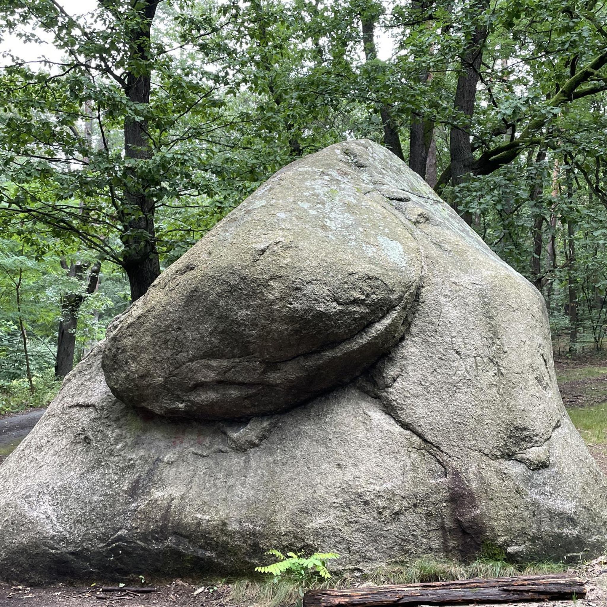
The region is rich in natural and historical sights. You might encounter fascinating granite formations like the 'Wackelstein' (Wobbling Rock) or the 'Wegererstein.' Some routes may pass by natural monuments such as the 'Schwammerlstein' or the ancient sycamore maple in Dauerbach. For a specific route, consider the Josef Kappacher Chapel – Unterweißenbach loop from Unterweißenbach, which offers scenic views.
Are there any places to stop for refreshments or accommodation along the routes?
Yes, the Mühlviertler Alm region offers various opportunities for refreshments. The Johannesweg, which has entry points in Unterweißenbach, features huts and inns along its path. You might find places like the Johannesweg Hut or the Stoaninger Alm, which are popular stops for cyclists and hikers.
What do other touring cyclists say about the no-traffic routes in Unterweißenbach?
The no-traffic touring cycling routes around Unterweißenbach are highly rated by the komoot community, with an average score of 4.4 stars. Reviewers often praise the quiet, scenic nature of the routes, the challenging yet rewarding hilly terrain, and the opportunity to explore the beautiful Mühlviertel landscape away from vehicle traffic.
Are there any routes that pass by lakes or water features?
While the region is known for its forests and hills, some routes may lead you to tranquil water features. For instance, the Rubner Pond in the Tannermoor – Rubenerteich loop from Greinerschlag specifically highlights a pond, offering a peaceful spot to rest and enjoy the natural surroundings.
Where can I find parking for my car when starting a no-traffic touring cycling route?
Unterweißenbach, as a hub for outdoor activities, generally offers parking facilities. For specific routes, it's advisable to check the route details on komoot, as many start points in villages or near popular attractions will have designated parking areas suitable for cyclists. Public transport options are more limited in this rural area, so driving to a starting point is often the most convenient option.
Are there any routes that offer particularly good viewpoints?
The 'Fernblickweg' is a marked circular route in the region specifically designed to highlight beautiful viewpoints into the hilly Mühlviertel. Many of the touring cycling routes, due to the undulating terrain, naturally offer panoramic vistas of the surrounding forests and valleys. The Johannesweg Hut – View of Königswiesen loop from Unterweißenbach, for example, provides excellent views towards Königswiesen.
Most popular routes around Unterweißenbach
Most popular attractions around Unterweißenbach

Get inspired with the komoot mobile app


Explore more
Browse the best Cycling routes in other regions.
