The best hikes from bus stations in the Allgäu
4.5
(173881)
782,332
hikers
7,750
hikes
Bus station hiking trails in the Allgäu traverse a diverse landscape in southern Germany, bordering Austria. The region features dramatic alpine mountains, rugged peaks, and rolling alpine foothills, alongside extensive forests and unique moorland areas. Numerous clear mountain lakes, pristine rivers, deep gorges, and cascading waterfalls define the terrain, offering varied hiking experiences. The Allgäu provides an extensive network of well-maintained trails suitable for different ability levels.
Best bus station hiking trails in the Allgäu
- The most popular bus station…
Last updated: August 12, 2026
4.7
(1211)
4,452
hikers
11.0km
03:00
150m
150m
Moderate hike. Good fitness required. Easily-accessible paths. Suitable for all skill levels.
4.7
(865)
2,850
hikers
6.54km
01:54
150m
150m
Moderate hike. Great for any fitness level. Mostly accessible paths. Sure-footedness required.

Sign up for free
4.7
(794)
2,619
hikers
6.50km
01:53
150m
150m
Moderate hike. Great for any fitness level. Mostly accessible paths. Sure-footedness required.
4.6
(533)
2,067
hikers
9.89km
03:21
440m
440m
Moderate hike. Good fitness required. Mostly accessible paths. Sure-footedness required.
4.5
(323)
1,243
hikers
9.07km
03:47
480m
480m
Moderate hike. Good fitness required. Mostly accessible paths. Sure-footedness required.
Get access to more routes and recommendations from other explorers.
Sign up for free
Already have an account?
Our route recommendations are based on thousands of hikes, rides, and runs completed by other people on komoot.
Start today with a free account
Your next adventure awaits.
Login or Signup
Popular around Allgäu
Hikes from bus stations in the Allgäu Alps
Hikes from bus stations in Oberallgäu
Hikes from bus stations in the Ostallgäu
Hikes from bus stations around Landkreis Lindau
Hikes from bus stations in Unterallgäu

Hikes from bus stations around Kempten Allgäu
Hikes from bus stations around Kaufbeuren

Hikes from bus stations around Memmingen

Augsburger Jakobsweg – Through Bavarian-Swabia
LechErlebnisWeg – multi-day Tour from Landsberg to Füssen
Other adventures in the Allgäu


Tips from the Community

Alp unfortunately no longer managed since 2025😞🤷♂️ "The alp is currently closed! As of 2025. As soon as information about a reopening or new operators is available, it will be added." https://share.google/DBFrc8vvw9TNBsgme
0
0

From here you have a fantastic view into the Weißachtal valley. The Weißach river rises west of Immenstadt, flows in its upper course through the Ehrenschwanger Tal valley, turns towards Oberstaufen and continues to the Austrian border, where it finally flows into the Bregenzer Ach. On its way, the river has carved the Buchenegger Waterfalls into the Nagelfluh rock.
1
0
Alpe Neugreuth is located above Steibis, in the middle of the Allgäu landscape panorama. If you walk from Steibis to the Buchenegger waterfalls, it is worth stopping at the cozy guesthouse. Drinks, homemade cakes, and hearty snacks are available on the terrace. A special feature is the own herb garden, whose ingredients give the dishes a fine note.
1
1

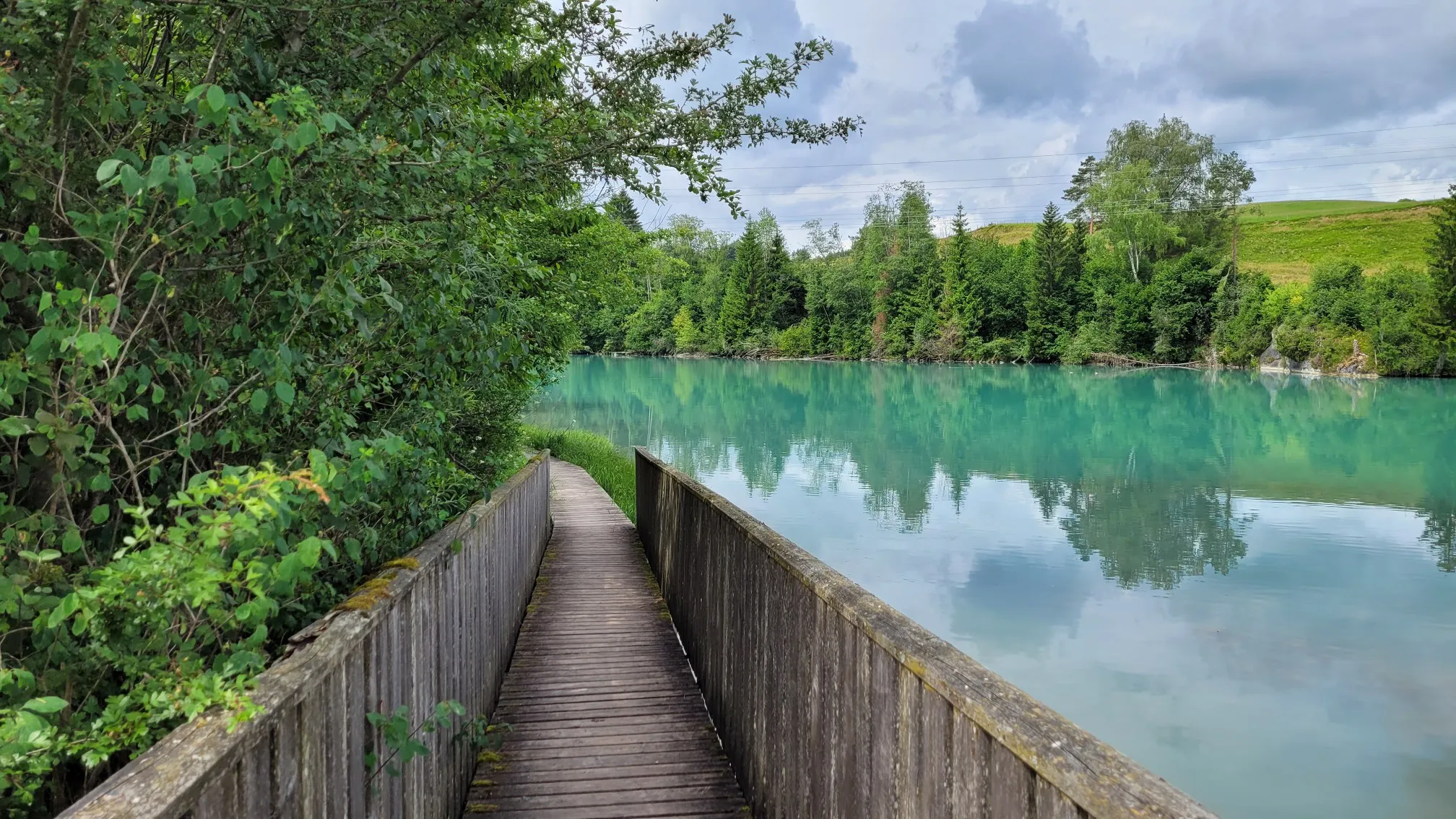
Wonderful path along the lake. Note that the path is intended for pedestrians.
0
0
The Hündlekopf, at 1,111 meters, is the ridge of the Hündle mountain and one of the most popular viewing summits around Oberstaufen. It is easy to hike up. If you want to spare yourself the partly steep ascent, simply take the gondola. At the summit cross, you have a great view of the Großer Alpsee and the Nagelfluhkette.
1
0
At around 900 meters, the Turaalpe offers a fantastic panorama. On one side, the Nagelfluhkette rises with the distinctive Hochgrat, while on the other, your gaze wanders over the rolling hills of the Alpine foothills. The lush green meadows are home to crocuses and many colorful flowers, especially in spring.
1
0

A very nicely prepared trail leading along the northern shore of the lake.
1
0

Great hiking trail and beautiful panorama in a fantastic landscape.
0
0
Frequently Asked Questions
How many bus-accessible hiking trails are available in the Allgäu region?
The Allgäu region offers a vast network of hiking trails accessible by bus. On komoot, you can find over 7,500 routes that start near bus stations, ranging from easy strolls to challenging mountain ascents. This extensive selection ensures there's a suitable option for every hiker.
What makes the Allgäu region particularly suitable for bus-accessible hiking?
The Allgäu boasts a remarkable diversity of landscapes, from dramatic alpine mountains to rolling hills, clear mountain lakes, and deep gorges. Its well-developed public transport network, combined with an extensive system of well-maintained and clearly marked trails, makes it exceptionally easy to explore the region's natural beauty without a car. Many trails lead directly from bus stops into stunning scenery.
Are there easy bus-accessible hikes suitable for beginners or families in the Allgäu?
Yes, the Allgäu offers numerous easy and family-friendly bus-accessible hikes. For instance, the Around the Großer Alpsee - Allgäu route provides a moderate, scenic walk around the expansive Alpsee, perfect for a leisurely day out. Another great option is the Steibis – Buchenegg waterfalls trail, which is also moderate and leads to beautiful cascades where swimming is possible in warmer months.
Which bus-accessible hikes feature waterfalls or gorges in the Allgäu?
The Allgäu is famous for its impressive gorges and waterfalls. The Steibis – Buchenegg waterfalls route is a fantastic choice, leading directly to the picturesque Buchenegger Waterfalls (Buchenegger Waterfalls). While not directly on a featured route here, the renowned Breitachklamm (Breitach Gorge) and Starzlachklamm (Starzlach Gorge) are also accessible via public transport connections and offer breathtaking experiences.
Can I bring my dog on bus-accessible hikes in the Allgäu?
Many trails in the Allgäu are dog-friendly, making it a great region for hiking with your canine companion. However, it's always advisable to check specific trail regulations, especially in nature reserves or protected areas. When using public transport, ensure your dog is leashed and consider muzzle requirements on buses. Always carry water for your dog and clean up after them.
Are there bus-accessible trails that lead to scenic lakes or offer swimming opportunities?
Absolutely! The Allgäu is dotted with beautiful lakes. The Around the Großer Alpsee - Allgäu route is a prime example, offering stunning views of the largest natural lake in the region. The Buchenegger Waterfalls, accessible via the Steibis – Buchenegg waterfalls trail, also provide opportunities for a refreshing dip in warmer weather.
What interesting sights or landmarks can I see along bus-accessible routes in the Allgäu?
Beyond natural beauty, the Allgäu is rich in cultural landmarks. Many bus-accessible routes offer views or access to historical sites. For example, some trails provide stunning vistas of the iconic Neuschwanstein Castle (Neuschwanstein Castle) or Hohenschwangau Castle (View of Alpsee and Hohenschwangau Castle). The charming Old Town of Füssen (Old Town of Füssen) is also a popular destination accessible by bus, serving as a gateway to many hikes.
Are there any circular bus-accessible routes in the Allgäu?
Yes, many bus-accessible routes in the Allgäu are designed as circular trails, allowing you to start and end your hike at the same bus stop without needing to retrace your steps. An example is the Ochsenberg Loop Trail, which offers a moderate challenge and diverse scenery.
What is the best season for bus-accessible hikes in the Allgäu?
The Allgäu is beautiful year-round, but the best season depends on your preferred hiking experience. Spring and autumn offer pleasant temperatures and vibrant colors, while summer is ideal for high-alpine routes and swimming. Winter transforms the landscape into a snowy wonderland, with many trails suitable for snowshoeing or winter hiking, though some higher routes may be inaccessible. Always check local conditions before heading out.
Are there bus-accessible trails that explore the unique moorland areas of the Allgäu?
Yes, the Allgäu features fascinating moorland areas that offer a different kind of hiking experience. The Moor Trail No. 1 is a great example of a bus-accessible route that takes you through these ecologically rich landscapes, providing insights into their unique flora and fauna.
What do other hikers enjoy most about bus-accessible hiking in the Allgäu?
The Allgäu is highly rated by the komoot community, with an average score of 4.5 stars. Reviewers often praise the region's stunning and diverse natural beauty, the excellent network of well-marked trails, and the convenience of accessing trailheads directly via public transport. The opportunity to combine challenging mountain tours with relaxing lakeside walks, all without a car, is frequently highlighted.
Most popular routes in the Allgäu
Most popular attractions in the Allgäu

Get inspired with the komoot mobile app


Didn’t find what you were looking for?
Check out more Hikes throughout Allgäu below and find the perfect route in your destination.
Explore more
Browse the best Hikes in other regions.
