The best cycling routes in Lost Cove Wilderness Study Area
5.0
(1)
50
riders
8
rides
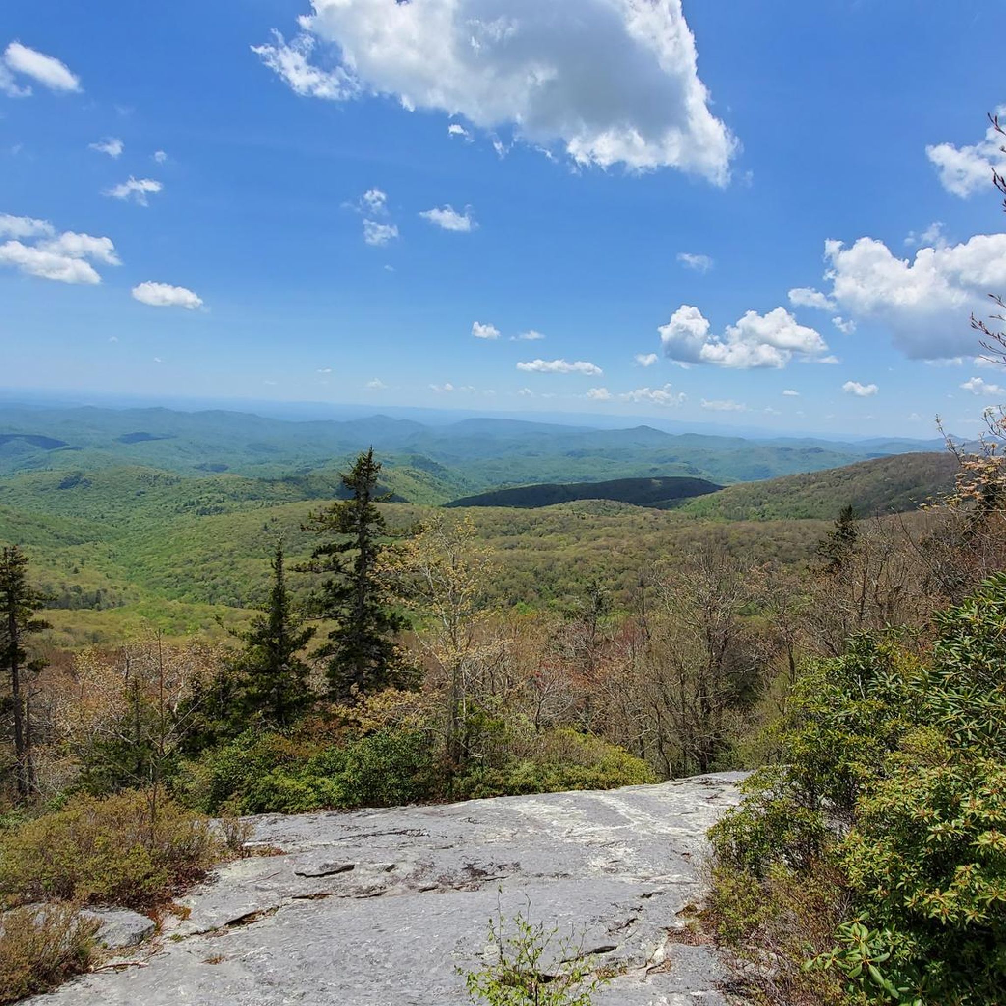
Touring cycling in Lost Cove Wilderness Study Area offers routes through forested mountains and along scenic parkways. The region is characterized by varied terrain, including sections of the Blue Ridge Parkway and the Mountains to Sea Trail. Elevations range from gentle climbs to more challenging ascents, providing diverse experiences for touring cyclists. This area features natural landscapes suitable for exploring on two wheels.
Best touring cycling routes in Lost Cove Wilderness Study Area
- The most popular touring cycling route is Mountains to Sea Trail: Blue Ridge Parkway Section, a 13.2 miles (21.2 km) trail that takes 1 hour 22 minutes to complete. This moderate route features sections of the iconic Blue Ridge Parkway.
- Another top favourite among local touring cyclists is Linville Falls Picnic Area & Linville Falls Road — Blue Ridge Parkway, an easy 4.3 miles (6.9 km) path. This route offers a more relaxed ride through forested areas near Linville Falls.
- Local touring cyclists also love the Mountains to Sea Trail: Spruce Pine Loop, a 26.7 miles (43.0 km) trail leading through mountainous terrain, often completed in about 3 hours.
- Touring cycling in Lost Cove Wilderness Study Area is defined by forested mountains, scenic parkways, and river valleys. The network offers options for easy, moderate, and difficult routes, catering to various skill levels.
- The routes in Lost Cove Wilderness Study Area are highly rated by the komoot community with an average score of 5.0 stars from 1 review. More than 10 touring cyclists have used komoot to explore Lost Cove Wilderness Study Area's varied terrain.
Last updated: September 28, 2026
2
riders
21.2km
01:23
290m
290m
Moderate bike ride. Good fitness required. Mostly paved surfaces. Suitable for all skill levels.
1
riders
Easy bike ride. Great for any fitness level. Mostly paved surfaces. Suitable for all skill levels.

43.0km
03:01
820m
820m
Hard bike ride. Very good fitness required. Mostly paved surfaces. Suitable for all skill levels.
21
riders
52.9km
05:24
1,030m
1,040m
Hard bike ride. Very good fitness required. Mostly paved surfaces. Suitable for all skill levels.
12
riders
22.4km
01:31
390m
390m
Moderate bike ride. Good fitness required. Mostly paved surfaces. Suitable for all skill levels.
5.0
(1)
14
riders
42.6km
02:51
680m
680m
Hard bike ride. Very good fitness required. Mostly paved surfaces. Suitable for all skill levels.
Get access to more routes and recommendations from other explorers.
Already have an account?
Our route recommendations are based on thousands of hikes, rides, and runs completed by other people on komoot.
Start today with a free account
Your next adventure awaits.



Tips from the Community

An easy walk around the lake. I saw bathing deer and snakes.
0
0

Linville Falls Picnic Area is at Milepost 316.5 on the Blue Ridge Parkway and plays host to a bunch of different picnic areas, pavilions, and parking lots. The majority of the sites are right on the Linville River; this is one of the more popular picnic areas on the parkway due to how many sites there are and how close it is to the Linville Gorge Wilderness.
0
0

With a pavillion and playground, this swimming lake makes a great spot to stop for a pitstop and perhaps a cool off.
0
0
North Cove Overlook is located at Milepost 327.3 on the Blue Ridge Parkway. At 2,815 feet, it isn't one of the highest overlooks on the parkway, but it still boasts views of nearly 20 different mountains. There are also views of a historic orchard, and you can read about the history on some informational signs.
0
0
Hefner Gap Overlook is situated at Milepost 325.9 on the Blue Ridge Parkway. The overlook offers a head-on view of Linville Mountain and some other lower-lying peaks. There is also a tiny apple orchard below the overlook, and you can read about the history of farming in the area on some informational signs nearby.
0
0
The Bear Den Overlook on the Blue Ridge Parkway is located at Milepost 323 and at an elevation of 3,360 feet. This expansive view is a popular stop for both motorists and bikers, and you expect to see some other people near the viewing area. This is an especially great place to watch the sunset.
0
0
The Chestoa View Overlook is situated at Milepost 320.8 on the Blue Ridge Parkway. The main overlook is a super short walk from the parking lot (no bikes allowed), and there is a smooth, crushed-gravel hiking trail that leaves the parking area that is quiet and boasts a couple views of its own. Some people choose to not even leave the parking area.
0
0
Linville Falls Picnic Area is at Milepost 316.5 on the Blue Ridge Parkway and plays host to a bunch of different picnic areas, pavilions, and parking lots. The majority of the sites are right on the Linville River; this is one of the more popular picnic areas on the parkway due to how many sites there are and how close it is to the Linville Gorge Wilderness.
0
0
Frequently Asked Questions
What is the overall difficulty level of touring cycling routes in Lost Cove Wilderness Study Area?
The touring cycling routes in Lost Cove Wilderness Study Area offer a range of difficulties. You'll find options from easy paths, such as the Linville Falls Picnic Area & Linville Falls Road — Blue Ridge Parkway, to more challenging routes like the Mountains to Sea Trail: Spruce Pine Loop, which features significant elevation changes. The area caters to various skill levels, with a majority of routes being difficult, some moderate, and at least one easy option.
What are the typical distances for touring cycling routes in Lost Cove Wilderness Study Area?
Route distances vary, offering options for shorter rides and longer excursions. For example, the Linville Falls Picnic Area & Linville Falls Road — Blue Ridge Parkway is a shorter 4.3 miles (6.9 km) ride, while the Wilson Ridge Trail – High Knob loop from Woodcock Knob extends to about 34.8 miles (56 km).
Are there family-friendly touring cycling routes in Lost Cove Wilderness Study Area?
Yes, there is at least one easy route suitable for families. The Linville Falls Picnic Area & Linville Falls Road — Blue Ridge Parkway is a 4.3-mile (6.9 km) path that offers a relaxed ride through forested areas, making it a good choice for a family outing.
Which touring cycling routes are suitable for beginners in Lost Cove Wilderness Study Area?
Beginners can enjoy the Linville Falls Picnic Area & Linville Falls Road — Blue Ridge Parkway. This route is classified as easy, covering 4.3 miles (6.9 km) with minimal elevation gain, providing a gentle introduction to touring cycling in the area.
What is the best time of year for touring cycling in Lost Cove Wilderness Study Area?
Given the region's forested mountains and scenic parkways, spring and fall are generally ideal. Spring offers lush greenery and blooming wildflowers, while fall provides stunning foliage. Summer can be pleasant at higher elevations, but be prepared for warmer temperatures. Winters may bring colder weather and potential snow, especially on higher sections of routes like the Blue Ridge Parkway.
Are there any circular touring cycling routes in Lost Cove Wilderness Study Area?
Yes, there are circular routes available. The Mountains to Sea Trail: Spruce Pine Loop is a notable example, offering a 26.7-mile (43 km) loop through mountainous terrain. Another option is the Wilson Ridge Trail – High Knob loop from Woodcock Knob, which is a longer 34.8-mile (56 km) loop.
What do other touring cyclists enjoy the most about touring cycling in Lost Cove Wilderness Study Area?
The area is highly rated by the komoot community, with an average score of 5.0 stars. Reviewers often praise the diverse terrain, from gentle climbs to challenging ascents, and the opportunity to cycle along iconic sections of the Blue Ridge Parkway and the Mountains to Sea Trail, all within a natural, forested setting.
How many touring cycling routes are available in Lost Cove Wilderness Study Area?
There are 7 touring cycling routes documented in Lost Cove Wilderness Study Area, offering a variety of experiences for cyclists.
What kind of terrain can I expect on touring cycling routes in Lost Cove Wilderness Study Area?
You can expect varied terrain, including forested mountains, sections of scenic parkways like the Blue Ridge Parkway, and river valleys. Routes feature both gentle climbs and more challenging ascents, providing a diverse cycling experience.
Are there any routes that follow the Blue Ridge Parkway?
Yes, several routes incorporate sections of the iconic Blue Ridge Parkway. For instance, the Mountains to Sea Trail: Blue Ridge Parkway Section is a 13.2-mile (21.2 km) route that features this scenic roadway, and the Linville Falls Picnic Area & Linville Falls Road — Blue Ridge Parkway also offers a ride along it.
What wildlife might I encounter while touring cycling in Lost Cove Wilderness Study Area?
As a wilderness study area, Lost Cove is home to diverse wildlife. Cyclists might encounter various bird species, white-tailed deer, and smaller mammals. While less common, black bears are also present in the region, so it's advisable to be aware of wildlife safety guidelines.
Are there any specific points of interest or landmarks along the touring cycling routes?
While specific highlights are not detailed in the provided data, routes often pass through or near significant natural features. For example, the Linville Falls Picnic Area & Linville Falls Road — Blue Ridge Parkway route is near the famous Linville Falls, offering scenic views and a chance to explore the area.
Most popular routes in Lost Cove Wilderness Study Area

Get inspired with the komoot mobile app


Explore more
Browse the best Cycling routes in other regions.
