Attractions and Places To See in Rio Grande National Forest - Top 20
Best attractions and places to see in Rio Grande National Forest include a diverse array of natural features and cultural sites across its 1.86-million-acre expanse in southwestern Colorado. The forest encompasses high-elevation deserts, dense forests, and the headwaters of the Rio Grande River. It features significant mountain ranges like the San Juan Mountains and Sangre de Cristo Range, offering varied landscapes and geological formations. The area also holds cultural importance, with sites used by Indigenous tribes and remnants of mining history.
Best attractions and places to see in Rio Grande National Forest
- The most popular attractions is San Luis Pass, a mountain pass located between two steep climbs along the Colorado Trail. San Luis Peak towers over the pass, and the area serves as a junction for various trails, including sections of the Continental Divide Trail.
- Another must-see spot is Rio Grande Headwaters, a river where the Rio Grande begins its journey. This humble stream at the base of Canby Mountain grows to become one of North America's longest rivers.
- Visitors also love Highest Point of the Colorado Trail, a summit marking the highest elevation on the Colorado Trail at 13,271 feet. It offers panoramic views and a sense of accomplishment for those who reach it.
- Rio Grande National Forest is known for its mountain passes, river headwaters, and unique natural monuments. Visitors can explore a variety of landscapes, from high mountain peaks to significant geological formations and historic sites.
- The attractions in Rio Grande National Forest are appreciated by the komoot community. With 1 upvote and 6 photos, visitors share their experiences and discoveries in the region.
Last updated: October 10, 2026
Natural Arch ⛰️
Highlight • Natural Monument
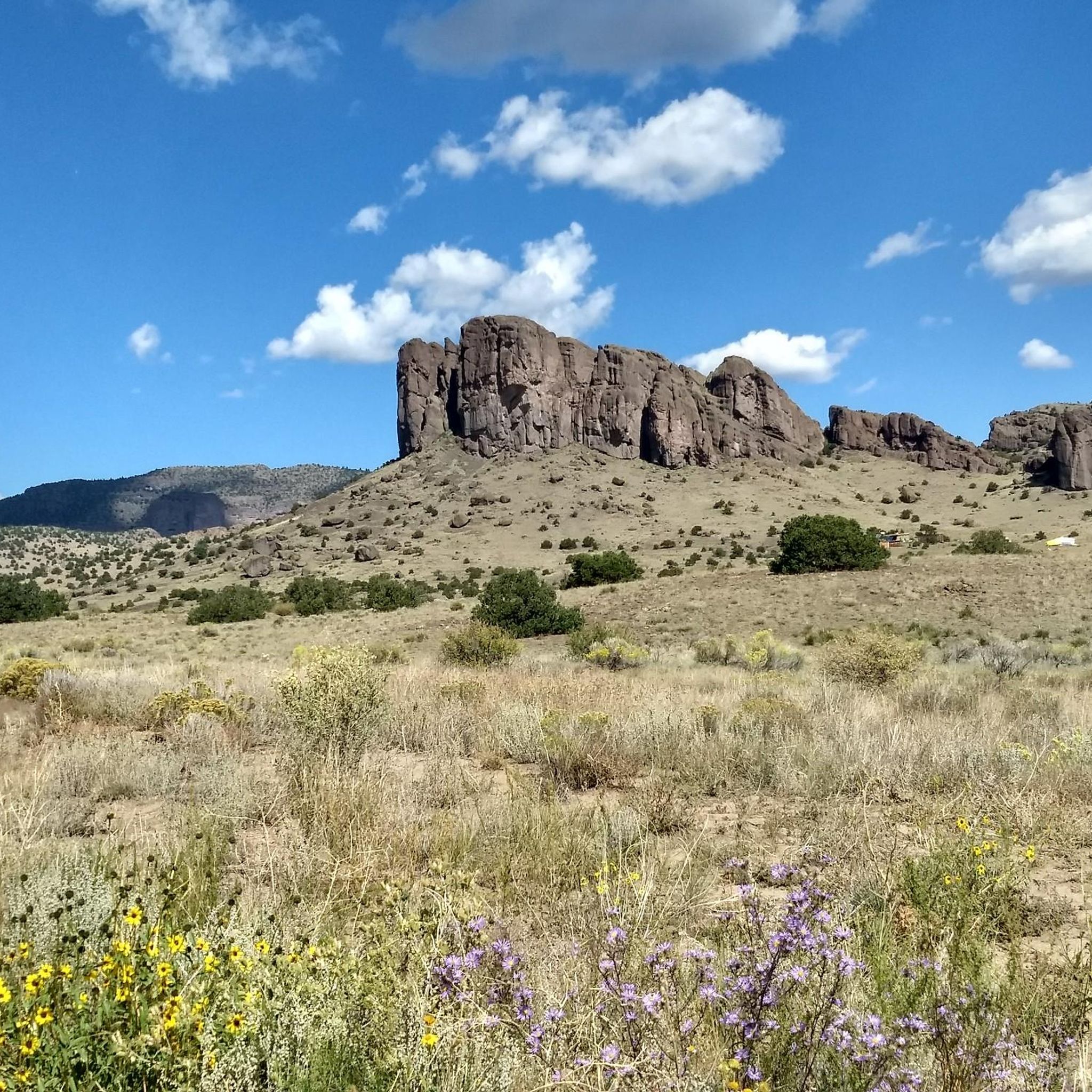
Lava from the Summer Coon volcanic complex intruded into cracks in the surrounding alluvial and volcanic deposits about 30 million years ago. Parts of the magma cooled at different rates and separated from the rest of the wall, and when the surrounding deposits eroded away, the inner part of the arch collapsed, leaving a hole in the dike. The end result was a 40-foot-tall, 30-foot-wide arch.
From the end of La Ventana Road, a steep scramble leads to the arch, rewarded with views across the San Luis Valley to the Sangre de Cristo mountains and the Great Sand Dunes National Park. The arch itself is difficult to see from any direction except directly in front of or behind it, quite clearly from the parking at the end of La Ventana Road. If you want to scramble up to the rock wall, bikes can be left at the end of the road, ideally locked in an elevated position, and can be seen when looking back while hiking up.
The arch is a sacred site for the Jicarilla Apache and Ute tribes and is still used for ceremonies.
The arch is about 11 miles northwest of Del Norte, Colorado, on Forest Service Road A23, a.k.a. La Ventana Road. The road is rough rocky gravel, but doable on most bikes. Signs in the area point to the arch. When hiking to the arch, wear sturdy shoes with good grip. Caution is warranted when climbing to the arch and when descending. Loose rock requires caution and stable footing.
To get to the Arch from Monte Vista – head north out of Monte Vista on Highway 285 for 18 miles to County Road G. Turn left and go west to the “Y” just past the La Garita Store. Take the dirt road south and follow the signs to the Natural Arch.
Tip by

Highest Point of the Colorado Trail
Highlight • Summit
Tip by

Sign up now to discover places like this
Get recommendations on the best single tracks, peaks, & plenty of other exciting outdoor places.
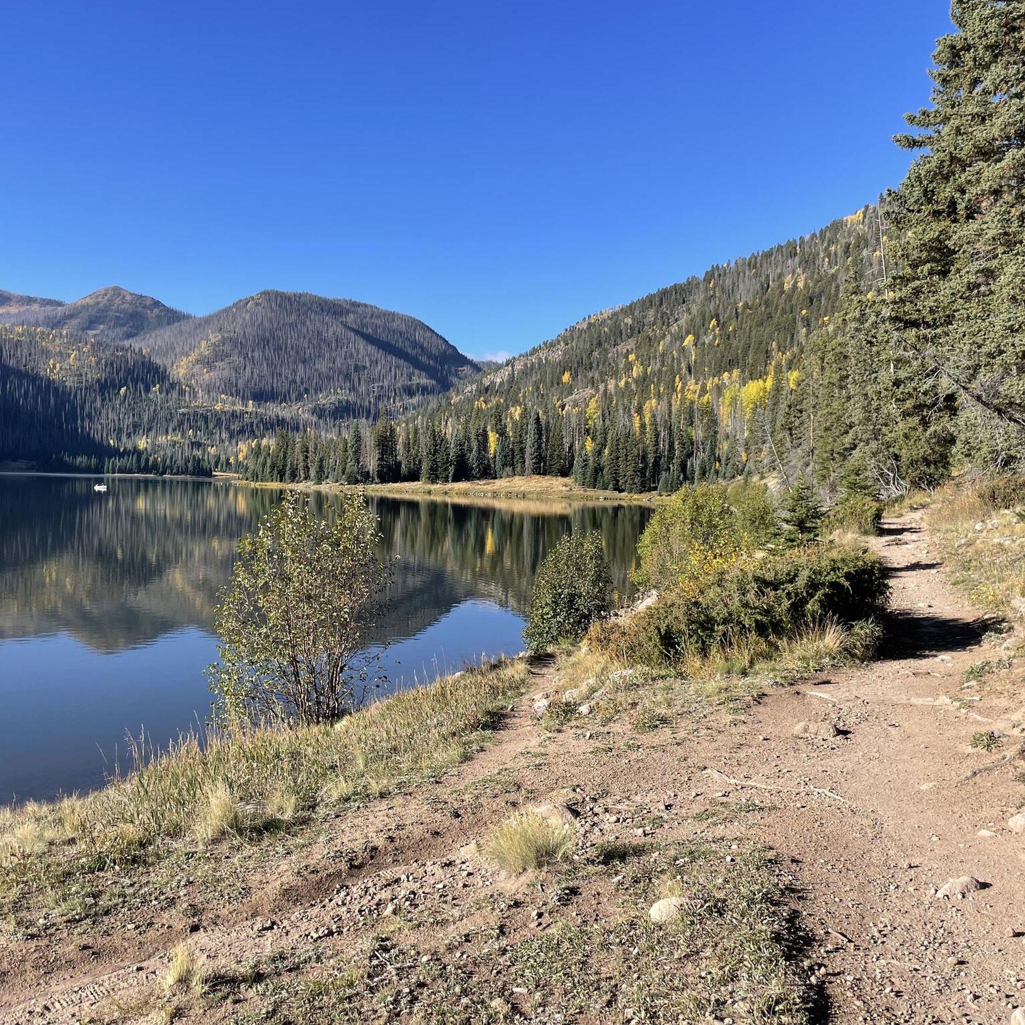
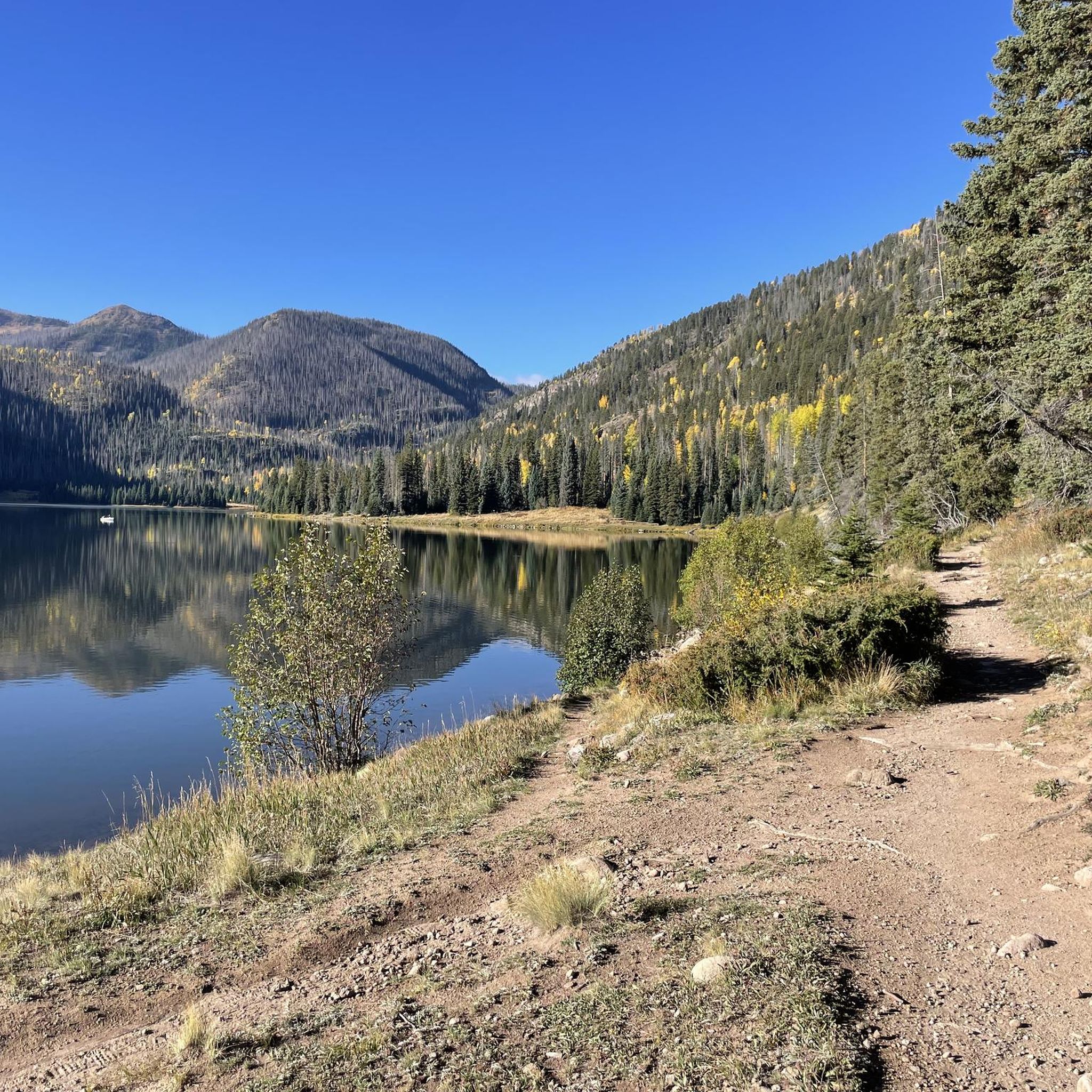
Lake and campsites
Highlight • Lake
Tip by
San Luis Pass
Highlight • Mountain Pass
Tip by
Carson Saddle
Highlight • Mountain Pass
Tip by

Sign up for free to discover even more attractions in Rio Grande National Forest.
Already have an account?
Start today with a free account
Your next adventure awaits.
Popular around Rio Grande National Forest

Colorado Trail — The pinnacle of wild Colorado

The Continental Divide Trail — Across the sky of America
Hiking in Rio Grande National Forest
Running Trails in Rio Grande National Forest
MTB Trails in Rio Grande National Forest
Cycling in Rio Grande National Forest

Road Cycling Routes in Rio Grande National Forest
Other adventures in Rio Grande National Forest


Tips from the Community

La Garita (or La Ventana) Natural Arch is different from many of the natural rock arches scattered around Colorado. Rather than being formed from uplifted sandstone as most arches are, the Ventana Arch formed within a magma intrusion called a volcanic dike. Lava from the Summer Coon volcanic complex intruded into cracks in the surrounding alluvial and volcanic deposits about 30 million years ago. Parts of the magma cooled at different rates and separated from the rest of the wall, and when the surrounding deposits eroded away, the inner part of the arch collapsed, leaving a hole in the dike. The end result was a 40-foot-tall, 30-foot-wide arch. From the end of La Ventana Road, a steep scramble leads to the arch, rewarded with views across the San Luis Valley to the Sangre de Cristo mountains and the Great Sand Dunes National Park. The arch itself is difficult to see from any direction except directly in front of or behind it, quite clearly from the parking at the end of La Ventana Road. If you want to scramble up to the rock wall, bikes can be left at the end of the road, ideally locked in an elevated position, and can be seen when looking back while hiking up. The arch is a sacred site for the Jicarilla Apache and Ute tribes and is still used for ceremonies. The arch is about 11 miles northwest of Del Norte, Colorado, on Forest Service Road A23, a.k.a. La Ventana Road. The road is rough rocky gravel, but doable on most bikes. Signs in the area point to the arch. When hiking to the arch, wear sturdy shoes with good grip. Caution is warranted when climbing to the arch and when descending. Loose rock requires caution and stable footing. To get to the Arch from Monte Vista – head north out of Monte Vista on Highway 285 for 18 miles to County Road G. Turn left and go west to the “Y” just past the La Garita Store. Take the dirt road south and follow the signs to the Natural Arch.
0
0

At this junction, you can decide to follow the Cataract Gulch Trail for some yards to get to Cataract Lake, stay at this smaller lake right in front of you or continue your hike along the Colorado Trail/CDT. The shore at the small lake offers room for 5+ tents, Cataract Lake has plenty of room for more camping. Moreover, there are big trout in Cataract Lake if you are into fishing.
2
0

This junction marks Cataract Lake Trail and the smaller lake on the southwest, which offers numerous open, dispersed camping areas and fantastic views. To access the main Cataract Lake, take the side trail off the Colorado Trail/CDT for a short .3 miles north.
0
0
San Luis Pass is located in a ditch between two steep climbs along the Colorado Trail. San Luis Peak is not visible from here.
2
0
At 13,271 feet you reach the official highest point of the Colorado Trail. Neither the ascent nor the descent are particularly steep, so you might think that you didn’t climb up that much. Nevertheless, enjoy the view and celebrate your achievement! If you like, you can hike up to the nearby summit to find a geological marker.
1
0

Here you will encounter a confluence of different singletrack trails and gravel roads. About a mile up the gravel road to the north is Carson, an old, well-preserved ghost town. Section 22 of the Colorado Trail runs east, and section 23 heads south. The Continental Divide Trail follows the same route as the CT.
0
0

A small sign on a wooden post marks the High Point of the Colorado Trail. This is an amazing place to pause and catch your breath (if you can at 13,271 feet!), take in the stunning panoramic views, and bask in your amazing accomplishment.
1
0
Here you will encounter a confluence of different singletrack trails and gravel roads. About a mile up the gravel road to the north is Carson, an old well-preserved ghost town. Section 22 of the Colorado Trail runs east, and section 23 heads south. The Continental Divide Trail follows the same route as the CT.
0
0
Frequently Asked Questions
What unique natural features can I explore in the Rio Grande National Forest?
The Rio Grande National Forest is home to several distinctive natural features. You can visit the Natural Arch ⛰️, also known as La Garita or La Ventana Arch, which is unique for being formed within a volcanic dike rather than sandstone. The forest also contains the humble beginnings of one of North America's longest rivers at the Rio Grande Headwaters, located at the base of Canby Mountain. Other notable features include North Clear Creek Falls, the remote Wheeler Geologic Area with its volcanic rock formations, and numerous sparkling reservoirs like Rio Grande, Continental, and Platoro.
Are there any significant historical or cultural sites within the forest?
Yes, the Rio Grande National Forest is rich in history and culture. The Natural Arch ⛰️ is not only a natural wonder but also a sacred site for the Jicarilla Apache and Ute tribes, still used for ceremonies. You can also explore Colorado's mining past at the Underground Mining Museum or visit the North Creede Ghost Town. The Bachelor Loop Interpretive Tour offers a self-guided driving experience through Creede's historic silver mining district, providing insights into the area's pioneer and mining heritage. The land itself has a deep history, having been home to Indigenous peoples and later traversed by Spanish explorers and gold-seeking pioneers.
What are the best places for panoramic views in the Rio Grande National Forest?
For breathtaking panoramic views, consider reaching the Highest Point of the Colorado Trail, which stands at 13,271 feet and offers stunning vistas. San Luis Pass also provides expansive views, with San Luis Peak towering nearby. Additionally, the Natural Arch ⛰️ offers views across the San Luis Valley to the Sangre de Cristo mountains and the Great Sand Dunes National Park from its elevated position.
What kind of hiking opportunities are available in the Rio Grande National Forest?
The forest offers an extensive network of hiking trails, catering to various skill levels. You can explore significant sections of the Continental Divide Trail, or hike to destinations like Blue Lake and the Rio Grande Headwaters. Wilderness areas such as Weminuche, La Garita, and South San Juan also feature numerous trails. For more specific routes, you can find options like the 'Up and Over Trail' (easy) or more challenging segments of the Colorado Trail in the Hiking in Rio Grande National Forest guide.
Are there any scenic drives in the Rio Grande National Forest?
Yes, the Rio Grande National Forest features two nationally designated scenic byways: the Silver Thread Scenic Byway and the Los Caminos Antiguos Scenic Byway. These routes offer spectacular vistas and provide access to various attractions and points of interest throughout the region.
What types of wildlife can I expect to see in the Rio Grande National Forest?
The diverse ecosystems of the Rio Grande National Forest support a wide array of wildlife. Visitors often spot deer, elk, and moose. Black bears and mountain lions also inhabit the area, though they are more elusive. Look out for bighorn sheep in higher elevations and various bird species, including bald eagles and peregrine falcons.
What water-based activities are available in the Rio Grande National Forest?
The forest's numerous lakes and reservoirs, such as Big Meadows, Platoro, and Trujillo Meadows, are popular for both motorized and non-motorized boating. Fishing is also a favored activity, with opportunities in these reservoirs and the gold medal section of the Upper Rio Grande River. The Rio Grande Headwaters marks the beginning of this mighty river, offering a serene natural setting.
Can I find mountain biking trails in the Rio Grande National Forest?
Absolutely. The Rio Grande National Forest offers a variety of mountain biking trails, from moderate to difficult. You can explore routes like the 'Red Lake Trail – Conejos Canyon Overlook loop' or challenging segments of the Colorado Trail. For a comprehensive list and details, refer to the MTB Trails in Rio Grande National Forest guide.
What are the options for road cycling or touring in the area?
For road cycling and touring, the Rio Grande National Forest and its surroundings provide several routes. Options range from easy loops like 'Spartan East Trail loop' to more challenging rides such as 'Cinnamon Pass' or the 'Willow Creek Drainage Pond loop'. You can find more details and route suggestions in the Cycling in Rio Grande National Forest guide.
Are there any ghost towns or historical mining sites to visit?
Yes, the region offers a glimpse into its rich mining history. Near Carson Saddle, about a mile up a gravel road, you can find Carson, an old, well-preserved ghost town. The North Creede Ghost Town is another site offering insights into the past. Additionally, the Bachelor Loop Interpretive Tour provides a self-guided driving experience through Creede's historic silver mining district.
What winter activities are available in the Rio Grande National Forest?
During the winter months, the Rio Grande National Forest transforms into a playground for snow sports. You can enjoy snowmobiling, ice fishing, snowshoeing, and cross-country skiing. The area, particularly near Wolf Creek, receives significant snowfall, averaging over 460 inches annually, making it ideal for these activities.
What is the significance of the Continental Divide Trail in this region?
The Continental Divide Trail (CDT) plays a significant role in the Rio Grande National Forest, with extensive sections running through it. Highlights like San Luis Pass and Carson Saddle are junctions for various trails, including the CDT. The Highest Point of the Colorado Trail is also a part of this extensive trail system, offering a challenging and rewarding experience for hikers and backpackers.
Most popular routes in Rio Grande National Forest
Most popular attractions in Rio Grande National Forest

Get inspired with the komoot mobile app


Explore more
Still not found the Highlight you’re looking for? See guides of the top attractions in other regions:
