The best cycling routes around Niederburnhaupt
4.4
(396)
3,514
riders
24
rides
Touring cycling around Niederburnhaupt offers diverse landscapes, transitioning from flat canal paths to the foothills of the Vosges mountains. The region is characterized by the tranquil Rhine-Rhône Canal, scenic river valleys like the Thur and Doller, and accessible ascents towards higher elevations. This varied terrain provides a range of experiences for touring cyclists, from leisurely rides along waterways to more challenging routes with elevation gains.
Best touring cycling routes around Niederburnhaupt
- The most popular touring cycling route is Saint-Thiébaut Collegiate…
Last updated: October 1, 2026
4.3
(3)
24
riders
24.1km
01:26
150m
150m
Moderate bike ride. Good fitness required. Mostly paved surfaces. Suitable for all skill levels.
5.0
(1)
16
riders
33.3km
02:22
270m
270m
Moderate bike ride. Good fitness required. Mostly paved surfaces. Suitable for all skill levels.

5.0
(1)
9
riders
Easy bike ride. Great for any fitness level. Mostly paved surfaces. Suitable for all skill levels.
12
riders
32.3km
01:55
220m
220m
Moderate bike ride. Good fitness required. Mostly paved surfaces. Suitable for all skill levels.
6
riders
44.4km
02:36
190m
190m
Moderate bike ride. Good fitness required. Mostly paved surfaces. Suitable for all skill levels.
Get access to more routes and recommendations from other explorers.
Already have an account?
Our route recommendations are based on thousands of hikes, rides, and runs completed by other people on komoot.
Start today with a free account
Your next adventure awaits.

Tips from the Community

Altkirch Altkirch is the historic capital of the Sundgau and lies on a striking rocky spur above the valley of the Ill. The town's origins date back to the Middle Ages. The Counts of Ferrette built Altkirch into a fortified town; from 1215 onwards, it was protected by town walls and towers. The characteristic layout, narrow streets, and remnants of the fortifications have been preserved from this medieval town plan to this day. Particularly worth seeing is the Vieille Porte, a former town gate from around 1245. For centuries, Altkirch was an important administrative and commercial center of the Sundgau. After the destructions of the Thirty Years' War, numerous buildings were newly erected. The representative town hall dates from the 18th century, built in 1778 according to plans by the Swabian architect Jean Nissler. In the 19th century, the town continued to develop: alongside its traditional importance as a market and trading place, industrial enterprises emerged, including the well-known Gilardoni brickworks. The 20th century also left its mark. After the First World War, Altkirch became part of the re-Frenchified Alsace. The memory of this period is evident, among other things, at the Vieille Porte, where a Borne Vauthier commemorates the former front line of 1918. The original Altkirch war memorial from 1927 was destroyed during the German occupation in the Second World War; preserved parts were later integrated into a new memorial. Today, Altkirch, with around 6,000 inhabitants, is an important center of the Sundgau. The historic upper town with its old houses, remnants of fortifications, the town hall, and the Sundgau Museum continues to shape the townscape. Source: Ville d’Altkirch – History of the town
0
0
War Memorial of Burnhaupt-le-Haut The War Memorial of Burnhaupt-le-Haut commemorates the residents of the place who lost their lives in the wars of the 20th century. The memorial is particularly closely linked to the history of the First World War. At that time, Burnhaupt-le-Haut was located immediately in the front line area and was severely devastated during the fighting. The municipality describes the place for the years 1914-1918 as literally marked by the events of the war and completely destroyed. The current memorial, however, was only inaugurated in 1969. On June 13, 1969, a large festive parade took place on the occasion of its inauguration. This created a central place of remembrance for the fallen and missing of the municipality. The memorial is therefore not isolated, but is part of the turbulent local history: Burnhaupt-le-Haut was located between French and German positions during the First World War. The fighting left deep scars in the village and led to the destruction of numerous buildings. The current church of Saint-Boniface also had to be rebuilt after the war and was inaugurated in 1929. Today, the War Memorial is a place for annual commemorative ceremonies. Here, especially on November 11, the anniversary of the armistice of 1918, the victims of the First World War are remembered. Source: Municipality of Burnhaupt-le-Haut – History Further reading: Société d’Histoire de la Vallée de Masevaux – Contribution „Le monument aux morts de Burnhaupt-le-Haut“
0
0
Anyone who wants to know more about this should visit this page: https://sundgaufront.pharmafix.com/index.php/interaktive-frontkarte
1
0
Anyone who wants to know more about it should visit this page: https://sundgaufront.pharmafix.com/index.php/interaktive-frontkarte
0
0
Bahnhof Burnhaupt-le-Haut The Bahnhof Burnhaupt-le-Haut is located on the former railway line from Cernay to Sewen, which led through the Dollertal. The line was built in the 19th century and was of great importance for passenger and freight transport in the region. During the First World War, the station gained particular strategic importance. Burnhaupt was located immediately behind or close to the front line between German and French troops. The railway was used to transport soldiers, weapons, ammunition, and other supplies. Due to the fighting, the station was heavily damaged. After the war, the station building was rebuilt between 1921 and 1923. A building typical of the region with elements of Alsatian architecture was created. The station has largely been preserved to this day and serves as a reminder of the importance of the railway for the region's development and the destruction of the First World War. Regular passenger service on the line was discontinued in 1967, and the line was later closed. Part of the former railway line is now operated as a museum railway by Train Thur Doller Alsace. Historic locomotives and wagons run on the line through the Dollertal, making the history of the railway tangible for visitors. The Bahnhof Burnhaupt-le-Haut is therefore not only a former transport hub, but also a historic site where the history of the region, the railway, and the First World War converge. Further information and historical photos: Train Thur Doller Alsace – Bahnhof Burnhaupt
0
0

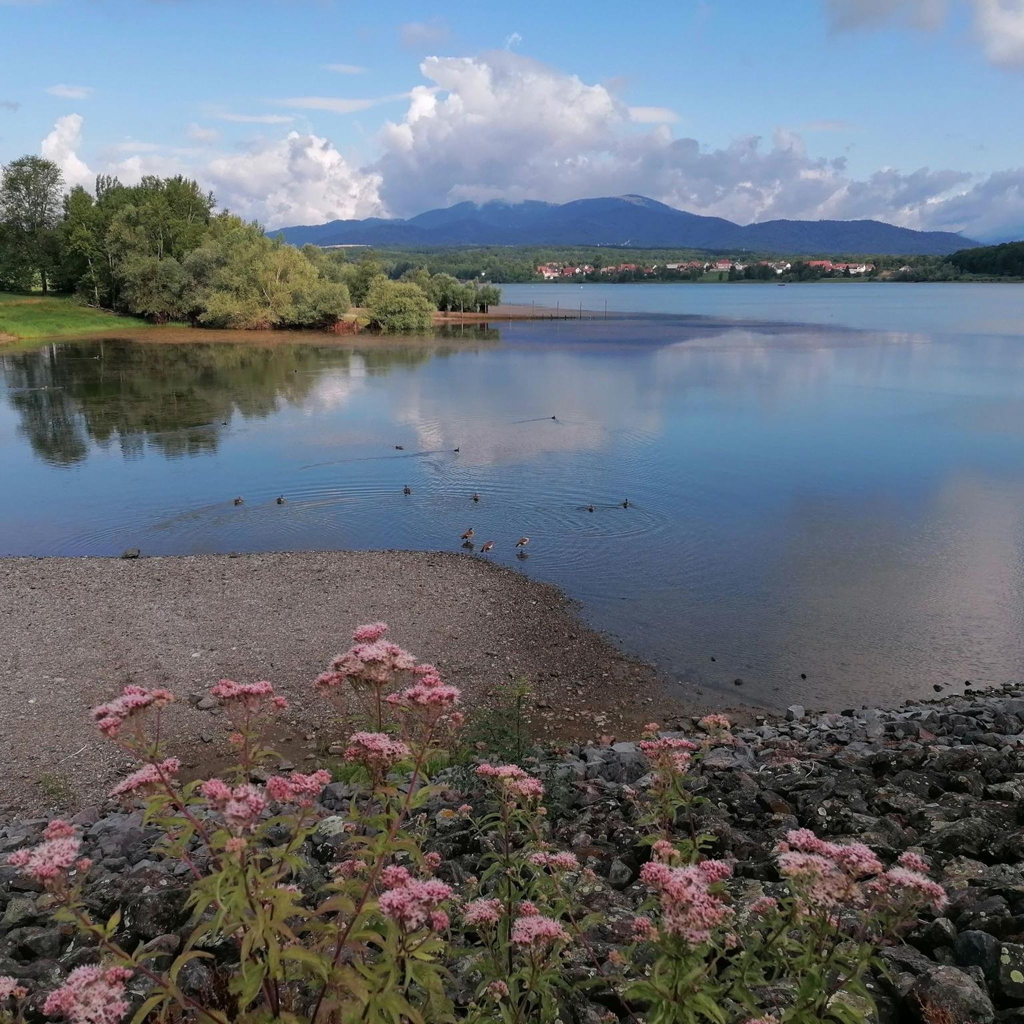
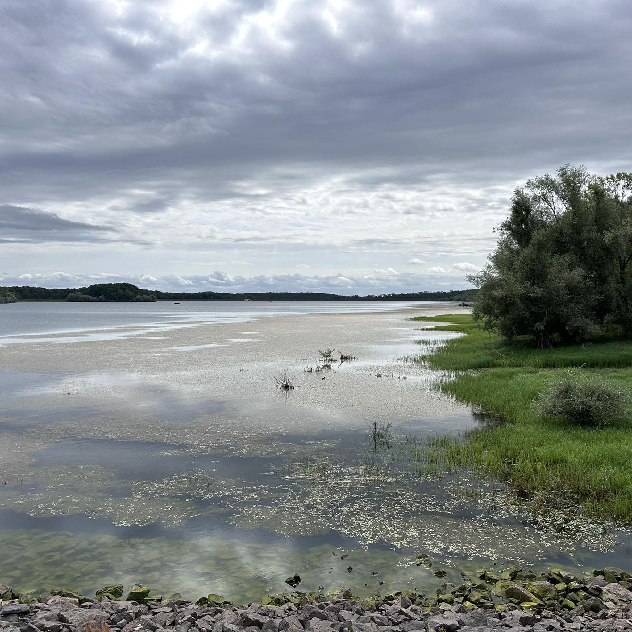
the Michelbach lake is a place where you can stop for a picnic during hikes or bike rides
0
0

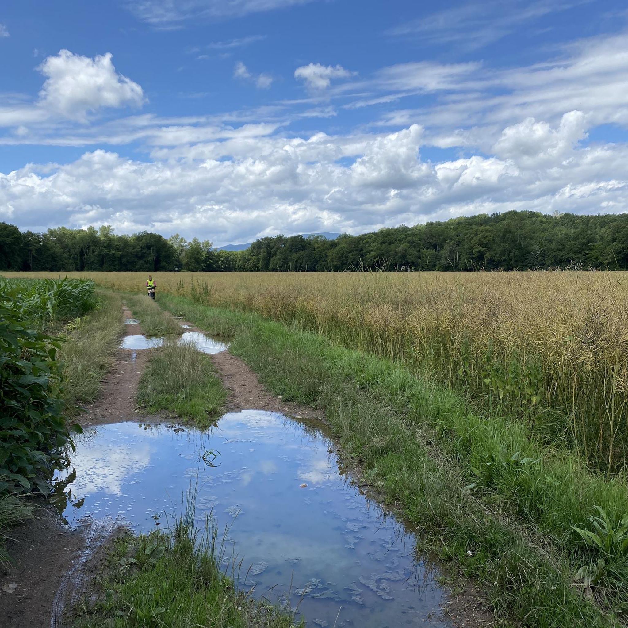
calm and well-rolling section
0
0

Frequently Asked Questions
How many touring cycling routes are available around Niederburnhaupt?
There are over 30 touring cycling routes around Niederburnhaupt, catering to various skill levels. This includes 13 easy routes, 18 moderate routes, and 1 more challenging option, ensuring a diverse range of experiences for cyclists.
What kind of terrain can I expect on touring cycling routes in Niederburnhaupt?
The terrain around Niederburnhaupt is quite varied. You'll find exceptionally quiet and flat routes along the Rhine-Rhône Canal, ideal for leisurely rides. There are also scenic passages along the Thur river and routes through the Doller Valley. For those seeking more challenge, routes ascend towards the foothills of the Vosges mountains, offering more significant elevation gains and panoramic views.
Are there routes suitable for beginners or those looking for an easy ride?
Yes, Niederburnhaupt offers several easy touring cycling routes, particularly along the flat paths of the Rhine-Rhône Canal. One such route is the Positions of the 1st World War loop from Burnhaupt-le-Bas, which is just over 9 km long and has minimal elevation gain. Another easy option is the Michelbach Lake – Michelbach Dam loop from Burnhaupt-le-Bas, covering about 17 km.
What are some more challenging touring cycling routes in the Niederburnhaupt area?
For cyclists seeking a challenge, the region offers routes that venture into the Vosges mountains. While specific challenging routes from the guide data are moderate, the region research indicates options like a demanding touring loop to Lac d'Alfeld in the Parc Naturel Régional des Ballons des Vosges, which includes tough climbs. Routes exploring the Doller Valley can also offer ascents towards peaks like the Grand Ballon.
What natural features or landmarks can I see while cycling around Niederburnhaupt?
Cyclists can enjoy diverse scenery, from the tranquil Rhine-Rhône Canal with its historic locks like the Eglingen Lock, to the picturesque Thur and Doller river valleys. The region also provides access to the foothills of the Vosges mountains, offering views of lakes such as Lac d'Alfeld and Lac Wildenstein-Kruht. You might also pass by the Port of Dannemarie, a nautical relay with amenities.
Are there any circular touring cycling routes in Niederburnhaupt?
Yes, many of the touring cycling routes around Niederburnhaupt are designed as loops, allowing you to start and end in the same location. Popular circular routes include the Saint-Thiébaut Collegiate Church – Thur River loop from Burnhaupt-le-Bas and the Michelbach Lake – A beautiful place... loop from Burnhaupt-le-Bas, both offering scenic experiences.
Can I find family-friendly touring cycling routes in Niederburnhaupt?
Absolutely. The flat and quiet paths along the Rhine-Rhône Canal are particularly well-suited for families. These routes offer a safe and enjoyable environment for cyclists of all ages. The Positions of the 1st World War loop from Burnhaupt-le-Bas is an easy, shorter option that could be suitable for families.
What are the best times of year for touring cycling in Niederburnhaupt?
The spring, summer, and early autumn months generally offer the most pleasant conditions for touring cycling in Niederburnhaupt. During these seasons, the weather is typically mild, and the natural landscapes are at their most vibrant, making for an enjoyable ride along the canals, rivers, and through the Vosges foothills.
Are there options for long-distance touring cyclists?
Yes, Niederburnhaupt is situated along the EuroVelo 6, a major European cycle route, making it an excellent base for long-distance touring cyclists. The presence of the Rhine-Rhône Canal also provides extensive, flat routes that can be linked for longer journeys.
What do other touring cyclists enjoy the most about touring cycling in Niederburnhaupt?
The area is highly rated by the komoot community, with an average score of 4.4 stars from over 400 reviews. Reviewers often praise the diverse landscapes, from the tranquil canal paths to the scenic river valleys and the rolling foothills of the Vosges mountains. The variety of routes catering to different ability levels is also frequently highlighted.
Where can I park my car when starting a touring cycling route in Niederburnhaupt?
While specific parking locations for each route are not detailed here, many touring cycling routes in the region, especially those starting from towns or popular attractions like the Port of Dannemarie, typically have designated parking areas nearby. It's advisable to check local signage upon arrival.
Is public transport accessible for cyclists in Niederburnhaupt?
The region's infrastructure often supports cycling, and public transport options like regional trains in Alsace may accommodate bicycles, though specific regulations and availability can vary. For detailed information on public transport access with bikes, it's best to consult local transport providers or the tourism office for the Alsace region.
Are there any specific points of interest along the Doller Valley routes?
Yes, routes through the Doller Valley offer rich, varied landscapes often dotted with charming mountain villages. The Camping de la Doller – Lake Michelbach loop from Burnhaupt-le-Bas is a popular route that leads through this scenic valley, providing views of the natural beauty and local character of the area.
Most popular routes around Niederburnhaupt
Most popular attractions around Niederburnhaupt

Get inspired with the komoot mobile app


Explore more
Browse the best Cycling routes in other regions.
