The best traffic-free bike rides around The Municipal District of Carlow
4.5
(2)
68
riders
2
rides
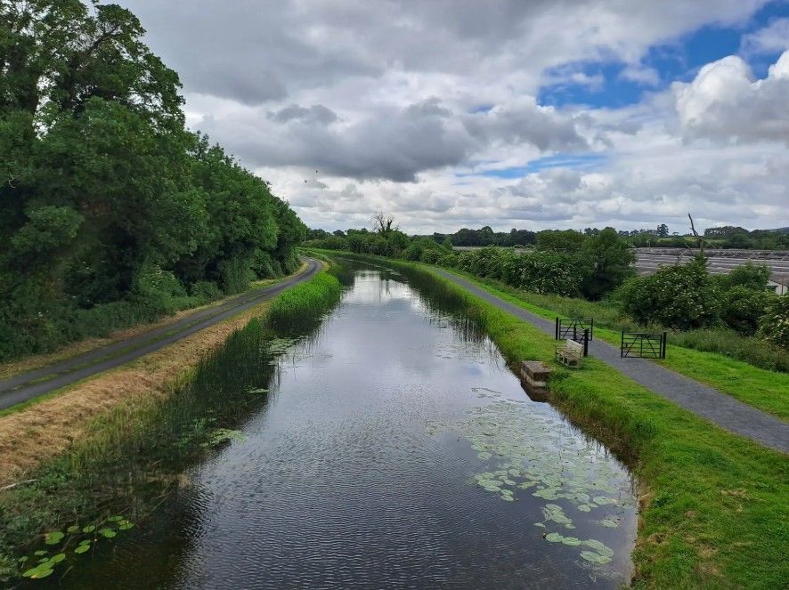
No traffic touring cycling routes around The Municipal District of Carlow offer diverse landscapes for exploration. The region features a mix of flat riverside paths along the River Barrow and more challenging ascents in the Blackstairs Mountains. Rolling hills and fertile valleys characterize much of the terrain, providing varied cycling experiences. Woodlands and historic sites are also integrated into the area's natural and cultural fabric.
Best no traffic touring cycling routes around The Municipal District of Carlow
- The most popular…
Last updated: May 13, 2026
1
riders
40.7km
03:59
100m
100m
Hard bike ride. Good fitness required. You may need to push your bike for some segments of this route.
5.0
(1)
9
riders
42.9km
03:50
160m
160m
Moderate bike ride. Good fitness required. Mostly paved surfaces. Suitable for all skill levels.

Sign up for free
4.0
(1)
3
riders
15.9km
00:56
90m
90m
Easy bike ride. Great for any fitness level. Mostly paved surfaces. Suitable for all skill levels.
2
riders
36.9km
02:26
550m
550m
Hard bike ride. Very good fitness required. Mostly paved surfaces. Suitable for all skill levels.
Our route recommendations are based on thousands of hikes, rides, and runs completed by other people on komoot.
Start today with a free account
Your next adventure awaits.
Login or Signup
Popular around The Municipal District of Carlow

Other adventures around The Municipal District of Carlow

Tips from the Community

There are plenty of places to get refreshments: next to the old stone bridge, or in the nearby town itself. A perfect stop when walking the Barrow Way.
0
0

This is a scenic bridge across the beautiful River Barrow, a fine sight on both the Barrow Way and South Leinster Way long-distance trails. The river here marks the border between Counties Kilkenny and Carlow.
0
0


Ballymoon Castle (Irish: Caisleán Baile Muáin) is a National Monument situated 2 miles (3 km) east of Bagenalstown, County Carlow, Ireland. The castle is thought to date from the 13th century. https://en.m.wikipedia.org/wiki/Ballymoon_Castle
1
0
On the lower side of the road, you will see an alignment of nine small stones in the ground. These are said to commemorate nine shepherds lost on Mount Leinster in some distant winter storm, hence the origin of the viewing point's name.
2
0
Nice double lock for smaller boats. Located directly on the Barrow Way.
0
0
13th Century castle that is now in ruins. Thought to be built by the Carew family, the ruins are an impressive site from the road.
0
0
Frequently Asked Questions
What kind of terrain can I expect on no-traffic touring cycling routes in The Municipal District of Carlow?
The Municipal District of Carlow offers a diverse range of terrain for traffic-free touring cycling. You'll find largely flat, leisurely paths along the River Barrow Greenway/Towpath, ideal for relaxed rides. For those seeking more challenging ascents and descents, routes venturing towards the Blackstairs Mountains, such as the Nine Stones – Ballymoon Castle loop from Muine Bheag, provide rugged beauty and significant elevation changes.
Are there any easy, traffic-free cycling routes suitable for beginners or families?
Yes, for an easier, traffic-free experience, the region offers routes like the Bike loop from Brownshill Dolmen. This route is approximately 16 km long with minimal elevation gain, making it a great option for beginners or families looking for a relaxed ride away from traffic.
What historical or natural landmarks can I see along these routes?
The no-traffic touring routes in Carlow often pass by significant historical and natural landmarks. You might encounter sites like the Carlow Castle Ruins, the ancient Brownshill Dolmen, or the picturesque Lovely paths around Milford Lock. The River Barrow itself is a natural feature, offering scenic views of locks, wildlife, and historic mills.
Are there any circular no-traffic touring routes available?
Yes, several routes are designed as loops, allowing you to start and end in the same location without retracing your steps. Examples include the Barrow Way: Carlow to Athy Loop and the Ballytiglea Bridge – Ballykeenan Lock loop from Muine Bheag, both offering varied scenery on a circular path.
What do other touring cyclists enjoy most about cycling in The Municipal District of Carlow?
The Municipal District of Carlow is highly rated by the komoot community, with an average score of 4.5 stars. Reviewers often praise the tranquil, traffic-free nature of the riverside paths, the scenic beauty of the diverse landscapes, and the opportunity to explore historical sites and natural features away from busy roads.
Can I access these routes using public transport?
While specific public transport links directly to every trailhead can vary, Carlow Town is a central hub with bus and train services. Many of the riverside routes, particularly those along the Barrow Way, are accessible from towns and villages that may have public transport connections. It's advisable to check local bus and train schedules for specific starting points.
Are there any specific woodlands or forest parks with cycling paths?
Carlow boasts extensive woodlands such as Oak Park Forest Park and Clogrennane Wood. While these offer tranquil settings and walking trails, dedicated traffic-free touring cycling paths within these specific parks might be limited. However, quiet country roads and bóithríns (narrow lanes) often wind through these areas, providing a peaceful cycling experience.
What is the best time of year to cycle the no-traffic routes in Carlow?
The best time to cycle in Carlow is generally from spring through autumn (April to October). During these months, the weather is typically milder, with longer daylight hours and less rainfall, making for more enjoyable conditions on the paths and trails. Summer offers lush green landscapes, while spring and autumn provide beautiful seasonal colours.
Are there any routes that offer panoramic views?
For panoramic views, routes that ascend into the Blackstairs Mountains are your best bet. The Nine Stones – Ballymoon Castle loop from Muine Bheag, for example, takes you towards the Nine Stones Viewing Point, which offers dramatic vistas of the Myshall plain and the surrounding landscape, and on clear days, even extends to the Wicklow Mountains and the Irish Sea.
Where can I find parking for these traffic-free cycling routes?
Parking is typically available in the towns and villages that serve as starting points for these routes. For example, Carlow Town, Muine Bheag (Bagenalstown), and Borris often have public car parks. For routes along the River Barrow, look for parking facilities near access points to the Barrow Way in various riverside communities.
Are there cafes or pubs near the no-traffic cycling routes for refreshments?
Yes, many of the routes, especially those following the River Barrow, pass through or near charming towns and villages. These often have local cafes, pubs, and shops where you can stop for refreshments, a meal, or to stock up on supplies. It's always a good idea to check opening times, especially in smaller villages.
Most popular routes around The Municipal District of Carlow
Most popular attractions around The Municipal District of Carlow

Get inspired with the komoot mobile app


