The best road cycling routes around The Municipal District of Carlow
3.8
(5)
403
riders
86
rides
Road cycling routes around The Municipal District of Carlow traverse a diverse landscape, offering options from flat riverside paths to challenging mountain ascents. The region is characterized by rolling hills, fertile valleys, and the meandering River Barrow. For more demanding rides, the Blackstairs Mountains, including Mount Leinster, provide significant elevation gain.
Best road cycling routes around The Municipal District of Carlow
- The most popular road cycling route is Carlow to Kilkenny loop via Leighlinbridge, a 66.1 miles (106.3 km)…
Last updated: May 18, 2026
5.0
(1)
3
riders
106km
04:29
720m
720m
Moderate road ride. Good fitness required. Mostly well-paved surfaces and easy to ride.
83
riders
67.8km
03:06
640m
640m
Moderate road ride. Good fitness required. Mostly well-paved surfaces and easy to ride.

Sign up for free
18
riders
Easy road ride. Great for any fitness level. Mostly well-paved surfaces and easy to ride.
17
riders
29.7km
01:10
110m
110m
Easy road ride. Great for any fitness level. Mostly well-paved surfaces and easy to ride.
10
riders
55.5km
02:15
260m
260m
Moderate road ride. Good fitness required. Mostly well-paved surfaces and easy to ride.
7
riders
66.1km
02:53
510m
510m
Moderate road ride. Good fitness required. Some segments of this route may be unpaved and difficult to ride.
4.0
(1)
7
riders
47.0km
01:53
210m
210m
Easy road ride. Great for any fitness level. Mostly well-paved surfaces and easy to ride.
10
riders
64.1km
02:36
320m
320m
Moderate road ride. Good fitness required. Mostly well-paved surfaces and easy to ride.
10
riders
51.0km
02:24
600m
600m
Moderate road ride. Good fitness required. Mostly well-paved surfaces and easy to ride.
6
riders
50.6km
02:09
400m
400m
Moderate road ride. Good fitness required. Mostly well-paved surfaces and easy to ride.
Get access to more routes and recommendations from other explorers.
Sign up for free
Already have an account?
Our route recommendations are based on thousands of hikes, rides, and runs completed by other people on komoot.
Start today with a free account
Your next adventure awaits.
Login or Signup
Other adventures around The Municipal District of Carlow

Tips from the Community


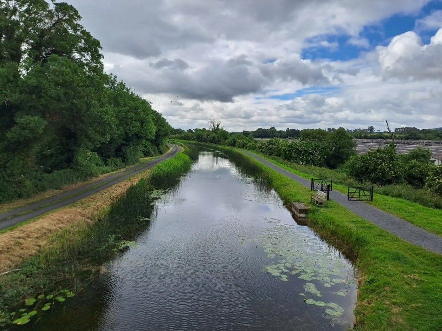
The bridge itself is not as pretty as nearby Gorsebridge stone bridge, but the view from up on top is not bad at all.
0
0

Carlow Castle was built early in the 13th century, replacing an earlier earth and timber construction on the same site. The castle was built as a classic four-towered keep - a large rectangular body with drum towers at each corner. Today only part of the structure remains, the west wall with two original towers, the rest is in ruins. The castle is free to visit and includes some information panels.
2
0


Athy is a quaint and picturesque town in County Kildare, Ireland, that offers visitors a delightful mix of history, natural beauty, and traditional Irish charm. The town is perhaps best known for White's Castle, a striking 15th-century tower house built to protect the strategic river crossing. Situated on the east bank of the River Barrow, the castle is a prominent feature that adds to Athy's historic atmosphere. The town's centerpiece is the Crom-a-Boo Bridge, a sturdy stone bridge dating back to the late 18th century, which leads directly into the heart of Athy. The bridge, coupled with the river's tranquil flow and the surrounding greenery, creates a serene and scenic environment perfect for a leisurely stroll. Athy's streets are lined with traditional pubs and shops, offering visitors the chance to soak in the typically Irish flair of this small town.
1
0

Ballymoon Castle (Irish: Caisleán Baile Muáin) is a National Monument situated 2 miles (3 km) east of Bagenalstown, County Carlow, Ireland. The castle is thought to date from the 13th century. https://en.m.wikipedia.org/wiki/Ballymoon_Castle
1
0
Carlow Castle (Irish: Caisleán Cheatharlach) is the ruins of a castle built between 1207 and 1213 in Carlow, Ireland. It is located on the banks of the River Barrow. https://en.m.wikipedia.org/wiki/Carlow_Castle
2
0
Frequently Asked Questions
How many road cycling routes are available in The Municipal District of Carlow?
There are nearly 100 road cycling routes available in The Municipal District of Carlow, catering to various skill levels. You'll find a diverse selection, from easy riverside spins to more challenging mountain ascents.
What kind of terrain can I expect when road cycling in Carlow?
The Municipal District of Carlow offers a varied landscape for road cycling. You can expect flat, scenic routes along the River Barrow, rolling hills and fertile valleys, and for those seeking a challenge, steep ascents and thrilling descents in the Blackstairs Mountains, including Mount Leinster.
Are there road cycling routes suitable for beginners or families in Carlow?
Yes, Carlow offers many easy road cycling options perfect for beginners or families. Routes along the River Barrow, such as the Milford Lock – Leighlinbridge loop from Carlow, provide flat and scenic paths. There are 45 easy routes in the region, ensuring a comfortable ride for all.
What about more challenging road cycling routes for advanced cyclists?
For advanced cyclists, the Blackstairs Mountains, including Mount Leinster, offer significant elevation gain and demanding terrain. While there are 3 difficult routes, many of the 49 moderate routes also feature notable climbs and descents, providing a good challenge. An example is the Carlow to Kilkenny loop via Leighlinbridge, which covers over 100 km with substantial elevation.
Are there any circular road cycling routes in the Carlow area?
Yes, many road cycling routes in Carlow are designed as loops, allowing you to start and finish in the same location. For instance, the Descent from the Hill – View of Carlow Town loop from Carlow offers a moderate 67.8 km circular path with scenic views. Another option is the Stretch along the Barrow Way – Carlow Castle Ruins loop from Brownshill Dolmen, an easy 46.1 km loop.
What scenic viewpoints or attractions can I see along road cycling routes in Carlow?
Road cycling routes in Carlow often pass by beautiful natural features and historical sites. You can cycle along the River Barrow, enjoy panoramic views from the Blackstairs Mountains, or visit landmarks like the Carlow Castle Ruins. The Stretch along the Barrow Way – Carlow Castle Ruins loop from Brownshill Dolmen is a great route to see the castle ruins.
What is the best time of year for road cycling in Carlow?
The Municipal District of Carlow is enjoyable for road cycling throughout much of the year. Spring and autumn offer pleasant temperatures and beautiful scenery, with fewer crowds. Summer provides longer daylight hours, while winter rides might require more preparation for cooler, potentially wetter conditions.
Where can I find parking for road cycling routes in Carlow?
Many routes in Carlow start from towns like Carlow itself, where public parking is generally available. For routes beginning outside urban areas, look for designated parking at trailheads or near popular attractions. Always check local signage for parking regulations.
Are there dedicated cycle networks in Carlow?
Yes, Carlow is committed to cycling infrastructure. The Carlow to Kilkenny National Cycle Network is a dedicated 35km on-road cycle route linking the two towns, and it connects to an extensive network within Carlow Town. This provides safe and enjoyable cycling opportunities. You can find more information on Carlow's outdoor activities at carlowtourism.com.
What do other road cyclists enjoy about the routes in The Municipal District of Carlow?
The road cycling routes in The Municipal District of Carlow are highly rated by the komoot community, with an average score of 3.8 stars from over 5 reviews. Cyclists often praise the diverse terrain, from the peaceful riverside paths of the Barrow Way to the challenging climbs of the Blackstairs Mountains, and the scenic views encountered along the way.
Can I find cafes or places to stop along the road cycling routes?
Yes, many road cycling routes in Carlow pass through or near charming towns and villages where you can find cafes, pubs, and shops to refuel and rest. Routes that connect towns like Carlow, Leighlinbridge, and Athy, such as the Athy – Carlow Castle Ruins loop from Carlow, offer convenient stopping points.
Are there any historical sites accessible by road bike in Carlow?
Carlow is rich in history, and several road cycling routes offer access to historical landmarks. Besides the Carlow Castle Ruins, you can also find routes near ancient sites like the Brownshill Dolmen. The region's landscape is dotted with monastic ruins and stately homes that can be incorporated into your cycling tours.
Most popular routes around The Municipal District of Carlow
Most popular attractions around The Municipal District of Carlow

Get inspired with the komoot mobile app


