The best traffic-free bike rides around Palo Alto
4.7
(133)
2,419
riders
25
rides
No traffic touring cycling routes around Palo Alto offer diverse landscapes, from flat marshlands to rolling hills and challenging mountain ascents. The region features an extensive network of trails, providing varied cycling experiences. Cyclists can explore the undisturbed marshlands of the Baylands Nature Preserve, the oak woodlands of Foothills Park, or the more challenging terrain extending into the Santa Cruz Mountains. Palo Alto is recognized as a bicycle-friendly community, with dedicated paths and an extensive network of bike lanes.
Best…
Last updated: November 7, 2026
5.0
(3)
67
riders
46.5km
03:27
980m
980m
Hard bike ride. Very good fitness required. Mostly paved surfaces.
5.0
(1)
29
riders
33.0km
02:12
450m
450m
Moderate bike ride. Good fitness required. Mostly paved surfaces.

3.0
(1)
25
riders
22.8km
01:39
290m
290m
Moderate bike ride. Good fitness required. Mostly paved surfaces.
22
riders
25.0km
01:51
320m
320m
Moderate bike ride. Good fitness required. Mostly paved surfaces.
5.0
(1)
16
riders
Easy bike ride. Mostly paved surfaces.
Get access to more routes and recommendations from other explorers.
Already have an account?
Our route recommendations are based on thousands of hikes, rides, and runs completed by other people on komoot.
Start today with a free account
Your next adventure awaits.


Other adventures around Palo Alto

Tips from the Community

Kite Hill Park is a lovely, low-key stop during your ride. Nestled in a small residential area, it features open grassy slopes—ideal for a quick picnic. You can also follow dirt paths that lead to the top of the small hill for a nice view.
0
0
Enid Pearson-Arastradero Preserve offers rolling grasslands mixed with oak and evergreen trees. The trail system starts on pavement and transitions to packed dirt and gravel—great for bikes with wider tires or a solid gravel setup. Keep an eye out for deer, coyotes, and even bobcats, and take a moment to pause at one of the benches or by Arastradero Lake to enjoy the open views.
0
0

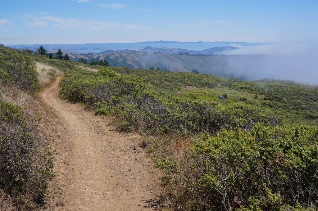
Borel Hill is my favorite place to watch spring flowers. The western slope near ancient oaks (5-10min west of Borel Hill) are covered with orange California Poppies and purple flowers starting in April. Borel Hill itself peaks around mid May and has a wide variety of flowers. The show lasts only a few weeks until end of May. The peak time and flower intensity varies from year to year, so come several times between April and May. There is small summit NW of Borel Hill and a narrow dirt trail leads you to a rock within 2 min. The rock is big enough for 2-3 to sit on. On a sunny day, the rock is nice warm even if the air is cold. Good views on the ocean and the Bay.
1
0

The Palo Alto-Los Altos Bike and Pedestrian Path, also known as the Hetch Hetchy Trail, is a well-maintained multi-use route that connects Los Altos Avenue to Arastradero Road. It’s popular for biking, running, and hiking, offering scenic views and access to parks like Terman Park, Bol Park, and Barron Park Donkeys. The trail includes a mini library and is part of Henry M. Gunn High School's recommended walking routes.
1
0

This winding side road is very lightly trafficked and carries you between Stanford and the Palo Alto hills with partial shade the entire way. On the east side of the road you will find Frenchman's Tower, and old brick landmark.
0
0
Moody Road is a short route for cyclists connected to nearby trails or longer climbs like Page Mill Road. It offers a mix of rolling hills and quiet, scenic vibes. The last km is tough, but in the end it is always worth it.
0
0

This two-story structure stands 32 feet tall and resembles something out of medieval times. Built in 1875 by a reclusive French refugee who fled France after the Franco-Prussian War, it still features an air of mystery today. The tower's owner vanished in 1883 when he returned to Paris, leaving behind a captivating enigma.
0
0

Lovely shortcut from LA to PA. A couple of things to watch out for: 1) near the LA end, the trail crosses a street. It's a cul-de-sac so traffic isn't an issue but the nearly curb shaped 'ramps' are worth noting. Also be careful going over the bridge as sightlines are limited and there could be other users
0
0
Frequently Asked Questions
How many no-traffic touring cycling routes are available in Palo Alto?
There are over 20 dedicated no-traffic touring cycling routes around Palo Alto, offering a variety of experiences for different skill levels. You'll find a mix of easy, moderate, and challenging options to explore.
What are some of the most scenic no-traffic cycling areas in Palo Alto?
The Baylands Nature Preserve is a prime location for scenic, flat, and traffic-free rides, offering beautiful marshland views and excellent birdwatching opportunities. The San Francisco Bay Trail – Stevens Creek bridge loop from California Avenue is an easy route that takes you through this area.
Are there any family-friendly no-traffic cycling routes in Palo Alto?
Yes, Palo Alto offers several family-friendly options. The Bol Park Path, known for its flat asphalt surface and historical donkey pasture, is a great choice. You can experience a longer ride incorporating this path with the Boronda Lake – Bol Park Path loop from California Avenue, which is rated as moderate.
What kind of elevation changes can I expect on these routes?
The no-traffic touring cycling routes in Palo Alto vary significantly in elevation. While routes like those in the Baylands are mostly flat, others, particularly those venturing towards the foothills, can include substantial climbs. For example, the Bike loop from Los Altos Hills is a difficult route with over 860 meters of elevation gain, offering a challenging experience.
What attractions or landmarks can I see along the no-traffic touring cycling routes?
Many routes offer views of natural and historical landmarks. You might pass by the San Francisco Bay Trail, offering expansive bay views, or cycle near the Woodside Store (Historic Site). The Bowl Loop Jumps – Old Page Mill Road loop from Lou Henry and Herbert Hoover House takes you through areas with historical significance.
Are there any loop routes that avoid traffic?
Absolutely. Many of the no-traffic touring cycling routes in Palo Alto are designed as loops for convenience. Examples include the Stevens Creek bridge – Moffett Federal Airfield loop from California Avenue and the San Francisco Bay Trail – Stevens Creek bridge loop from California Avenue, both offering circular journeys with minimal car interaction.
What is the best time of year to go touring cycling in Palo Alto?
Palo Alto generally enjoys mild weather, making it suitable for cycling year-round. However, spring and fall offer particularly pleasant temperatures and often clearer skies, ideal for enjoying the diverse landscapes from the Baylands to the foothills. Summers can be warm, especially inland, while winters are mild but may bring occasional rain.
What do other touring cyclists enjoy most about cycling in Palo Alto?
The komoot community highly rates the touring cycling experience in Palo Alto, with an average score of 4.67 stars. Reviewers often praise the region's diverse landscapes, from the peaceful Baylands to the challenging foothill climbs, and the extensive network of bike-friendly paths that allow for enjoyable, traffic-free exploration.
Are there any routes that pass by lakes or water features?
Yes, several routes offer views of lakes and water features. The Boronda Lake – Bol Park Path loop from California Avenue passes by Boronda Lake. Additionally, you can find highlights like Stevens Creek Reservoir and Arastradero Lake near some of the cycling areas, providing picturesque stops.
Can I find routes suitable for beginners looking for no-traffic options?
Absolutely. Palo Alto offers several easy, no-traffic routes perfect for beginners. The San Francisco Bay Trail – Stevens Creek bridge loop from California Avenue is an excellent choice, being relatively flat and providing a pleasant, car-free experience along the bay.
Are there any challenging no-traffic touring routes for experienced cyclists?
For experienced cyclists seeking a challenge, the region offers routes with significant elevation gains. The Bike loop from Los Altos Hills is classified as difficult, featuring substantial climbs through the varied landscapes of the foothills, providing a rewarding workout away from main roads.
Most popular routes around Palo Alto
Most popular attractions around Palo Alto

Get inspired with the komoot mobile app


Explore more
Browse the best Cycling routes in other regions.
