The best traffic-free bike rides around Saint-Bonnet-De-Montauroux
4.4
(8)
39
riders
4
rides
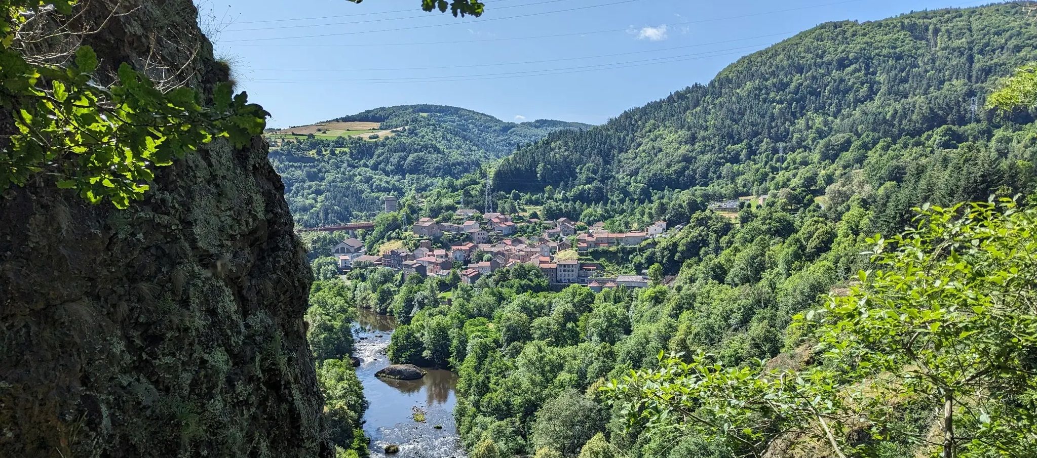
No traffic gravel bike trails around Saint-Bonnet-De-Montauroux offer a diverse and engaging experience within the mid-mountainous landscapes of the Lozère department in France. The region features varied terrain, including little-used roads, forest tracks, and dirt paths, providing extensive networks for gravel biking. Elevations range from approximately 2,392 to 3,871 feet (729 to 1,180 meters), creating dynamic routes with significant elevation changes. This environment, characterized by its natural features and extensive trail systems, is well-suited for cyclists seeking routes away from…
Last updated: May 24, 2026
4.3
(6)
14
riders
32.5km
02:26
480m
480m
Hard gravel ride. Very good fitness required. Mostly paved surfaces. Suitable for all skill levels.
7
riders
79.7km
06:19
1,360m
1,360m
Hard gravel ride. Very good fitness required. Mostly paved surfaces. Suitable for all skill levels.

Sign up for free
5.0
(1)
2
riders
39.1km
02:59
770m
770m
Hard gravel ride. Very good fitness required. Mostly paved surfaces. Suitable for all skill levels.
4.0
(1)
4
riders
17.1km
01:14
200m
200m
Moderate gravel ride. Good fitness required. Mostly paved surfaces. Suitable for all skill levels.
7
riders
21.6km
01:41
340m
340m
Moderate gravel ride. Good fitness required. Mostly paved surfaces. Suitable for all skill levels.
Our route recommendations are based on thousands of hikes, rides, and runs completed by other people on komoot.
Start today with a free account
Your next adventure awaits.
Login or Signup
Popular around Saint-Bonnet-De-Montauroux

Other adventures around Saint-Bonnet-De-Montauroux

Tips from the Community

These ruins once housed the Choisinets castle and orphanage. The construction of this unusual building spanned the entire second millennium. The ruins of two towers dating from the 12th and 17th centuries are still in good condition, testifying to the various architectural influences.
0
0
In one of the best-preserved parts of the Margeride massif, the Three Sisters pass is said to have been named after the story of three sisters born in the parish of La Panouse, all three of whom were hired as servants in the local barracks. According to the dictionary of the rural world, these barracks refer to old inns located at the start of steep roads. This allowed the wagoners to reinforce their teams before setting off.
1
0
Unexpected and yet very present! In the middle of this wild part of the Margeride massif you will find this superb washing and repair station for your bike: compressor, all valves and tools are available free of charge, while the washing device requires a contribution (normal). Also take the opportunity to fill your water bottles thanks to the small tap on the left.
0
0

Lac de Charpal lies at an altitude of 1,360 meters amidst raised bogs, forests, and heathland. This artificial reservoir, built in the 1930s, supplies Mende with drinking water. Today, it is a tranquil retreat, popular for hiking, nature observation, and its protected flora and fauna.
0
0
Lac de Charpal lies at an altitude of 1,360 meters amidst raised bogs, forests, and heathland. This artificial reservoir, built in the 1930s, supplies Mende with drinking water. Today, it is a tranquil retreat, popular for hiking, nature observation, and its protected flora and fauna.
0
0

Market on Tuesdays (summer) and Saturdays
0
0
There we found the Meteil bread seller (a mixture of rye and sourdough) from the previous day's market in Costaros, under the market hall. Producers of fruit and vegetables, cheeses, and charcuterie. Everything for an ideal picnic.
0
0
Rehabilitation work in progress. Please note that the site is not on the route. You must take a 200m detour from the intersection with the statue of Saint Germaine.
0
0
Frequently Asked Questions
How many no-traffic gravel bike trails are available around Saint-Bonnet-de-Montauroux?
There are currently 4 dedicated no-traffic gravel bike trails featured in this guide for the Saint-Bonnet-de-Montauroux area. These routes offer a range of distances and challenges, allowing you to explore the region's natural beauty away from cars.
What kind of terrain can I expect on gravel bike trails in the Lozère department?
The Lozère department, where Saint-Bonnet-de-Montauroux is located, offers a diverse gravel biking experience. You can expect a mix of little-used roads, forest tracks, and dirt roads. The region is mid-mountainous, with elevations ranging from approximately 729 to 1,180 meters, providing undulating routes with significant elevation changes and rewarding climbs.
Are there any easy or moderate no-traffic gravel routes for beginners or families?
Yes, while many routes in the region are challenging, there are options suitable for those seeking a less strenuous ride. For example, the Lake Naussac – Nice return to Langogne loop from Langogne is rated moderate, covering 17 km with around 200 meters of elevation. Another moderate option is the Lake Naussac – Lake Naussac loop from Le Mas d'Armand, which is 21.6 km long with about 336 meters of ascent. These routes are great for enjoying the scenery without excessive difficulty.
What natural features or landmarks can I see along the gravel bike trails?
The no-traffic gravel trails around Saint-Bonnet-de-Montauroux offer access to stunning natural features and local landmarks. You might pass by picturesque lakes like Lake Bouchet or the scenic Donozau Waterfall. The routes often traverse forests like the Forêt du Patus and plateaus such as the Margeride, providing tranquil paths and rich natural beauty. You'll also encounter rivers like the Chapeauroux, which flows through the commune.
What do other gravel bikers enjoy most about the trails in Saint-Bonnet-de-Montauroux?
The komoot community highly rates the gravel biking experience in this area, with an average score of 4.4 out of 5 stars from 8 ratings. Reviewers often praise the quiet, traffic-free nature of the routes, the diverse landscapes, and the rewarding climbs that offer panoramic views. The sense of immersion in nature and the challenging yet beautiful terrain are frequently highlighted.
Are there any challenging no-traffic gravel routes for experienced riders?
Absolutely. For experienced riders seeking a challenge, the region offers several difficult no-traffic gravel routes. Consider the Lac de Charpal – Lake Charpal loop from Le Mas d'Armand, which is nearly 80 km long with over 1300 meters of elevation gain. Another demanding option is the Col des Trois Sœurs – Baraque des Bouviers (1410 m) loop from Grandrieu, covering 39 km with over 770 meters of ascent, taking you through high-altitude landscapes.
Can I find circular gravel bike routes in the area?
Yes, all the gravel bike routes featured in this guide are circular, allowing you to start and end your ride at the same point. This makes planning your trip and logistics, such as parking, much simpler. Examples include the Lake Naussac – Auradoux Pond loop from Le Mas d'Armand and the Lake Naussac – Lake Naussac loop from Le Mas d'Armand.
What is the best time of year for gravel biking in Saint-Bonnet-de-Montauroux?
The best time for gravel biking in Saint-Bonnet-de-Montauroux is generally from spring through autumn (April to October). During these months, the weather is typically milder and more stable, with less chance of snow or heavy rain, making the trails more accessible and enjoyable. Summer offers long daylight hours, but spring and autumn provide pleasant temperatures and vibrant scenery.
Are there opportunities for bikepacking or extended gravel adventures in the wider Lozère region?
Absolutely. The broader Lozère department is renowned for its extensive gravel networks, making it an excellent destination for bikepacking. The famous "Grand Tour of Lozère" is a significant gravel route spanning 490 km with 11,000 meters of elevation gain, traversing some of the most beautiful landscapes. While this guide focuses on shorter no-traffic routes, the region's infrastructure supports multi-day adventures for those looking to explore further.
Are there any historical villages or cultural sites near the gravel trails?
Yes, beyond the natural beauty, the region boasts charming historical villages. Nearby attractions include the historic village of La Garde-Guérin, known for its preserved character, and Pradelles, recognized as a "Most Beautiful Village." These offer a glimpse into the local heritage and can be interesting stops during or after your gravel biking excursions.
What are the typical elevation changes on these no-traffic gravel routes?
The routes in this guide feature varied elevation changes, reflecting the mid-mountainous terrain of the Lozère department. For example, the moderate Lake Naussac – Nice return to Langogne loop from Langogne has around 200 meters of ascent, while the more difficult Lac de Charpal – Lake Charpal loop from Le Mas d'Armand involves over 1300 meters of climbing. You should be prepared for undulating terrain and some significant ascents, even on shorter routes.
Most popular routes around Saint-Bonnet-De-Montauroux
Most popular attractions around Saint-Bonnet-De-Montauroux

Get inspired with the komoot mobile app


Explore more
Browse the best Gravel rides in other regions.
