The best traffic-free bike rides around Titaguas
302
riders
4
rides
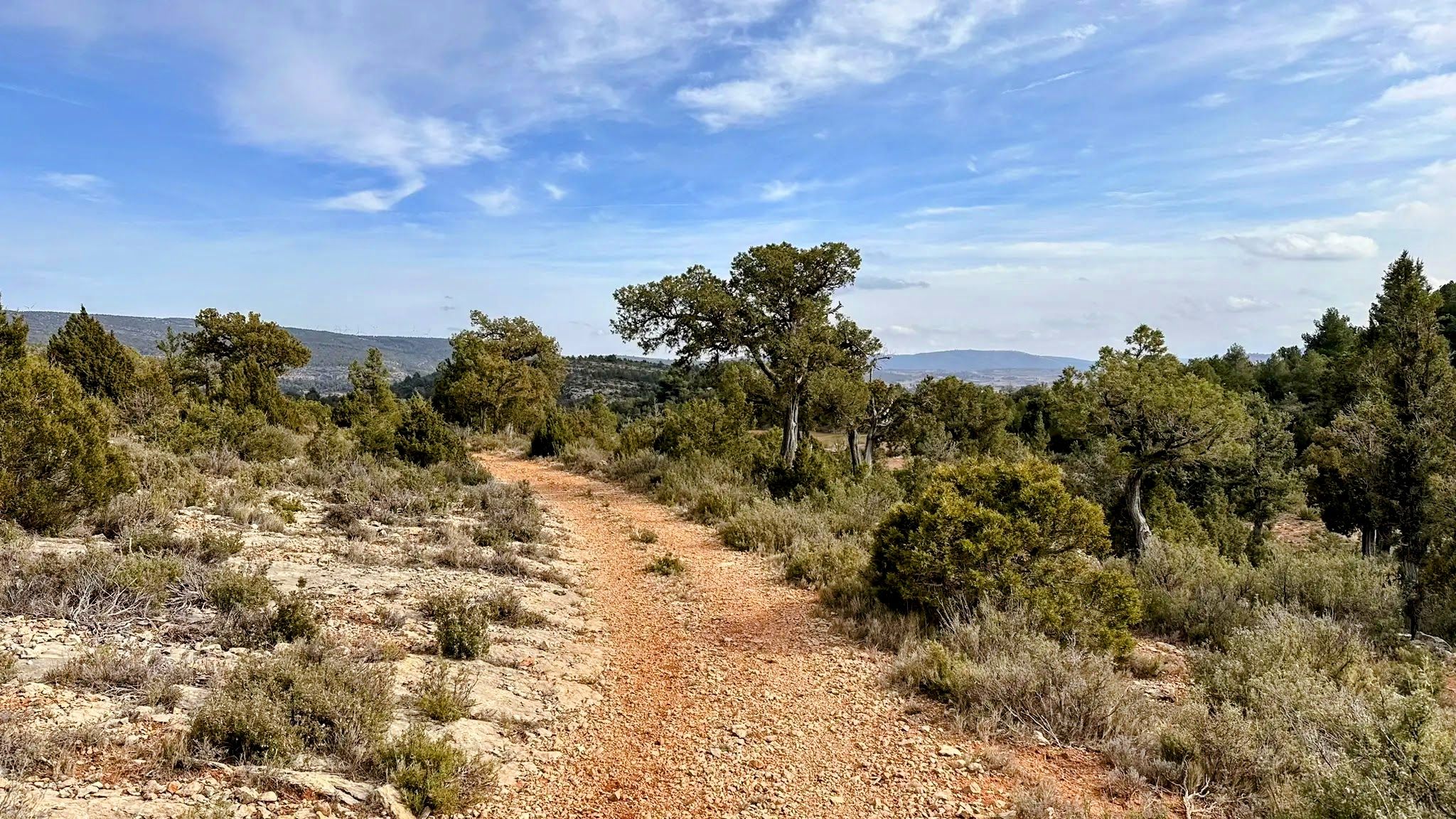
No traffic road cycling routes around Titaguas traverse the Valencian mountains within the Alto Turia region, offering diverse landscapes for cyclists. The area features hilly terrain with varying elevations, characterized by river valleys, mountain springs, and significant forest masses. Road cyclists can expect routes with notable ascents and descents, providing elevation challenges amidst a rural environment.
Best no traffic road cycling routes around Titaguas
- The most popular no traffic road cycling route is Arcos de las Salinas – Source of the Arcos River loop from Titaguas, a 48.8 miles (78.6 km) trail that takes 4 hours 23 minutes to complete. This difficult route features substantial elevation gain through mountainous terrain.
- Another top favourite among local road cyclists is Dirt road to Moya – Old Town of Moya loop from Talayuelas, a difficult 53.0 miles (85.4 km) path. This route offers significant climbing and passes through varied landscapes.
- Local road cyclists also love the Alpuente – Alpuente Village loop from Campo de Abajo, a 18.7 miles (30.1 km) trail leading through rural areas and offering moderate climbs, often completed in about 1 hour 26 minutes.
- Road cycling around Titaguas is defined by mountain roads, river valleys, and extensive forest areas. The network offers options for different ability levels, from moderate climbs to more challenging routes with significant elevation gain.
- The guide includes highly-rated routes that showcase the best of the region's landscape. More than 300 road cyclists have used komoot to explore Titaguas's varied terrain.
Last updated: July 15, 2026
9
riders
24.6km
01:10
310m
310m
Moderate road ride. Good fitness required. Mostly well-paved surfaces and easy to ride.
9
riders
30.1km
01:27
400m
400m
Moderate road ride. Good fitness required. Some segments of this route may be unpaved and difficult to ride.
Get access to more routes and recommendations from other explorers.
Sign up for free
Already have an account?
Our route recommendations are based on thousands of hikes, rides, and runs completed by other people on komoot.
Start today with a free account
Your next adventure awaits.
Login or Signup

Other adventures around Titaguas

Tips from the Community

La Yesa is a small village in the Los Serranos region, surrounded by mountains covered with holm oaks and pine forests, ideal for leisurely hikes with beautiful views of the mountains and even the sea on clear days. Its attractions include the Church of Nuestra Señora de los Ángeles, several chapels, and monumental trees such as the Carrasca Tumbada and the Pino Sombrero. The surrounding area offers trails through natural sites such as El Carrascal and El Castellar, with archaeological remains. To replenish your energy, there's nothing better than trying "Olla de pueblo" (village pot), a hearty rice dish with beans and turnips, typical of the area.
1
0
The Los Arcos aqueduct, located in Alpuente, is a 16th and 17th-century hydraulic structure that supplied water to the town and its orchards. With its thirteen pointed arches and a length of 265 meters, the arcade bridged the uneven level of the Reguero River, although the main arch was lost in a flood in 1880. Today, it is preserved as a Site of Cultural Interest and can be easily visited from the road to La Yesa. It is an interesting spot for combining history and hiking; good footwear is recommended to explore the surroundings.
2
0
Alpuente is a picturesque town in the Los Serranos region, surrounded by mountains and ravines, making it an ideal destination for hiking enthusiasts. Its historic center preserves remains of walls, towers, and the medieval castle, as well as an interesting paleontological museum with dinosaur fossils. From the town, you can take a 46-kilometer trail that connects its numerous villages, a good option for exploring its natural and rural surroundings. The terrain is rocky and uneven, so it's advisable to wear comfortable shoes and bring water, especially in summer.
1
0

A very pretty town located in a very picturesque setting within the region of La Serranía. You can see very nice views both from the town and from the road to there. A highly recommended place to visit.
1
0

A must visit village. Dramatic location with stunning views over the Los Serranos region
0
1
150 million years old and displayed super clearly in this modest exhibition area.
0
0

Los Arcos de Alpuente, a medieval aqueduct
1
1
Frequently Asked Questions
How many no-traffic road cycling routes are available around Titaguas?
There are 4 dedicated no-traffic road cycling routes around Titaguas. These routes offer a mix of moderate and difficult challenges, perfect for exploring the Valencian mountains.
Are there any circular no-traffic road cycling routes in Titaguas?
Yes, all the no-traffic road cycling routes listed are circular. For example, you can enjoy the challenging Arcos de las Salinas – Source of the Arcos River loop from Titaguas or the more moderate Alpuente – Alpuente Village loop from Corcolilla.
What kind of elevation gain can I expect on these no-traffic road cycling routes?
The routes around Titaguas feature varying elevations, offering engaging climbs. You can expect ascents ranging from around 300 meters on moderate routes like the Alpuente – Alpuente Village loop from Campo de Abajo, up to over 1600 meters on more difficult routes such as the Arcos de las Salinas – Source of the Arcos River loop from Titaguas.
Are there any waterfalls or natural pools to see along the no-traffic road cycling routes?
While not directly on every route, the region boasts beautiful natural water features. You can visit the picturesque La Playeta de Chelva or the Azud de Tuéjar, both offering clear water and recreational areas. The Tuéjar River Waterfall – Water Route is also a notable natural attraction nearby.
What are some historical or cultural landmarks I can explore near the cycling routes?
Titaguas and its surroundings are rich in history. You can find historical sites like the Jewish Quarter of Azoque in Chelva or the Mudéjar-Morisco Quarter of Arrabal. The Archpriest Church of Our Lady of the Angels is also a significant religious building in the area.
What is the best time of year for road cycling in Titaguas?
The broader Region of Valencia is popular for cycling year-round. Given Titaguas's mountainous terrain, spring and autumn generally offer the most pleasant temperatures for challenging climbs, avoiding the peak heat of summer. However, the region's mild winters can also be suitable for cycling.
Are there any beginner-friendly no-traffic road cycling routes?
The available routes are categorized as moderate to difficult. The most accessible options are the moderate routes, such as the Alpuente – Alpuente Village loop from Corcolilla (24.5 km with 309m ascent) or the Alpuente – Alpuente Village loop from Campo de Abajo (30 km with 402m ascent). These offer a good introduction to the region's terrain.
Where can I find parking for my bike when visiting Titaguas?
Titaguas is a rural town, and parking is generally available within the municipality. While specific dedicated cyclist parking isn't detailed, you'll typically find suitable spots in or around the town center to begin your rides.
Can I reach Titaguas by public transport with my bike?
Public transport options to Titaguas are limited, reflecting its rural location. It's advisable to check local bus schedules and their bike policies in advance, as direct routes allowing bikes might be infrequent or require specific arrangements. Driving to the area is often the most convenient option for cyclists.
Are there any cafes or places to eat in Titaguas after a ride?
Titaguas, as a small town, offers local establishments where you can refuel. You'll find cafes and traditional eateries in the town center, providing a welcoming stop after exploring the surrounding no-traffic routes.
What makes Titaguas a good destination for no-traffic road cycling?
Titaguas is nestled in the Valencian mountains, offering a serene and rural environment with varying elevations and scenic routes. The focus on 'no traffic' routes means you can enjoy the diverse landscapes, including river valleys, springs, and forests, with minimal vehicle disturbance, making for a peaceful and engaging cycling experience.
Are there any viewpoints along the no-traffic road cycling routes?
The region around Titaguas is known for its scenic beauty. While specific viewpoints on each route are not detailed, the varying elevations and mountain roads naturally offer numerous panoramic vistas. Notable viewpoints in the area include Nuestra Señora del Remedio Chapel, El Azagador, and Monte Calvario, which provide stunning views of the landscape.
Most popular attractions around Titaguas

Get inspired with the komoot mobile app


Explore more
Browse the best Road cycling routes in other regions.
