The best traffic-free bike rides around Regentalaue zwischen Cham und Pösing
4.6
(21)
61
riders
11
rides
Gravel biking around Regentalaue zwischen Cham und Pösing offers routes through a diverse river valley and extensive floodplains shaped by the Regen river. The landscape features largely flat, open terrain, interspersed with numerous ponds, wet meadows, and old river arms, providing varied ecosystems. As the largest nature reserve in the Upper Palatinate, the area is characterized by mixed surfaces suitable for gravel biking, including unpaved forest and farm tracks. It is important to note that some paths are subject to seasonal closures from March 1st to June 30th to protect ground-nesting birds.
Best no traffic gravel bike trails around Regentalaue zwischen Cham und Pösing
- The most popular no traffic gravel bike trail is Pösinger bathing pond – Regen River Bridge loop from Cham (Oberpf), a 29.3 miles (47.2 km) trail that takes 2 hours 36 minutes to complete. This moderate route follows the river through the open floodplain landscape.
- Another top favourite among local gravel bikers is Boardwalk at Neubäuer See – View of Walderbach Abbey loop from Roding, a moderate 23.4 miles (37.7 km) path. This route offers views of the Neubäuer See and passes through varied natural surroundings.
- Local gravel bikers also love the View of Hammersee (Bodenwöhr) – View of Hammersee loop from Roding, a 26.7 miles (42.9 km) trail leading through the region's characteristic flat terrain and near water bodies, often completed in about 2 hours 26 minutes.
- Gravel biking around Regentalaue zwischen Cham und Pösing is defined by river valleys, floodplains, and wetlands, offering a network of routes suitable for different ability levels.
- The routes in Regentalaue zwischen Cham und Pösing are highly rated by the komoot community with an average score of 4.5 stars from over 20 reviews. More than 70 gravel bikers have used komoot to explore Regentalaue zwischen Cham und Pösing's varied terrain.
Last updated: July 25, 2026
4.5
(2)
11
riders
47.2km
02:36
160m
160m
Moderate gravel ride. Good fitness required. Mostly paved surfaces. Suitable for all skill levels.
5.0
(1)
4
riders
101km
06:08
1,310m
1,310m
Hard gravel ride. Very good fitness required. Mostly paved surfaces. Suitable for all skill levels.

Sign up for free
5.0
(3)
4
riders
37.6km
02:24
360m
360m
Moderate gravel ride. Good fitness required. Mostly paved surfaces. Suitable for all skill levels.
4.0
(1)
4
riders
42.9km
02:26
300m
300m
Moderate gravel ride. Good fitness required. Mostly paved surfaces. Suitable for all skill levels.
3
riders
56.2km
03:49
700m
700m
Hard gravel ride. Very good fitness required. Mostly paved surfaces. Suitable for all skill levels.
Get access to more routes and recommendations from other explorers.
Sign up for free
Already have an account?
Our route recommendations are based on thousands of hikes, rides, and runs completed by other people on komoot.
Start today with a free account
Your next adventure awaits.
Login or Signup
Popular around Regentalaue zwischen Cham und Pösing

Other adventures around Regentalaue zwischen Cham und Pösing

Tips from the Community

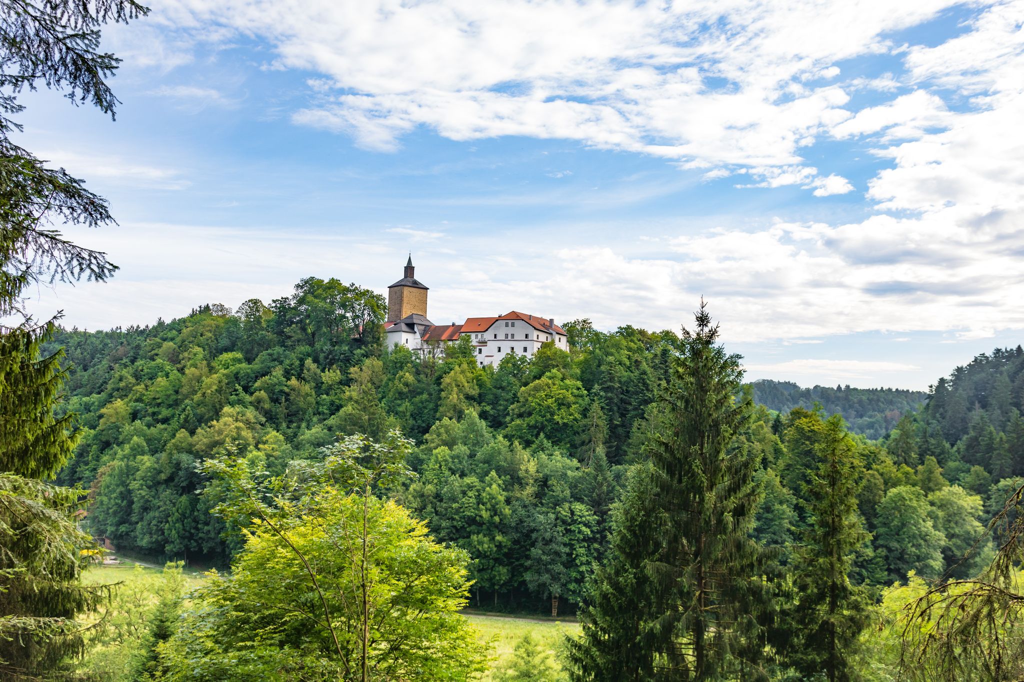
from the Donau-Regen-Radweg you have this view of the castle
0
0
The cycle path runs directly along the Regen river and therefore naturally has no significant climbs.
0
0

View of the lake to enjoy...........
2
0

From here you have a magnificent view.
0
0

Beautiful old bridge over the Regen.
1
0

From the observation tower you can enjoy a fantastic view of the Regen and the surrounding fields and meadows.
0
0

Beautiful lake for almost all leisure activities.
1
0
Frequently Asked Questions
How many no-traffic gravel bike trails are available in Regentalaue zwischen Cham und Pösing?
There are 11 dedicated no-traffic gravel bike routes in the Regentalaue zwischen Cham und Pösing area. These routes offer a mix of easy, moderate, and difficult options, ensuring there's something for every skill level.
What is the best time of year to go gravel biking in Regentalaue zwischen Cham und Pösing?
The best time for gravel biking is generally outside of the bird breeding season. Please note that to protect ground-nesting birds, several paths in the Regentalaue are closed annually from March 1st to June 30th. Outside of this period, the flat and open floodplain landscape offers excellent conditions, especially in late spring, summer, and early autumn.
Are there any family-friendly no-traffic gravel bike routes in the area?
Yes, the Regentalaue's largely flat terrain and the presence of the Regental Cycle Path make it suitable for families. While specific 'easy' routes are available, many of the paths are low gradient and offer a relaxed cycling experience. For a moderate option, consider the Pösinger bathing pond – Regen River Bridge loop from Cham (Oberpf), which covers 47 km with minimal elevation gain.
Can I bring my dog on the gravel bike trails?
The Regentalaue is a sensitive ecosystem, and visitors, especially those with dogs, are requested to stay on designated paths to protect the diverse wildlife. Always keep your dog on a leash and be mindful of ground-nesting birds, particularly during the breeding season (March 1st to June 30th).
What kind of terrain can I expect on the no-traffic gravel trails?
You can expect a varied and largely flat terrain. The routes primarily follow the expansive river valley and floodplains of the Regen river, featuring a mix of unpaved forest and farm tracks, which are perfect for gravel biking. The low gradient makes for relaxed cycling, with occasional gentle ascents.
Are there any circular no-traffic gravel bike routes available?
Yes, many of the routes are designed as loops, allowing you to start and end at the same point. An example is the Boardwalk at Neubäuer See – View of Walderbach Abbey loop from Roding, a moderate 37 km route that offers scenic views.
What can I see along the no-traffic gravel bike trails in Regentalaue?
The trails offer a rich natural experience with diverse habitats including ponds, wet meadows, and old river arms. You can also visit specific points of interest such as the Untertraubenbach Observation Tower for panoramic views, or the Rötelseeweiher Nature Reserve, known for its specialized plant species and bird observation station. The historic Biertor in Cham is also a notable landmark nearby.
Where can I park my car to access these trails?
Parking is generally available in the towns bordering the Regentalaue, such as Cham or Roding, which serve as common starting points for many routes. Specific parking information can often be found on individual route pages on komoot.
What makes the Regentalaue area special for gravel biking?
The Regentalaue is special due to its unique natural features, including the expansive river valley and floodplains of the Regen river. It's the largest nature reserve in the Upper Palatinate, offering a rich mosaic of habitats and exceptional biodiversity. The largely flat, open terrain and mixed surfaces (gravel, forest tracks) provide ideal conditions for relaxed, traffic-free gravel biking amidst stunning natural scenery.
What do other gravel bikers enjoy most about the Regentalaue zwischen Cham und Pösing?
The area is highly rated by the komoot community, with an average score of 4.5 stars. Reviewers often praise the quiet, traffic-free nature of the routes, the beautiful floodplain landscapes, and the opportunity to observe diverse birdlife. The flat and varied terrain is also frequently highlighted as ideal for enjoyable gravel rides.
Are there any easy gravel bike routes for beginners?
Yes, the Regentalaue offers several easy to moderate routes suitable for beginners, thanks to its predominantly flat profile. While all routes listed are for 'mtb_easy' sport type, some are rated 'moderate' in difficulty. For a good starting point, look for routes with lower elevation gain and shorter distances. The View of Hammersee (Bodenwöhr) – View of Hammersee loop from Roding is a moderate 42 km option with manageable elevation.
Most popular routes around Regentalaue zwischen Cham und Pösing
Most popular attractions around Regentalaue zwischen Cham und Pösing

Get inspired with the komoot mobile app


Explore more
Browse the best Gravel rides in other regions.
