Top 5 Natural Monuments around Ester
Best natural monuments around Ester offer diverse landscapes for exploration. The region features river valleys, mountain passes, and elevated viewpoints, providing varied outdoor experiences. These natural monuments include significant geological formations and historical sites, reflecting the area's rich natural and cultural heritage. The landscape is characterized by its mountainous terrain and pristine waterways.
Best natural monuments around Ester
- The most popular natural monuments is Path along the Bestança, a trail that descends through the valley of the River Bestança, known for its 13.5 kilometres of crystal-clear water. This river is recognized as one of the purest in Europe, sustaining diverse wildlife and ancient mills.
- Another must-see spot is View of the Serras da Freita e Arada Mountains, a viewpoint accessible via a trail through scrubland, oaks, and chestnut trees. The path leads to a vantage point where the landscape reveals itself in its full grandeur.
- Visitors also love São Macário Climb, a climb that is 9 km long with an average gradient of 9%. This challenging route offers significant elevation gain and is ranked among climbs globally.
- Ester is known for its river valleys, mountain passes, and historical sites. The region offers a variety of natural monuments to see and explore, from pristine rivers to ancient archaeological traces.
- The natural monuments around Ester are appreciated by the komoot community, with 7 upvotes and 11 photos contributing to the guide.
Last updated: October 3, 2026
Path along the Bestança
Highlight (Segment) • Trail
Its ecological balance sustains otters, trout and genets, while since ancient times, mills scattered throughout the valley have used its waters to grind cereals, especially corn, preserving a valuable rural heritage.
Translated by Google •
Tip by

Portas de Montemuro
Highlight • Mountain Pass
Nearby, the ruins of the Wall of Portas de Montemuro preserve echoes of a distant past. Mentioned in the Inquiries of 1258, they reveal traces of an ancient fortified settlement from the Iron Age, possibly linked to the Castro culture. Later, the site was reused by the Romans and, at the time of the Reconquista, by D. Afonso Henriques, the first king of Portugal.
Translated by Google •
Tip by
Sign up now to discover places like this
Get recommendations on the best single tracks, peaks, & plenty of other exciting outdoor places.
View of the Serras da Freita e Arada Mountains
Highlight • Viewpoint
But the real gem is when you reach the top. The landscape reveals itself in all its grandeur. The effort is worth it!
Translated by Google •
Tip by
São Macário Climb
Highlight (Segment) • Climb
Tip by

Menhir of Marco da Jogada
Highlight • Monument
Near the wind farm, this ancient presence lives on. The Marco da Jogada and the tombs next to the chapel of São Pedro do Campo are just some of the landmarks that unite past and present.
Translated by Google •
Tip by
Sign up for free to discover even more natural monuments around Ester.
Already have an account?
Start today with a free account
Your next adventure awaits.
Popular around Ester
Tips from the Community

At Portas de Montemuro, the landscape stretches out without limits. Here, tables and benches invite you to take a break and enjoy the view, while the national road 321, popular with cyclists, marks the 1,215 metres of altitude. The highest peak of the Montemuro mountain range, at 1,381 metres, is nearby, to the east. Nearby, the ruins of the Wall of Portas de Montemuro preserve echoes of a distant past. Mentioned in the Inquiries of 1258, they reveal traces of an ancient fortified settlement from the Iron Age, possibly linked to the Castro culture. Later, the site was reused by the Romans and, at the time of the Reconquista, by D. Afonso Henriques, the first king of Portugal.
0
0
On the vast plateaus of Montemuro, time can be seen in stone. Between moss-covered mounds, solitary menhirs and ancient sacred circles, the landscape tells stories that date back to prehistoric times. Near the wind farm, this ancient presence lives on. The Marco da Jogada and the tombs next to the chapel of São Pedro do Campo are just some of the landmarks that unite past and present.
1
0
At Portas de Montemuro, the landscape stretches out without limits. Here, tables and benches invite you to take a break and enjoy the view, while the national road 321, popular with cyclists, marks the 1,215 metres of altitude. The highest peak of the Montemuro mountain range, at 1,381 metres, is nearby, to the east. Nearby, the ruins of the Wall of Portas de Montemuro preserve echoes of a distant past. Mentioned in the Inquiries of 1258, they reveal traces of an ancient fortified settlement from the Iron Age, possibly linked to the Castro culture. Later, the site was reused by the Romans and, at the time of the Reconquista, by D. Afonso Henriques, the first king of Portugal.
1
0
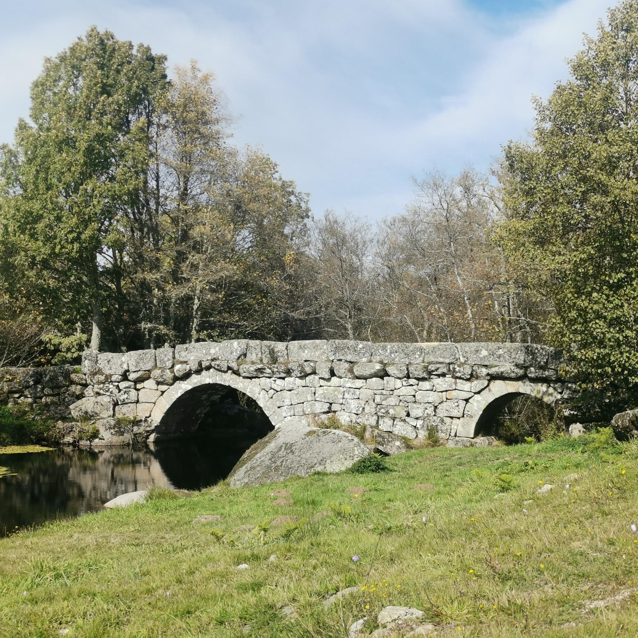
This path descends through the valley of the River Bestança along one of the old roads that lead to the Prado area. The Bestança rises at Portas de Montemuro and flows into the Douro: 13.5 kilometres of crystal-clear water, it is one of the purest rivers in Europe. Its ecological balance sustains otters, trout and genets, while since ancient times, mills scattered throughout the valley have used its waters to grind cereals, especially corn, preserving a valuable rural heritage.
1
0
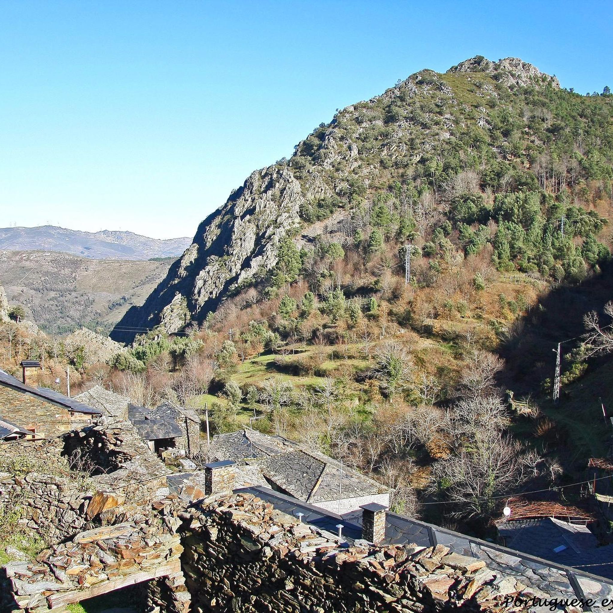
The path to Drave begins in Regoufe, with a demanding climb right from the start. The trail winds through scrubland and brambles, among oaks, eucalyptus trees, scattered pine trees and even a small forest of centuries-old chestnut trees that offers a moment of enchantment. But the real gem is when you reach the top. The landscape reveals itself in all its grandeur. The effort is worth it!
1
0
On the imposing plateaus of Montemuro, the landscape bears traces of human presence over the centuries. Here, among the first stone constructions in the region, there are prehistoric tombs, solitary menhirs and ancient sacred sites, such as cromlechs. Here, near the wind farm, these traces of the past still echo. The Marco da Jogada and several mounds near the chapel of São Pedro do Campo are testament to this heritage. Interestingly, the sacred remains in these heights, where modern chapels stand not far from these ancient necropolises.
1
0


The São Macário climb is 9 km long. You gain 820 heightmeters, so the average gradient is 9 %. The climb is ranked 1600 in the world. The maximum slope is 20%.
0
0
Frequently Asked Questions
What are the most notable natural monuments to explore around Ester?
The Ester region offers several significant natural monuments. You can explore the Path along the Bestança, known for its exceptionally pure river and ancient mills. Another highlight is the View of the Serras da Freita e Arada Mountains, offering expansive vistas after a scenic trail. Don't miss Portas de Montemuro, a mountain pass with historical significance and panoramic views.
Are there any historical or archaeological sites among the natural monuments in Ester?
Yes, the natural monuments around Ester include sites with rich history. At Portas de Montemuro, you'll find ruins of an ancient fortified settlement dating back to the Iron Age, reused by Romans and during the Reconquista. Additionally, the Menhir of Marco da Jogada is a prehistoric monument, part of a landscape dotted with ancient tombs and sacred circles on the Montemuro plateaus.
What kind of natural features can I expect to see in Ester's natural monuments?
Ester's natural monuments showcase diverse features. The Path along the Bestança follows a crystal-clear river valley, supporting unique ecological balance. The region also features mountainous terrain, with elevated viewpoints like the View of the Serras da Freita e Arada Mountains, offering grand landscapes of scrubland, oaks, and chestnut trees.
Are there challenging routes for cyclists or hikers near Ester's natural monuments?
Absolutely. For cyclists, the São Macário Climb is a challenging 9 km route with an average gradient of 9%, gaining 820 meters in height. For those seeking demanding hikes, the path leading to the View of the Serras da Freita e Arada Mountains from Regoufe involves a significant climb through varied terrain.
What outdoor activities can I do near the natural monuments around Ester?
Beyond visiting the monuments themselves, the Ester region is excellent for various outdoor activities. You can find numerous cycling routes, including difficult ones like the 'Albufeira de Pretarouca loop' or 'Rio Paiva – Ermida do Paiva loop'. For mountain biking, there are trails such as the 'Montemuro e Paiva MTB Center: Black Route'. Road cyclists can tackle challenging routes like the 'Santa Cristin Spring – Aerodrome Climb loop'. You can find more details on these activities in the Cycling around Ester, MTB Trails around Ester, and Road Cycling Routes around Ester guides.
Are there any viewpoints offering panoramic scenery in the Ester region?
Yes, the Ester region is home to stunning viewpoints. The View of the Serras da Freita e Arada Mountains provides a magnificent panorama after a rewarding climb. Additionally, Portas de Montemuro, a mountain pass, offers expansive, limitless views where you can take a break and enjoy the scenery.
What makes the River Bestança, near Ester, special?
The River Bestança, which you can follow along the Path along the Bestança, is renowned for being one of the purest rivers in Europe. Its 13.5 kilometers of crystal-clear water sustain a rich ecological balance, home to otters, trout, and genets. The valley also preserves a valuable rural heritage with ancient mills that have used its waters for centuries.
What do visitors enjoy most about the natural monuments around Ester?
Visitors particularly appreciate the stunning natural beauty and the sense of accomplishment from exploring the region. The grand landscapes revealed from viewpoints like the View of the Serras da Freita e Arada Mountains are often highlighted as worth the effort. The friendliness and simplicity of the area, as well as the challenging yet rewarding climbs like São Macário Climb, also receive positive feedback.
Can I find trails that combine natural beauty with historical elements in Ester?
Yes, the Ester region offers trails that blend natural beauty with historical significance. The area around Portas de Montemuro, for instance, is a mountain pass where you can enjoy vast landscapes while also encountering the ruins of an ancient fortified settlement. Similarly, the Menhir of Marco da Jogada allows you to experience prehistoric traces amidst the Montemuro plateaus.
Are there any natural monuments in Ester that are particularly suitable for cycling?
Cyclists will find the São Macário Climb to be a significant challenge, known for its steep gradient. Additionally, the national road 321, which passes through Portas de Montemuro, is popular with cyclists, offering scenic routes at high altitudes.
What kind of geological formations are present in Ester's natural monuments?
The natural monuments around Ester feature significant geological formations, particularly in its mountainous terrain. The region's landscape is characterized by river valleys and mountain passes, such as Portas de Montemuro, which is part of the Montemuro mountain range. The presence of ancient stone structures like the Menhir of Marco da Jogada also speaks to the long geological history of the area.
Most popular routes around Ester
Most popular attractions around Ester

Get inspired with the komoot mobile app


Explore more
Extend your search for the best caves by checking out these guides of the top ones around Ester:
