National Park Hoces del Cabriel
National Park Hoces del Cabriel
Top 15 Natural Monuments around National Park Hoces del Cabriel
Best natural monuments around National Park Hoces del Cabriel are found within a significant natural expanse spanning 31,446 hectares across the Valencian Community and Castilla-La Mancha. This area is designated a UNESCO Cabriel Valley Biosphere Reserve, characterized by the Cabriel River's dramatic gorges, meanders, and impressive vertical stone ridges. It offers a diverse array of natural monuments, geological formations, and scenic viewpoints. The park's landscape provides compelling experiences for nature enthusiasts and active tourists.
Best natural monuments around National Park…
Last updated: May 14, 2026
Turia-Cabriel Nature Trail (section)
Highlight (Segment) • Trail
Translated by Google •
Tip by

El Moluengo
Highlight • Summit
Translated by Google •
Tip by
Sign up now to discover places like this
Get recommendations on the best single tracks, peaks, & plenty of other exciting outdoor places.
Sign up for free
Peña Azul Viewpoint
Highlight • Viewpoint
Translated by Google •
Tip by
Hoz del Rabo de la Sartén Viewpoint
Highlight • Viewpoint
Translated by Google •
Tip by

Impressive valley
Highlight (Segment) • Gorge
Translated by Google •
Tip by

Sign up for free to discover even more natural monuments around National Park Hoces del Cabriel.
Sign up for free
Already have an account?
Start today with a free account
Your next adventure awaits.
Login or Signup
Popular around National Park Hoces del Cabriel

GR 238 Tierra del Vino - A journey on foot through lands of silence
Hiking around National Park Hoces del Cabriel
MTB Trails around National Park Hoces del Cabriel
Road Cycling Routes around National Park Hoces del Cabriel
Cycling around National Park Hoces del Cabriel

Gravel biking around National Park Hoces del Cabriel
Running Trails around National Park Hoces del Cabriel
Other adventures around National Park Hoces del Cabriel

Tips from the Community

It is a mountain peak located in the vicinity of the Valencian municipality of Villargordo del Cabriel, in the enclave of the Hoces del Cabriel Natural Park, a privileged natural environment that serves as a border with the neighboring region of Castilla – La Mancha. This peak has an altitude of around 1040 m and from its summit it is possible to obtain privileged views of the Sierra del Rubial to which this rocky promontory belongs. The panoramic view offered from this point allows you to see all the towns in the Requena-Utiel region in which this Natural Park is included. Likewise, from the Moluengo peak it is possible to see the depression of the Cabriel River and the neighboring plains of Cuenca. It is possible to go up to the Moluengo peak and cross the privileged natural environment that surrounds it thanks to one of the routes that cross the Hoces del Cabriel Natural Park, known as the yellow route, which starts from the town of Villargordo del Cabriel and leads the traveler to the top of Moluengo. Along this itinerary, which has an extension of 16 km, it is possible to visit places such as the town of Moluengo, the Fonseca viewpoint, the Oliva fountain or the Vadocañas bridge, over the waters of the Cabriel river and which constitutes the point at which the route ends.
0
0

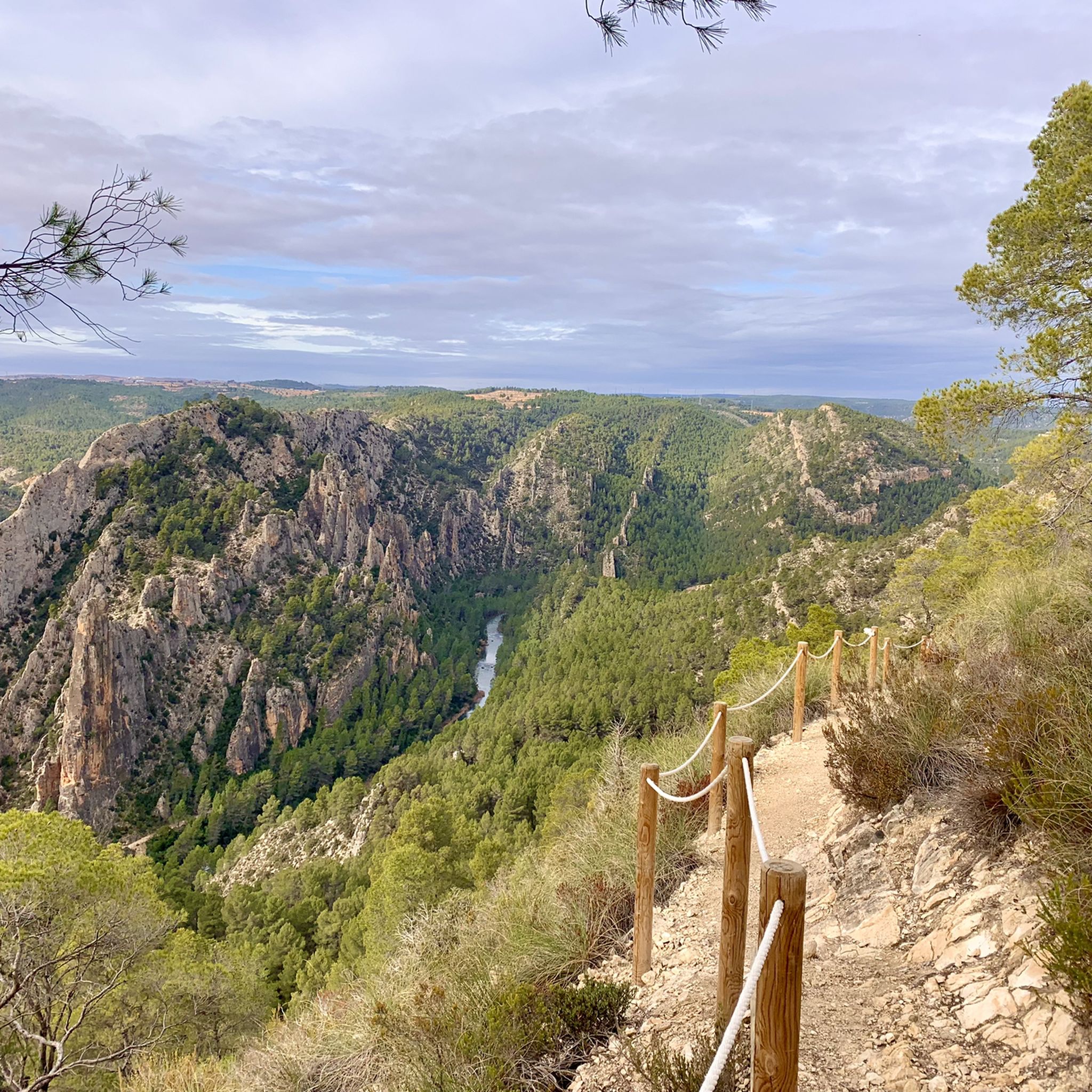
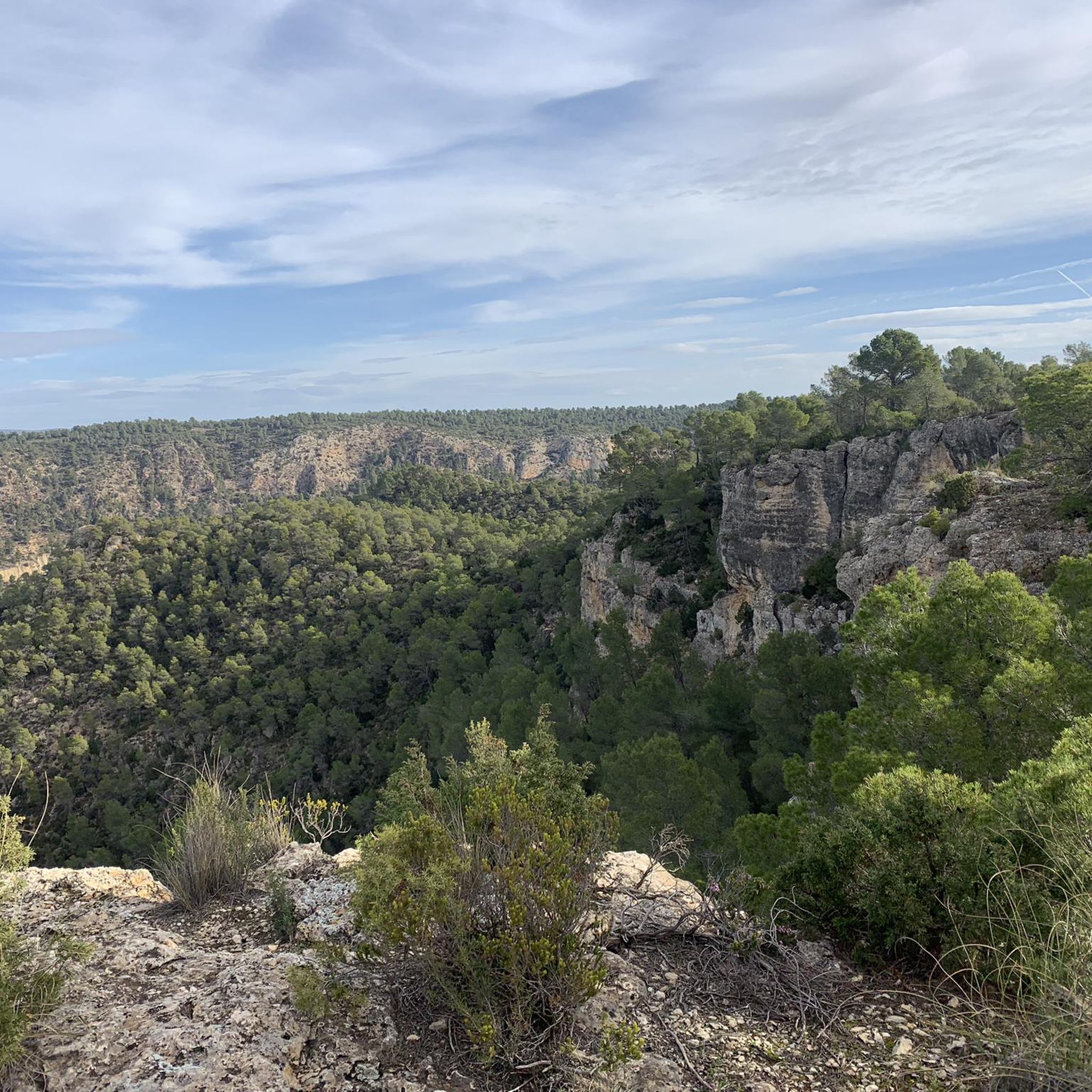
If you go around the Fuente de Oliva counterclockwise (which I recommend), this is the second viewpoint and the first where you can see the Rio Cabriel in the gorges below beautiful cliffs. Continue to the right of the first bench along the cliff, and you will find a second bench and more beautiful views.
1
0

Viewpoint of the Fuente de Oliva route (PR-CV 344) with beautiful views of the gorges of the Cabriel River and its impressive cliffs. The arrival path is completely along a forest track and is a very pleasant and pleasant route with a lot of trees.
0
0

The first climb from Casas del Rio to Balsa de Ves is very hard. The road is in poor condition and has a lot of slope!
0
0

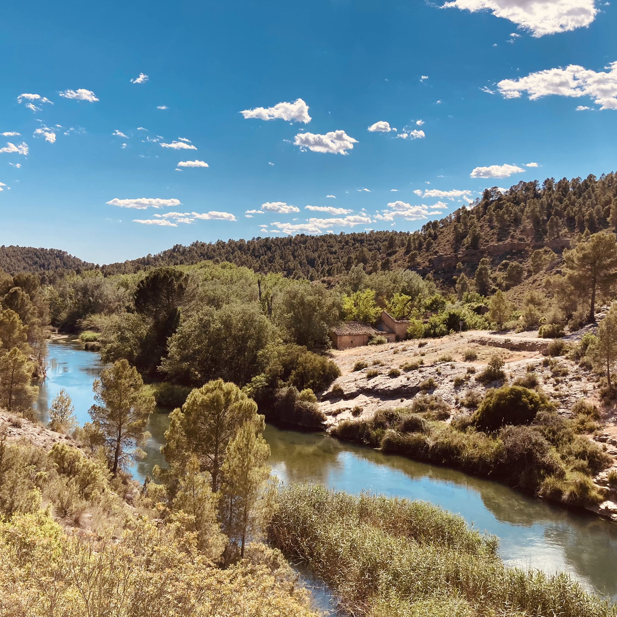
From Balsa de Ves it's an absolutely beautiful route down to the Rio Cabriel and then up again towards La Portera. An absolutely breathtaking route - you discover something new at every bend. At the Rio Cabriel there is a bathing area and a campsite as well as an old hydraulic water wheel.
1
0
Top of the peak "El Moluengo" at 1023 m above sea level, highest point of the Natural Park of Las Hoces del Cabriel. It allows to appreciate beautiful views to all the valley of the Cabriel, the province of Valencia and the one of Cuenca.
4
0
Viewpoint of the Fuente de Oliva route (PR-CV 344) with beautiful views of the gorges of the Cabriel River and its impressive cliffs. The arrival path is completely along a forest track and it is a very pleasant and pleasant route with many trees.
3
0
Top of the mountain "El Moluengo" at 1023 meters above sea level with beautiful views of the entire Cabriel valley, the provinces of Valencia and Cuenca.
3
0
Frequently Asked Questions
What are some of the most impressive natural monuments to see in National Park Hoces del Cabriel?
The National Park Hoces del Cabriel is home to several remarkable natural monuments. Highlights include the dramatic limestone formations known as Los Cuchillos, the crystal-clear waters and gorges of the Cabriel River, and the historic Vadocañas Bridge. For panoramic views, consider visiting Peña Azul Viewpoint or Hoz del Rabo de la Sartén Viewpoint.
What geological formations can I expect to see in the National Park Hoces del Cabriel?
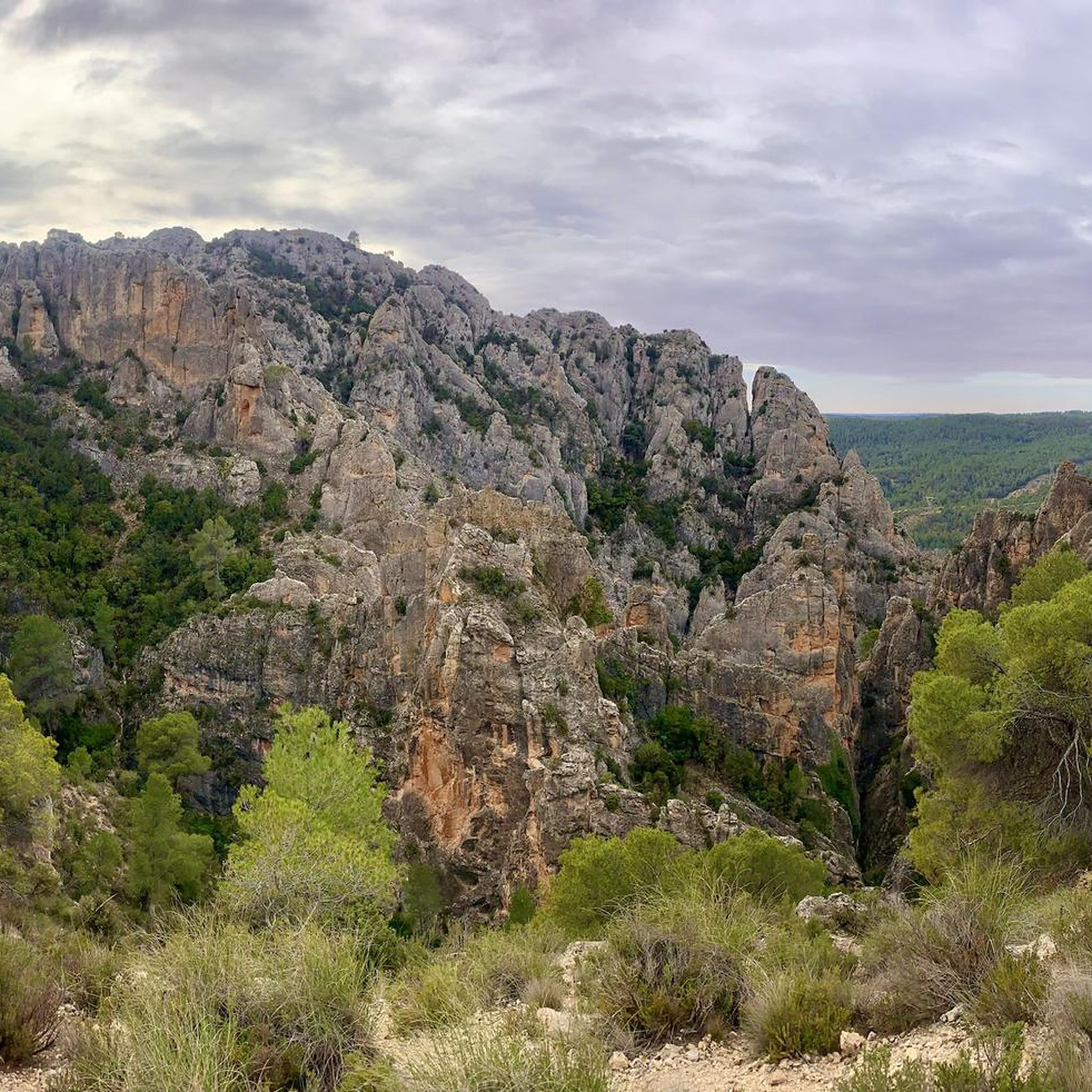
The park is renowned for its diverse geological features. You'll encounter impressive limestone formations, particularly the sharp, pointy crags of Los Cuchillos. The Cabriel River has carved out deep gorges and meanders, showcasing the erosive power of water over millennia. These geomorphological phenomena are shaped by wind, water, and chemical processes, creating a visually stunning landscape.
Are there family-friendly natural monuments suitable for all ages?
Yes, several natural monuments and associated trails are suitable for families. The Turia-Cabriel Nature Trail (section) is a gravel road with gentle slopes, ideal for cycling or mountain biking with family. Viewpoints like Peña Azul Viewpoint and La Fonseca Viewpoint also offer accessible spots to enjoy the scenery.
What types of outdoor activities can I do near the natural monuments?
The area around the natural monuments offers a wide range of outdoor activities. The Cabriel River is perfect for active tourism, including rafting, kayaking, and canyoning. For land-based activities, there are numerous hiking and cycling opportunities. You can explore easy hikes like the Cuchillos de Contreras Trail or Los Cuchillos del Cabriel Trail, or try more challenging cycling routes. Find more options in the easy hikes, cycling, and gravel biking guides for the region.
Where can I find panoramic views of the Cabriel Valley?
For breathtaking panoramic views, several viewpoints offer stunning vistas of the Cabriel Valley and its unique landscape. The Peña Azul Viewpoint provides excellent views of the valley and the Natural Park. Another popular spot is the Peñas Blancas Viewpoint, which offers expansive views of the Cabriel Valley, Los Cuchillos, and the Fonseca Valley. Hoz del Rabo de la Sartén Viewpoint also provides beautiful views of the Cabriel River gorges.
Are there opportunities for wild swimming near the natural monuments?
Yes, the Cabriel River is known for its pristine, clear waters, making it ideal for swimming. Sites like Las Chorreras, Los Ojos, and Cascada del Molino de San Pedro offer natural pools and abundant waterfalls, providing excellent spots for bathing in the cool waters. Las Chorreras, in particular, is famous for its numerous waterfalls and natural pools.
What is the best time of year to visit the natural monuments in National Park Hoces del Cabriel?
The National Park Hoces del Cabriel can be enjoyed throughout the year, but spring and autumn are often considered ideal. During these seasons, the weather is milder, making it comfortable for hiking, cycling, and exploring the natural monuments. The river levels are also generally good for water activities in spring, and autumn brings beautiful foliage.
What is the Turia-Cabriel Nature Trail and where can I access it?
The Turia-Cabriel Nature Trail is a significant route that connects the Turia and Cabriel rivers. A notable section of this trail begins or ends at the Vadocañas Bridge over the Cabriel River. This particular section is a well-maintained gravel road with gentle slopes, making it suitable for cycling or mountain biking and offering scenic views of the surrounding vegetation.
What do visitors enjoy most about the natural monuments in National Park Hoces del Cabriel?
Visitors frequently praise the stunning natural beauty and the diverse opportunities for outdoor activities. The impressive geological formations, such as the 'cuchillares' (knife-like ridges), and the pristine, turquoise waters of the Cabriel River are often highlighted. The numerous viewpoints, like Peña Azul Viewpoint, are also highly appreciated for their panoramic vistas. The komoot community has shared over 18 photos and given more than 10 upvotes, reflecting the area's appeal.
Is the Vadocañas Bridge a natural monument or a historical site?
The Vadocañas Bridge holds significance as both a natural monument and a historical structure. Dating back to the 16th century, it is an important cultural and historical landmark. Its location, bridging the provinces of Valencia and Cuenca over the Cabriel River, also integrates it into the natural landscape, making it a point of natural and scenic interest. It serves as a key access point for sections of the Turia-Cabriel Nature Trail.
Are there any hidden gems or less-known natural monuments worth exploring?
While many natural monuments are well-known, exploring the various sections of the Cabriel River can reveal less-frequented spots. The area around the Contreras Reservoir, for instance, offers splendid views with its distinctive blue-green waters and hiking trails along its high banks, providing a serene experience away from more crowded areas. The diverse gorges and meanders of the river itself often hold secluded natural pools and scenic spots.
What is the significance of the Contreras Reservoir in the park?
The Contreras Reservoir, located at the confluence of the Cabriel and Guadazaón rivers, is a significant feature within the park. While man-made, it is beautifully integrated into the natural landscape, offering splendid views with its distinctive blue-green waters. Hiking trails along its high banks provide excellent opportunities to appreciate this vast body of water and the surrounding natural environment, contributing to the park's diverse scenery.
Most popular routes around National Park Hoces del Cabriel
Most popular attractions around National Park Hoces del Cabriel

Get inspired with the komoot mobile app


Explore more
Extend your search for the best caves by checking out these guides of the top ones around National Park Hoces del Cabriel:
