The best gravel rides in Santiago Oaks Regional Park
5.0
(1)
41
riders
5
rides
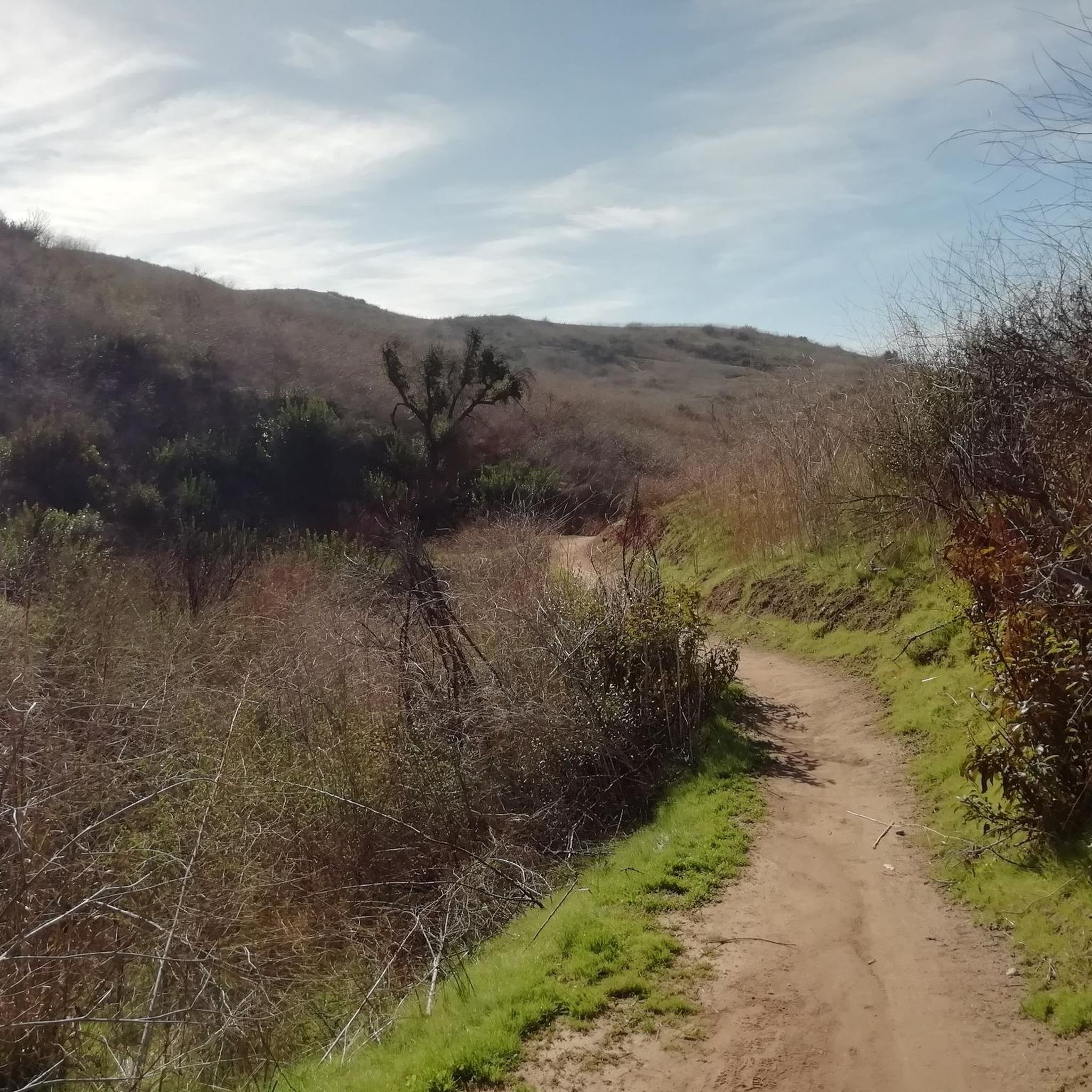
Gravel biking in Santiago Oaks Regional Park offers diverse terrain and scenic landscapes across its network of interconnecting trails. The park features multi-use trails with a mix of smooth paths, engaging bank turns, and unpaved segments. The ground, a clay-like material over sandstone, provides good traction. The region is characterized by mountain vistas, an orange grove, and the meandering Santiago Creek, with mature oak and sycamore groves providing shade at lower elevations.
Best gravel bike trails in Santiago Oaks Regional Park
- The most popular gravel bike trail is View of Sierra Peak – Barham Ridge Trail viewpoint loop from Santiago Canyon College, a 43.2 miles (69.6 km) trail that takes 6 hours 19 minutes to complete. This challenging route offers panoramic views from the Barham Ridge Trail lookout.
- Another top favourite among local gravel bikers is Santiago Creek Trail – Roadrunner Loop trailhead loop from Orange Park Acres, a moderate 13.5 miles (21.8 km) path. This route follows Santiago Creek, passing through shaded groves and offering a less strenuous option.
- Local gravel bikers also love the Black Star Falls – Native American Village loop from Santiago Canyon College, a 33.2 miles (53.4 km) trail leading through varied terrain, often completed in about 5 hours 1 minute.
- Gravel biking in Santiago Oaks Regional Park is defined by diverse terrain, mountain vistas, and shaded oak and sycamore groves. The network offers options for different ability levels, from moderate paths along the creek to more challenging climbs.
- The guide includes highly-rated routes that showcase the best of the region's landscape. More than 40 gravel bikers have used komoot to explore Santiago Oaks Regional Park's varied terrain.
Last updated: July 12, 2026
12
riders
51.5km
04:09
1,030m
1,030m
Hard gravel ride. Very good fitness required. Mostly paved surfaces. Suitable for all skill levels.
5
riders
55.7km
04:29
1,060m
1,060m
Hard gravel ride. Very good fitness required. Mostly paved surfaces. Suitable for all skill levels.

Sign up for free
1
riders
Moderate gravel ride. Good fitness required. Mostly paved surfaces. Suitable for all skill levels.
5.0
(1)
12
riders
64.8km
04:22
510m
510m
Hard gravel ride. Very good fitness required. Mostly paved surfaces. Suitable for all skill levels.
6
riders
47.0km
04:00
1,190m
1,190m
Hard gravel ride. Very good fitness required. Mostly paved surfaces. Suitable for all skill levels.
Our route recommendations are based on thousands of hikes, rides, and runs completed by other people on komoot.
Start today with a free account
Your next adventure awaits.
Login or Signup
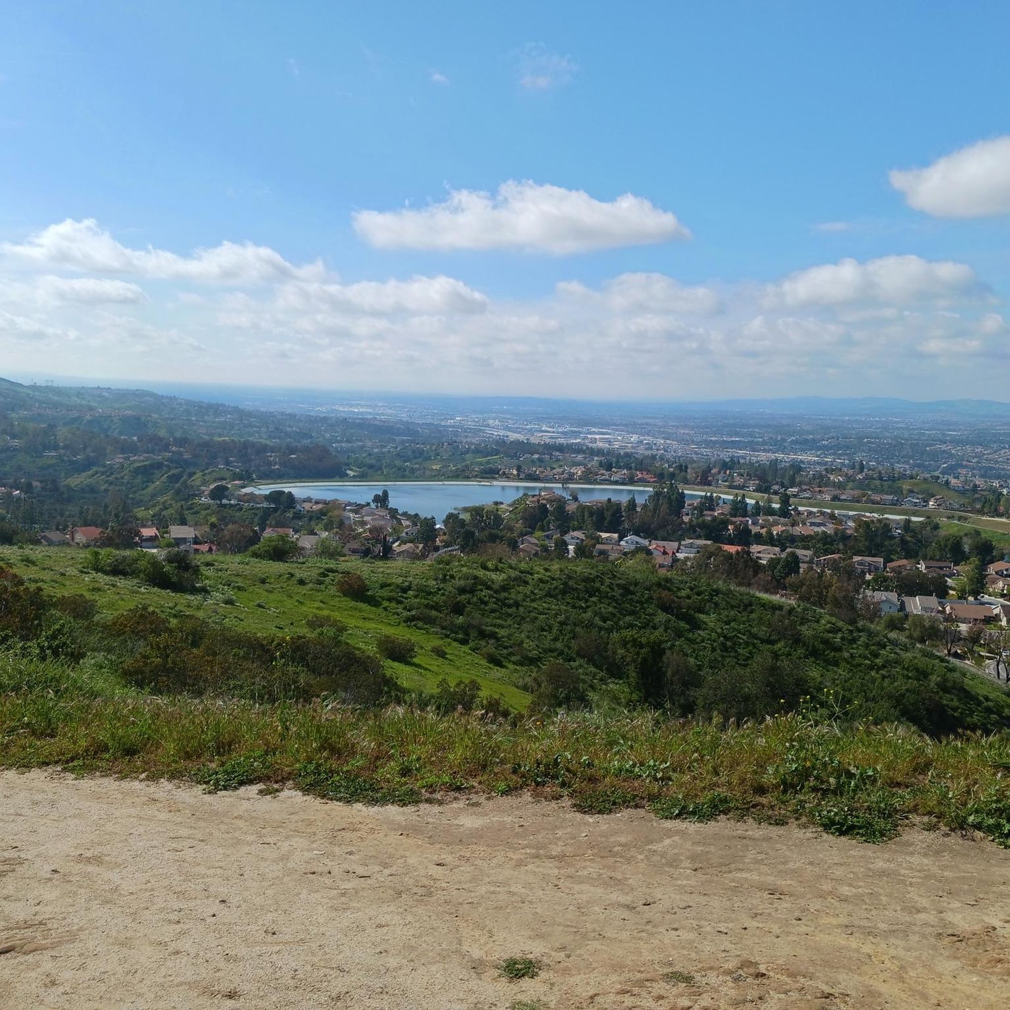
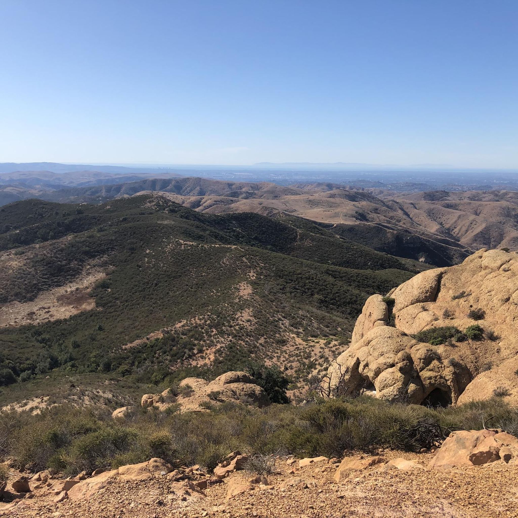
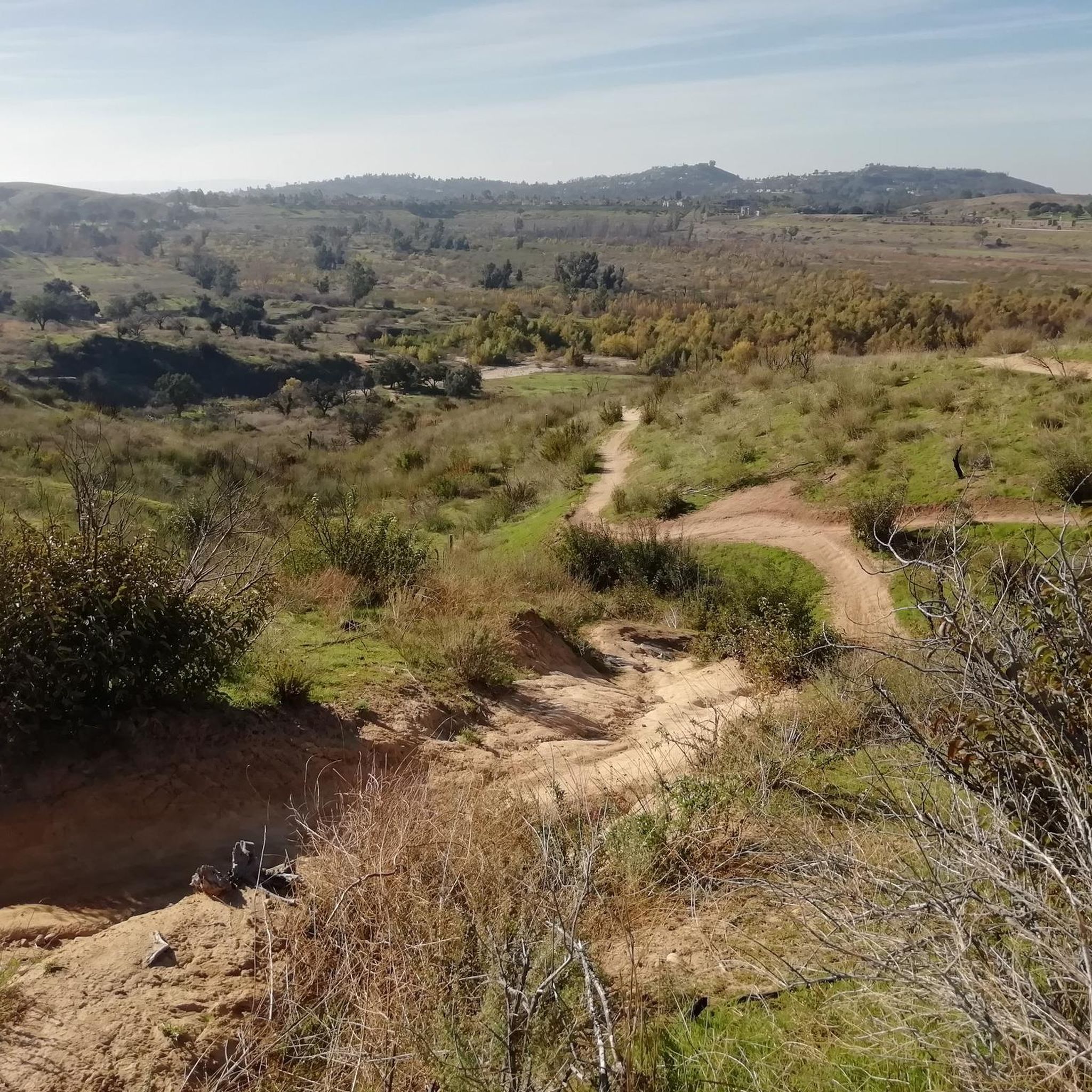
Tips from the Community

This is the intersection of five trails: Raptor Ridge Trail, North Ridge Trail, Bovinian Delight Trail or Telegraph Canyon Road. There are also some boards with information about the trails and a restroom.
0
0

Bring plenty of water. There only are water fountains midway in Anaheim.
0
0

This view of Sierra Peak showcases one of the highest and most easily identifiable peaks in northern Orange County. It stands at 3,045 feet above sea level.
1
0

Carbon Canyon Regional Park is a great local park with a small lake and some nature trails featuring Redwoods and the Carbon Canyon Creek. It connects to the Chino Hills State Park and is a great spot for some quick day hiking, fishing, sports, or just sitting and enjoying some nature.
0
0
Nice wooden bridge along the Santa Ana River Trail. It takes you over the river and gives you a good view of the water.
1
0

Set along the edge of the Santa Ana Canyon this park offers visitors a variety of amenities such as sports fields, picnic & BBQ areas, fishing, playgrounds, and more. The Santa Ana Trail runs along the edge of the park and allows you to access other nearby areas as well.
0
0

Situated up with the cell towers at 3,045 feet, Sierra Peak offers awesome views of Orange County and the surrounding mountains. Because it's such a long trek from car to summit, you'll likely have most of the route and the peak to yourself.
0
0

The trail is a wide dirt road through what feels like remote terrain, despite being quite close to Orange County. There is some loose rock that could make the descent mildly technical, but otherwise, this is a fairly steady route to Mini Moab and Sierra.
0
0
Frequently Asked Questions
How many gravel bike trails are available in Santiago Oaks Regional Park?
Santiago Oaks Regional Park offers a selection of 6 gravel bike trails. These routes cater to various skill levels, from moderate paths to more challenging climbs.
What are the difficulty levels for gravel biking in Santiago Oaks Regional Park?
The park features a range of difficulty levels. You'll find 1 moderate route, such as the Santiago Creek Trail – Roadrunner Loop trailhead loop from Orange Park Acres, which is a less strenuous option. For more experienced riders, there are 5 difficult routes, including the challenging View of Sierra Peak – Barham Ridge Trail viewpoint loop from Santiago Canyon College.
Are there any family-friendly gravel bike trails in Santiago Oaks Regional Park?
While many trails can be challenging, the park's amenities, including picnic areas and a playground, make it suitable for families. For a less strenuous ride, consider the moderate Santiago Creek Trail – Roadrunner Loop trailhead loop from Orange Park Acres, which follows the creek through shaded groves.
What kind of terrain can I expect on the gravel bike trails?
The park's trails offer diverse terrain, including a mix of mostly smooth paths with engaging bank turns and some unpaved segments. The ground is a clay-like material over sandstone, providing good traction when damp, though it can be slippery when dry. Some sections can be steep, requiring good fitness.
Are there scenic viewpoints or landmarks along the gravel bike trails?
Yes, the park boasts several scenic spots. You can enjoy panoramic views from Robber's Peak and the Barham Ridge Trail viewpoint. Other notable features include a historic orange grove and a historic dam leading to a small waterfall and stepping stones to cross the river.
Can I find loop trails for gravel biking in the park?
Yes, many of the gravel bike routes in Santiago Oaks Regional Park are designed as loops. For example, the Black Star Falls – Native American Village loop from Santiago Canyon College offers varied terrain in a circular format.
What is the best time of year to go gravel biking in Santiago Oaks Regional Park?
The park is generally enjoyable year-round. Lower elevations offer welcome shade from mature oak and sycamore groves, which can be particularly pleasant during warmer months. However, the clay-like ground provides good traction when damp, so consider conditions after rain. Always check local weather before heading out.
Are there amenities like restrooms or picnic areas available in the park?
Yes, Santiago Oaks Regional Park is well-equipped with amenities. You'll find restrooms, picnic areas with grills, and even a playground, making it convenient for longer rides or family outings.
Is parking available for gravel bikers at Santiago Oaks Regional Park?
Yes, parking is available at Santiago Oaks Regional Park. Many routes, such as the Whiting Ranch viewpoint – Lower Peters Canyon Reservoir loop from Santiago Canyon College, often start from locations like Santiago Canyon College, which typically offers parking facilities.
What wildlife might I see while gravel biking in Santiago Oaks Regional Park?
The park's natural charm is enhanced by abundant wildlife. While specific sightings vary, the diverse landscapes, including shady oak and sycamore groves and shrubbery, provide habitats for various species. Keep an eye out for local fauna as you ride.
How do other gravel bikers rate the trails in Santiago Oaks Regional Park?
The gravel bike routes in Santiago Oaks Regional Park are highly rated by the komoot community, with an average score of 5.0 stars. Over 40 gravel bikers have used komoot to explore the park's varied terrain, often praising the diverse landscapes and engaging trails.
How can I extend my gravel bike ride beyond Santiago Oaks Regional Park?
The park's trails connect to the wider Anaheim Hills Trail System, offering possibilities for longer rides. Additionally, the Santiago Creek Trail links to other Orange County parks like Grijalva, Yorba, and Hart Parks, allowing for extensive explorations.
Are there options for advanced gravel bikers looking for a challenge?
Absolutely. For advanced riders, Santiago Oaks Regional Park offers several difficult routes, such as the Sierra Peak Summit – View of Sierra Peak loop from A, which features significant elevation gain. More experienced riders can also extend their rides into adjacent areas like Weir Canyon, known for advanced and intermediate singletrack trails.
Most popular routes in Santiago Oaks Regional Park
Most popular attractions in Santiago Oaks Regional Park

Get inspired with the komoot mobile app


Explore more
Browse the best Gravel rides in other regions.
