The best walks and hikes in Santiago Oaks Regional Park
4.6
(56)
891
hikers
11
hikes
Hiking in Santiago Oaks Regional Park offers diverse landscapes across its 1,269 acres in Orange, California. The park features expansive oak woodlands, chaparral-covered hillsides, and mountain vistas. Santiago Creek meanders through the area, providing a riparian habitat, while a mature forest contributes to the environment. The terrain includes hills and moderate climbs, with elevations reaching over 250 meters.
Best hiking trails in Santiago Oaks Regional Park
- The most popular hiking route is Weir Canyon Trail loop — Anaheim Hills, a 3.4 miles (5.5 km) trail that takes 1 hour 32 minutes to complete. This easy route explores the Anaheim Hills area.
- Another top favourite among local hikers is Robbers Peak loop via Santiago Creek Trail — Santiago Oaks Regional Park, a moderate 5.2 miles (8.4 km) path. This trail ascends to Robber's Peak, offering panoramic views, and follows Santiago Creek.
- Local hikers also love the Skull Rock and Historic Dam — Santiago Oaks Regional Park, a 2.5 miles (4.0 km) trail leading through varied terrain to the historic dam, often completed in about 1 hour 9 minutes.
- Hiking in Santiago Oaks Regional Park is defined by oak woodlands, chaparral-covered hillsides, and the Santiago Creek riparian area. The network offers options for different ability levels, from easy strolls to moderate climbs.
- The routes in Santiago Oaks Regional Park are highly rated by the komoot community with an average score of 4.7 stars from over 40 reviews. More than 700 hikers have used komoot to explore Santiago Oaks Regional Park's varied terrain.
Last updated: October 10, 2026
10
hikers
7.31km
02:09
190m
200m
Explore Santiago Oaks Regional Park on this moderate 4.5-mile hike, featuring creek views, historic sites, and panoramic ridge vistas.
4
hikers
6.91km
02:03
210m
220m
Hike the moderate 4.3-mile Weir Canyon to Robbers Peak to Yucca Ridge to Deer Trail for panoramic views of Orange County and diverse landsca

2.52km
00:39
20m
10m
Hike the easy 1.6-mile Roadrunner Loop Trail in Irvine Regional Park, gaining 50 feet in 39 minutes, with diverse scenery and wildlife.
4.8
(4)
52
hikers
5.46km
01:32
100m
110m
Embark on the Weir Canyon Trail Loop for a refreshing escape into nature, even though it's nestled close to urban areas. This easy 3.4-mile (5.5 km) hike, with its 344 feet (105 metres) of elevation gain, takes about 1 hour and 32 minutes to complete, guiding you through rolling, chaparral-covered hills and peaceful wooded canyon bottoms. You'll enjoy diverse terrain, from single-track paths to wide dirt roads, and be treated to expansive views of Anaheim and the surrounding mountains, including glimpses of the Walnut Canyon Reservoir.
Planning your trip means preparing for sun exposure, as shade is minimal along the route. The trail is clearly marked and well-maintained, making navigation straightforward. While the main loop is open to the public, access to the very bottom of the canyon is restricted to guided tours. Spring is an ideal time to visit, as the hills come alive with an abundance of wildflowers, adding vibrant color to the landscape.
This loop is considered an "unspoiled gem" within Santiago Oaks Regional Park, offering a sense of remoteness despite its proximity to the city. It's a fantastic option for those seeking a moderately challenging adventure with diverse plant and animal life. While there's an "Old Weir Canyon Trail" option that is steeper and less maintained, this route follows the "New Weir Canyon Trail" for a more gradual and enjoyable experience.
5.0
(2)
11
hikers
8.41km
02:30
250m
250m
Hike the moderate 5.2-mile Barham Ridge and Oak Trail to Robbers Roost for panoramic views and diverse scenery in Santiago Oaks Regional Par
Get access to more routes and recommendations from other explorers.
Already have an account?
Our route recommendations are based on thousands of hikes, rides, and runs completed by other people on komoot.
Start today with a free account
Your next adventure awaits.

Tips from the Community

The dam stops up Santiago Creek in Orange County. The 136-foot dam was build for flood control.
0
0
A series of beautiful stepping stones placed for convenient riving crossing.
0
0
From atop the rocky outcropping of the Roost you get spectacular sweeping views of Orange County. This is a popular sunset spot.
0
0

After descending Chutes Trail, here begins the Roadrunner Loop, a double-track trail that can be done in both directions. Additionally, you'll come across a panel providing contact numbers and other useful information about the park.
2
0
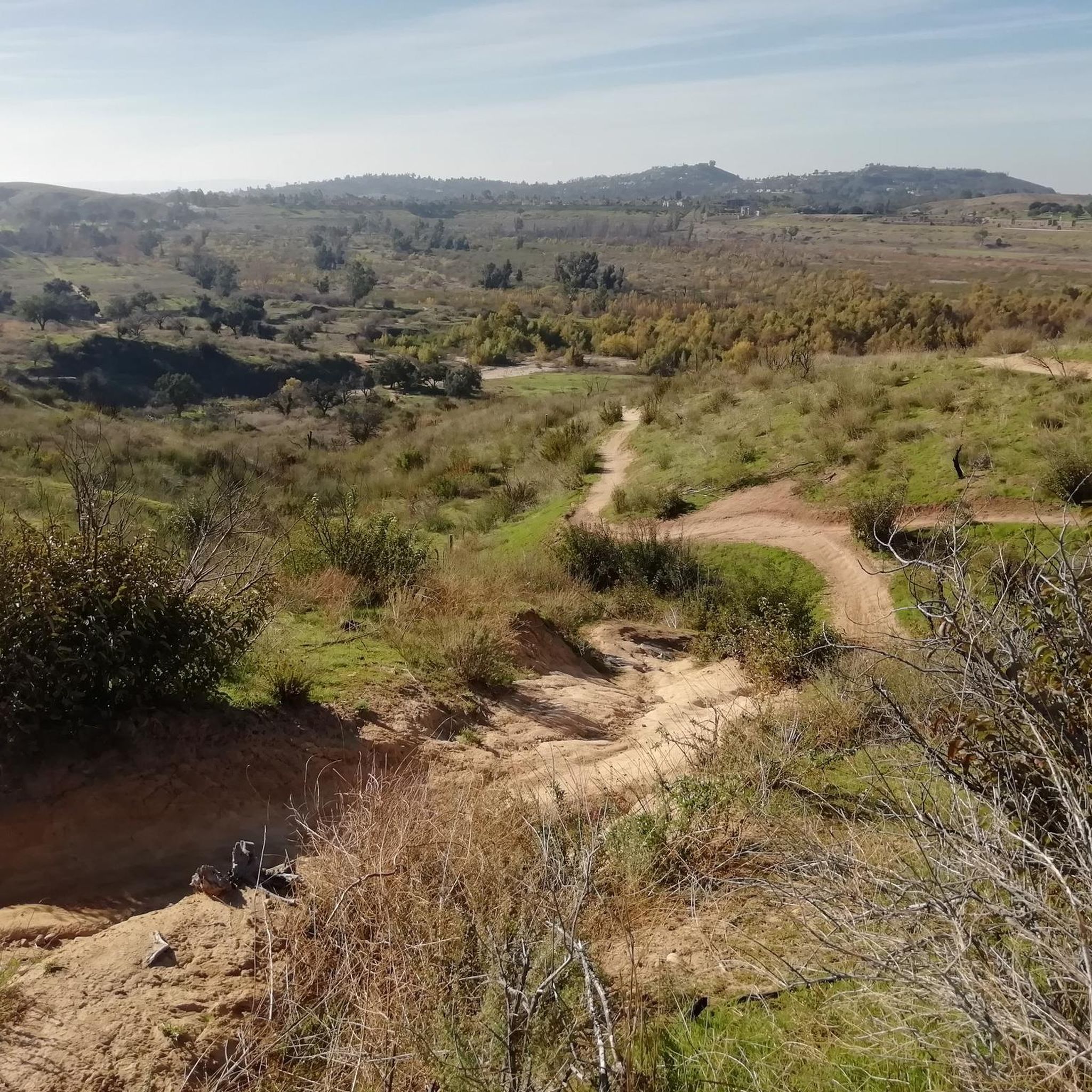
At the end of the Barham Ridge Trail, you'll find this nice viewpoint from which you can observe nature and many of the trails surrounding you from the heart of Santiago Oaks Regional Park.
1
0
If you're cycling along the Santiago Creek Trail, at some point you'll reach this point where you'll need to cross the creek that gives the trail its name. Depending on the water level, you'll likely have to do it using these stepping stones, and even if you have to dismount your bike, the fun is guaranteed!
1
0
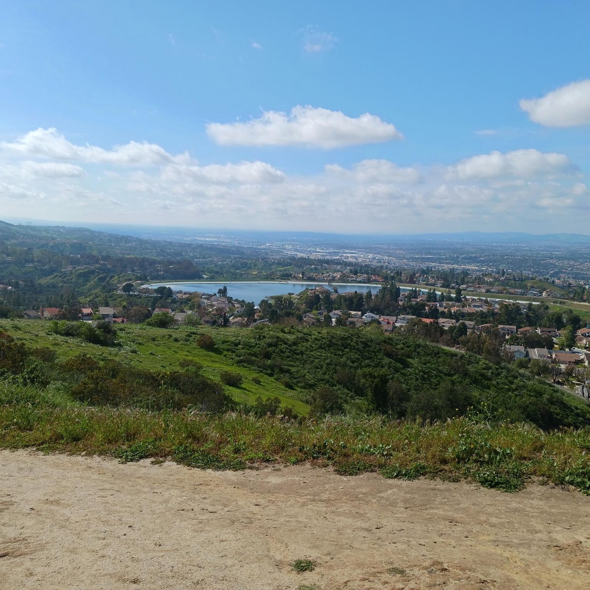
Right at the northern edge of Santiago Oaks Regional Park, the 1,159-feet (329 m) elevation of Robbers Peak allows for a sweeping view of the surroundings. You'll be able to see the neighborhoods below and Walnut Canyon Reservoir a bit further in the distance.
0
0

Situated just at the edge of Santiago Oaks Regional Park, 1152-feet (329 m) Robbers Peak makes a great quick run — especially if you happen to live in one of the nearby neighborhoods.
0
0
Frequently Asked Questions
How many hiking trails are available in Santiago Oaks Regional Park?
Santiago Oaks Regional Park offers a wide variety of hiking experiences, with over 50 trails to explore. These routes cater to different skill levels, from easy walks to more challenging climbs.
What kind of terrain and landscapes can I expect when hiking in Santiago Oaks Regional Park?
The park features diverse landscapes, including expansive oak woodlands, chaparral-covered hillsides, and tranquil riparian habitats along Santiago Creek. You'll encounter mountain vistas and can enjoy views of northern Orange County from various lookouts. The terrain includes hills and moderate climbs, with some routes reaching elevations over 250 meters.
Are there family-friendly hiking options in Santiago Oaks Regional Park?
Yes, Santiago Oaks Regional Park is very family-friendly. Many trails are suitable for all ages, including easy routes like the Skull Rock and Historic Dam trail, which leads to the historic dam and a small waterfall. The park also has shaded picnic areas and a playground, making it ideal for family outings.
What are some notable landmarks or viewpoints to see along the trails?
Hikers can discover several interesting landmarks and viewpoints. The climb to Robber's Peak offers panoramic vistas of the Anaheim Hills cityscape. The Barham Ridge Trail viewpoint provides expansive natural views, and the historic dam, built in 1892, features a small waterfall. You can also visit a preserved historic orange grove, a nod to the area's agricultural past.
Are there any trails that feature waterfalls or water crossings?
Yes, the Historic Dam, accessible via trails like the Skull Rock and Historic Dam route, features a small waterfall. Depending on water levels, you might also find stepping stones to cross Santiago Creek near the dam, offering a unique experience.
Can I find loop trails in Santiago Oaks Regional Park?
Absolutely. Many of the trails in Santiago Oaks Regional Park are designed as loops, allowing you to experience diverse scenery without retracing your steps. Examples include the Weir Canyon Trail loop and the Robbers Peak loop via Santiago Creek Trail.
What is the best time of year to visit Santiago Oaks Regional Park for hiking?
Santiago Oaks Regional Park is enjoyable year-round, but spring is particularly beautiful when the hillsides burst with vibrant wildflowers. Autumn also offers golden hues as the leaves change. Early mornings and late afternoons are ideal for wildlife spotting and to avoid the midday heat, especially during warmer months.
What do other hikers enjoy most about hiking in Santiago Oaks Regional Park?
The area is highly rated by the komoot community, with an average score of 4.7 stars. Reviewers often praise the park's diverse landscapes, the sense of removal from the urban environment, and the well-maintained trails that cater to various skill levels. The panoramic views from points like Robber's Peak are also frequently highlighted.
Are there any educational opportunities or nature programs available in the park?
Yes, the park features a Nature Center that offers exhibits and programs on local flora and fauna, as well as artifacts from the dam-building days. Park Rangers also conduct interpretive activities such as nature walks, providing educational opportunities about the natural history of the area.
What are some of the longer or more challenging hikes in the park?
For those seeking a more strenuous experience, trails like the Robbers Peak loop via Willow Trail offer moderate climbs and longer distances. Other challenging routes include the Hawk, Grasshopper, and Chutes Ridgeline Trails, which provide a good workout and rewarding views.
Is there parking available at Santiago Oaks Regional Park?
Yes, Santiago Oaks Regional Park provides designated parking areas for visitors. It's advisable to check the park's official website or signage upon arrival for any specific parking fees or regulations.
Can I spot wildlife while hiking in Santiago Oaks Regional Park?
The park is home to various wildlife, including different bird species and deer. Dawn and dusk are typically the best times for wildlife observation. The diverse habitats, from oak woodlands to riparian areas along Santiago Creek, support a rich ecosystem.
Most popular routes in Santiago Oaks Regional Park
Most popular attractions in Santiago Oaks Regional Park

Get inspired with the komoot mobile app


Explore more
Browse the best Hikes in other regions.
