The best walks and hikes in Folsom Lake State Recreation Area
4.8
(40)
1,271
hikers
28
hikes
Hiking trails in Folsom Lake State Recreation Area traverse a diverse landscape of rolling hills, dense oak forests, and rocky beaches surrounding Folsom Lake and Lake Natoma. Located in the Sierra Nevada foothills, the area features varied topography with grasslands and open meadows. Hikers can experience views of the lake, the Sierra Nevada, and the Sacramento Valley. The terrain generally consists of moderate elevation changes, making it accessible for various skill levels.
Best hiking trails in Folsom Lake State Recreation Area
- The most popular hiking route is Monte Vista and New York Creek Trails, a 2.6 miles (4.2 km) easy trail that takes 1 hour 10 minutes to complete, offering views along New York Creek.
- Another top favourite among local hikers is New York Creek Cove via Monte Vista Trail — Folsom Lake State Recreation Area, a moderate 5.9 miles (9.5 km) path. This route provides varied terrain and scenic lake views.
- Local hikers also love the Beal's Point to Folsom Lake — Folsom Lake State Recreation Area, a 3.1 miles (5.0 km) trail leading through oak woodlands to the lake's edge, often completed in about 1 hour 17 minutes.
- Hiking in Folsom Lake State Recreation Area is defined by lake shore paths, rolling hills, and dense oak forests. The extensive network offers options for different ability levels, from easy strolls to moderate excursions.
- The routes in Folsom Lake State Recreation Area are highly rated by the komoot community with an average score of 4.7 stars from over 14 reviews. More than 470 hikers have used komoot to explore Folsom Lake State Recreation Area's varied terrain.
Last updated: October 11, 2026
12
hikers
10.7km
02:52
110m
160m
Explore the Monte Vista and New York Creek Trails, a moderate hiking route spanning 6.6 miles (10.7 km) with an elevation gain of 376 feet (115 metres). You can expect to complete this journey in about 2 hours and 52 minutes. As you hike, you will pass through varied landscapes, from woodlands dotted with majestic oak trees to open grassy meadows, offering a diverse outdoor experience.
Plan your visit to the Folsom Lake State Recreation Area, where these trails are located. The Monte Vista Trail Loop is a multi-use path, so be prepared to share it with mountain bikers and equestrians. Consider the seasonal conditions; you will find green grass in winter, while summer brings drier conditions and potential stickers along the path.
This route provides pleasant views across Folsom Lake and the South Fork of the American River, with occasional glimpses of New York Creek Cove. If you visit in spring, you will see the trails come alive with blooming wildflowers, showcasing a vibrant riparian ecosystem along New York Creek.
5.0
(1)
10
hikers
8.72km
02:42
350m
320m
Embark on the Shirland Canal and Cardiac Bypass Loop, a moderate hike that offers a diverse and engaging experience. You will cover 5.4 miles (8.7 km) and ascend 1141 feet (348 metres), typically taking around 2 hours and 41 minutes to complete. The route blends the tranquility of shady canal-side paths with the challenge of steep climbs and switchbacks in the Cardiac sections. As you hike, you will pass through old growth manzanita chaparral, oak woodlands, and riparian zones along creeks. The canal section provides a cool, shaded respite, perfect for enjoying the natural surroundings. This trail truly delivers a varied workout and scenic journey.
When planning your visit, be aware that this is a multi-use trail, so you will likely encounter mountain bikers. It is always a good idea to stay alert and share the path respectfully with others. Parking is generally available at various trailheads within the Auburn State Recreation Area, making access straightforward. A key consideration for your comfort and safety is the abundance of poison oak along the trail sides; wearing long pants and sleeves is highly recommended. Prepare for a rewarding outing by checking local conditions before you go.
This trail stands out for its unique combination of natural features and historical elements. The Shirland Canal itself is a notable feature, providing a consistent water source and a distinct riparian environment. You might spot various wildflowers like blue dicks and rainbow iris, especially during spring, adding vibrant color to your hike. The contrast between the gentle canal and the vigorous Cardiac sections makes this route a dynamic exploration of the local landscape, offering both serene moments and physical exertion.

3
hikers
11.9km
03:11
120m
180m
Embark on the Darrington and Sweetwater Trail for a moderate hiking experience that spans 7.4 miles (11.9 km) with an elevation gain of 388 feet (118 metres). You can expect to complete this route in about 3 hours and 10 minutes. The trail offers diverse terrain, beginning with a rocky ascent before smoothing out, and winds alongside the American River, revealing scenic views of Folsom Lake from various elevations. As you hike, you will encounter several stream crossings and opportunities to explore creeks, adding to the adventure. Keep an eye out for the historic Salmon Falls Bridge, a distinctive landmark along the way.
This trail is accessible throughout the year, making it an excellent choice when other higher elevation routes might be covered in snow. However, be aware that much of the route is exposed, so summer hikes can become very hot; plan your visit for cooler parts of the day during warmer months. The Darrington and Sweetwater Trail is a multi-use path popular with mountain bikers, so remain alert and share the trail respectfully, especially on fair-weather weekends. Dogs are also welcome to join you on your adventure.
Located within the Folsom Lake State Recreation Area, this route provides a dynamic experience for hikers of varying skill levels. The varied landscape, from rocky sections to smoother paths, ensures a continuously engaging journey. The presence of the American River and Folsom Lake adds a significant natural element, offering both visual appeal and opportunities for creek exploration. This trail stands out as a versatile option for those seeking a moderate outing with diverse natural features and historical interest in the region.
2
hikers
15.4km
04:26
370m
390m
Embark on a moderate hike along the Pioneer Express Trail, stretching 9.6 miles (15.4 km) from Newcastle to Rattlesnake Bar. This route offers continuous views of Folsom Lake as you traverse through oak woodlands and chaparral. You will gain 1227 feet (374 metres) of elevation over an estimated 4 hours and 26 minutes, making it a rewarding journey for those seeking a scenic outing. The path often stays just above the high water line, providing a unique perspective of the lake.
When planning your visit, be aware that this segment of the trail is popular with hikers and horse riders, but bikes are not permitted. The path features some rocky areas and steep drop-offs, so wearing good hiking shoes is essential for your comfort and safety. Families with children should exercise caution due to these steep sections and the presence of poison oak along the route.
As you hike, keep an eye out for remnants of the historic North Fork Ditch, an 1856 water canal system once used for mining in the area. The trail also provides opportunities for birdwatching, with diverse wildlife often spotted among the trees. Even during summer, you will find shaded sections, offering a pleasant escape from the sun.
2
hikers
6.02km
01:45
170m
150m
Embark on an easy hike along the South Fork American River Trail, a scenic route spanning 3.7 miles (6.0 km) with a gentle elevation gain of 572 feet (174 metres). You can expect to complete this journey in about 1 hour and 45 minutes, making it perfect for a refreshing outdoor escape. As you traverse the rolling singletrack, you'll pass through beautiful oak woodlands, offering a peaceful atmosphere. Keep an eye out for vibrant wildflowers if you visit in spring or summer. One of the highlights is observing Satan's Cesspool, a renowned whitewater rapid, from the trail, providing a dynamic view of the river below. The route also opens up to dramatic canyon vistas and occasional glimpses of Folsom Lake.
For the most comfortable hiking experience on the South Fork American River Trail, plan your visit during spring or fall when temperatures are mild and sun exposure is less intense. You can access the trail from several convenient points, including Greenwood Creek, Magnolia Ranch Trailhead, Cronan Ranch Regional Trails Park, and Salmon Falls. Be aware that this area is home to wildlife, so it's wise to stay alert for potential encounters with cougars and rattlesnakes. Also, familiarize yourself with identifying poison oak to avoid contact during your hike.
This trail is nestled within the Folsom Lake State Recreation Area, offering a unique blend of river and lake scenery. The South Fork American River itself is a significant waterway, known for its whitewater rafting opportunities, which you can appreciate from the safety of the trail. The diverse ecosystem supports a variety of plant life, from the shady oak woodlands to the seasonal blooms that add splashes of color. It's a fantastic way to connect with the natural beauty of the region and experience its varied landscapes.
Get access to more routes and recommendations from other explorers.
Already have an account?
Our route recommendations are based on thousands of hikes, rides, and runs completed by other people on komoot.
Start today with a free account
Your next adventure awaits.
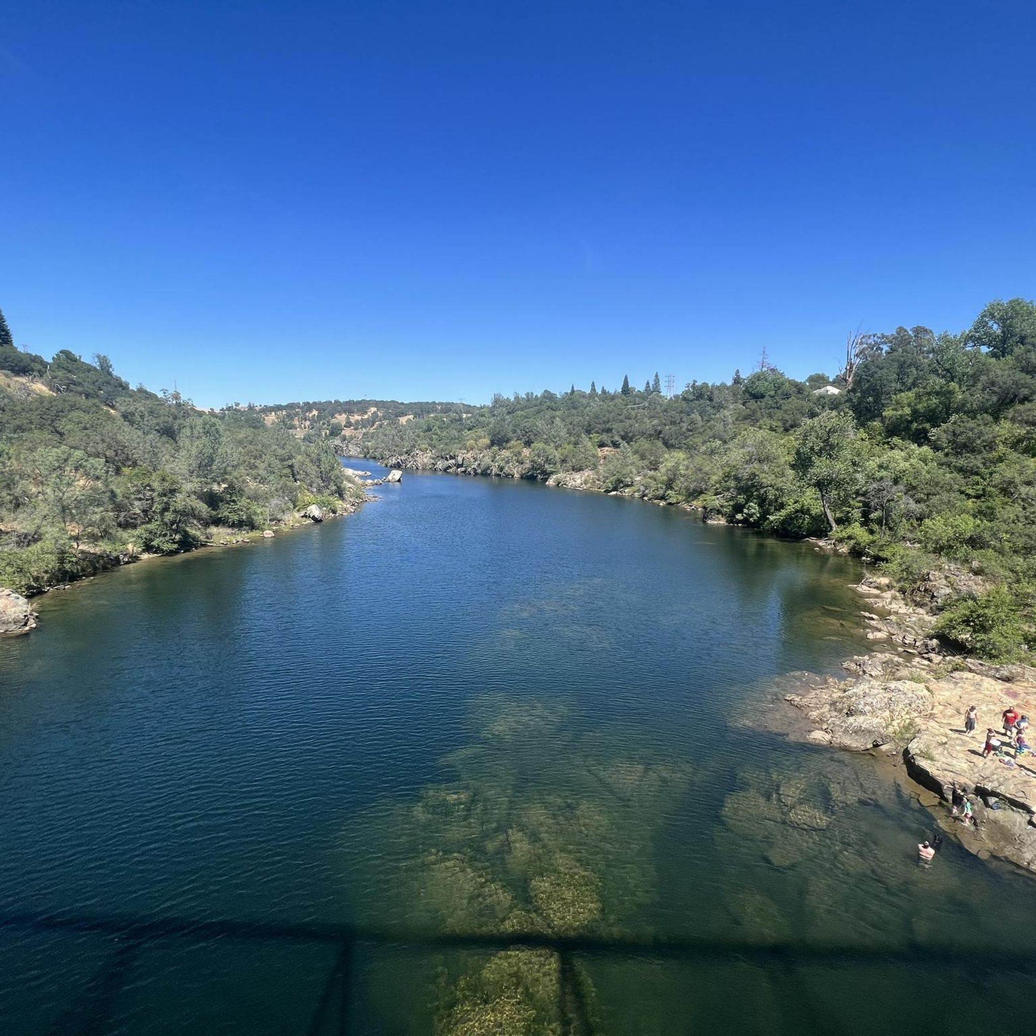
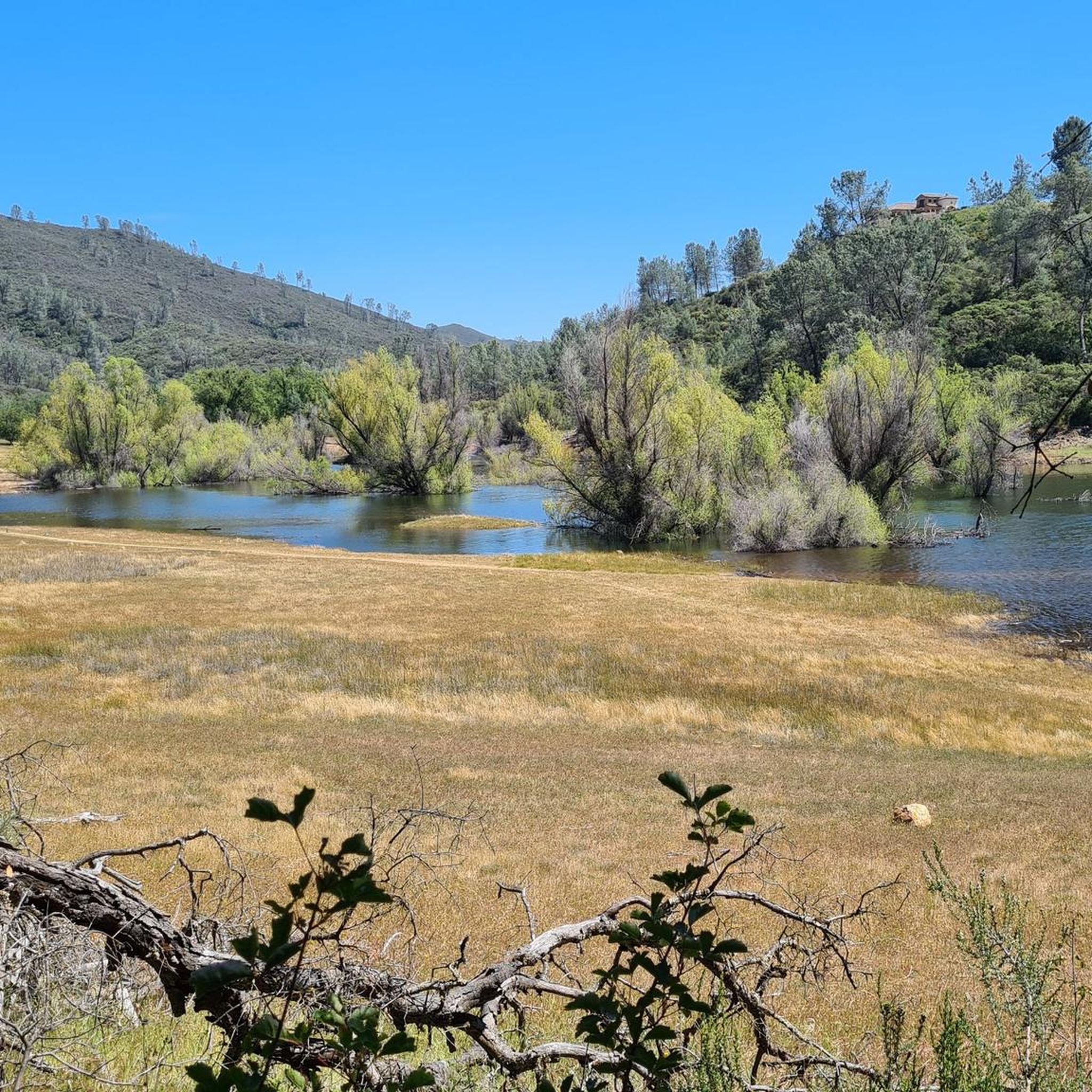
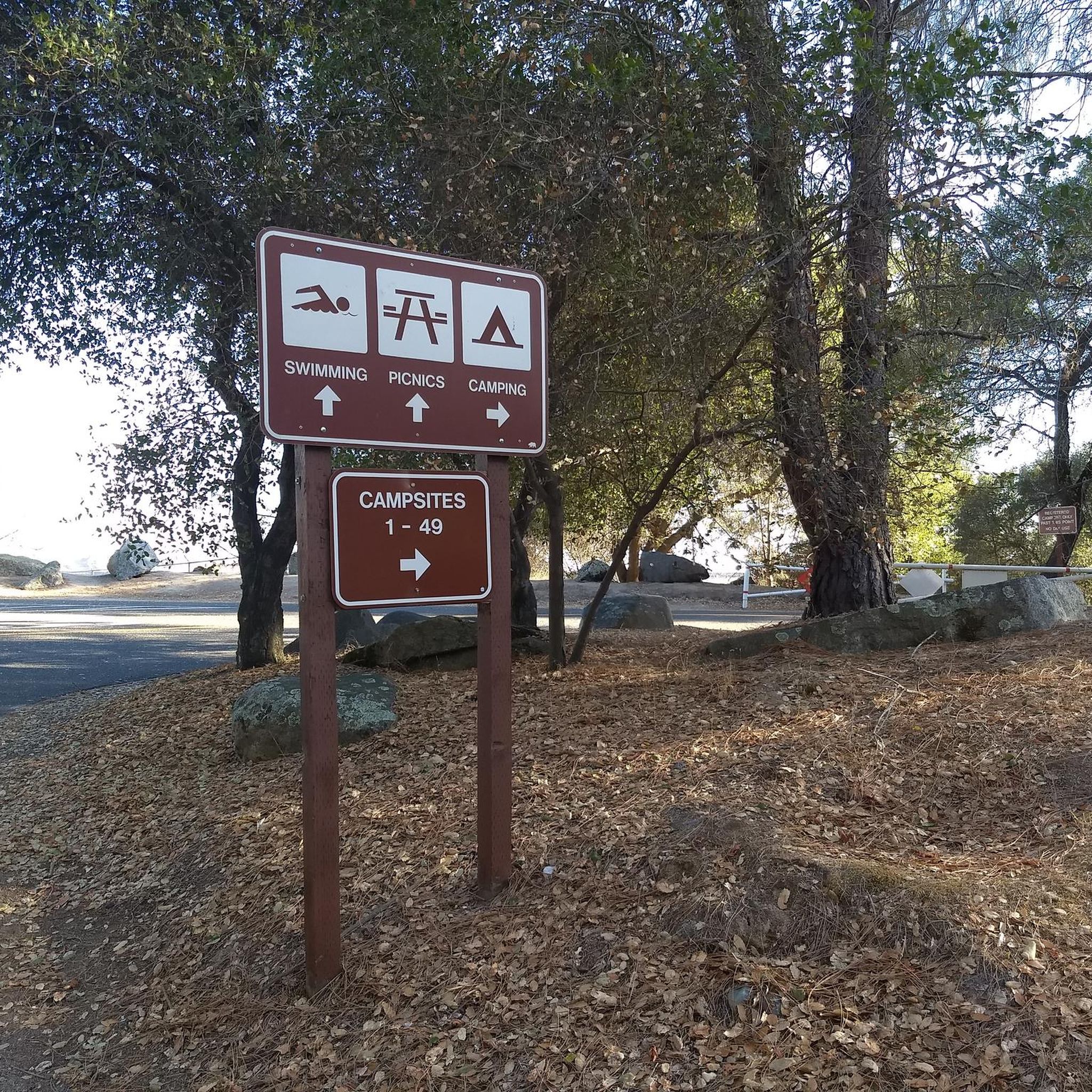
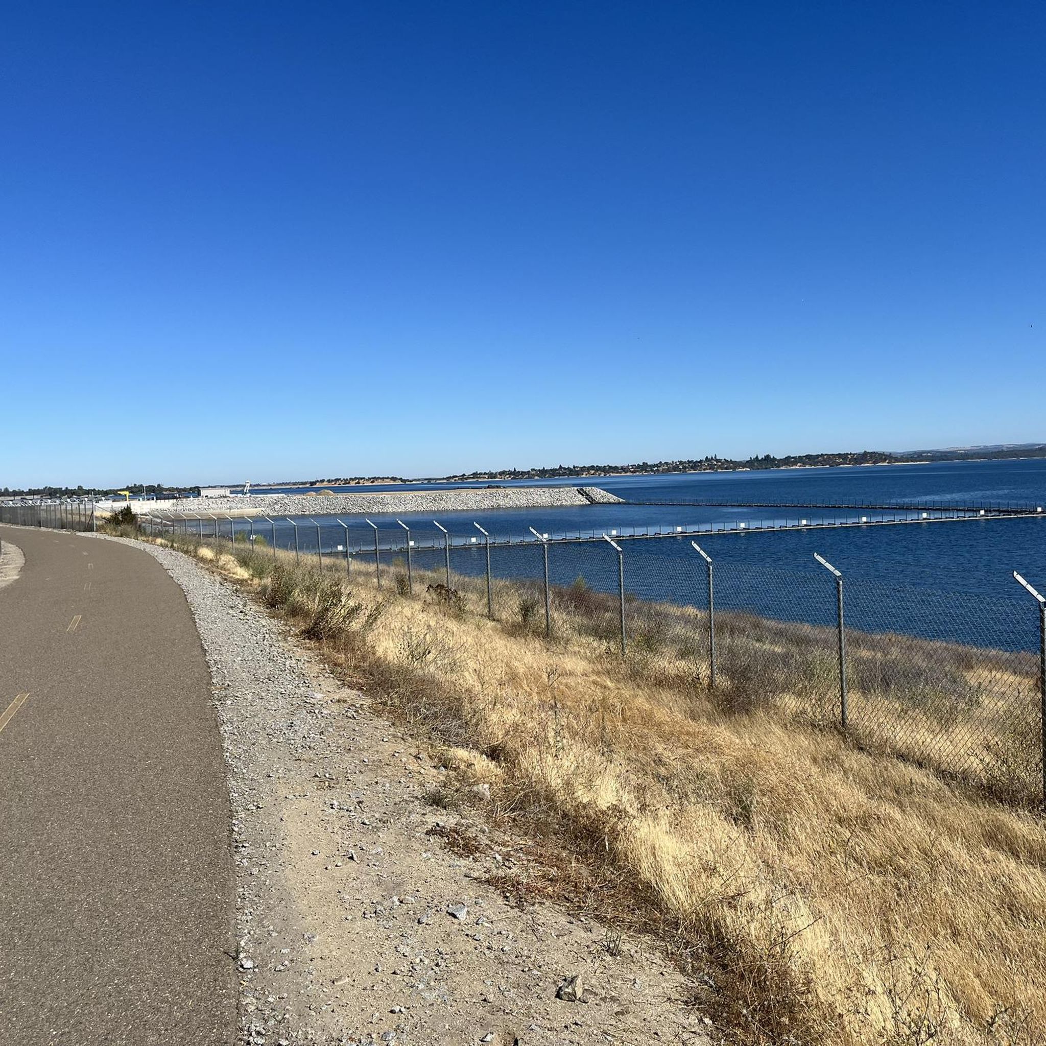

Tips from the Community

Trailhead with drinking water fountain, picnic area, and a central location along Shirland Canal Trail that crosses Maidu Drive here.
0
0

Rattlesnake Bar is right on the border of Placer County and El Dorado County on the North Fork American River. This area features the Rattlesnake Boat Launch and Avery's Pond Trailhead for hikers. When the water gets low, the bottom of the muddy river is exposed, and it can be an interesting sight to see.
0
0

This tranquil pond has a loop trail around it and is a great spot for observing beautiful wildflowers as well as a local turtle population.
0
0

Nestled along the southern banks of Folsom Lake, the New York Creek Cove offers a peaceful retreat from the bustling trails around Beals Point. This out-and-back hike follows a nearly level path along the lush creek banks shaded by oak and manzanita trees
0
0
This bridge is unique as it's not always available for crossing. The water level at Folsom Lake needs to be below 400 feet in order for the bridge to be visible. Typically, the bridge is visible in the fall and early winter.
0
0
Folsom Lake is at the base of the beautiful Sierra foothills, the lake offers a variety of activities from hiking and camping to boating and water-skiing. Please note, there's not much shade on most of the trails around the lake, so come prepared with lots of water and sunscreen.
0
0
A spur trail leads down from the American River Trail to an overlook where the turbulent cascades of the river form popular tricky obstacles for white water rafting. It is best observed midday on weekends when the upstream dams are opened to release water for these trips even during low water periods.
0
0
Skunk Hollow is a medium size State Park on the upper section of Folsom Lake. At Skunk Canyon the South Fork American River trail goes upstream (east) and Darrington Trail, an official bike trail, goes west toward Folsom Lake from the trailhead on the other side of Salmon Falls road
1
0
Frequently Asked Questions
How many hiking trails are available in Folsom Lake State Recreation Area?
Folsom Lake State Recreation Area offers a network of over 15 hiking trails, catering to various preferences and skill levels. These routes traverse diverse landscapes, from rolling hills to dense oak forests and rocky beaches.
What kind of terrain can I expect when hiking around Folsom Lake?
The area features varied topography, including grasslands, rolling hills, dense oak forests, and rocky beaches. You'll find paths winding along the lake shore, through woodlands, and across open meadows. The terrain generally consists of moderate elevation changes, making it accessible for a wide range of hikers.
Are there any easy hiking trails suitable for beginners or casual walkers?
Yes, Folsom Lake State Recreation Area has several easy trails. For a pleasant, shorter walk, consider the Beal's Point to Folsom Lake trail, which is 3.1 miles (5.0 km) and leads through oak woodlands to the lake's edge.
Are there any trails that offer scenic viewpoints of Folsom Lake or the surrounding area?
Many trails provide stunning vistas. The Folsom Lake Viewpoint via State Park Road loop is a great option for panoramic views. Hikers can also enjoy stunning vistas of Folsom Lake, the Sierra Nevada, and the Sacramento Valley from various points along the Pioneer Express Trail.
Can I bring my dog on the hiking trails in Folsom Lake State Recreation Area?
Yes, Folsom Lake State Recreation Area is generally dog-friendly, but regulations can vary by specific trail or area. It's always best to keep your dog on a leash and ensure you clean up after them. Check local signage for any specific restrictions.
Are there any family-friendly hiking options in the area?
Absolutely. Many trails are suitable for families. The Monte Vista and New York Creek Trails offer an easy 2.6-mile (4.2 km) path with views along New York Creek, perfect for a family outing.
What historical sites or natural attractions can I see while hiking?
The area is rich in history and natural beauty. You can visit the historic Folsom Powerhouse State Historic Park, or during periods of low water, the remains of Mormon Island, a former gold rush town, become visible. Natural features include the impressive Folsom Dam and the expansive Folsom Lake itself.
Are there any loop trails for hikers who prefer not to retrace their steps?
Yes, there are several loop options. The Folsom Lake Viewpoint via State Park Road loop is a moderate 5-mile (8.1 km) route that provides a circular experience with great views.
What is the best time of year to go hiking in Folsom Lake State Recreation Area?
Spring and fall are generally the best times for hiking, offering mild temperatures and beautiful scenery. Spring brings a vibrant display of wildflowers. Summer can be hot, so early morning or late afternoon hikes are recommended, and winter can be pleasant but check weather conditions.
Where can I park when visiting Folsom Lake State Recreation Area for hiking?
Parking is available at various access points and trailheads throughout the recreation area. Popular spots include Beal's Point, Granite Bay, and Folsom Point. There is typically a day-use fee for parking within the State Recreation Area.
What do other hikers enjoy most about hiking in Folsom Lake State Recreation Area?
The area is highly rated by the komoot community, with an average score of 4.7 stars. Reviewers often praise the diverse landscapes, stunning lake views, and the extensive network of trails that cater to different abilities. The opportunity to explore both natural beauty and historical sites is also frequently highlighted.
Are there any longer, more challenging trails for experienced hikers?
For those seeking a longer, more challenging experience, the Salmon Falls Bridge via Sweetwater Trail offers a moderate 7.5-mile (12.1 km) journey. The Pioneer Express Trail also provides extensive sections with varied and sometimes more challenging terrain.
Most popular routes in Folsom Lake State Recreation Area
Most popular attractions in Folsom Lake State Recreation Area

Get inspired with the komoot mobile app


Explore more
Browse the best Hikes in other regions.
