The best cycling routes in Auburn State Recreation Area
4.3
(3)
289
riders
10
rides
Touring cycling routes in Auburn State Recreation Area traverse a diverse landscape characterized by the steep canyons of the North and Middle Forks of the American River. The region features varied terrain, including riparian zones along riverbanks and foothill woodlands with oaks and pines. Cyclists encounter significant elevation changes and a network of trails that cater to different skill levels.
Best touring cycling routes in Auburn State Recreation Area
- The most popular touring cycling route is Foresthill Divide Loop Trail, a 13.8 miles (22.1 km) trail that takes 2 hours 12 minutes to complete. This difficult route offers views of the American River Canyon and surrounding foothills.
- Another top favourite among local touring cyclists is Confluence and Clementine Trail Loop, a moderate 7.8 miles (12.5 km) path. This route provides scenic views of Lake Clementine and the North and Middle Forks of the American River.
- Local touring cyclists also love the North Fork American River Sugar Pine Reservoir Dam, a 24.2 miles (39.0 km) trail leading through varied terrain with significant elevation gain, often completed in about 3 hours 11 minutes.
- Touring cycling in Auburn State Recreation Area is defined by American River Canyons, riparian habitats, and foothill woodlands. The extensive trail network offers options for different ability levels, from moderate paths to difficult climbs.
- The routes in Auburn State Recreation Area are highly rated by the komoot community with an average score of 5.0 stars from 1 review. More than 300 touring cyclists have used komoot to explore Auburn State Recreation Area's varied terrain.
Last updated: September 27, 2026
58
riders
22.1km
02:12
500m
500m
Hard bike ride. Very good fitness required. Mostly paved surfaces. Suitable for all skill levels.
5
riders
12.5km
01:08
390m
390m
Moderate bike ride. Good fitness required. Mostly paved surfaces. Suitable for all skill levels.

2
riders
39.0km
03:11
1,230m
1,230m
Hard bike ride. Very good fitness required. Mostly paved surfaces. Suitable for all skill levels.
42
riders
38.6km
03:59
890m
890m
Hard bike ride. Very good fitness required. Mostly paved surfaces. Suitable for all skill levels.
11
riders
19.0km
01:45
480m
470m
Hard bike ride. Very good fitness required. Mostly paved surfaces. Suitable for all skill levels.
Get access to more routes and recommendations from other explorers.
Already have an account?
Our route recommendations are based on thousands of hikes, rides, and runs completed by other people on komoot.
Start today with a free account
Your next adventure awaits.

Tips from the Community

The brick tells a fascinating story about a small Gold Rush town that was burnt down and rebuilt multiple times until the gold is running out.
0
0

Middle Fork of the American River is a popular spot for rafting, with many trails around it. Be careful swimming in some spots as the current is strong.
0
0

Foresthill Divide Loop, in the Auburn State Recreation Area, is a multi-use trail for hiking and biking. You'll encounter diverse landscapes, including pine and oak woodlands, as well as panoramic views of the American River Canyon.
1
0
The Fuel Break Trail near Foresthill offers a relatively short and easy hike. It leads through oak meadows, woodlands and once you reach the ridgeline, it offers nice views of the surrounding area.
0
0
Sugar Pine Reservoir Dam serves as the water supply for the Foresthill community. Visitors can find a day-use and swimming area featuring restrooms, drinking water facilities, and a campground just 1.2 miles down Iowa Hills Road heading east. The reservoir is home to rainbow trout and bass.
0
0
Iowa Hill was settled in the 1850s during the gold rush. The town was destroyed by fires a few times, and rebuilt. The ruins include the original Wells Fargo Bank vault, and old store, both original from the 1800s. Today a few hundred people live here among the historical structures. Look down in the river and find folks still panning for gold today.
0
0
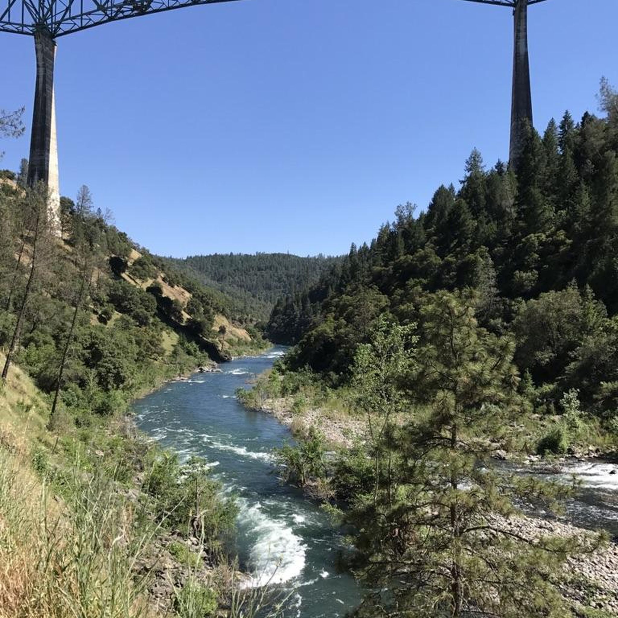
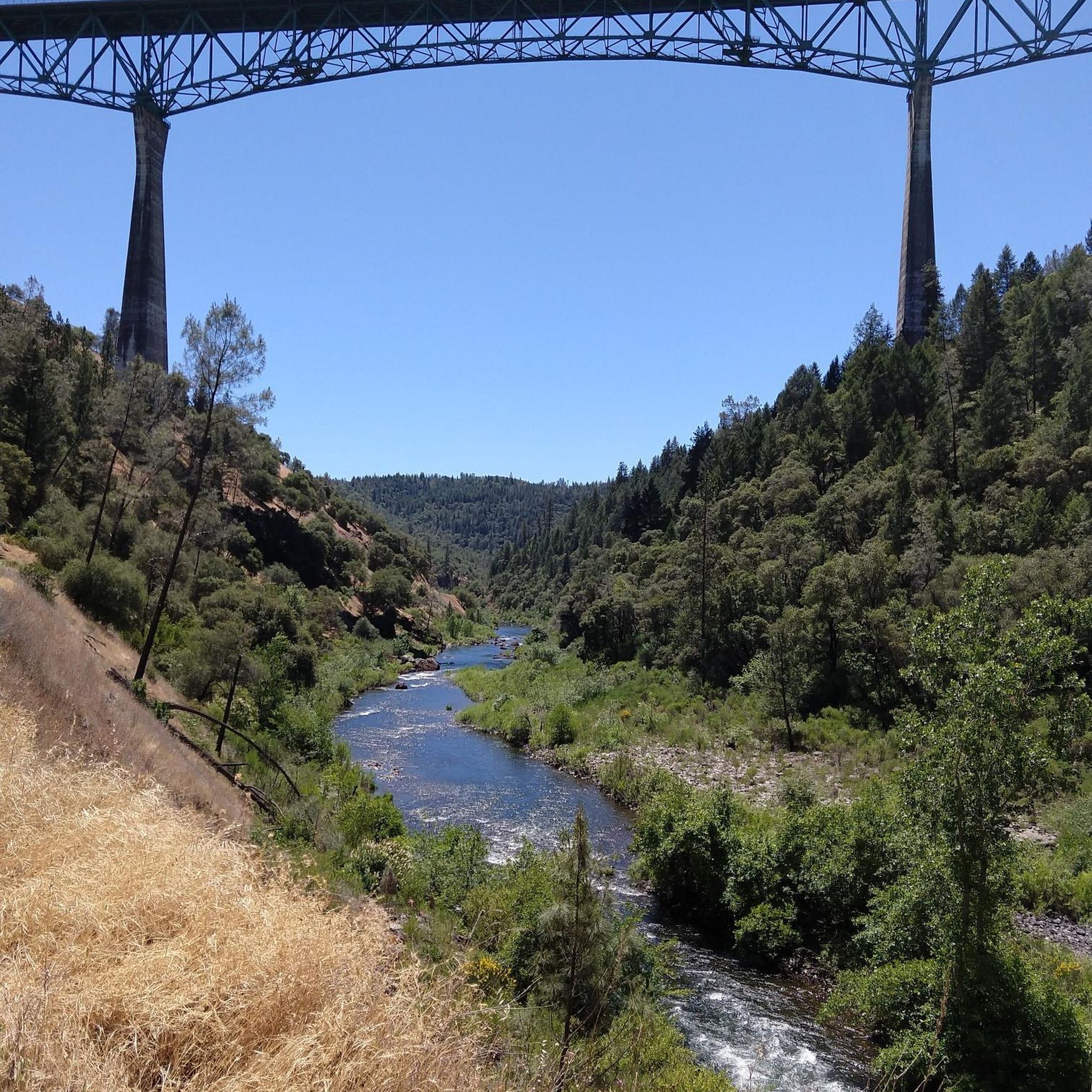
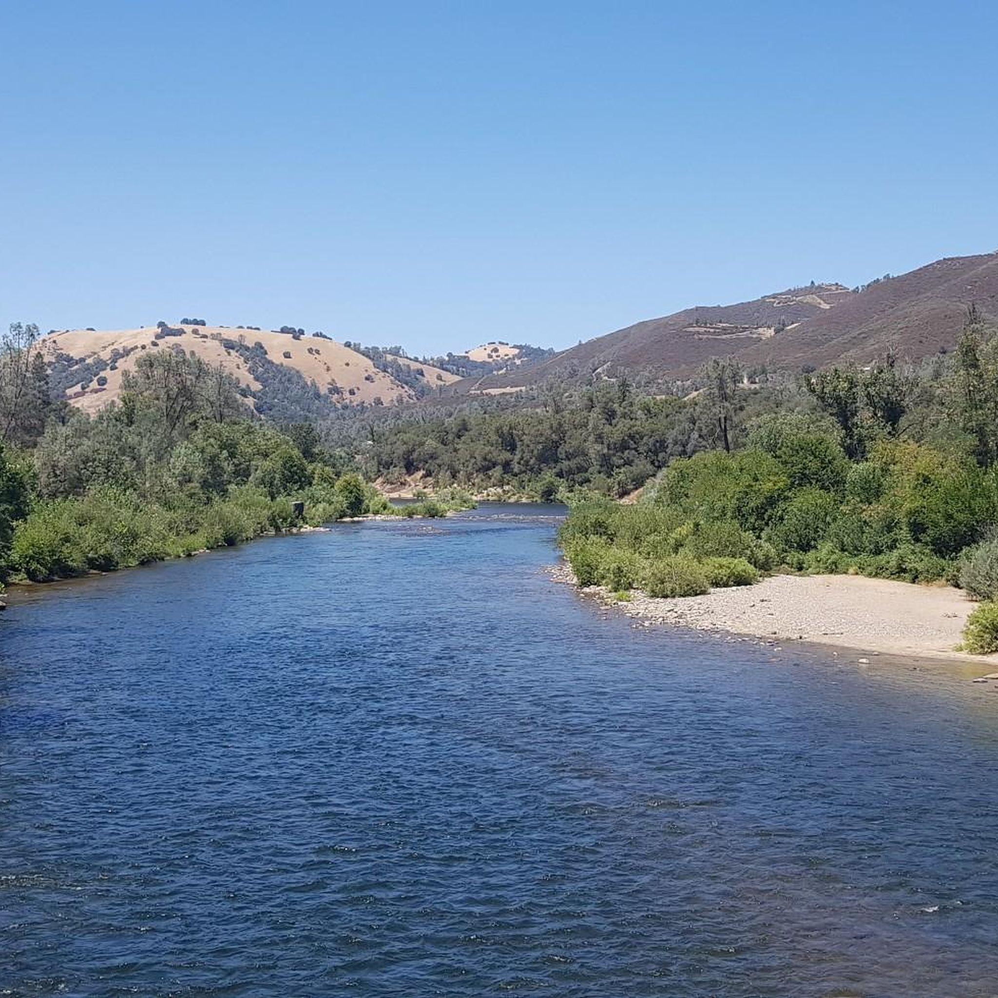
Pass over the American North Fork River, which is one of the three main forks of the American River, alongside the South and Middle forks. The river is home to rainbow trout and sometimes brown trout. It offers rapids for whitewater enthusiasts, with features like Chamberlain Falls, Tongue & Groove, Zig Zag, Achilles Heel, Bogus Thunder, The Wall, Grand Slalom, and Staircase.
0
0
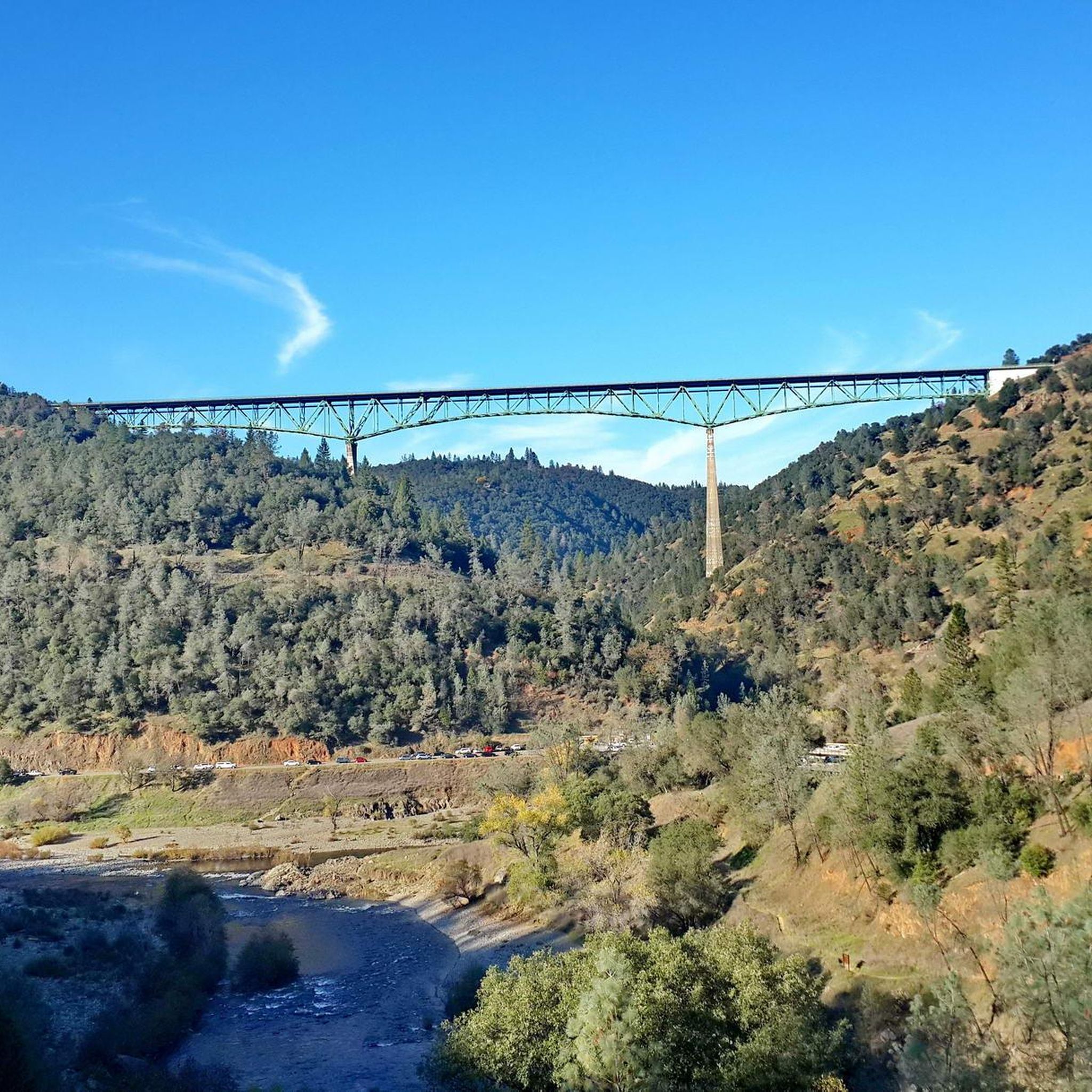
The Foresthill Bridge, spanning 2,428 feet over the North Fork American River, holds the title of the tallest bridge in California. Does it look familiar? Movie buffs might recognize it from Xander Cage's parachute jump in "XXX" and John Travolta's 1996 blockbuster "Phenomenon."
0
0
Frequently Asked Questions
How many touring cycling routes are available in Auburn State Recreation Area?
Auburn State Recreation Area offers a network of over 100 miles of trails, with komoot featuring 14 dedicated touring cycling routes. These routes range from moderate to difficult, providing options for various skill levels.
What kind of terrain can I expect on touring cycling routes in Auburn State Recreation Area?
The terrain is highly diverse, characterized by the steep canyons of the North and Middle Forks of the American River. You'll encounter everything from smooth, flowing singletrack to more technical, rocky sections with significant elevation changes. The routes traverse riparian zones along riverbanks and foothill woodlands with oaks, manzanita, and ponderosa pines.
Are there any family-friendly touring cycling routes in Auburn State Recreation Area?
While many routes in Auburn State Recreation Area feature significant elevation gain and technical sections, there are moderate options available. For example, the Confluence and Clementine Trail Loop is a moderate 7.8-mile path offering scenic views, which might be suitable for families with some cycling experience. Always check the route details for specific difficulty and elevation profiles.
What are some notable landmarks or natural features to see along the touring cycling routes?
You'll find several impressive sights. The Foresthill Bridge, California's tallest, offers a dramatic crossing. The North Fork Dam at Lake Clementine is particularly spectacular during peak runoff when it creates a man-made waterfall. You can also experience the powerful natural spectacle of The Confluence, where the North and Middle Forks of the American River meet. The Clementine Trail itself is a popular scenic path.
Are there any circular touring cycling routes in the area?
Yes, several routes are designed as loops. For instance, the Foresthill Divide Loop Trail is a popular difficult route offering views of the American River Canyon. Another option is the Clementine Trail – Foresthill Bridge loop from Stony Hill, which is also a challenging ride.
What is the best time of year to go touring cycling in Auburn State Recreation Area?
The region is generally accessible year-round, but spring and fall often offer the most pleasant conditions with milder temperatures. Late winter or early spring can be particularly scenic, as the North Fork Dam at Lake Clementine often overflows, creating a spectacular waterfall. Summers can be hot, so early morning rides are recommended, while winters can bring cooler, wetter weather.
Are there any challenging touring cycling routes for experienced riders?
Absolutely. Auburn State Recreation Area is known for its challenging terrain. Routes like the North Fork American River Sugar Pine Reservoir Dam offer significant elevation gain over 24 miles. Other difficult options include the Old Auburn Foresthill Road loop from Stony Hill, which features substantial climbs and descents.
What should I know about sharing trails with other users?
Many trails in Auburn State Recreation Area are multi-use, shared with hikers and equestrians. Cyclists are generally welcomed, but it's important to practice trail etiquette, maintain specific speed limits where posted, and yield to other users to ensure a safe and enjoyable experience for everyone.
Are there any historical points of interest along the cycling routes?
Yes, the entire area is rich in Gold Rush history. You may encounter remnants of this era, such as historic bridges and old railroad routes, adding a cultural dimension to your ride through the natural landscapes.
What are the typical elevation changes on touring cycling routes in Auburn State Recreation Area?
The routes in Auburn State Recreation Area are characterized by significant elevation changes due to the canyon landscape. For example, the Foresthill Divide Loop Trail involves over 500 meters of ascent, while the North Fork American River Sugar Pine Reservoir Dam route features over 1200 meters of climbing, making for challenging and rewarding rides.
Can I use an e-bike on the trails in Auburn State Recreation Area?
Some trails in Auburn State Recreation Area are e-bike friendly, specifically for Class 1 electric bicycles. It's always best to check local regulations and specific trail signage before heading out, as rules can vary.
What wildlife might I encounter while cycling?
The diverse riparian and woodland habitats support various wildlife. Keep an eye out for red-tailed hawks and bald eagles soaring overhead, especially near the American River canyons. You might also spot other local fauna in the chaparral and foothill woodlands.
Most popular routes in Auburn State Recreation Area
Most popular attractions in Auburn State Recreation Area

Get inspired with the komoot mobile app


Explore more
Browse the best Cycling routes in other regions.
