The best walks and hikes in Nairn Falls Provincial Park
4.6
(54)
394
hikers
13
hikes
Hiking in Nairn Falls Provincial Park offers diverse trails through a mixed forest environment, characterized by the powerful Nairn Falls and the clear waters of the Green River. The park's landscape features dense woodlands of Western Hemlock and Douglas Fir, with the Green River carving through deep rock channels. Trails often follow the river, providing views of the falls and access to riparian areas. The terrain includes relatively flat paths near the river and more challenging sections with elevation gains, connecting to broader trail networks.
Best hiking trails in Nairn Falls Provincial Park
- The most popular hiking route is Nairn Falls – Nairn Falls Trailhead Parking loop from Nairn Falls Provincial Park, a 6.1 miles (9.8 km) moderate trail that takes about 2 hours 47 minutes to complete, offering views of the falls and river.
- Another top favourite among local hikers is Nairn Falls Trailhead Parking – One Mile Lake Park loop from Nairn Falls Provincial Park, a moderate 5.7 miles (9.2 km) path. This route features varied terrain connecting the falls area to One Mile Lake, with notable elevation changes.
- Local hikers also love the Nairn Falls Trailhead Parking – Lumpy’s Epic Trail loop from Nairn Falls Provincial Park, a 3.6 miles (5.9 km) trail leading through forested areas, often completed in about 1 hour 41 minutes.
- Hiking in Nairn Falls Provincial Park is defined by dramatic waterfalls, the Green River, and mixed forests, with options for both easy strolls and more challenging hikes. The trail network provides access to natural features like One Mile Lake and sections of the Sea to Sky Trail.
- The routes in Nairn Falls Provincial Park are highly rated by the komoot community with an average score of 4.6 stars from over 40 reviews. More than 300 hikers have used komoot to explore Nairn Falls Provincial Park's varied terrain.
Last updated: October 11, 2026
4.8
(11)
85
hikers
Moderate hike. Good fitness required. Easily-accessible paths. Suitable for all skill levels.
5.0
(1)
48
hikers
Easy hike. Great for any fitness level. Easily-accessible paths. Suitable for all skill levels.

4.7
(6)
29
hikers
Moderate hike. Good fitness required. Mostly accessible paths. Sure-footedness required.
3.8
(5)
21
hikers
Easy hike. Great for any fitness level. Easily-accessible paths. Suitable for all skill levels.
4.5
(2)
6
hikers
6.12km
01:57
260m
260m
Easy hike. Great for any fitness level. Easily-accessible paths. Suitable for all skill levels.
Get access to more routes and recommendations from other explorers.
Already have an account?
Our route recommendations are based on thousands of hikes, rides, and runs completed by other people on komoot.
Start today with a free account
Your next adventure awaits.

Other adventures in Nairn Falls Provincial Park

Tips from the Community

The Green River in the Nairn Falls area is known for its strong currents. Therefore, swimming is not permitted in the Green River in Nairn Falls Provincial Park. Visitors are advised to stay on the trails.
2
0
The Nairn Falls parking lot is located directly on Highway 99 / Sea-to-Sky, about 30 km from Whistler and 4 km before the town of Pemberton – near a cliff that drops 15 meters to the Green River.
2
0

Starting point of a short, fairly flat hike
0
0
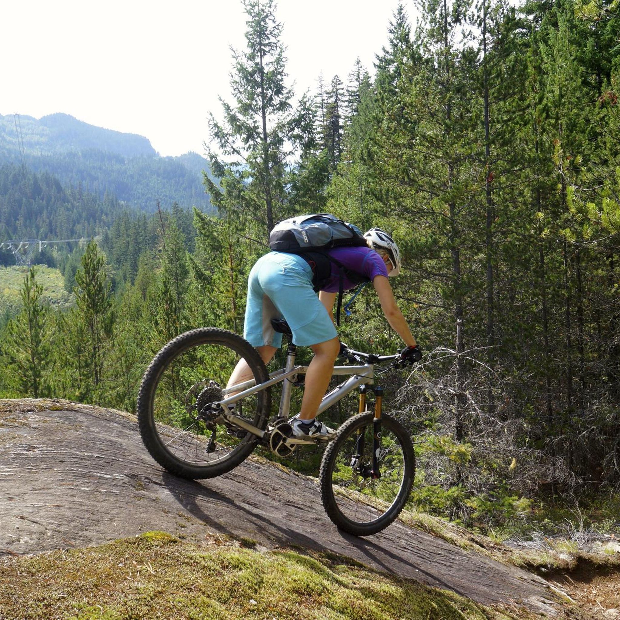
The Tower of Power Trail is primarily used by mountain bikers, who plunge at breakneck speeds over the smooth granite cliffs into the depths. We're hiking high above the Green River down to One Mile Lake and climbing the partially steep rocky path to the electricity pylon, near which a metal helipad has been constructed. In the distance, the imposing Mount Currie rises above the wide valley of the Lillooet River near Pemberton. (Visit May 27, 2025) https://www.trailforks.com/trails/tower-of-power/
2
1
Lumpy's Epic is a loop trail south of Pemberton for mountain bikers and hikers. Part of the trail runs high on the rocky cliffs above the Green River - outside Nairn Falls Park, with views of Mount Currie in the distance. We ascended from Nairn Falls via the Tower of Power Trail, continued north for a section of Lumpy's Epic, and enjoyed the view of the mountains and the wide valley of the Lillooet River in bright sunshine. (Visit May 27, 2025) https://www.trailforks.com/trails/lumpy-s-epic-8691/
2
1
The Green River flows beneath the rocky cliff before joining the Lillooet River further north. The northern peaks of the Garibaldi Ranges are still covered in snow at the end of May. (Visit May 27, 2025)
2
1
One Mile Lake Park is located directly off Highway 99 / Sea to Sky Highway, a few kilometers south of Pemberton. In summer, the lake is a popular destination for swimming, hiking, and kayaking.
2
0
On the Lumpy's Epic Trail, you'll enjoy magnificent views down into the Green River Valley and north into the wide Lillooet River Valley with Mount Currie in the background. We weren't expecting to find a bench on the trail (visit May 27, 2025).
2
1
Frequently Asked Questions
How many hiking trails are available in Nairn Falls Provincial Park?
Nairn Falls Provincial Park offers a variety of hiking experiences, with over 10 distinct trails to explore. These routes range from easy strolls to more challenging hikes, catering to different skill levels.
What natural features can I expect to see while hiking in Nairn Falls Provincial Park?
The park's main attraction is the spectacular Nairn Falls, a powerful 60-meter-high double waterfall on the Green River. You'll also encounter lush mixed forests of Western Hemlock and Douglas Fir, and the clear, emerald waters of the Green River itself. Some trails connect to One Mile Lake, offering additional scenic views.
What do other hikers say about the trails in Nairn Falls Provincial Park?
The trails in Nairn Falls Provincial Park are highly rated by the komoot community, with an average score of 4.6 stars from over 40 reviews. Hikers often praise the dramatic waterfalls, the beautiful river views, and the well-maintained paths through the mixed forests.
What is the best time of year to go hiking in Nairn Falls Provincial Park?
The Nairn Falls Trail is hike-able year-round. While beautiful in all seasons, spring and fall offer pleasant temperatures and vibrant foliage. In winter, sections can be icy, so appropriate footwear is recommended. Summer provides warm weather, ideal for enjoying the park's natural beauty.
Are the trails in Nairn Falls Provincial Park suitable for families with children?
Yes, Nairn Falls Provincial Park is an excellent destination for families. The main Nairn Falls Trail is an easy, relatively flat 3-kilometer round-trip walk, perfect for children. Additionally, trails connecting to One Mile Lake offer more recreational options like swimming and picnicking.
Can I bring my dog on the hiking trails in Nairn Falls Provincial Park?
Dogs are generally permitted in British Columbia Provincial Parks, but they must be kept on a leash at all times. Please ensure you clean up after your pet to help maintain the park's natural environment.
Is there parking available at the trailheads?
Yes, there is a dedicated day-use parking lot at the Nairn Falls Trailhead Parking, which serves as the starting point for the popular trail to the falls. Other routes, like those connecting to One Mile Lake, may have alternative parking options.
Are there any circular hiking routes in Nairn Falls Provincial Park?
Yes, the park offers several loop trails. A popular option is the Nairn Falls Trailhead Parking – One Mile Lake Park loop, which is a moderate 5.7-mile (9.2 km) path connecting the falls area to One Mile Lake. Another is the Nairn Falls Trailhead Parking – Lumpy’s Epic Trail loop, a 3.6-mile (5.9 km) route through forested areas.
Can I swim in the Green River or One Mile Lake?
While the Green River near the falls has swift currents and is not suitable for swimming, a short trail from the campground leads to a wide bend in the river, resembling a beach, where the water is calm enough for a refreshing dip on warm days. One Mile Lake is also a popular spot for swimming and picnicking.
Are there options for longer, more challenging hikes in the park?
Beyond the main falls trail, sections of the extensive Lumpy's Epic Trail can be accessed from the park, offering more challenging terrain and magnificent views of the Green River Valley and the Lillooet River Valley with Mount Currie in the background. The Nairn Falls – Nairn Falls Trailhead Parking loop is also a moderate 6.1-mile (9.8 km) trail with notable elevation changes.
How long does it take to hike the main trail to Nairn Falls?
The most popular trail leading directly to Nairn Falls is an easy, relatively flat 3-kilometer round-trip walk (1.5 km one-way) from the day-use parking lot. It typically takes approximately one hour to complete, allowing ample time to enjoy the views of the falls.
Most popular routes in Nairn Falls Provincial Park
Most popular attractions in Nairn Falls Provincial Park

Get inspired with the komoot mobile app


Explore more
Browse the best Hikes in other regions.
