The best walks and hikes in Heesseltsche Uiterwaarden
4.4
(2715)
13,927
hikers
564
hikes
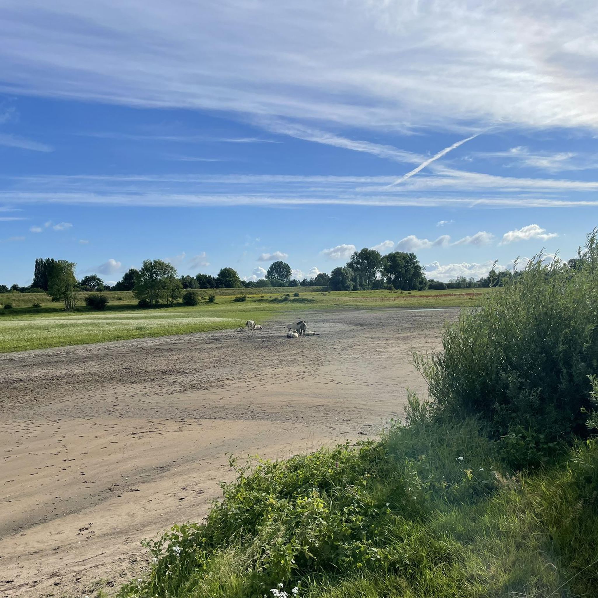
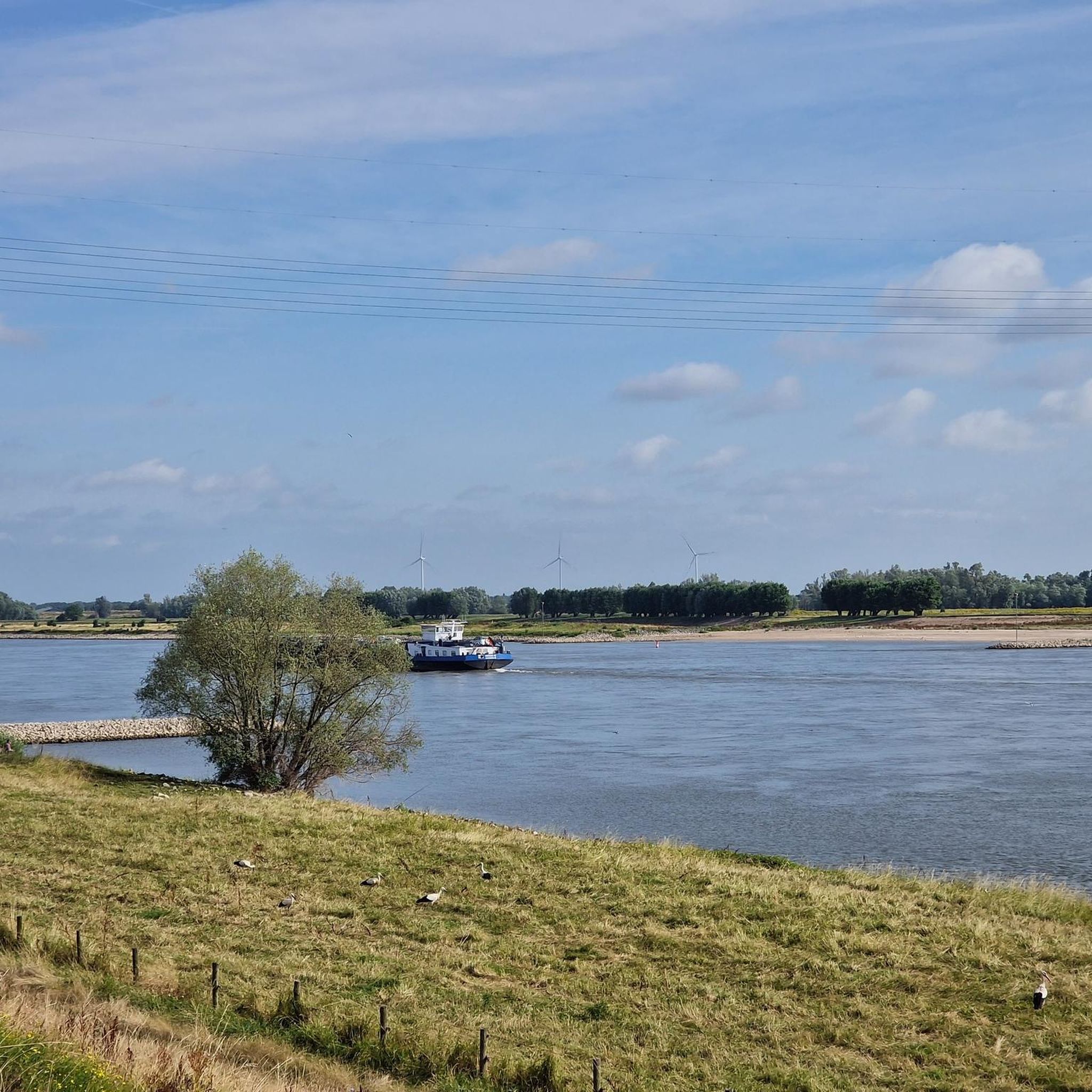
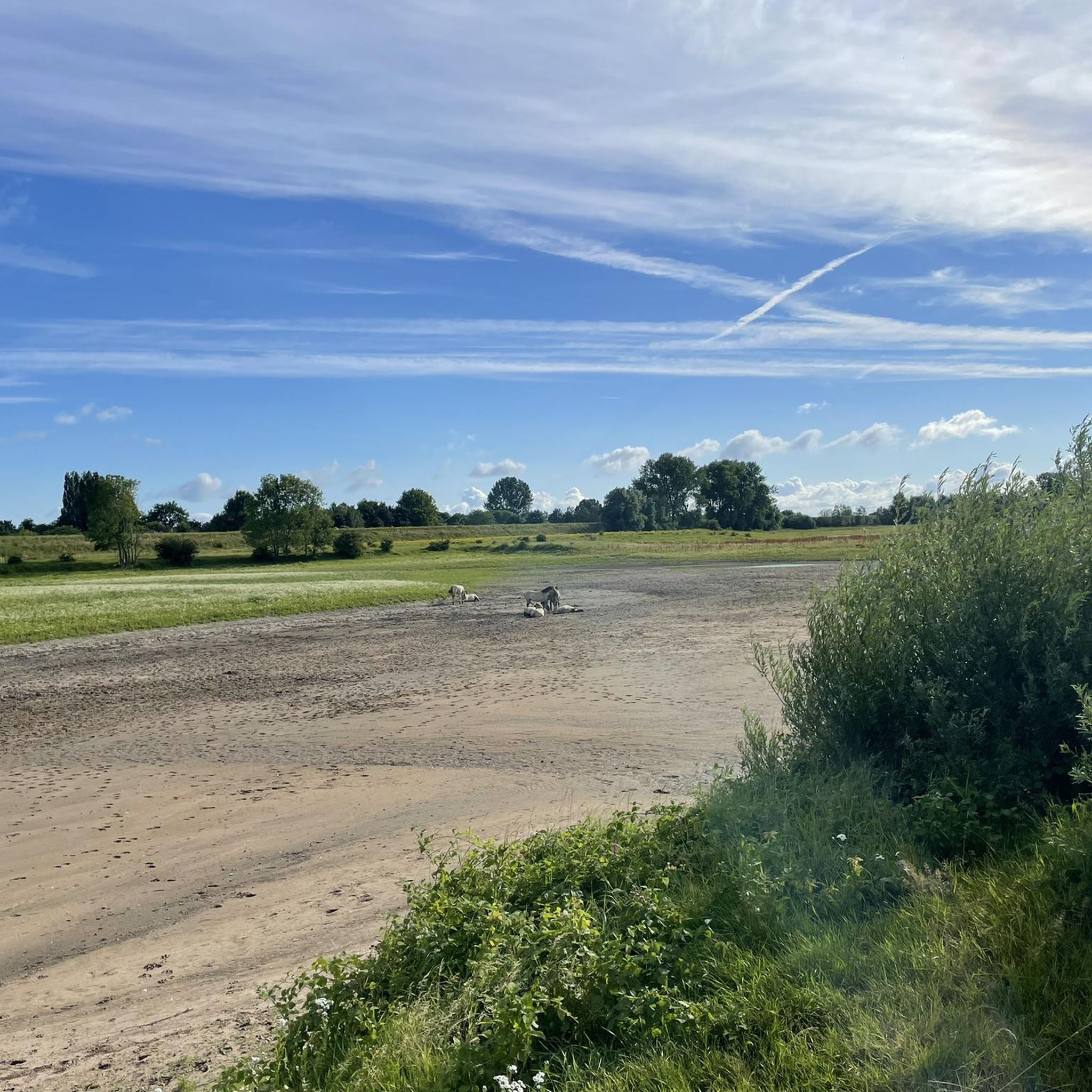
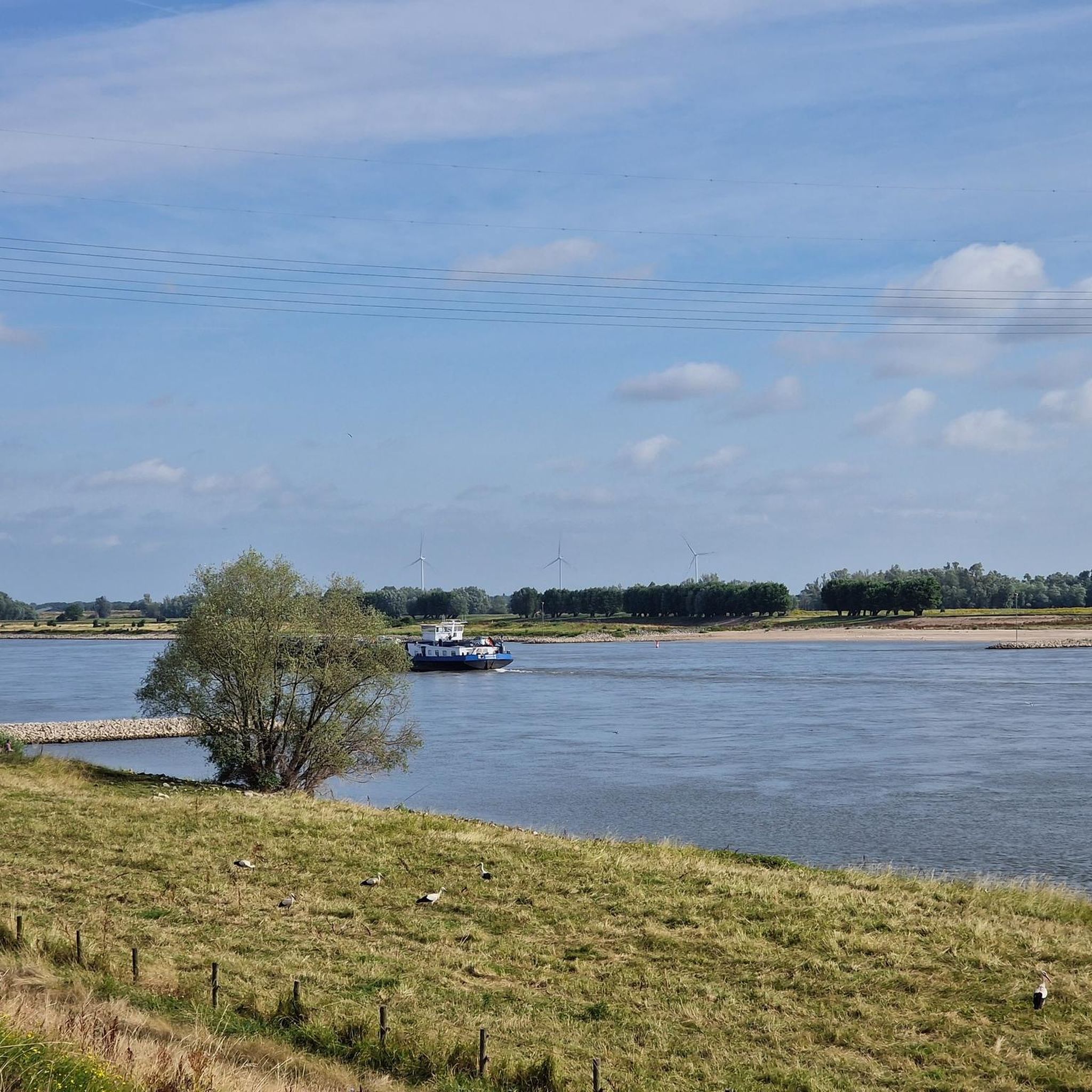
Hiking in Heesseltsche Uiterwaarden offers exploration of a dynamic riverine landscape shaped by the Waal river. This nature reserve features diverse water bodies, including old clay pits and side channels, alongside varied habitats such as marshes, floodplain forests, and grasslands. The terrain is characterized by its ever-changing nature due to river dynamics, supporting a rich array of plant life and providing habitat for grazing animals like Hereford cattle and Konik horses.
Best hiking trails in Heesseltsche Uiterwaarden
- The most popular…
Last updated: October 12, 2026
4.2
(17)
94
hikers
12.2km
03:04
20m
20m
Moderate hike. Good fitness required. Easily-accessible paths. Suitable for all skill levels.
4.4
(16)
93
hikers
Easy hike. Great for any fitness level. Easily-accessible paths. Suitable for all skill levels.

4.6
(20)
86
hikers
8.62km
02:11
10m
10m
Moderate hike. Good fitness required. Easily-accessible paths. Suitable for all skill levels.
4.7
(23)
83
hikers
9.70km
02:27
10m
10m
Moderate hike. Good fitness required. Easily-accessible paths. Suitable for all skill levels.
4.5
(10)
43
hikers
Moderate hike. Good fitness required. Easily-accessible paths. Suitable for all skill levels.
Get access to more routes and recommendations from other explorers.
Already have an account?
Our route recommendations are based on thousands of hikes, rides, and runs completed by other people on komoot.
Start today with a free account
Your next adventure awaits.

Tips from the Community


The plastered Reformed Church in Opijnen was built around 1860. The church contains a richly carved pulpit in the Louis XIV-Louis XV style as well as a two-manual organ, made in 1859 by H. Knipscheer.
0
0
The original mill, which collapsed in a storm in 1874, stood on the road. By order of the mayor, the current mill was built 50 meters from the road. At the time, horses were the main mode of transportation, and the rotating sails would frighten them. The mill is still in operation and grinds grains for animal feed. Source: the miller
1
0

On July 30, 1943, an American crew was flying their B-17F bomber back to England. They had carried out a raid on the Messerschmidt aircraft factories in Kassel, Germany. The B-17, renamed "Man-O-War" by the crew, had completed the mission without incident, but was fired upon by German anti-aircraft fire on the return flight. The aircraft crashed near Opijnen, killing eight of the ten crew members. The American B-17 bomber, belonging to the 323 Squadron of the 91st Bombardment Group, was returning to its base in England on July 30, 1943. Only two crew members survived the flight. The bombardier had fallen through the thatched roof of a farmhouse on a damaged parachute; he died from his injuries. The pilot and co-pilot landed safely by parachute but were captured by German troops. On August 1, 1943, the fallen Americans were buried in the cemetery of the Reformed Church in Opijnen. Despite the fact that only the mayor received permission from the occupying forces to attend the funeral, the villagers turned out to attend. They listened to the speech and laid flowers on the graves to show their respect for the fallen Americans. Gravediggers were assisted, and a large sea of flowers formed. The mayor sent a letter to his American counterpart from the pilot's hometown; a copy of this letter was sent to all the relatives of the eight fallen crew members. During a memorial service in 1947, the people of Opijnen received a triptych. They were also thanked with a memorial. Almost all American soldiers who died in the Netherlands are buried in Margraten; Opijnen is one of the exceptions.
1
0
Architecturally very striking church that doesn't quite fit in with the rest of the town, but is very attractive.
2
0
@Julia Nikolaeva Source reference would be fair: https://nl.wikipedia.org/wiki/Huis_Neerijnen
2
0

Heesselt is a village in the municipality of West Betuwe in the Dutch province of Gelderland and is located on the Waalbandijk.
0
0

Visit the Anne Frank tree in Neerijnen and park easily at the Stroomhuis, where you can also go for a cup of coffee or a cultural activity. A beautiful combination of nature and culture!
0
0
Frequently Asked Questions
How many hiking trails are available in Heesseltsche Uiterwaarden?
Heesseltsche Uiterwaarden offers a wide selection of hiking opportunities, with over 560 routes available on komoot. These range from easy strolls to more challenging treks, ensuring there's something for every hiker.
What kind of terrain can I expect on the trails in Heesseltsche Uiterwaarden?
The terrain in Heesseltsche Uiterwaarden is highly dynamic, shaped by the Waal river. You'll encounter varied landscapes including marshes, floodplain forests, rough grasslands, and sandy river beaches. The area is characterized by its ever-changing nature due to river dynamics, so paths can vary with seasons and water levels. Waterproof shoes or boots are highly recommended.
Are there any family-friendly hiking options in Heesseltsche Uiterwaarden?
Yes, Heesseltsche Uiterwaarden is suitable for families. There's an 'ontdekkingstocht' (discovery tour) designed for children aged 6 to 12, which includes facts and assignments to make exploring engaging. Many of the 390+ easy routes are also great for families. For example, the Waardenburg Castle – Huis Neerijnen loop from Uiterwaarden Waal is an easy 7.3 km path that passes by historical landmarks.
Can I bring my dog on the hiking trails?
The Heesseltsche Uiterwaarden is generally accessible for visitors, including those with dogs. However, please be aware that Hereford cattle and Konik horses graze year-round in over 200 hectares of the Uiterwaarden. It's crucial to keep dogs under control, preferably on a leash, and maintain a safe distance (at least 25 meters) from the large grazing animals to ensure their safety and that of your pet.
What are the best times of year to hike in Heesseltsche Uiterwaarden?
Heesseltsche Uiterwaarden offers a unique experience in every season due to its dynamic riverine environment. Spring and autumn are particularly beautiful for observing migratory birds and changing plant life. However, be aware that during high water periods, parts or even the entire area may be partially or completely inaccessible. Always check local conditions before your visit, especially in wetter months.
Are there any circular hiking routes available?
Yes, circular routes are a popular way to explore the area. The region research mentions a 17 km circular route from Heesselt to Neerijnen and Waardenburg that passes through the Uiterwaarden. Additionally, komoot offers several loop trails, such as the Cow statue along the dike – Heesselt loop from Heesselt, which is an 8.6 km moderate trail.
Where can I park when visiting Heesseltsche Uiterwaarden?
While specific parking locations are not detailed, many explorations often start near a walking bridge, such as the one at Waalbandijk 106 in Heesselt. It is advisable to look for designated parking areas in or near the villages bordering the Uiterwaarden, such as Heesselt, Opijnen, Neerijnen, or Waardenburg.
What kind of wildlife can I observe while hiking?
Heesseltsche Uiterwaarden is excellent for wildlife observation. You can spot Hereford cattle and Konik horses grazing year-round. The area is also a prime location for birdwatching, with IVN West-Betuwe organizing bird excursions and counting migratory birds in autumn. The diverse habitats support a rich variety of insects and aquatic animals as well.
Are there any notable landmarks or viewpoints along the trails?
The area offers beautiful panoramic views across the expansive river landscape. While specific landmarks are not numerous, the dynamic river environment itself, with its old clay pits, channels, and floodplain forests, provides constant natural points of interest. Historical landmarks like Waardenburg Castle and Huis Neerijnen can be seen on routes such as the Waardenburg Castle – Huis Neerijnen loop from Uiterwaarden Waal.
What should I bring or be aware of for a hike in Heesseltsche Uiterwaarden?
Given the dynamic riverine environment, it's highly recommended to wear waterproof shoes or boots. Bringing binoculars can enhance your wildlife observation experience. Always maintain a safe distance (at least 25 meters) from the large grazing animals. Swimming in the Waal is strongly discouraged due to safety concerns.
What do other hikers enjoy most about Heesseltsche Uiterwaarden?
The area is highly rated by the komoot community, with an average score of 4.4 stars from over 2,100 reviews. Reviewers often praise the dynamic riverine landscapes, the diverse natural features, and the opportunities for wildlife viewing, particularly the presence of grazing animals like Hereford cattle and Konik horses.
Are there routes suitable for experienced hikers looking for a challenge?
While much of the area is accessible, there are routes that offer a more extended experience. For instance, A successful hike on the Zandslagenpad is a moderate 12.2 km trail that navigates through the varied riverine environment. There are also 31 difficult routes available for those seeking a greater challenge.
Most popular routes in Heesseltsche Uiterwaarden

Get inspired with the komoot mobile app


Explore more
Browse the best Hikes in other regions.
