The best MTB trails in Carp Hills
5.0
(1)
40
riders
5
rides
Mountain biking in Carp Hills offers a network of trails through a landscape characterized by dense woodlands, rocky outcrops, and numerous small ponds. This region is an outcropping of the Canadian Shield, featuring rugged topography with exposed granite and rock barrens. The terrain includes cross-country style singletrack with technical features like drops and rock gardens. These trails provide opportunities for mountain bikers to navigate natural obstacles and explore the area's unique geological formations.
Best mountain bike trails in Carp Hills
…Last updated: August 14, 2026
8
riders
19.5km
01:27
80m
80m
Hard mountain bike ride. Great for any fitness level. Advanced riding skills necessary. Some portions of the route may require you to push your bike.
5.0
(1)
12
riders
16.5km
01:12
90m
90m
Moderate mountain bike ride. Great for any fitness level. Advanced riding skills necessary.

Sign up for free
7
riders
Moderate mountain bike ride. Great for any fitness level. Advanced riding skills necessary.
5
riders
Moderate mountain bike ride. Great for any fitness level. Advanced riding skills necessary.
8
riders
Moderate mountain bike ride. Good fitness required. Advanced riding skills necessary.
Our route recommendations are based on thousands of hikes, rides, and runs completed by other people on komoot.
Start today with a free account
Your next adventure awaits.
Login or Signup
Tips from the Community

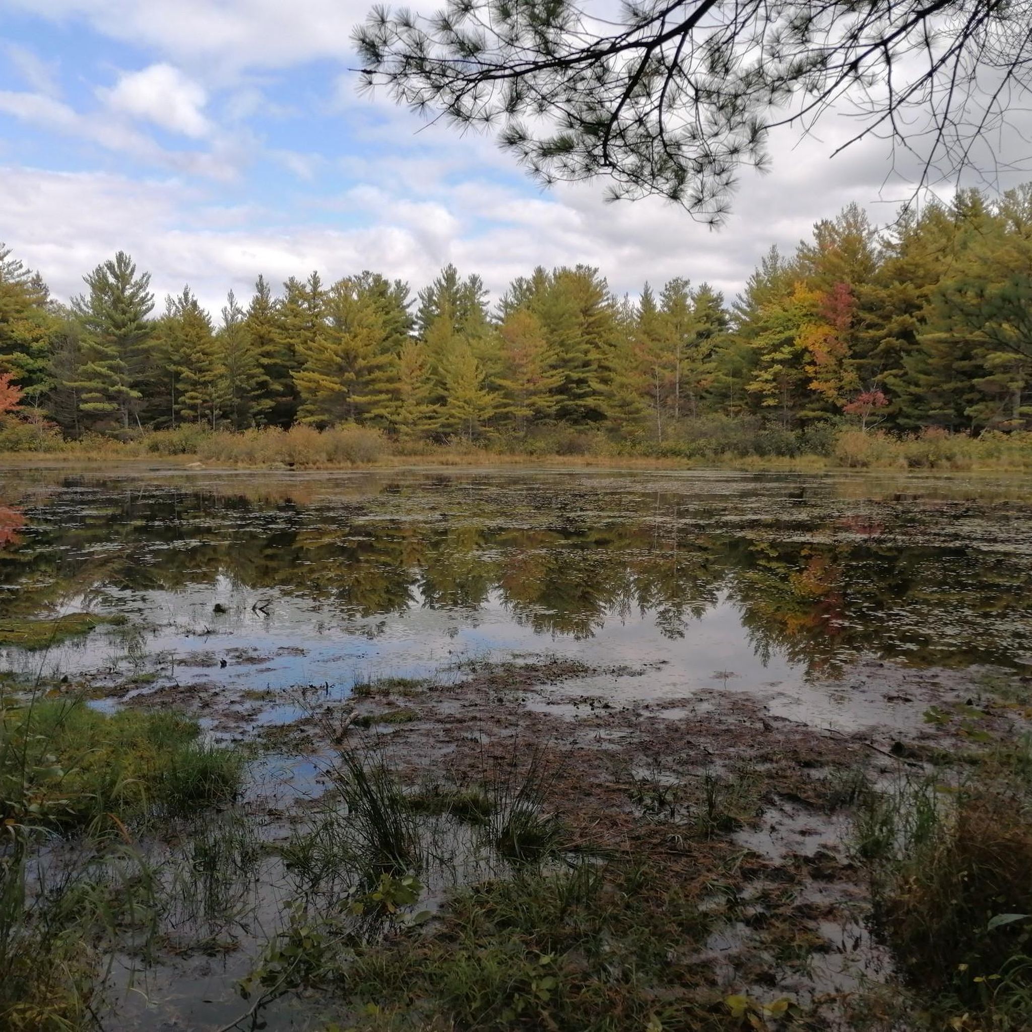
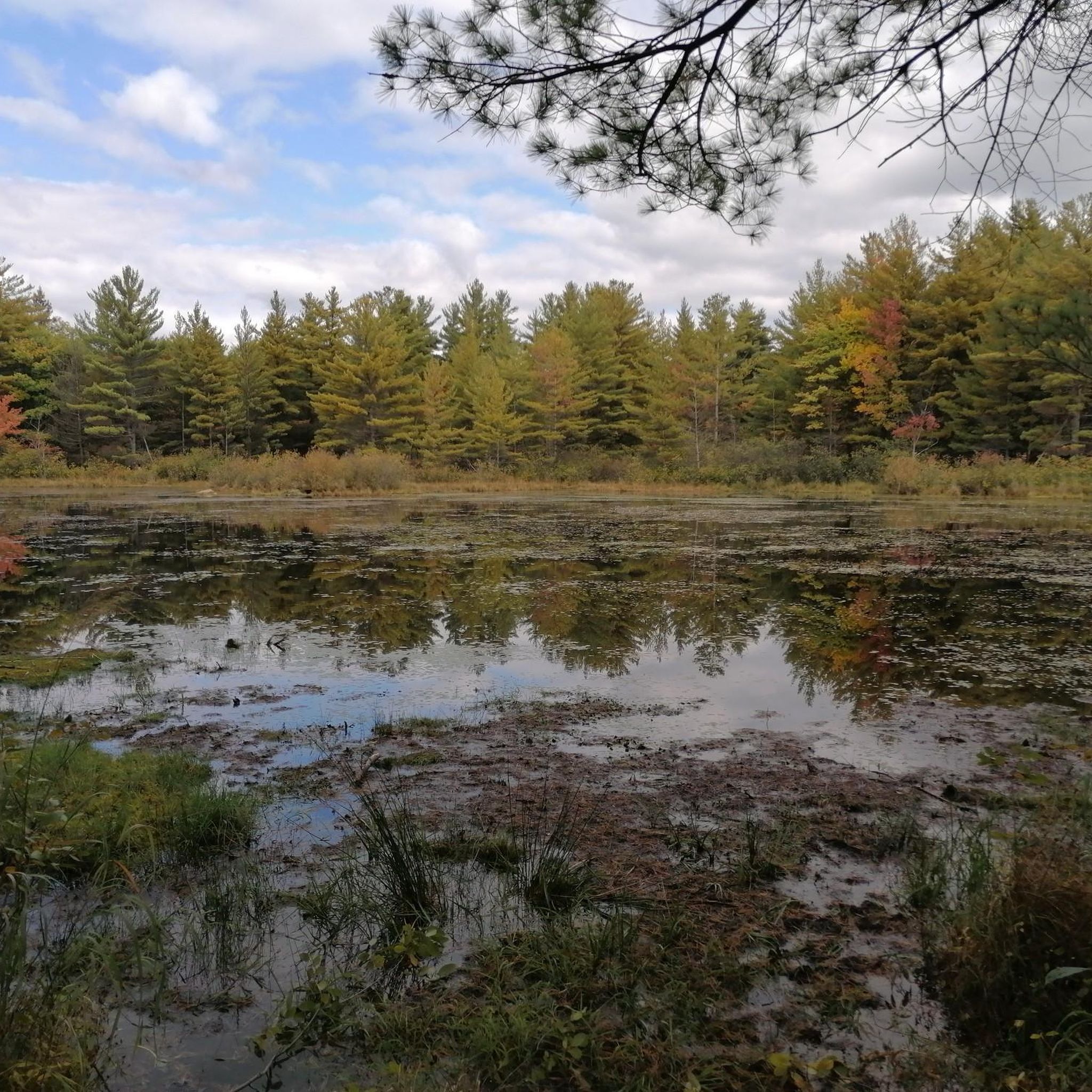
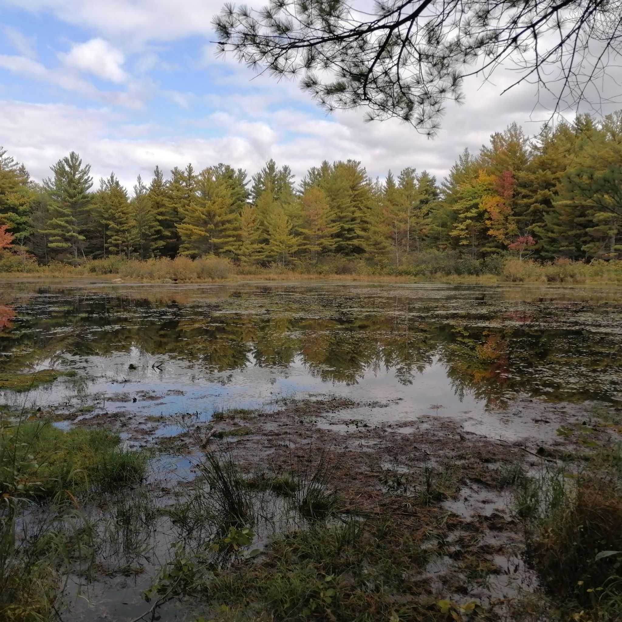
Surrounded by forest and wetlands, Kizell Pond is the heart of this beautiful protected natural area. The calm water reflects the surrounding trees, and the quiet atmosphere makes it a lovely place to pause and enjoy nature.
0
0
Kizell Pond Trail North is a peaceful route that runs through mature woodland along the north banks of Beaver Pond. It connects to several other trails that wind through open meadows and along the wetlands near Kizell Pond, and there is a short spur trail with a nice bench leading down to the lake near the start at around 300 metres. The connections to the other paths offer plenty of options to explore this diverse natural area, where you’ll see birds, turtles, and other wildlife throughout the year that call this area home.
0
0

The north path along Beaver Pond is made from crushed gravel, and has some little spur trails that take you down to the water. There is also some singletrack here to explore.
0
0
You'll find a couple little gravel singletrack spurs leading a few feet off the main trail to benches overlooking the marsh on the west side of Beaver Pond. The wetlands are a great spot for birdwatching.
0
0
Most of the vegetation down to the bank is mowed, so you get a great view across the pond. There are some benches to sit and enjoy the water, and the trail is paved. This is a very family-friendly spot.
0
0
Beartree Trail winds through mixed forest with mostly flat terrain, and is a shared route for hikers and mountain bikers, typically used to connect to other trails deeper within the South March Highlands network. Depending on the weather, it can be muddy in the spring or after heavy rainfall, but the beautiful forested setting makes it a lovely route for exploring the conservation area.
0
0
This is a short singletrack that winds through mixed forest with roots, rock patches, and narrow sections, adding some variety along the way. It is a shared route for hikers and mountain bikers, often used to connect to nearby trails within the South March Highlands network, so keep an eye out for riders who may also be using the trail while you’re here.
0
0

Watt's Creek Pathway follows Watt's Creek and is open to hiking, running, and biking. It's fully paved and easy to access with a stroller or wheelchair, as there is only a 0-5% grade, except for a roughly 10% grade near Carling Avenue. This trail passes over Watt's Creek a few times, through forests and into open grassy areas.
0
0
Frequently Asked Questions
Are there easy mountain bike trails in Carp Hills suitable for beginners?
Yes, Carp Hills offers an easy mountain bike trail perfect for beginners. The Kizell Pond loop from Kanata is an easy 10.2-mile (16.4 km) route that winds around the scenic Kizell Pond, providing a gentle introduction to the area's terrain.
What kind of challenges can advanced mountain bikers expect in Carp Hills?
Advanced mountain bikers will find challenging routes in Carp Hills, characterized by dense forest, rocky sections, and exposed bedrock. Trails like the Mountainbike loop from Kanata (8.2 miles / 13.3 km) and the Beaver Pond loop from Kanata (10.7 miles / 17.2 km) are rated as difficult, offering technical sections and varied terrain to test your skills.
Are there any good loop trails for mountain biking in Carp Hills?
Many of the mountain bike routes in Carp Hills are designed as loops, allowing you to start and finish at the same point. Examples include the popular PWT Trail – South Dogsled Trail loop from Kanata and the scenic Kizell Pond loop from Kanata.
Are the mountain bike trails in Carp Hills suitable for families?
For families looking for a less strenuous ride, the Kizell Pond loop from Kanata is an easy option. Its relatively flat profile and scenic pond views make it a good choice for those riding with children or seeking a relaxed outing.
Where can I park when visiting the Carp Hills mountain bike trails?
Most mountain bike routes in Carp Hills, such as those starting from Kanata, typically have parking available at or near the trailhead. Specific parking details can often be found on individual route pages on komoot or by checking local municipal websites for designated parking areas in the Carp Hills region.
Can I reach the Carp Hills mountain bike trails using public transport?
While some routes start from areas like Kanata, which has public transport connections, direct access to the Carp Hills trailheads via public transport can be limited. It is advisable to check local bus routes and schedules from OC Transpo to see how close they get to your desired starting point, or consider driving to the trailheads.
What is the best time of year for mountain biking in Carp Hills?
The best time for mountain biking in Carp Hills is typically from late spring through early autumn (May to October). During these months, the weather is generally mild, and the trails are dry and clear of snow, offering optimal riding conditions. Fall also provides beautiful foliage views.
Is winter mountain biking possible in Carp Hills?
Winter mountain biking in Carp Hills can be challenging due to snow and ice. While some dedicated fat biking enthusiasts might venture out, many trails may become impassable or require specialized equipment. Conditions can vary greatly, so it's best to check local trail reports before planning a winter ride.
What kind of wildlife might I encounter on the Carp Hills mountain bike trails?
Carp Hills is known for its natural environment, including dense woodlands and ponds, which are home to various wildlife. You might encounter white-tailed deer, foxes, and a variety of bird species. Keep an eye out for smaller mammals and listen for the sounds of local birds while riding.
Are there any cafes or amenities near the Carp Hills mountain bike trails?
The Carp Hills area is primarily natural and rural. While there might not be cafes directly on the trails, the nearby communities, such as Kanata and Carp Village, offer various amenities, including cafes, restaurants, and convenience stores, where you can refuel before or after your ride.
What do other mountain bikers say about the trails in Carp Hills?
The mountain bike trails in Carp Hills are highly rated by the komoot community, with an average score of 5.0 stars from more than 9 reviews. Riders often praise the varied terrain, the natural beauty of the dense woodlands and ponds, and the well-maintained network of trails that cater to different skill levels.
How many mountain bike trails are available in Carp Hills?
There are 7 mountain bike trails available in Carp Hills on komoot, ranging from easy to difficult. This selection provides options for various skill levels, allowing riders to explore the region's unique landscape of woodlands, rocky outcrops, and small ponds.

Get inspired with the komoot mobile app


Explore more
Browse the best MTB trails in other regions.
