The best cycling routes in Maroon Bells-Snowmass Wilderness
4.8
(24)
645
riders
32
rides
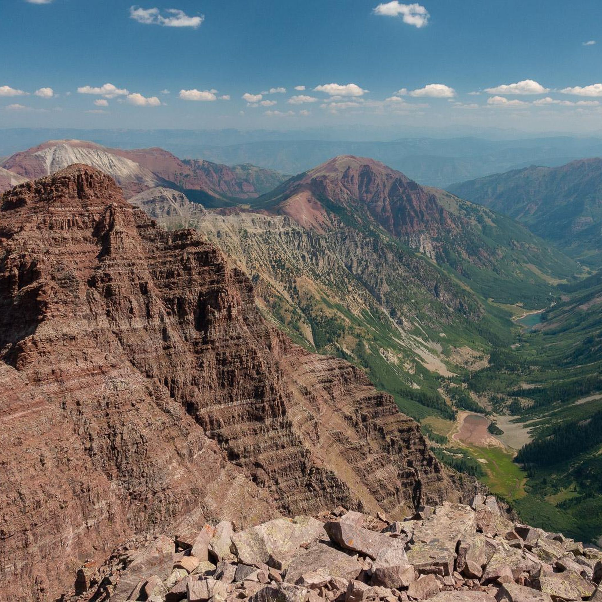
Touring cycling in Maroon Bells-Snowmass Wilderness offers routes through diverse landscapes, from subalpine forests to high mountain passes. The region is characterized by the iconic Maroon Bells peaks, numerous alpine lakes, and glacial valleys. Paved roads, such as Maroon Creek Road, provide accessible cycling opportunities with significant elevation changes, winding through aspen groves and offering views of the surrounding Elk Mountains.
Best touring cycling routes in Maroon Bells-Snowmass Wilderness
- The most popular touring cycling route is Carbondale – Rio Grande Trail loop from Eagle Mountain Wilderness Study Area, a 66.9 miles (107.8 km) trail that takes 7 hours 11 minutes to complete. This difficult route follows the scenic Rio Grande Trail.
- Another top favourite among local touring cyclists is Mt. Crested Butte Rec Path, a moderate 16.3 miles (26.2 km) path. This route offers a recreational path experience with views of the surrounding mountain terrain.
- Local touring cyclists also love the Maroon Bells Climb – Maroon Lake loop from Snowmass Village, a 36.8 miles (59.3 km) trail leading through the iconic Maroon Bells area and past Maroon Lake, often completed in about 4 hours 3 minutes.
- Touring cycling in Maroon Bells-Snowmass Wilderness is defined by iconic Maroon Bells vistas, alpine lakes, and subalpine forests. The network offers options for various ability levels, from moderate recreational paths to challenging climbs.
- The routes in Maroon Bells-Snowmass Wilderness are highly rated by the komoot community with an average score of 4.7 stars from over 20 reviews. More than 500 touring cyclists have used komoot to explore Maroon Bells-Snowmass Wilderness's varied terrain.
Last updated: July 21, 2026
5.0
(1)
14
riders
Hard bike ride. Very good fitness required. Mostly paved surfaces. Suitable for all skill levels.
7
riders
26.2km
01:51
300m
300m
Cycle the moderate 16.3-mile Mt. Crested Butte Rec Path, a paved route through scenic pastures with mountain views and access to Lake Grant.

Sign up for free
5.0
(11)
17
riders
19.8km
01:22
320m
320m
Moderate bike ride. Good fitness required. Mostly paved surfaces. Suitable for all skill levels.
16
riders
Easy bike ride. Great for any fitness level. Mostly paved surfaces. Suitable for all skill levels.
13
riders
108km
07:47
1,890m
1,890m
Hard bike ride. Very good fitness required. Mostly paved surfaces. Suitable for all skill levels.
Get access to more routes and recommendations from other explorers.
Sign up for free
Already have an account?
Our route recommendations are based on thousands of hikes, rides, and runs completed by other people on komoot.
Start today with a free account
Your next adventure awaits.
Login or Signup
Popular around Maroon Bells-Snowmass Wilderness
Other adventures in Maroon Bells-Snowmass Wilderness

Tips from the Community


The Rio Grande Trail is 42 miles between Glenwood Springs and Aspen. The trail is fully paved and traffic-free, except for crossings at intersections. This is a beautiful section that takes you into Carbondale.
0
0
The road up to the top of Watson Divide is a well-maintained dirt road. The climb is challenging, but it is worth it for the view at the top.
1
0

The Grotto Cascades on the Roaring Fork River are a set of step-down rapids. They appear different in different seasons, and they run fullest in the late spring and early summer months.
0
0
The Grotto Cascades are a section of the Roaring Fork River where the water flows over a series of small, drop-like ledges or rock shelves. The water flows the highest in late spring and early summer months.
0
0

The North Star Nature Preserve is an access point to the Roaring Fork River. There is kayaking access, access to the East of Aspen Trail, and parking at this south gate. Dogs are allowed on the East of Aspen Trail as long as they are leashed, but are not allowed anywhere else in the preserve so as not to disturb the moose population here.
0
0
Moore Opens Space spans 65 acres and was acquired by Pitkin County in 1992. This scenic area boasts sage-dominated shrubland, providing interesting habitats and picturesque views. Notable features include the Moore Trail singletrack connecting to Maroon Creek Road, the Aspen Recreation Center, and the Tiehack Bridge bike/pedestrian crossing, as well as a winter nordic loop with access to the Aspen Golf Course nordic trails. Dogs are welcome but must be leashed and kept on designated trails.
0
0
The North Star Nature Preserve is an access point to the Roaring Fork River. There is kayaking access, access to the East of Aspen Trail, and parking at this south gate. Dogs are allowed on the East of Aspen Trail as long as they are leashed, but are not allowed anywhere else in the preserve so as not to disturb the moose population here.
0
0
Frequently Asked Questions
How many touring cycling routes are available in Maroon Bells-Snowmass Wilderness?
There are over 35 touring cycling routes documented in the Maroon Bells-Snowmass Wilderness on komoot. These routes offer a variety of experiences, from moderate recreational paths to challenging climbs through iconic landscapes.
What are the difficulty levels of touring cycling routes in the region?
The routes in Maroon Bells-Snowmass Wilderness cater to various skill levels. You'll find 9 easy routes, 10 moderate routes, and 16 difficult routes. This variety ensures options for both casual riders and experienced touring cyclists seeking a challenge.
Are there any family-friendly touring cycling routes?
Yes, the region offers several routes suitable for families. For a moderate option, consider the Mt. Crested Butte Rec Path. While not explicitly listed as 'easy' in the data, recreational paths are generally more accessible for families. Always check the route details for specific elevation and terrain information.
Can I bring my dog on the touring cycling routes?
While many outdoor areas in the Maroon Bells-Snowmass Wilderness are dog-friendly, specific rules may apply to cycling routes, especially paved roads or designated paths. It's always best to check local regulations for each specific trail regarding pets, particularly on shared-use paths or within the wilderness area boundaries where mechanized vehicles (including bikes) are often restricted.
What is the best time of year to go touring cycling in Maroon Bells-Snowmass Wilderness?
The best time for touring cycling is generally during the summer months, from late spring to early fall, when roads are clear of snow and the weather is mild. Midsummer offers lush subalpine forests and expansive wildflower meadows. However, it's always advisable to check current road conditions and weather forecasts, as high mountain passes can experience unpredictable conditions.
Are there any circular touring cycling routes?
Yes, many routes in the region are designed as loops. An example is the difficult Maroon Bells Climb – Maroon Lake loop from Snowmass Village, which takes you through the iconic Maroon Bells area and past Maroon Lake. Another challenging loop is the Carbondale – Rio Grande Trail loop from Eagle Mountain Wilderness Study Area.
What are some notable natural attractions I can see along the touring cycling routes?
The Maroon Bells-Snowmass Wilderness is rich in natural beauty. Along various routes, you might encounter stunning alpine lakes such as Crater Lake, Thomas Lakes, and Avalanche Lake. The iconic Maroon Bells themselves are a highlight, and you might even spot wildlife like bighorn sheep or elk. For a unique natural attraction, the Conundrum Hot Springs are also within the wilderness area, though accessing them requires a hike and permits for overnight stays.
What are the rules for cycling on Maroon Creek Road?
Maroon Creek Road is a premier touring cycling route. During much of the summer, vehicle access is restricted during daytime hours, making it exceptionally cyclist-friendly. This allows cyclists to enjoy the paved road, which winds through aspen groves and offers spectacular views of the Maroon Bells. It's advisable to check current seasonal access rules and shuttle schedules before planning your ride.
Is public transport available to access cycling routes, and can I bring my bike?
Yes, the Roaring Fork Transportation Authority (RFTA) operates shuttles that can transport cyclists and their bikes to key access points, particularly for Maroon Creek Road. This is a great option to avoid parking challenges and enjoy the scenic ride without worrying about the return journey. Always check RFTA's specific schedules and bike policies.
Are there any permits required for touring cycling in the Maroon Bells-Snowmass Wilderness?
Generally, permits are not required for day touring cycling on established roads or paths outside the designated wilderness area. However, if your route involves hiking or overnight stays within the Maroon Bells-Snowmass Wilderness, especially to places like Conundrum Hot Springs or for backpacking, permits are required. Always verify specific regulations for your chosen route.
What do other touring cyclists say about the routes in Maroon Bells-Snowmass Wilderness?
The touring cycling routes in Maroon Bells-Snowmass Wilderness are highly regarded by the komoot community, with an average rating of 4.7 out of 5 stars from over 20 reviews. Cyclists often praise the stunning scenic beauty, particularly the iconic Maroon Bells vistas, the well-maintained paved roads like Maroon Creek Road, and the diverse terrain that offers both challenging climbs and enjoyable recreational rides.
Where can I find parking for touring cycling routes?
Parking is available at various access points for touring cycling routes, particularly near Aspen Highlands for Maroon Creek Road. However, due to the popularity of the area, parking can be limited, especially during peak season. Utilizing public transport options like the RFTA shuttle, which allows bikes, is often recommended to alleviate parking concerns and enhance the cycling experience.
Are there any long-distance touring cycling routes in the area?
Yes, the region offers several longer routes for endurance cyclists. For example, the difficult Rio Grande Trail – Independence Pass loop from Snowmass Village covers over 108 kilometers (67 miles) with significant elevation gain, offering a substantial challenge and expansive views.
Most popular routes in Maroon Bells-Snowmass Wilderness
Most popular attractions in Maroon Bells-Snowmass Wilderness

Get inspired with the komoot mobile app


Explore more
Browse the best Cycling routes in other regions.
