The best walks and hikes in Maroon Bells-Snowmass Wilderness
4.8
(77)
2,383
hikers
173
hikes
Hikes in Maroon Bells-Snowmass Wilderness explore a landscape of high-altitude peaks, glacial valleys, and alpine lakes within the Rocky Mountains. The area is part of the White River National Forest and is defined by its two prominent peaks, Maroon Peak and North Maroon Peak. The terrain features extensive aspen groves and meadows, with a trail network that includes both short lakeside walks and multi-day backpacking routes.
Best hiking trails in Maroon Bells-Snowmass Wilderness
- The most popular hiking route is the Maroon-Snowmass Trail to Crater Lake, a 3.9 mile (6.3 km) trail that takes around 2 hours 20 minutes to complete. This route follows a rocky path through an aspen forest to the lake at the base of the Maroon Bells.
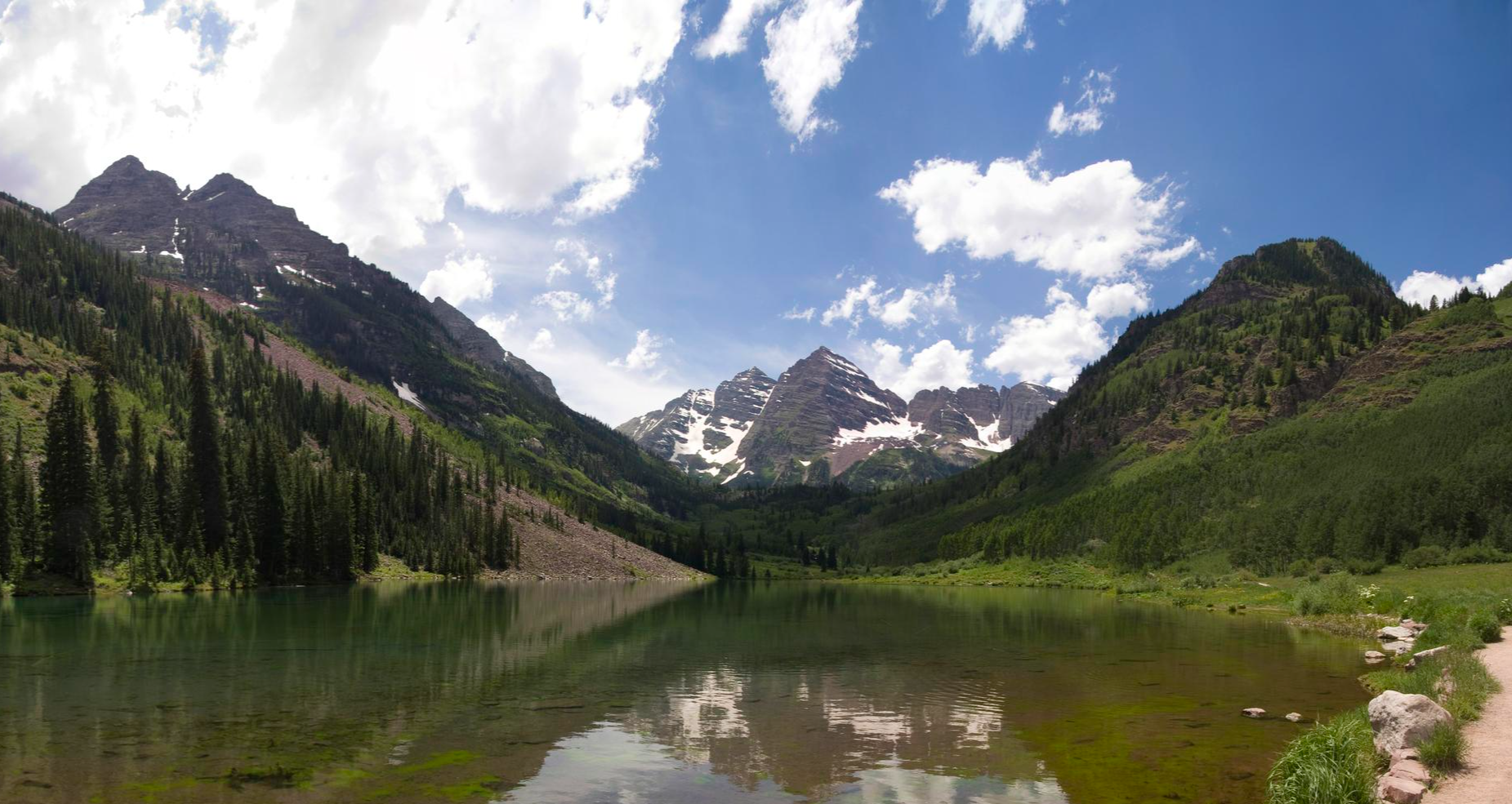
- Another top favourite among local hiking enthusiasts is the Scenic Loop Trail, a moderate 2.0 mile (3.2 km) path. The trail circles Maroon Lake, providing clear views of the surrounding peaks and access to a beaver pond.
- Local hiking enthusiasts also love the American Lake Trail, a 5.8 mile (9.3 km) trail leading through aspen and conifer forests, often completed in about 4 hours 35 minutes.
- Hiking in Maroon Bells-Snowmass Wilderness is defined by high-altitude passes, alpine lakes, and extensive aspen forests. The trail network provides options for different ability levels, from accessible lakeside paths to challenging backpacking routes.
- The routes in Maroon Bells-Snowmass Wilderness are highly rated by the komoot community with an average score of 4.8 stars from more than 60 reviews. More than 2,000 hikers have used komoot to explore Maroon Bells-Snowmass Wilderness's varied terrain.
Last updated: July 21, 2026
31
hikers
3.20km
01:15
190m
20m
The Crater Lake trail offers a quintessential Colorado hiking experience, leading you through stunning Aspen Forests to the serene Crater Lake nestled beneath Sievers Mountain. This moderate 2.0-mile (3.2 km) route, with 636 feet (194 metres) of elevation gain, provides a fantastic journey into the Maroon Bells–Snowmass Wilderness, making it one of the best Crater Lake hiking trails for dramatic mountain vistas.
Expect to spend about 1 hour and 14 minutes on this trail, which starts near the iconic Maroon Lake. Due to the area's popularity, especially for its notable landmarks and viewpoints, you'll likely need to plan for shuttle access or very early morning entry during peak season. Always confirm current parking and permit requirements for the Maroon Bells Scenic Area before heading out.
This trail is a highlight of the Maroon Bells area, renowned for its unique geological features and the breathtaking panoramic view of the Maroon Bells. It's a perfect option for those seeking a rewarding hike without an extensive time commitment, offering a taste of the high-alpine environment and its vibrant ecosystems.
31
hikers
3.20km
01:15
190m
20m
The Crater Lake trail offers a quintessential Colorado alpine experience, leading you through lush Aspen forests and past the stunning Maroon Lake before culminating at the pristine Crater Lake. You'll be treated to iconic views of the Maroon Bells, with Sievers Mountain standing guard, making this a truly memorable journey into the heart of the wilderness. The route provides a fantastic opportunity to immerse yourself in the natural beauty of the region, with the changing terrain keeping the hike engaging from start to finish.
This moderate hiking route covers 2.0 miles (3.2 km) with an elevation gain of 636 feet (194 metres), typically taking about 1 hour and 14 minutes. Due to its popularity, especially for Crater Lake hiking routes, planning your visit is crucial. During peak season, access to the Maroon Bells Scenic Area often requires shuttle bus reservations, as private vehicle access is restricted. Always check current regulations and consider an early start to avoid crowds and secure any necessary permits or parking.
Crater Lake is nestled within the Maroon Bells–Snowmass Wilderness, an area renowned for its dramatic peaks and pristine alpine lakes. The trail offers a fantastic introduction to this wilderness, showcasing the unique geological formations and vibrant ecosystems. It's a prime example of the best hikes Crater Lake has to offer, providing a relatively short but incredibly scenic outing that highlights the natural splendor of Pitkin County, Colorado.

Sign up for free
30
hikers
10.8km
03:54
980m
40m
The Capitol Peak via Capitol Ditch Trail offers a challenging and scenic hike through the Maroon Bells-Snowmass Wilderness, winding through aspen and fir forests before opening into vibrant meadows. You'll enjoy increasingly impressive views of Capitol Peak and Mount Daly, with alpine streams adding to the Rocky Mountain aesthetic. This difficult 6.7-mile (10.8 km) route involves a substantial 3210 feet (978 metres) of elevation gain, making it a strenuous but rewarding experience for seasoned hikers, typically taking around 3 hours and 53 minutes.
Planning your visit requires some foresight, especially regarding trailhead access; the last two miles to the Capitol Creek Trailhead often demand a high-clearance 4WD vehicle. This trail is a popular alternative to the traditional Capitol Creek Trail, avoiding an initial drop and climb. If you're considering an overnight trip, be aware that hard-sided bear canisters are mandatory for camping in the Capitol Creek drainage.
This trail is often favored as an approach to Capitol Lake, a common basecamp for those aiming to summit Capitol Peak, one of Colorado's most difficult fourteeners. The route provides a unique perspective of Capitol Peak from the moment you start, showcasing its dramatic "Swiss alpine aesthetic." It's a fantastic option for advanced hikers looking for a remote wilderness experience and stunning mountain vistas.
29
hikers
15.4km
06:21
1,230m
50m
The Snowmass Lake via Maroon-Snowmass Trail is a demanding 9.6-mile (15.4 km) hike that takes you deep into the Maroon Bells-Snowmass Wilderness, offering a true alpine adventure. You'll journey through changing terrain, from gentle aspen groves to steep talus slopes and dense pine forests, with glimpses of towering peaks like Capitol Peak and Snowmass Mountain along the way. The ultimate reward is the pristine Snowmass Lake, nestled at 10,980 feet, reflecting the majestic mountains around it.
This difficult route involves a substantial 4024 feet (1227 metres) of elevation gain and typically takes around 6 hours and 21 minutes to complete one-way. Hikers should be prepared for challenging conditions, including water crossings and a log jam, and be aware of the altitude. Starting early is advisable to avoid crowds and afternoon thunderstorms, especially during peak season.
Snowmass Lake is a significant point on the renowned Four Pass Loop trail and is a popular destination for both day hikers and backpackers. The area is rich in wildlife, with potential sightings of marmots, deer, moose, and black bears. Camping is permitted at designated sites around the lake, requiring the use of bear canisters for food storage.
7
hikers
43.8km
13:34
1,560m
1,560m
The Conundrum Hot Springs via Conundrum Creek Trail offers a deep dive into the Maroon Bells-Snowmass Wilderness, leading you through wildflower meadows and dense forests with stunning views of peaks like Cathedral Peak and Castle Peak. This challenging 27.2-mile (43.8 km) out-and-back hike features a significant 5133 feet (1564 metres) of elevation gain, culminating in a steep final push to the natural hot springs. You'll navigate several creek crossings, some requiring wading, making for a true backcountry experience that typically takes 13 hours and 33 minutes to complete.
Planning your visit requires careful attention to logistics, especially if you intend to camp overnight, as advance permits and bear canisters are mandatory. Day hikers do not need a permit, but should start early for this difficult route. The trail is often snow-covered and subject to avalanches from October to June, so the prime hiking season is generally July through September. Always be prepared for high-altitude conditions.
What truly sets this trail apart is the destination: the Conundrum Hot Springs themselves. These primitive, natural pools are nestled deep in the Rockies, offering a therapeutic soak with incredible mountain vistas. The largest pool often feels like an infinity pool, and the atmosphere is communal and social, with clothing optional. This unique reward makes the long, strenuous journey a memorable adventure for experienced hikers.
Get access to more routes and recommendations from other explorers.
Sign up for free
Already have an account?
Our route recommendations are based on thousands of hikes, rides, and runs completed by other people on komoot.
Start today with a free account
Your next adventure awaits.
Login or Signup
Popular around Maroon Bells-Snowmass Wilderness
Other adventures in Maroon Bells-Snowmass Wilderness

Tips from the Community

In my opinion, actually more worth seeing than the Maroon Bells.
0
0
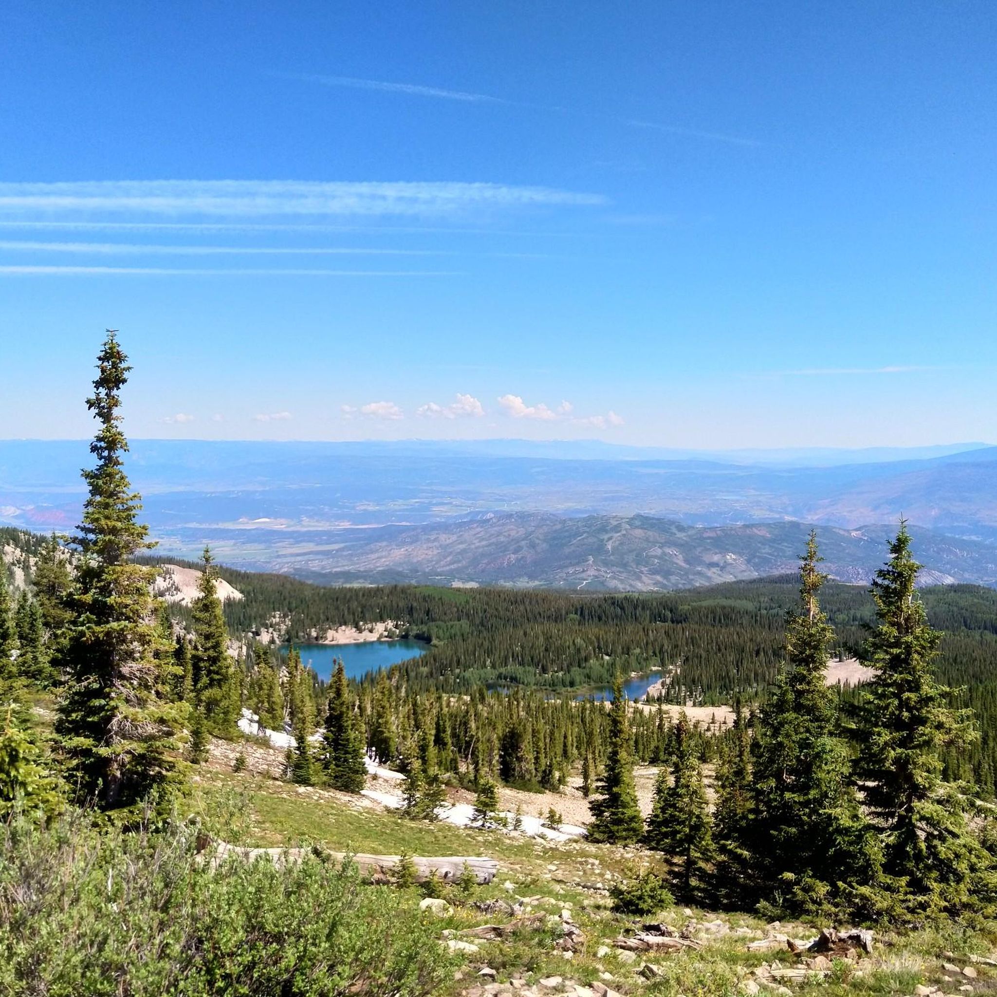
A little off the beaten track but with a beautiful panoramic view and conifers in the foreground.
0
0
Especially beautiful in autumn, of course.
0
0

Located in a beautiful glaciated basin, it's surrounded by towering peaks. It's quite a challenge to get here, but you will likely find more solitude here compared to Crater Lake.
0
0

Located at 11,200 feet, Conundrum Hot Springs is a natural set of hot springs with incredible views of the surrounding Aspen wilderness. There are several pools of varying sizes and the temperature averages 100° F in the larger pools. Conundrum Hot Springs has transitioned to a permit-only system, requiring all overnight users to purchase and carry a permit when staying above Silver Dollar Pond.
0
0

There are a lot of Crater Lakes in the United States. The best known is found in the state of Oregon. This one offers the particularity of drying up, if it is not supplied with water from mountain rivers and glaciers.
0
0
Maroon Lake, near Aspen, is undoubtedly one of the most photographed landscapes of the Rocky Mountains of Colorado. It occupies a basin dug by glaciers during a glaciation, and later closed by a dam naturally formed during landslides and rock falls from the slopes upstream.
2
0
Frequently Asked Questions
When is the best time to hike in the Maroon Bells-Snowmass Wilderness?
The main hiking season runs from July through September when the trails and high-altitude passes are generally free of snow. Midsummer is fantastic for seeing vibrant wildflowers, while visiting in the fall offers the chance to see the aspen groves turn a brilliant gold.
Do I need a reservation or permit to access the area?
Yes, due to the area's popularity, reservations are required to visit the Maroon Bells Scenic Area by personal vehicle or by shuttle bus during the busy summer and fall seasons. For overnight backpacking trips, including to popular spots like Conundrum Hot Springs, you must also obtain a permit in advance.
Are there any family-friendly hikes in the area?
Absolutely. The Scenic Loop Trail is a great option for families. It's a relatively gentle 2-mile (3.2 km) path that circles the iconic Maroon Lake, offering spectacular views of the peaks and a chance to spot a beaver pond.
What are the options for parking and public transport?
Parking at the Maroon Lake Trailhead is extremely limited and requires an advance reservation. The most common way to access the trails is by taking the public shuttle bus from Aspen Highlands. You must purchase shuttle tickets in advance. This system helps manage traffic and preserve the natural environment.
Are dogs allowed on the trails?
Yes, dogs are generally permitted in the Maroon Bells-Snowmass Wilderness, but they must be kept on a leash at all times. This is to protect wildlife and ensure a positive experience for all hikers. Be aware that on the shuttle bus, regulations may vary, so it's best to check with the provider beforehand.
What kind of wildlife might I see?
The wilderness is home to a diverse range of wildlife. It's common to spot mule deer, porcupines, and various bird species. If you're lucky, you might also see bighorn sheep, red fox, or elk. Black bears also inhabit the area, so it's crucial to store food properly and be bear-aware.
I'm looking for a challenging day hike. What do you recommend?
For a strenuous but rewarding day out, consider the American Lake Trail. This 5.8-mile (9.3 km) route involves a significant amount of climbing through aspen and conifer forests to reach a beautiful alpine lake.
Are there any trails that lead to hot springs?
Yes, the Conundrum Creek Trail is a famous backpacking route that leads to natural hot springs. This is a long and challenging hike, typically done as an overnight trip, and requires a specific, hard-to-get permit.
What do other hikers enjoy about the Maroon Bells-Snowmass Wilderness?
The area is highly rated by the komoot community, with an average score of 4.8 stars. Hikers consistently praise the breathtaking scenery, especially the iconic views of the peaks reflecting in the alpine lakes. The well-maintained trails and the sheer scale of the landscape are also frequently mentioned.
How many hiking trails are in the Maroon Bells-Snowmass Wilderness?
There are over 100 miles of trails to explore, with more than 120 distinct routes available on komoot. The network ranges from easy lakeside walks to demanding, multi-day backpacking circuits, offering options for every skill level.
What should I pack for a day hike?
The weather in the Rocky Mountains can change rapidly. Always pack layers of clothing, including a waterproof jacket. Bring plenty of water, high-energy snacks, sun protection (sunscreen, hat, sunglasses), and a map. Sturdy hiking boots are essential as many trails are rocky and uneven.
Is there a long-distance trail connecting to other towns?
Yes, the hike from Crested Butte to Aspen via West Maroon Trail is a classic point-to-point trek. It's a very challenging route that crosses a high mountain pass and is popular with experienced hikers during the summer wildflower season.
Most popular routes in Maroon Bells-Snowmass Wilderness
Most popular attractions in Maroon Bells-Snowmass Wilderness

Get inspired with the komoot mobile app


Explore more
Browse the best Hikes in other regions.
