The best cycling routes in the Flat Tops
5.0
(4)
166
riders
12
rides
Touring cycling in the Flat Tops offers routes through a landscape characterized by high plateau formations, basalt caps, and expansive alpine meadows. The region encompasses a vast wilderness area with diverse terrain, including both paved roads and challenging dirt or gravel sections. Extensive waterways, such as lakes and streams, are common features along many routes, providing varied scenery for cyclists.
Best touring cycling routes in the Flat Tops
- The most popular touring cycling route is Glenwood Canyon Trail, a…
Last updated: May 26, 2026
11
riders
8.79km
00:34
100m
100m
Easy bike ride. Great for any fitness level. Mostly paved surfaces. Suitable for all skill levels.
2
riders
41.7km
02:40
510m
500m
Hard bike ride. Very good fitness required. Mostly paved surfaces. Suitable for all skill levels.

Sign up for free
1
riders
38.6km
02:20
350m
350m
Moderate bike ride. Good fitness required. Mostly paved surfaces. Suitable for all skill levels.
58.2km
03:36
600m
600m
Hard bike ride. Very good fitness required. Mostly paved surfaces. Suitable for all skill levels.
5.0
(4)
46
riders
37.1km
02:12
150m
150m
Moderate bike ride. Good fitness required. Mostly paved surfaces. Suitable for all skill levels.
14
riders
22.6km
01:22
100m
100m
Easy bike ride. Great for any fitness level. Mostly paved surfaces. Suitable for all skill levels.
7
riders
Hard bike ride. Very good fitness required. Mostly paved surfaces. Suitable for all skill levels.
5
riders
Hard bike ride. Very good fitness required. Mostly paved surfaces. Suitable for all skill levels.
7
riders
Easy bike ride. Great for any fitness level. Mostly paved surfaces. Suitable for all skill levels.
4
riders
38.1km
02:30
460m
460m
Hard bike ride. Very good fitness required. Mostly paved surfaces. Suitable for all skill levels.
Get access to more routes and recommendations from other explorers.
Sign up for free
Already have an account?
Our route recommendations are based on thousands of hikes, rides, and runs completed by other people on komoot.
Start today with a free account
Your next adventure awaits.
Login or Signup
Tips from the Community

Good start/stop point is downtown New Castle at the Down Valley Brewery for a post ride beverage.
0
0

From this pedestrian bridge, you can enjoy a view above the Roaring Fork River. Here is the connection between the Rio Grande Trail and the Atkinson Canal Trail. This is an easy walk/bike trail that runs alongside the river. Rio Grande Trail connects Glenwood Springs to Aspen, so you can choose your distance and go for as long as you like.
0
0

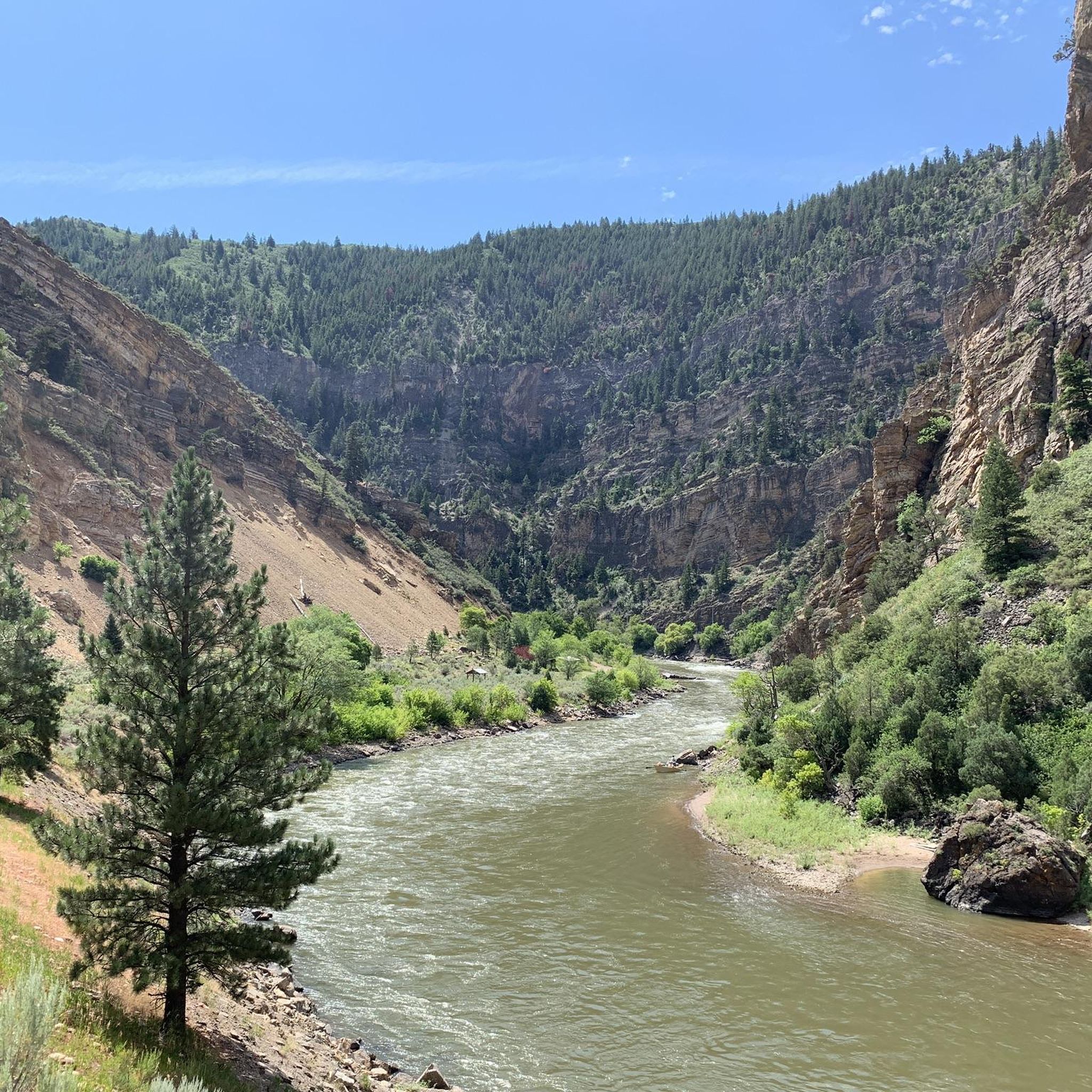
The Roaring Fork River is a fast-flowing and crystal-clear tributary of the Colorado River, extending for 70 miles through stunning canyons and valleys. It begins at Independence Lake in the Sawatch Range and winds its way past the towns of Aspen, Basalt, and Carbondale before it merges with the Colorado River in Glenwood Springs. Known for its fast and exciting currents, the river attracts many thrill-seekers and is a prime spot for whitewater rafting.
0
0
From this pedestrian bridge, you can enjoy a view above the Roaring Fork River. Here is the connection between the Rio Grande Trail and the Atkinson Canal Trail. This is an easy walk/bike trail that runs alongside the river. Rio Grande Trail connects Glenwood Springs to Aspen, so you can choose your distance and walk for as long as you like.
0
0

Grass Valley Reservoir, located in Harvey Gap State Park, is a scenic lake set amid the Rocky Mountains.
0
0

Satank Bridge spans the Roaring Fork River and was constructed in a style to resemble the period of wagon bridges. On the bridge, you have a view up the Elk Scenic Corridor and a backdrop of majestic Mount Sopris. The bridge is also called "pink bridge" due to the pink hue it takes at sunset.
0
0

Rifle is located along the Colorado River and Interstate 70, just east of the Roan Plateau. While it's known for cattle ranching, there are however a wide variety of outdoor activities in the Rifle area.
1
0

Downtown Glenwood Springs, Colorado, is a vibrant hub that boasts a mix of local shops, restaurants, and historic architecture. It is a great place to explore after a ride, hike, or run in the scenic Glenwood Canyon, or a soak in the famous hot springs.
1
0
Frequently Asked Questions
How many touring cycling routes are available in the Flat Tops region?
The Flat Tops region offers a diverse selection of touring cycling routes. There are currently 12 routes documented on komoot, catering to various skill levels. This includes 3 easy routes, 3 moderate routes, and 6 difficult routes, ensuring options for every cyclist.
What kind of terrain can I expect on touring cycling routes in the Flat Tops?
Touring cycling in the Flat Tops features a mix of terrain, from paved roads to challenging dirt and gravel sections. The region is known for its distinctive high plateau formations, expansive alpine meadows, and basalt caps. You'll encounter routes through scattered aspen stands, evergreen forests, and along extensive waterways, offering varied scenery and surfaces.
Are there any easy or family-friendly touring cycling routes in the Flat Tops?
Yes, the Flat Tops region offers several easy routes suitable for beginners or families. One popular option is the Glenwood Canyon Trail, an easy 5.5-mile path that provides stunning views of the canyon. Another easy route is the Glenwood Springs – View of Roaring Fork River loop from Glenwood Springs, which is about 4.2 miles long.
What are some notable natural attractions or landmarks I can see along touring cycling routes?
The Flat Tops region is rich in natural beauty. Along various routes, you might encounter impressive geological features like the Devils Causeway, a dramatic rock formation. The area is also home to beautiful lakes such as Trappers Lake, often called the 'Cradle of Wilderness,' and Rifle Gap Reservoir. Many routes also offer views of the Colorado River, especially along the Glenwood Canyon Trail.
Are there any circular touring cycling routes in the Flat Tops?
Yes, several touring cycling routes in the Flat Tops are designed as loops, allowing you to start and end in the same location. Examples include the challenging New Castle/Harvey Gap loop, the moderate Dry Gulch Road loop, and the longer Rifle loop. These offer varied distances and difficulties for a full circular experience.
What is the best time of year for touring cycling in the Flat Tops?
The best time for touring cycling in the Flat Tops is generally during the warmer months, from late spring through early autumn. This period offers more accessible routes, especially those at higher elevations in the alpine meadows, and avoids the challenges of snow and ice. Summer provides the most favorable conditions for exploring the region's diverse landscapes.
Can I bring my dog on touring cycling routes in the Flat Tops?
While specific regulations can vary by trail and wilderness area, many parts of the Flat Tops Wilderness and surrounding National Forests are dog-friendly, often requiring dogs to be on a leash. It's always best to check the specific rules for each route or area you plan to visit, especially within designated wilderness areas, to ensure compliance and safety for your pet and local wildlife.
Are there opportunities for long-distance touring cycling in the Flat Tops?
Yes, the Flat Tops region is known for its long-distance cycling opportunities. The multi-day 'Tour of the Flat Tops' is a prime example, spanning 172 miles with significant elevation changes, primarily on forest roads. For a challenging day ride, the Rifle loop covers over 36 miles with substantial climbing, offering a taste of the region's expansive routes.
What do other touring cyclists enjoy most about touring cycling in the Flat Tops?
The Flat Tops region is highly rated by the komoot community, with an average score of 5.0 stars. Cyclists often praise the unique landscapes, including the high plateau formations and sweeping alpine meadows, as well as the sense of solitude and opportunities for wildlife viewing. The varied terrain and extensive waterways also contribute to a memorable touring experience.
Where can I find parking for touring cycling routes in the Flat Tops?
Parking availability varies by route and access point. Many trailheads and access points to the Flat Tops Scenic Byway (such as from Yampa or Meeker) or Buford Road (from Rifle) offer designated parking areas. For specific routes, checking the komoot tour details or local forest service information for the trailhead you plan to use will provide the most accurate parking information.
Are there any routes with significant elevation gain for a challenging ride?
Absolutely. The Flat Tops offer numerous challenging routes with significant elevation gain. For instance, the New Castle/Harvey Gap loop is a difficult 25.9-mile path with over 1,600 feet of climbing. Another demanding option is the Glenwood Springs – Glenwood Springs Scout Trail loop, a 19-mile route with over 2,600 feet of ascent, providing a strenuous workout and rewarding views.
Can I combine touring cycling with exploring nearby towns or amenities?
Yes, the Flat Tops region is accessible from several towns that offer amenities. Towns like Meeker and Yampa serve as gateways to the Flat Tops and can provide services such as bike rentals, lodging, and dining options. Routes like the New Castle – Grass Valley Reservoir loop from New Castle start directly from a town, allowing for easy access to local facilities before or after your ride.
Most popular routes in the Flat Tops
Most popular attractions in the Flat Tops

Get inspired with the komoot mobile app


Explore more
Browse the best Cycling routes in other regions.
