The best MTB trails in the Flat Tops
4.5
(2)
277
riders
14
rides
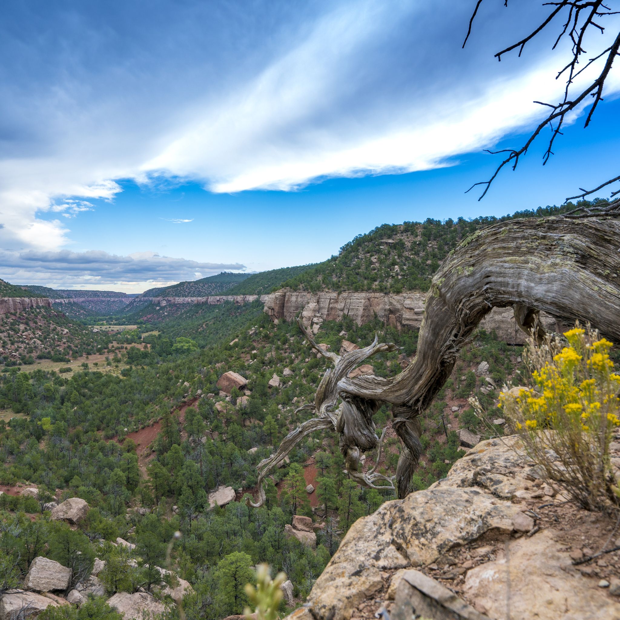
Mountain biking in the Flat Tops offers diverse terrain across a unique high plateau landscape in Colorado. This region features elevations ranging from 7,600 to nearly 13,000 feet, encompassing treeless plateaus, subalpine meadows, and alpine tundra. The area is also characterized by deep canyons carved by rivers and a mosaic of evergreen and aspen forests. Mountain bikers can explore a variety of paths, from smooth dirt roads to rugged forest roads.
Best mountain bike trails in the Flat Tops
- The…
Last updated: May 12, 2026
1.31km
00:06
10m
0m
This easy 0.8-mile mountain biking route in Rifle Gap State Park offers scenic views of the reservoir and surrounding mountains.
46
riders
13.5km
01:40
570m
570m
Challenge yourself on the Grandstaff and Wulfsohn Trail Loop, a difficult 8.4-mile mountain biking route with massive views near Glenwood Sp

Sign up for free
10
riders
29.0km
02:51
820m
820m
Tackle the Forest Hollow and Boy Scout Loop, a 18.0-mile mountain biking route with stunning views and a thrilling downhill section.
5.30km
00:40
220m
220m
Challenge yourself on the 3.3-mile Colorow Trail mountain biking route, featuring steep climbs and panoramic views near New Castle, Colorado
45
riders
18.6km
02:07
650m
650m
Hard mountain bike ride. Good fitness required. Advanced riding skills necessary. Some portions of the route may require you to push your bike.
15
riders
43.0km
04:21
1,210m
1,210m
Hard mountain bike ride. Very good fitness required. Suitable for all skill levels.
13
riders
12.2km
01:23
390m
390m
Moderate mountain bike ride. Good fitness required. Advanced riding skills necessary.
13
riders
10.8km
01:07
260m
260m
Moderate mountain bike ride. Great for any fitness level. Advanced riding skills necessary.
7
riders
10.6km
01:05
340m
340m
Moderate mountain bike ride. Good fitness required. Advanced riding skills necessary.
6
riders
7.42km
00:46
180m
180m
Moderate mountain bike ride. Great for any fitness level. Advanced riding skills necessary.
Get access to more routes and recommendations from other explorers.
Sign up for free
Already have an account?
Our route recommendations are based on thousands of hikes, rides, and runs completed by other people on komoot.
Start today with a free account
Your next adventure awaits.
Login or Signup
Tips from the Community

Nice to walk along the river, but nothing special.
1
0

From this pedestrian bridge, you can enjoy a view above the Roaring Fork River. Here is the connection between the Rio Grande Trail and the Atkinson Canal Trail. This is an easy walk/bike trail that runs alongside the river. Rio Grande Trail connects Glenwood Springs to Aspen, so you can choose your distance and go for as long as you like.
0
0
From this pedestrian bridge, you can enjoy a view above the Roaring Fork River. Here is the connection between the Rio Grande Trail and the Atkinson Canal Trail. This is an easy walk/bike trail that runs alongside the river. Rio Grande Trail connects Glenwood Springs to Aspen, so you can choose your distance and walk for as long as you like.
0
0

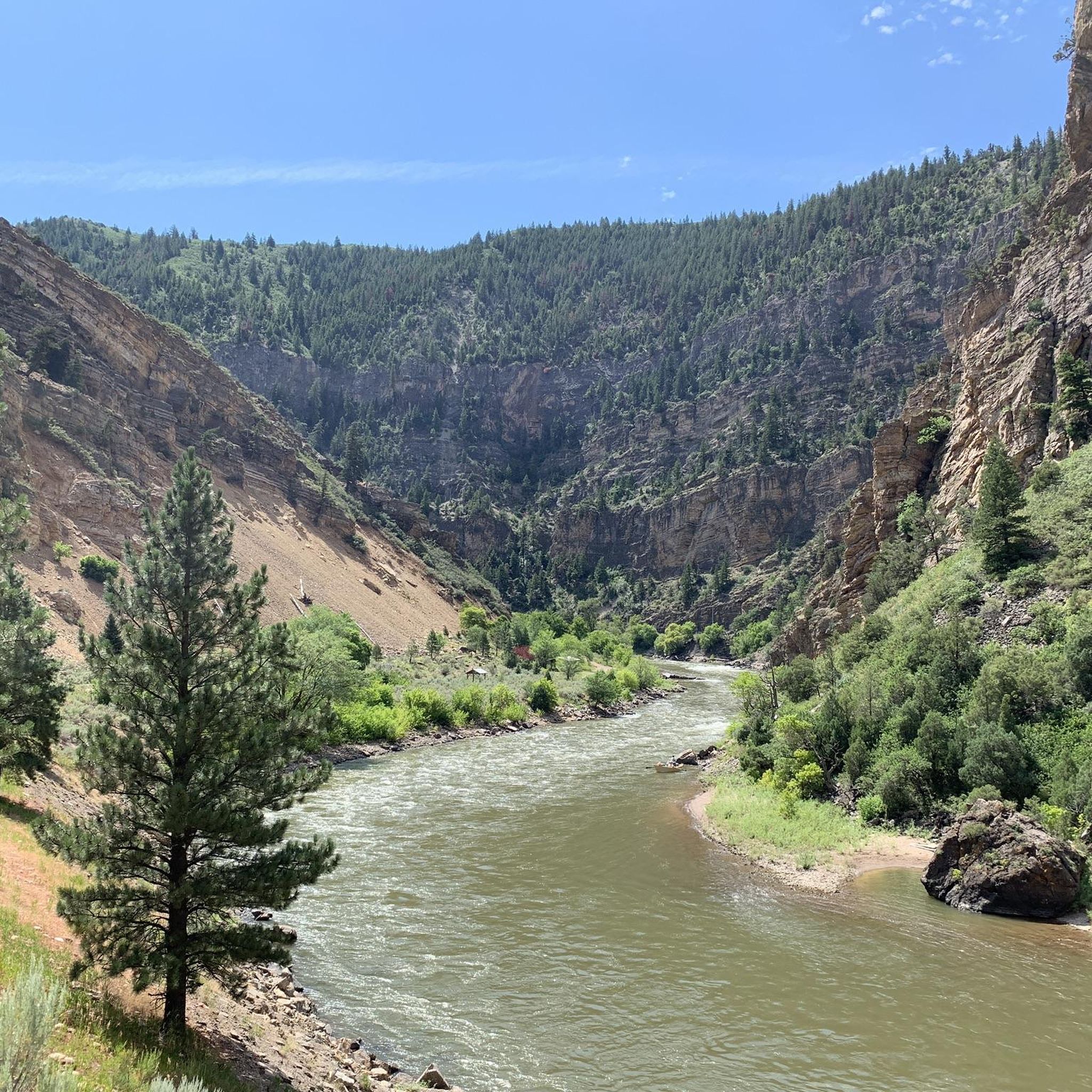
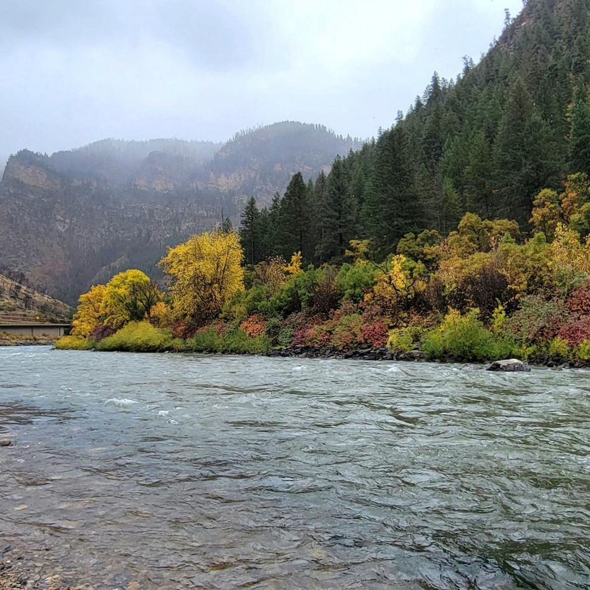
This is a great place to park to access the bike path along the Colorado River through Glenwood Canyon. There are restrooms, river access, and shaded green space at the park.
1
0
The trail is nontechnical, wide, and made of crushed stone. It winds through the red dirt and partial stone of the preserve with some nice sloping descents.
0
0

Downtown Glenwood Springs, Colorado, is a vibrant hub that boasts a mix of local shops, restaurants, and historic architecture. It is a great place to explore after a ride, hike, or run in the scenic Glenwood Canyon, or a soak in the famous hot springs.
1
0
The trailhead has little to no parking, but you can always park back in town or at Sayre park and jog over. From here you have access to the Boy Scout Trail and Lookout Mountain Trail, both of which offer splendid views out over the Colorado River and Glenwood Springs.
0
0
There is a large parking lot at the trailhead. You can access the trail from the north or the south side of the lot; both are connected via a singletrack through the meadow.
0
0
Frequently Asked Questions
How many mountain bike trails are available in the Flat Tops region?
The Flat Tops region offers a variety of mountain biking experiences with over 10 distinct trails. These routes cater to different skill levels, from easy scenic rides to more demanding multi-day challenges across the unique high plateau landscape.
What is the best time of year to go mountain biking in the Flat Tops?
Mountain biking in the Flat Tops is generally best from late June until October. This period avoids the heavy snowpack of winter and spring, allowing access to the higher elevations and diverse terrain, including subalpine meadows and alpine tundra.
Are there mountain bike trails suitable for beginners in the Flat Tops?
Yes, there are options for beginners. For an easy ride, consider the Rifle Gap Reservoir Road. This short, 0.8-mile trail offers pleasant views near Rifle Gap State Park and is a great introduction to the area's scenery.
What options are there for experienced mountain bikers seeking a challenge?
Experienced mountain bikers will find several challenging routes. The Grandstaff and Wulfsohn Trail Loop is a difficult 8.4-mile path featuring significant elevation changes and varied terrain. The region also offers multi-day bikepacking routes like the 'Tour of the Flat Tops' for those seeking extensive climbs and rough forest roads.
Can I find mountain bike loop trails in the Flat Tops?
Yes, loop trails are available for mountain bikers. A popular option is the Forest Hollow and Boy Scout Loop, an 18.0-mile trail that takes you through forests and meadows, offering a comprehensive riding experience.
Are there family-friendly mountain biking options in the Flat Tops?
For families, the Flat Tops offer easier, less technical routes, particularly around areas like Rifle Gap State Park. The Rifle Gap Reservoir Road is a short and easy trail that could be suitable for families looking for a gentle ride with scenic views.
What kind of terrain can I expect on mountain bike trails in the Flat Tops?
The Flat Tops region features diverse terrain, from smooth dirt roads to rough forest roads and technical sections. You'll encounter a unique high plateau landscape with elevations ranging from 7,600 to nearly 13,000 feet, encompassing treeless plateaus, subalpine meadows, alpine tundra, and deep canyons carved by rivers.
Are there any scenic viewpoints or natural landmarks to see while mountain biking?
The Flat Tops are rich in natural beauty. You can expect outstanding scenery including aspen and evergreen forests, alpine meadows, and small lakes. Notable geological features in the broader region include the dramatic Devil's Causeway and the impressive Chinese Wall, formed by glacial activity.
What wildlife might I encounter on the trails?
The Flat Tops are home to abundant wildlife. Mountain bikers often have opportunities for wildlife viewing, as the area hosts Colorado's largest elk herd, bighorn sheep, moose, mule deer, and black bear. Keep an eye out, especially in the early mornings or late evenings.
Are there any waterfalls or water features accessible from mountain bike routes?
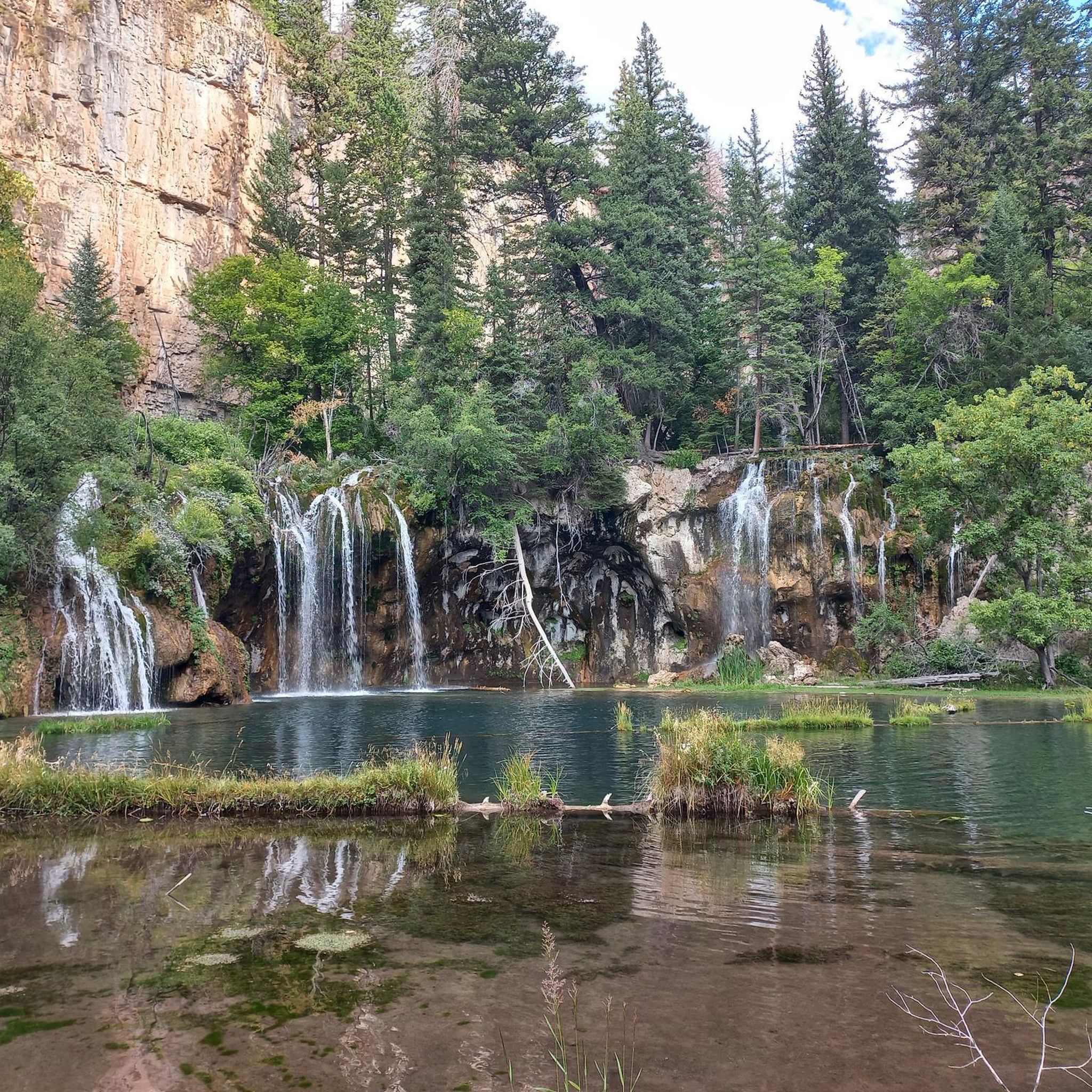
Yes, the region features several beautiful water features. You can find Rifle Falls and Spouting Rock Waterfall, both offering picturesque stops. The area is also characterized by rivers and creeks like the White River and Rifle Creek, which carve impressive canyon systems.
What do other mountain bikers enjoy most about the Flat Tops?
The Flat Tops are highly rated by the komoot community, with an average score of 4.5 stars. Reviewers often praise the unique high plateau landscape, the diverse terrain offering challenges for all levels, and the opportunities for stunning scenery and wildlife encounters in this remote wilderness.
Where are some common trailheads or parking areas for mountain biking in the Flat Tops?
Common access points include areas near Rifle Gap State Park for easier trails. For more rugged routes, roads like Blair Mountain Road and Coffee Pot Road provide entry into the Flat Tops, though specific parking details can vary by trail. Always check local regulations before heading out.
Most popular routes in the Flat Tops
Most popular attractions in the Flat Tops

Get inspired with the komoot mobile app


Explore more
Browse the best MTB trails in other regions.
