The best walks and hikes around Schalkenmehrener Maar
4.5
(18420)
61,779
hikers
840
hikes
Hiking trails around Schalkenmehrener Maar traverse a unique volcanic landscape in the Eifel region of Germany. The area is characterized by the Maar itself, a water-filled volcanic crater, and an adjacent dry maar that has developed into a raised bog. Surrounding the maars are gentle, often forested hills, showcasing the region's geological past. This diverse terrain offers a blend of clear waters, volcanic features, and varied vegetation, providing a range of hiking experiences.
Best hiking trails around Schalkenmehrener Maar
- The…
Last updated: October 28, 2026
4.7
(924)
3,124
hikers
11.4km
03:18
280m
280m
Moderate hike. Good fitness required. Easily walkable paths.
4.4
(35)
160
hikers
26.2km
07:20
510m
510m
Hard hike. Very good fitness required. Easily walkable paths.

4.7
(187)
932
hikers
5.72km
01:31
60m
60m
Easy hike. Easily walkable paths.
4.8
(48)
164
hikers
11.9km
03:12
150m
150m
Moderate hike. Good fitness required. Easily walkable paths.
4.7
(50)
150
hikers
Moderate hike. Good fitness required. Easily walkable paths.
Get access to more routes and recommendations from other explorers.
Already have an account?
Our route recommendations are based on thousands of hikes, rides, and runs completed by other people on komoot.
Start today with a free account
Your next adventure awaits.
Tips from the Community

This wayside cross made of red sandstone is heavily weathered. The Baroque cross features an altar top as well as roof-like ornaments on the front and both sides of the shaft base. The original inscription "Anno 1713 -Johannes Hermes" is recorded, but is no longer legible. Above it, one can recognize a Pietà carved out of the sandstone. Source: https://kulturdb.de/einobjekt.php?id=18439
3
0
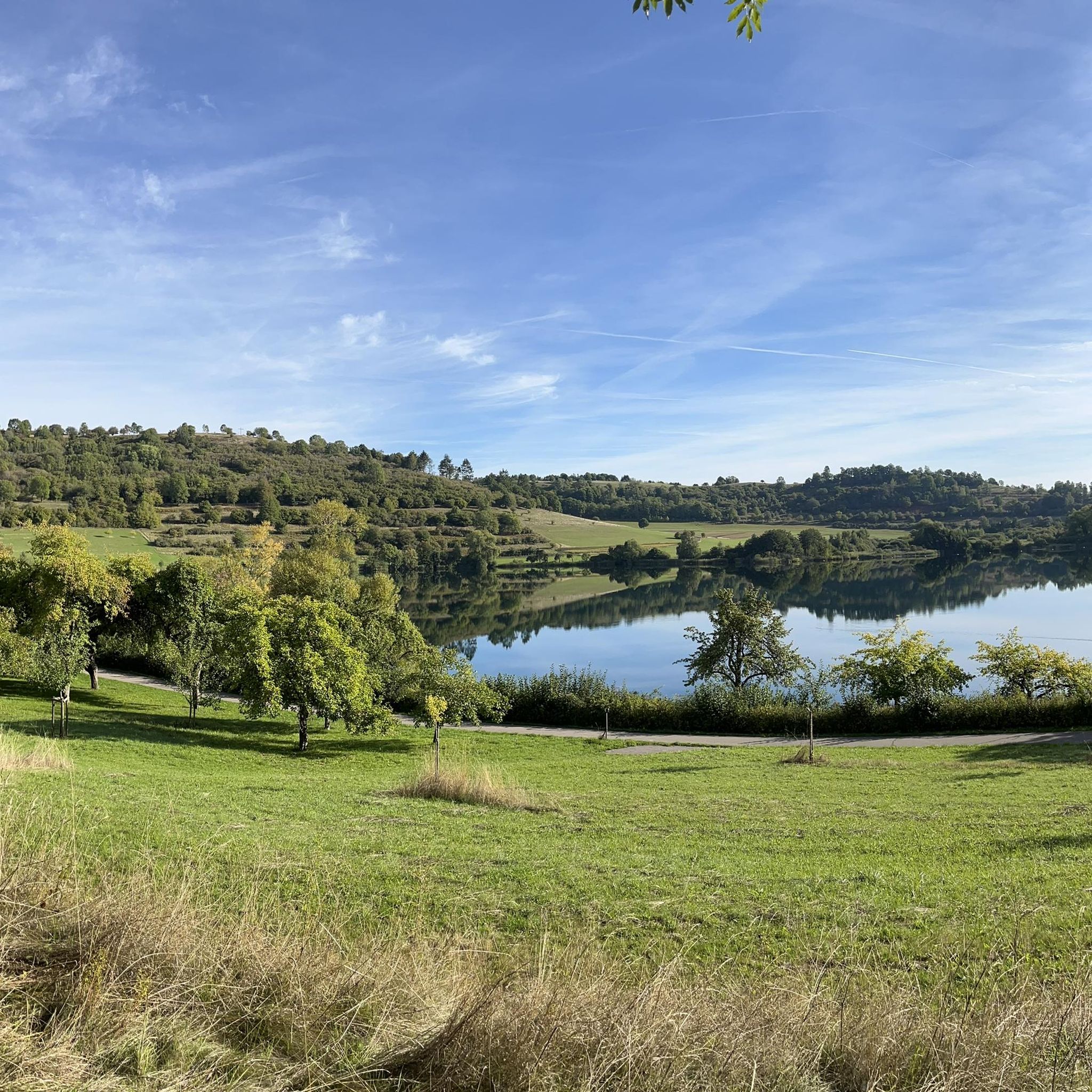
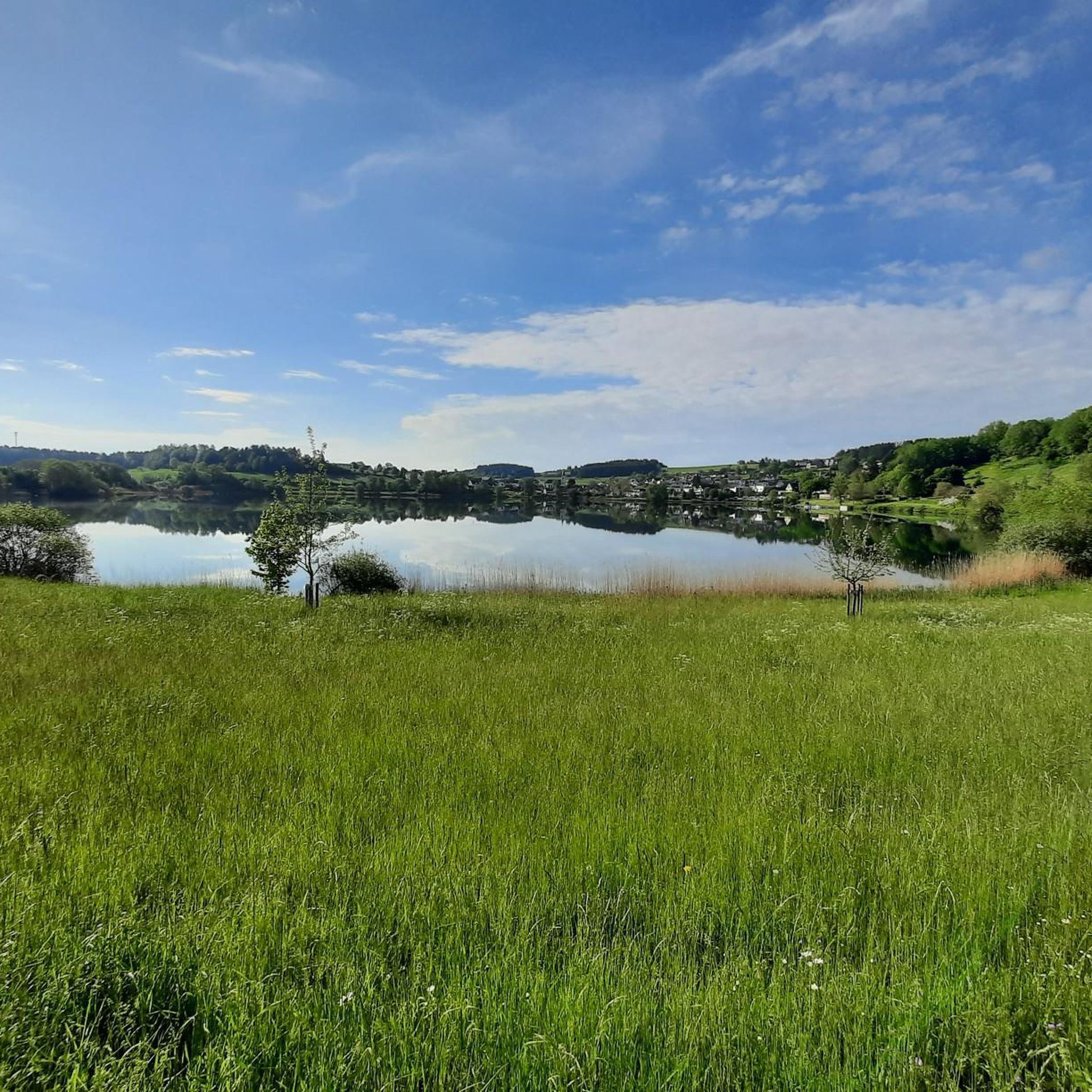
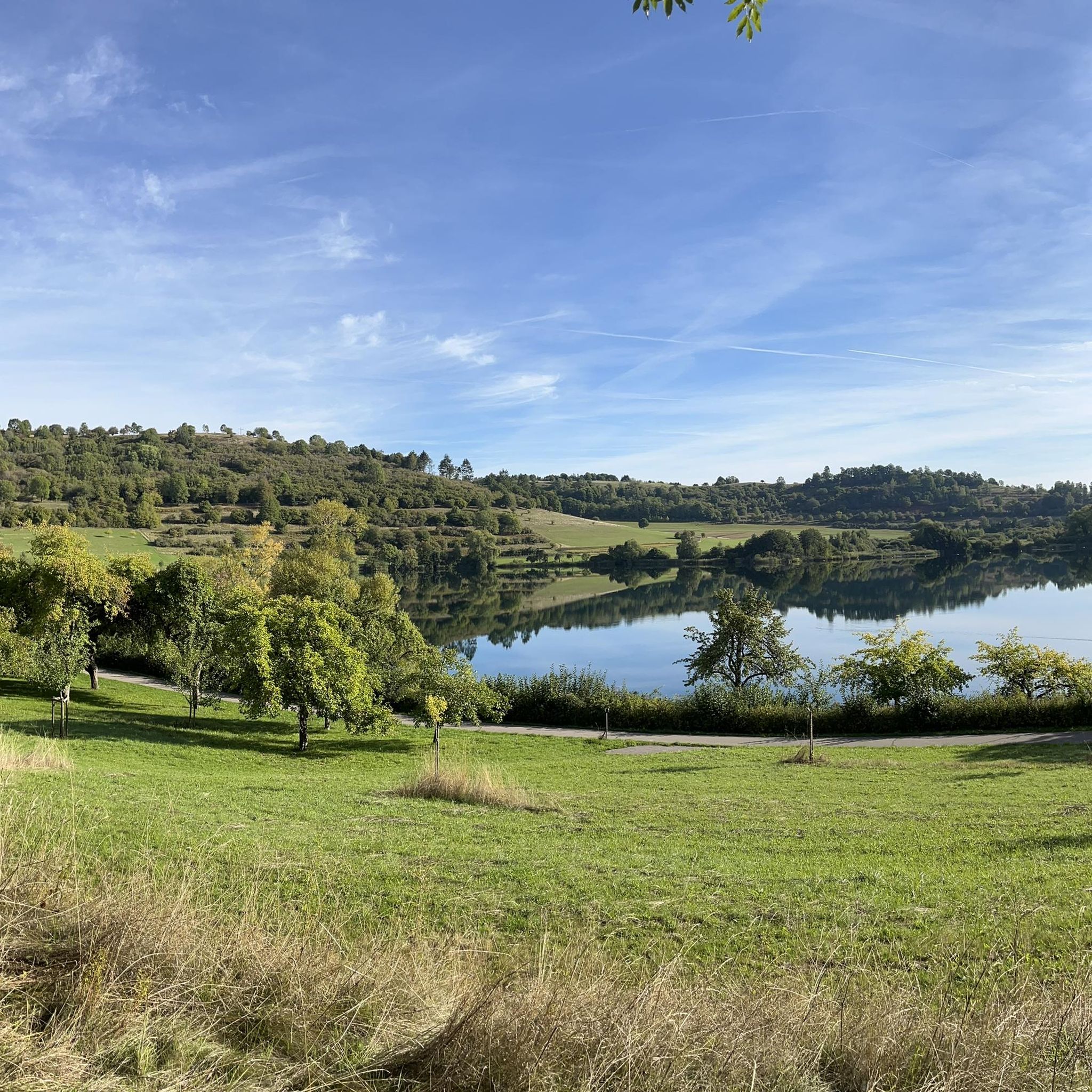
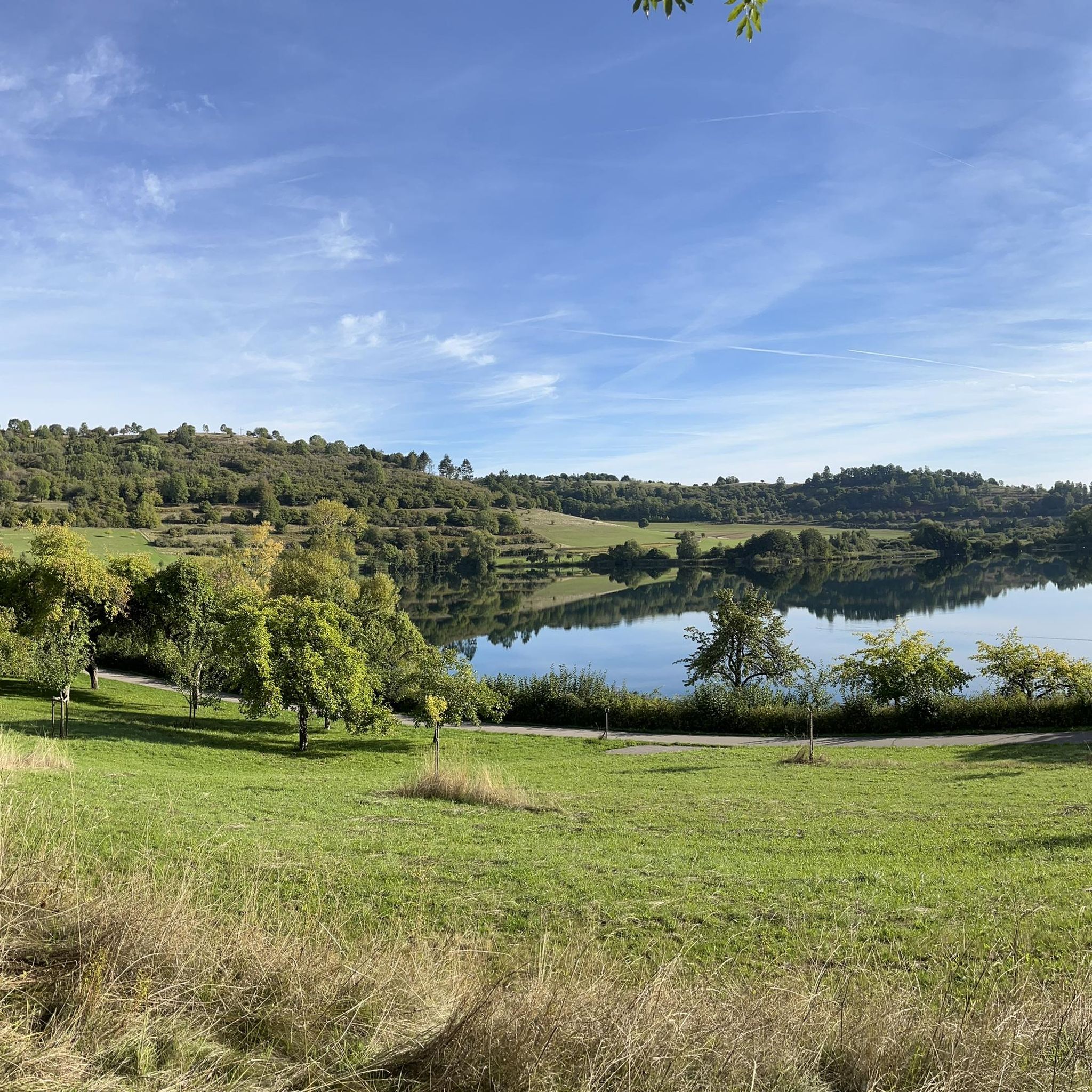
Very beautiful panoramic view of the Schalkenmehrener Maar and Schalkenmehren itself.
3
0
A historic Baroque cross from the year 1713
1
0
Created through historical slash-and-burn agriculture and centuries of grazing by sheep and goats from the Middle Ages into the 20th century.
2
0


„Birds are singing, flowers are blooming, green is again the forest and the field. Oh, let us go and wander from one place to another through the wide, green world!“ (Hoffmann von Fallersleben)
5
0

very nice view of Schalkenmehren and its Maar
0
0

A well-maintained cycle path runs around the maar, and beautiful views are guaranteed.
0
0
Frequently Asked Questions
How many hiking trails are available around Schalkenmehrener Maar?
There are over 800 hiking routes around Schalkenmehrener Maar, catering to various skill levels. You'll find a wide selection, including over 400 easy trails, more than 350 moderate options, and around 70 challenging routes for experienced hikers.
Are there any easy, family-friendly walks around Schalkenmehrener Maar?
Yes, the area offers several easy, family-friendly options. A manageable, asphalted circular route of about 3 km encircles the maar, making it accessible for families with children and individuals with limited mobility. For a slightly longer easy option, consider the View of Schalkenmehren – Weinfelder Maar viewpoint loop from Schalkenmehren, which is about 6.7 km long.
Can I bring my dog on the hiking trails around Schalkenmehrener Maar?
Most trails around Schalkenmehrener Maar are dog-friendly, allowing you to enjoy the volcanic landscape with your canine companion. It's always recommended to keep dogs on a leash, especially around wildlife habitats and other hikers. Please ensure you clean up after your pet.
Are there circular hiking routes available?
Yes, many routes around Schalkenmehrener Maar are circular, offering convenient starting and ending points. A popular moderate circular trail is the Schalkenmehrener Maar – Gemündener Maar loop from Schalkenmehren, which connects two significant maars over 8.1 km.
What kind of terrain can I expect on the hikes?
The terrain around Schalkenmehrener Maar is diverse, reflecting its volcanic origins. You'll encounter gentle, often forested hills, clear waters, and unique bog landscapes. Paths range from asphalted circular routes directly around the maar to more rugged trails through volcanic terrain and woodlands. The area is known for its distinct geological features, including the 'double maar' itself.
What are some notable landmarks or viewpoints along the trails?
Hikers can enjoy several interesting landmarks and viewpoints. The Konrad Scholzen Chainsaw Wood Sculptures are located directly on the shore, adding an artistic touch. For panoramic views, the Dronketurm on the Mäuseberg offers expansive vistas over Schalkenmehrener Maar, Gemündener Maar, and the wider Volcanic Eifel landscape. You can reach it via the Schalkenmehrener Maar – Dronke Tower on the Mäuseberg loop from Schalkenmehren.
Where can I find parking for hiking around Schalkenmehrener Maar?
Parking is generally available in and around the village of Schalkenmehren, which serves as a common starting point for many trails. Specific parking areas are often signposted near popular trailheads and attractions. It's advisable to check local signage for any parking fees or restrictions.
Are there cafes or restaurants near the hiking trails?
Yes, the village of Schalkenmehren, located directly by the maar, offers amenities such as cafes and restaurants. You can find places like Café Maarblick, perfect for a break before or after your hike. The Village Shop Maaritimes also provides local provisions.
What is the best time of year to hike in Schalkenmehrener Maar?
The Schalkenmehrener Maar region is beautiful year-round, but spring and autumn are particularly popular. In spring, the diverse flora, including yellow iris and various clover species, comes alive. Autumn offers stunning colors in the forested areas. Summer is ideal for combining hiking with swimming in the maar's natural outdoor pool, while winter can provide serene, snow-dusted landscapes.
What do other hikers enjoy most about hiking in Schalkenmehrener Maar?
The area is highly rated by the komoot community, with an average score of 4.6 stars from over 15,000 reviews. Reviewers often praise the unique volcanic landscapes, the serene beauty of the maar, and the well-maintained paths that offer a blend of easy strolls and more challenging treks. The diverse scenery, from the water-filled crater to the raised bog and forested hills, is frequently highlighted.
Are there any longer or more challenging trails for experienced hikers?
For experienced hikers seeking a challenge, the Volcano Trail is a notable option. This difficult route spans 26.2 km and leads through diverse volcanic terrain, typically taking over 7 hours to complete. It offers significant elevation changes and a deeper immersion into the region's geological features.
Most popular routes around Schalkenmehrener Maar
Most popular attractions around Schalkenmehrener Maar

Get inspired with the komoot mobile app


Explore more
Browse the best Hikes in other regions.
