The best walks and hikes around Area F (Trout Creek Valley)
4.6
(56)
501
hikers
15
hikes
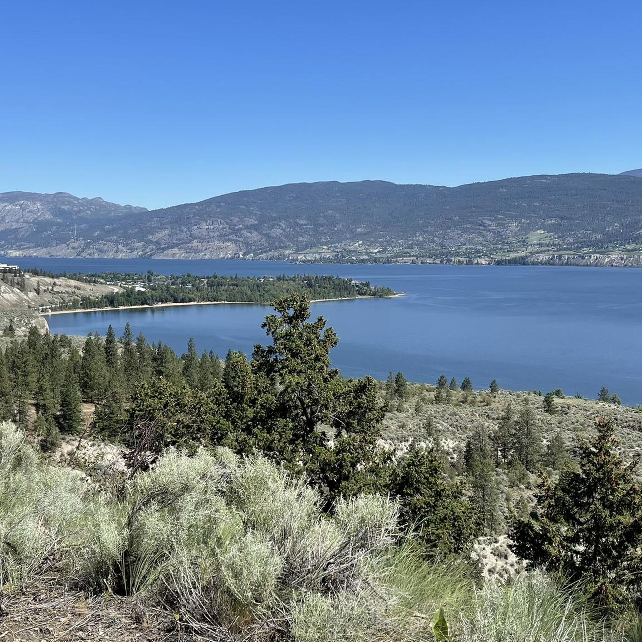
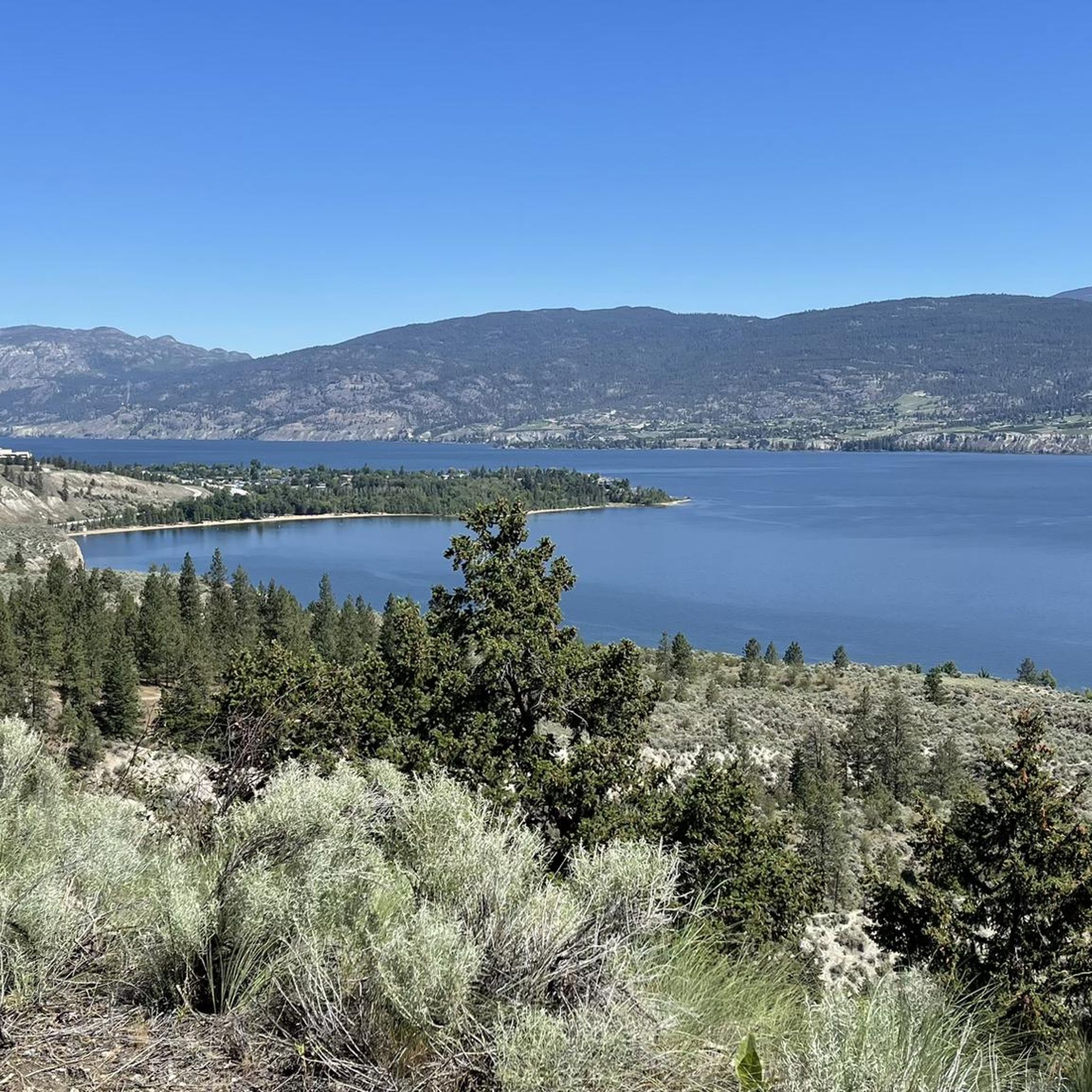
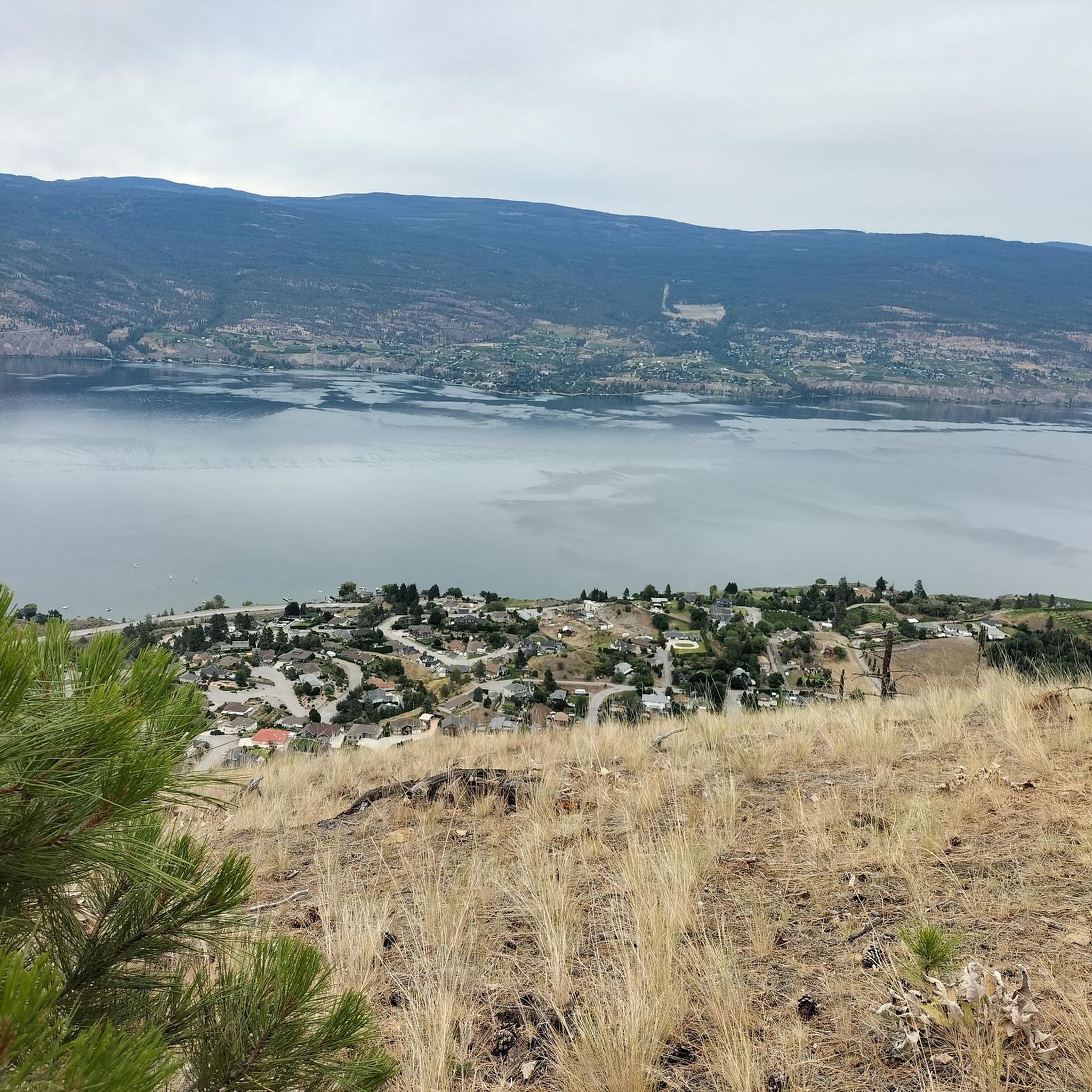
Hiking around Area F (Trout Creek Valley) offers trails through diverse landscapes, primarily characterized by the Okanagan Valley's unique blend of semi-arid terrain and lakeside environments. The region features prominent hills like Giant's Head, providing elevated viewpoints over the valley and Okanagan Lake. Trails often traverse areas with varied vegetation, from open parklands to more forested sections.
Best hiking trails around Area F (Trout Creek Valley)
- The most popular hiking route is Giant's Head Loop — Giant's Head Mountain Park, a 2.7 miles (4.4 km) trail that takes 1 hour 32 minutes to complete. This easy loop offers panoramic views from the summit of Giant's Head Mountain.
- Another top favourite among local hikers is Sun-Oka Beach and Trout Creek loop — Sun-Oka Beach Provincial Park, an easy 3.2 miles (5.2 km) path. This route follows the shoreline and the banks of Trout Creek, offering a flat and accessible experience.
- Local hikers also love the Mount Nkwala loop from Madeline Lake, a 4.6 miles (7.5 km) trail leading through varied terrain with significant elevation gain, often completed in about 2 hours 40 minutes.
- Hiking around Area F (Trout Creek Valley) is defined by lakeside paths, hill climbs, and parkland trails, offering options for different ability levels.
- The routes in Area F (Trout Creek Valley) are highly rated by the komoot community with an average score of 4.6 stars from over 30 reviews. More than 300 hikers have used komoot to explore Area F (Trout Creek Valley)'s varied terrain.
Last updated: July 24, 2026
5.0
(6)
31
hikers
4.35km
01:32
250m
250m
Easy hike. Great for any fitness level. Easily-accessible paths. Suitable for all skill levels.
4.0
(1)
3
hikers
Easy hike. Great for any fitness level. Easily-accessible paths. Suitable for all skill levels.

Sign up for free
4.8
(4)
54
hikers
6.29km
02:02
280m
280m
Moderate hike. Good fitness required. Easily-accessible paths. Suitable for all skill levels.
5.0
(2)
27
hikers
4.89km
01:50
330m
330m
Moderate hike. Good fitness required. Easily-accessible paths. Suitable for all skill levels.
4.3
(3)
9
hikers
7.45km
02:40
430m
430m
Moderate hike. Good fitness required. Easily-accessible paths. Suitable for all skill levels.
Get access to more routes and recommendations from other explorers.
Sign up for free
Already have an account?
Our route recommendations are based on thousands of hikes, rides, and runs completed by other people on komoot.
Start today with a free account
Your next adventure awaits.
Login or Signup
Popular around Area F (Trout Creek Valley)

Other adventures around Area F (Trout Creek Valley)

Tips from the Community

Sun-Oka Beach Provincial Park is a 30-hectare park situated on the shores of Okanagan Lake. It features a large, south-facing beach that is perfect for swimming. The park also offers amenities such as a playground, fire pits, picnic tables, water fountains, and watersport rentals.
0
0
Trout Creek is a small yet vital river located just south of Summerland, serving as the primary water source for the district. Further upstream, the creek becomes a popular destination for whitewater kayaking in the dramatic Trout Creek Canyon.
0
0

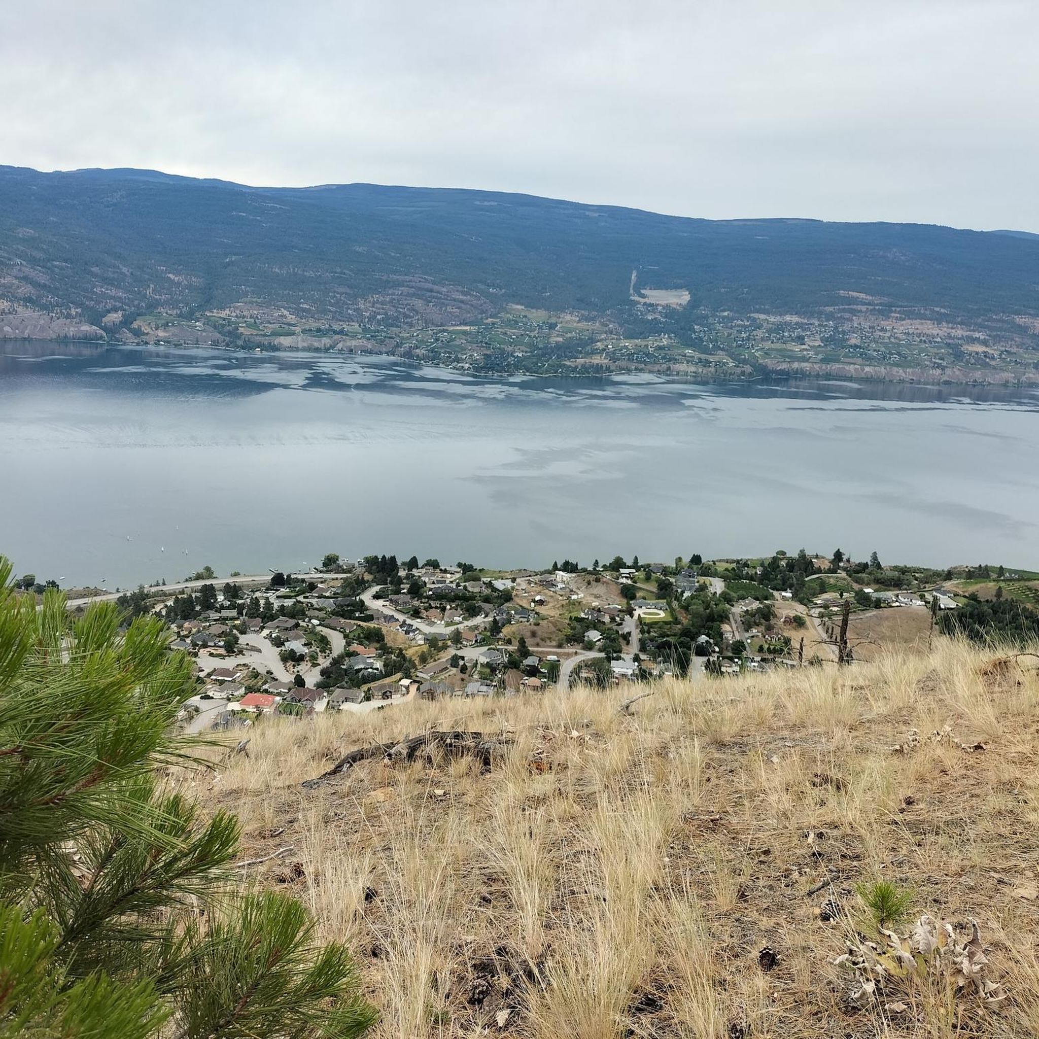
True to its name, the Grind Trail is the steepest route to the summit of Giant’s Head Mountain. It climbs quickly through exposed hillside terrain, offering a solid workout and impressive lake views as you gain elevation. The trail is well maintained but demanding — bring water, take breaks at the benches, and be prepared for a steady climb from start to finish.
0
0
A compact park with some of the best views in the South Okanagan, Giant’s Head Mountain Park features a mix of paved and dirt trails leading to a panoramic summit lookout. The route is short but steep, so bring water and sturdy shoes, especially in summer when the sun can be intense. Parking is available near the upper gate, and benches along the trail offer good rest stops for taking in the lake and valley scenery.
0
0
The summit of Giant’s Head Mountain offers sweeping panoramas across the Okanagan Valley — look out over the shimmering waters of Okanagan Lake, the vineyards of the Naramata Bench, and the hills surrounding Penticton. From here, you’re perched above the valley’s patchwork of orchards, vineyards and lakefront homes, making the viewpoint a standout for both sunrise and sunset. It’s accessible enough for many hikers yet delivers those “high vantage” views that feel more remote.
0
0

Great view! Anyone who wants to see the Okanagan Valley from above should have been at Giants Head in Summerland. You can drive up and then walk about 20min to the summit and have a fantastic view. We recommend.
0
0
Frequently Asked Questions
How many hiking trails are available in Area F (Trout Creek Valley)?
There are 16 hiking routes in Area F (Trout Creek Valley). These trails range in difficulty, offering options for various skill levels.
What kind of landscapes can I expect to see while hiking in Area F (Trout Creek Valley)?
Hiking in Area F (Trout Creek Valley) primarily features the unique blend of semi-arid terrain and lakeside environments characteristic of the Okanagan Valley. You'll find trails traversing prominent hills like Giant's Head, offering elevated viewpoints, as well as paths through varied vegetation, from open parklands to more forested sections. Many routes also feature beautiful lakeside paths.
Are there any easy hikes suitable for beginners or families in Area F (Trout Creek Valley)?
Yes, Area F (Trout Creek Valley) offers 5 easy hiking routes. A great option is the Sun-Oka Beach and Trout Creek loop, an easy 5.2 km path that follows the shoreline and the banks of Trout Creek, providing a flat and accessible experience.
What are some notable landmarks or attractions to see near the hiking trails?
Hikers can explore several interesting landmarks. The Giants Head Summit offers panoramic views. You can also find highlights like Okanagan Lake, Lakeside Beach on Okanagan Lake, and sections of the historic Kettle Valley Railway, including the Adra Tunnel.
Are there any circular hiking routes in Area F (Trout Creek Valley)?
Yes, there are several circular routes. For example, the Giant's Head Loop is an easy 4.4 km trail offering panoramic views from the summit. Another option is the Mount Nkwala loop from Madeline Lake, a moderate 7.5 km trail through varied terrain.
What do other hikers say about the trails in Area F (Trout Creek Valley)?
The trails in Area F (Trout Creek Valley) are highly rated by the komoot community, with an average score of 4.6 stars from over 30 reviews. Hikers often praise the diverse terrain, the beautiful lakeside paths, and the rewarding views from elevated points like Giant's Head.
Are there any challenging hikes for experienced hikers?
Yes, for experienced hikers seeking a challenge, there is 1 difficult route available in Area F (Trout Creek Valley). Additionally, there are 10 moderate routes, such as the Mount Nkwala loop from Madeline Lake, which involves significant elevation gain.
Can I find trails that offer views of Okanagan Lake?
Absolutely. Many trails in Area F (Trout Creek Valley) provide stunning views of Okanagan Lake. Hikes around prominent hills like Giant's Head offer elevated perspectives, and routes near the shoreline, such as the Sun-Oka Beach and Trout Creek loop, follow the lake's edge.
What is the typical duration for hikes in this area?
Hike durations vary depending on the trail and your pace. Easy loops like the Giant's Head Loop can be completed in about 1 hour 30 minutes, while moderate trails such as the Mount Nkwala loop from Madeline Lake might take around 2 hours 40 minutes.
Are there any trails that follow a river or creek?
Yes, the Sun-Oka Beach and Trout Creek loop is an excellent option. This easy path follows the banks of Trout Creek, offering a pleasant experience alongside the water.
What are the elevation changes like on the trails in Area F (Trout Creek Valley)?
Elevation changes vary significantly. Easy trails like the Sun-Oka Beach and Trout Creek loop have minimal elevation gain (around 36m). More challenging routes, such as the Mount Nkwala loop from Madeline Lake, can feature substantial climbs, with over 430m of ascent.
Most popular routes around Area F (Trout Creek Valley)
Most popular attractions around Area F (Trout Creek Valley)

Get inspired with the komoot mobile app


Explore more
Browse the best Hikes in other regions.
