The best walks and hikes around Area E (Chilliwack River Valley)
4.7
(88)
1,520
hikers
49
hikes
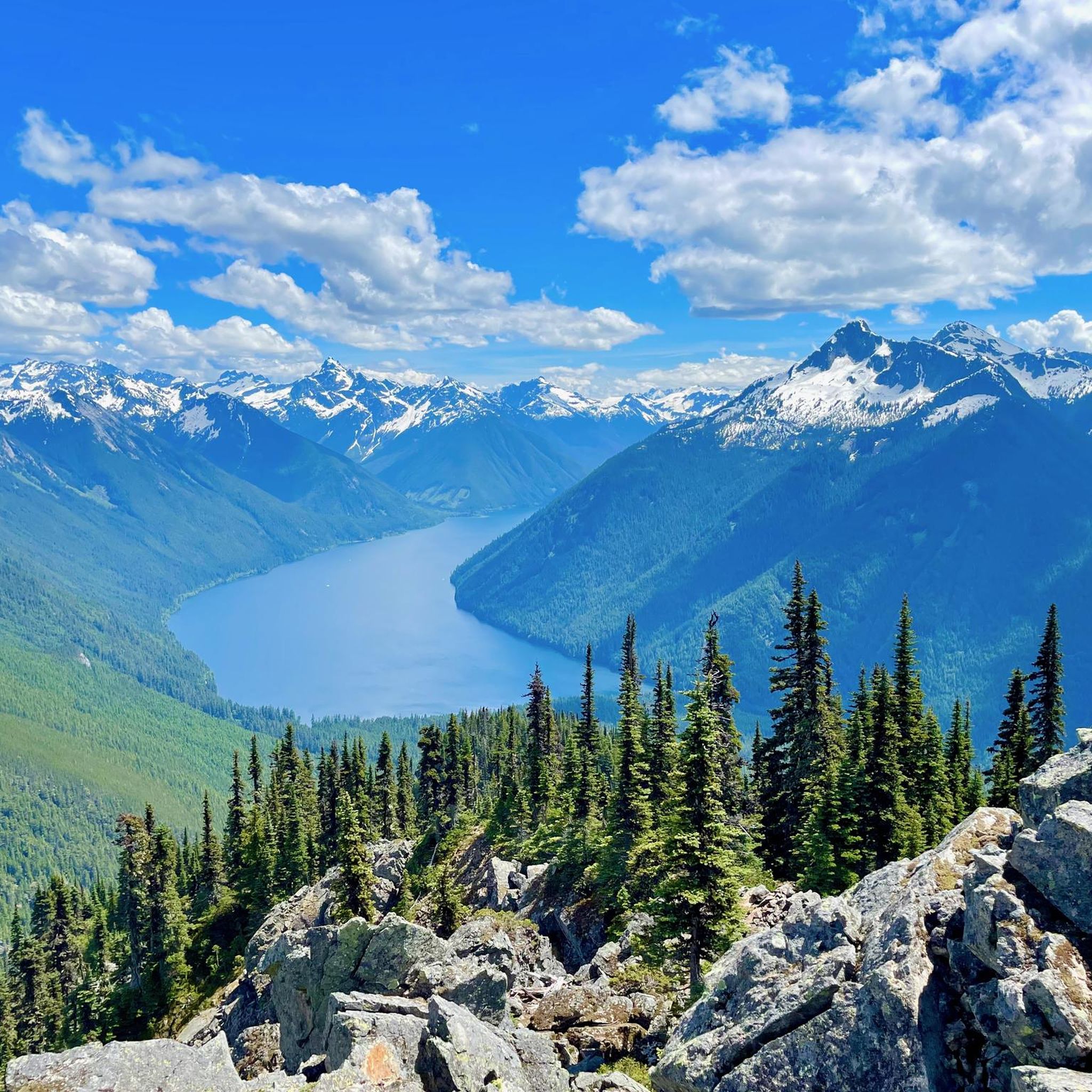
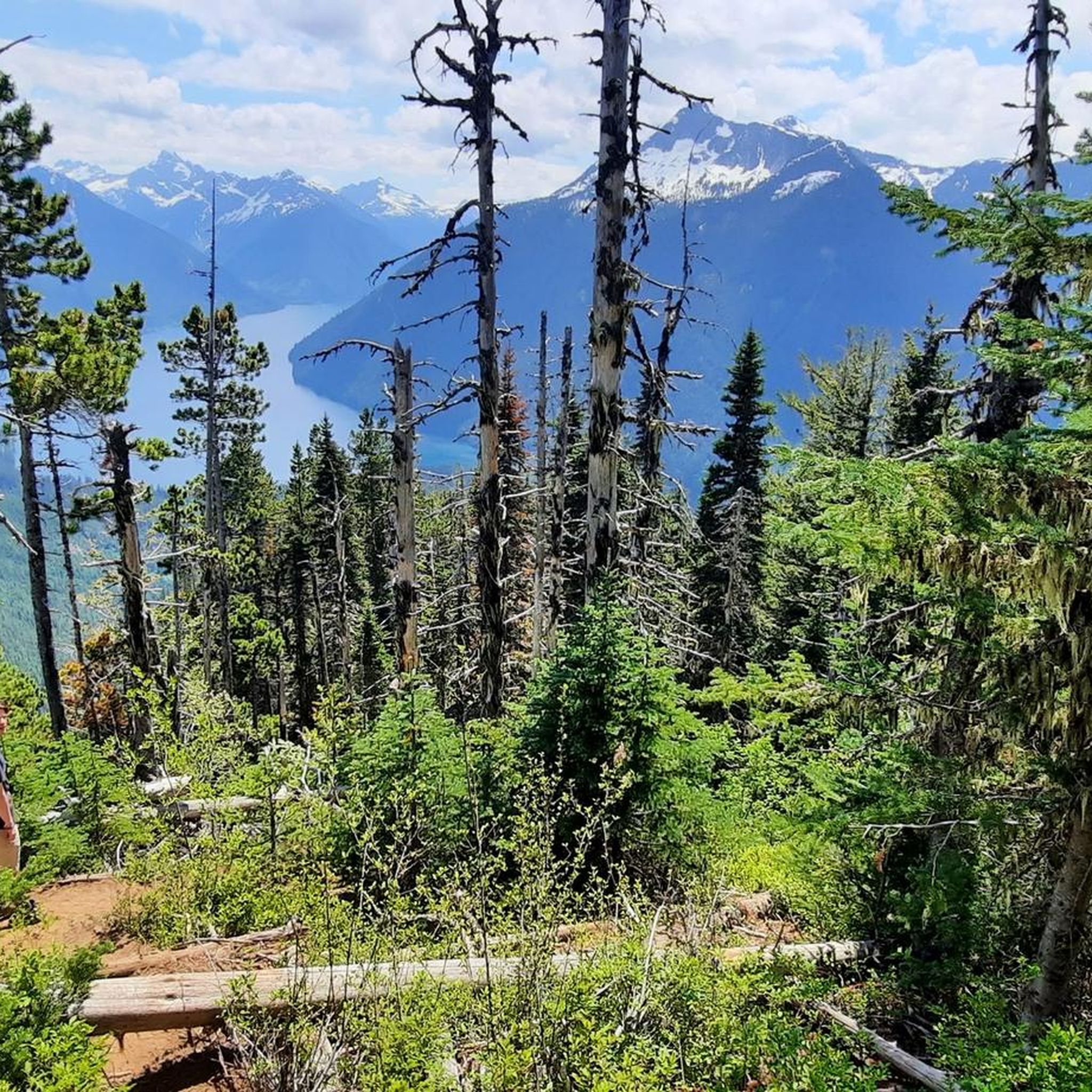
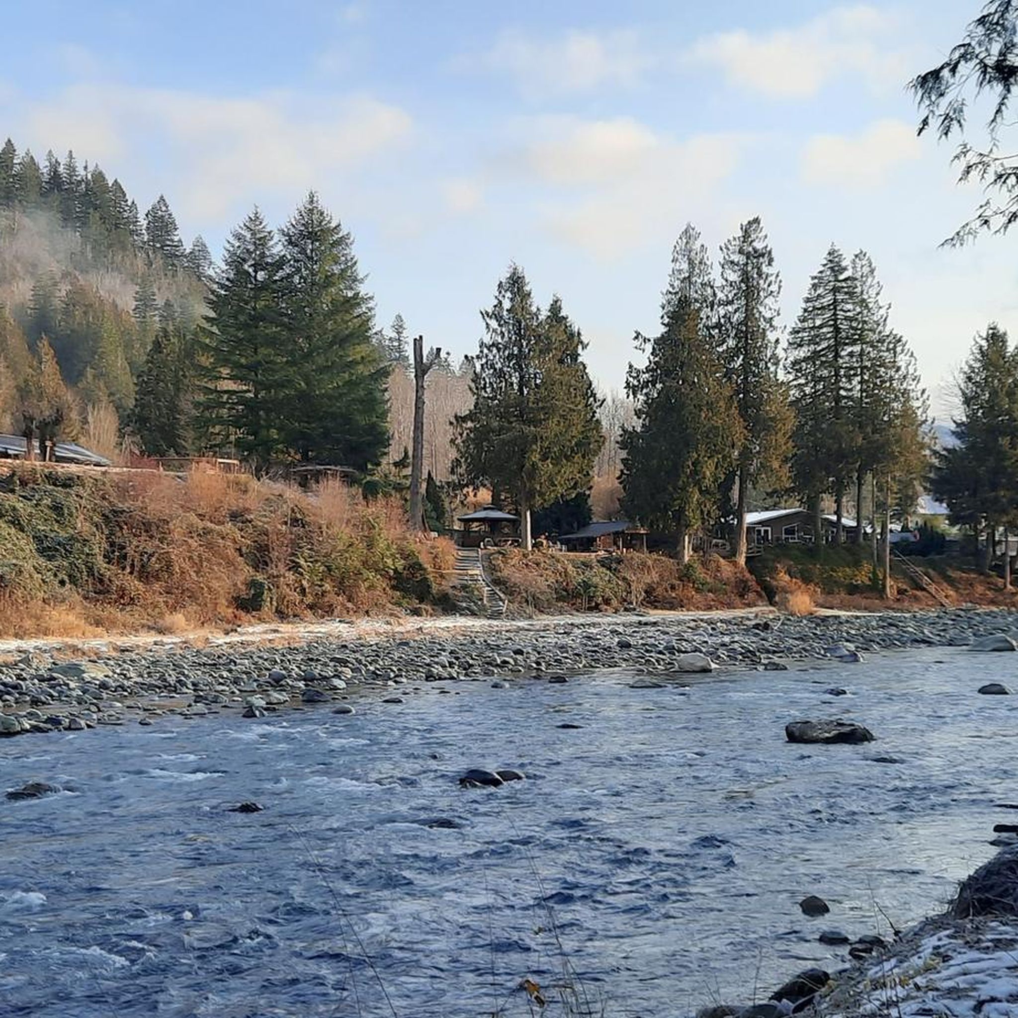
Hiking around Area E (Chilliwack River Valley) offers diverse and rugged natural beauty within the Northern Cascades mountain range, east of Vancouver. The region is characterized by majestic mountains, such as Mount Cheam and Slesse Mountain, providing panoramic views. It features numerous alpine lakes, including Lindeman Lake and Flora Lake, and the Chilliwack River itself. Hikers will traverse lush, dense forests, open ridgelines, and varied alpine terrain.
Best hiking trails around Area E (Chilliwack River Valley)
- The most popular hiking route is Mount MacFarlane Trail, a 10.6 miles (17.1 km) trail that takes 8 hours 35 minutes to complete. This difficult route involves significant elevation gain to reach panoramic views.
- Another top favourite among local hikers is Mount Slesse Memorial Trail, a difficult 8.2 miles (13.3 km) path. This trail leads through rugged mountain terrain, featuring substantial elevation gain and scenic vistas.
- Local hikers also love the Williams Peak via Williams Ridge Trail, a 9.2 miles (14.8 km) trail leading through dense forests and challenging ascents, often completed in about 7 hours 17 minutes.
- Hiking around Area E (Chilliwack River Valley) is defined by majestic mountain peaks, pristine alpine lakes, and lush forests. The extensive trail network offers options for various ability levels, from easy strolls to demanding multi-day expeditions.
- The routes in Area E (Chilliwack River Valley) are highly rated by the komoot community with an average score of 4.8 stars from more than 50 reviews. More than 1000 hikers have used komoot to explore Area E (Chilliwack River Valley)'s varied terrain.
Last updated: July 27, 2026
33
hikers
17.1km
08:35
1,710m
1,710m
Hike the difficult Mount MacFarlane Trail, a 10.7-mile route with 5604 feet of elevation gain, offering panoramic views and alpine lakes.
15
hikers
13.3km
05:46
920m
920m
Mount Slesse Memorial Trail is a difficult 8.2-mile hike with 3016 feet of gain, leading to a historic crash site and panoramic views.

Sign up for free
9
hikers
14.8km
07:17
1,630m
1,630m
Hard hike. Very good fitness required. Easily-accessible paths. Suitable for all skill levels.
7
hikers
20.4km
05:12
60m
60m
Hard hike. Very good fitness required. Easily-accessible paths. Suitable for all skill levels.
4
hikers
16.7km
06:46
1,240m
1,240m
Hike the challenging Mount Lindeman Trail in Chilliwack Lake Provincial Park for panoramic views and a scramble to the summit.
Get access to more routes and recommendations from other explorers.
Sign up for free
Already have an account?
Our route recommendations are based on thousands of hikes, rides, and runs completed by other people on komoot.
Start today with a free account
Your next adventure awaits.
Login or Signup
Popular around Area E (Chilliwack River Valley)

Forests, desert, wilderness - day tours in British Columbia
Running Trails around Area E (Chilliwack River Valley)
Cycling around Area E (Chilliwack River Valley)
Road Cycling Routes around Area E (Chilliwack River Valley)
MTB Trails around Area E (Chilliwack River Valley)
Gravel biking around Area E (Chilliwack River Valley)
Other adventures around Area E (Chilliwack River Valley)

Tips from the Community

Shortly after reaching the ridgeline by a very steep hike up from the valley floor you'll pass by a few small clearings with excellent views of Williams Peak and other mountains. You'll definitely be ready for a rest to let your legs and lungs recover while you enjoy the mountain vistas.
0
0
The summit of Williams Peak is attained through a steep, grueling hike that ends with a scramble through a gully and over loose rocks. Those that persevere and reach the summit with have unobstructed views around the mountains and valley below.
0
0
The Williams Ridge Trail starts steep, stays steep, and gets even steeper at the end. There's a bit of reprieve once you gain the ridgeline, but the rocky terrain keeps you on your toes literally and figuratively as you pick your way around, over, and through the boulders. Due to the difficulty level, lack of water, and route finding skills needed on this hike it is not recommended for beginners, but those with the proper skills and equipment will be rewarded with stunning views across the Fraser Valley and surrounding mountains.
0
0

Browne Creek Wetlands is a small, protected marsh and riparian habitat along Browne Creek. The area is key in filtering water and is easy to explore via a network of flat gravel paths and wooden boardwalks. Visitors come here for birdwatching, strolling, running, or biking.
0
0
The Great Blue Heron Nature Reserve spans 325 acres across a protected wetland habitat for one of the area’s largest colonies of great blue herons. Visitors can explore the reserve on flat gravel trails and raised boardwalks. This beautiful marshland and wooded area are open year-round, with educational programs and volunteer stewardship.
0
0
The Vedder River flows along the southern edge of Chilliwack, beginning at Cultus Lake and running northwest until it joins the Fraser River. The river is famous for salmon fishing during fall salmon runs. Besides fishing, visitors like to swim, tube, kayak, and raft.
0
0

The summit push from here is a Class 3 off-trail scramble requiring good route-finding skills.It’s considered a strenuous objective best suited for experienced hikers or scramblers. Mount Lindeman is a prominent peak in the Chilliwack River Valley, rising above the eastern end of Chilliwack Lake near the U.S. border. The mountain is accessed by a steep, unofficial trail that climbs rapidly from the lakeshore and involves loose rock and exposed sections. The summit reaches roughly 2,312 meters and offers wide views of Chilliwack Lake, Mount Rexford, and the surrounding North Cascades.
0
0
The Mount Lindeman Route begins off Centre Creek FSR. Since the forest service road is very rough, you will likely need to park off Chilliwack Lake Road. At the end of the road, the Mount Lindeman Route branches off to the left and could initially be confused with a creek bed. The next three kilometers offer a diverse mix of overgrown, muddy, dry, and smooth hiking. Once you cross a log bridge and step into the meadow, you will see Mount Lindeman emerging in the distance.
0
0
Frequently Asked Questions
How many hiking trails are available in Area E (Chilliwack River Valley)?
There are over 45 hiking trails in Area E (Chilliwack River Valley), offering a wide range of experiences. You'll find a good mix of easy strolls, moderate treks, and challenging alpine ascents.
What is the best time of year to go hiking in the Chilliwack River Valley?
The Chilliwack River Valley is generally best for hiking from late spring through early fall. During this period, trails are typically clear of snow, and the weather is more favorable for exploring the diverse landscapes, from lush forests to alpine peaks. Winter hiking is possible but requires appropriate gear and awareness of snow conditions.
Are there any family-friendly hiking trails in the Chilliwack River Valley?
Yes, the region offers several easier trails suitable for families. While many routes are challenging, you can find more accessible options like sections of the Vedder Rotary Trail or walks within the Great Blue Heron Nature Reserve. These provide gentler terrain and opportunities to enjoy nature with children.
Can I bring my dog on the hiking trails in Area E (Chilliwack River Valley)?
Many trails in the Chilliwack River Valley are dog-friendly, but it's always best to check specific park regulations or trail signage before heading out. When hiking with your dog, ensure they are on a leash, you pack out all waste, and they are prepared for the terrain and weather conditions.
Are there any scenic waterfalls to visit in the Chilliwack River Valley?
Absolutely! The Chilliwack River Valley is home to beautiful waterfalls. One of the most popular and easily accessible is Bridal Veil Falls, known for its impressive 60-meter cascade. You can also find Bosumarne Falls, adding to the region's natural splendor.
Where can I find the best panoramic views in the Chilliwack River Valley?
For breathtaking panoramic views, consider challenging routes that lead to higher elevations. Trails like Mount MacFarlane Trail offer stunning 360-degree vistas of the Fraser Valley, surrounding peaks, and even Mount Baker on clear days. Sumas Mountain Regional Park also provides excellent viewpoints.
Are there any loop trails for hiking in the Chilliwack River Valley?
Yes, there are several loop options available for hikers. For example, the Vedder Rotary Trail North and South loop offers a longer, relatively flat experience along the river. For more challenging multi-day adventures, the Flora Lake Loop is a popular choice for backcountry enthusiasts.
What are some of the most challenging hikes in the Chilliwack River Valley?
The Chilliwack River Valley is known for its demanding alpine hikes. Experienced hikers often seek out trails like Mount Slesse Memorial Trail, Williams Peak via Williams Ridge Trail, and Mount Lindeman Trail. These routes involve significant elevation gain, rugged terrain, and reward with exceptional scenery.
Are there opportunities for overnight or backpacking trips?
Yes, the Chilliwack River Valley is a popular destination for backcountry enthusiasts. Trails leading to alpine lakes such as Flora Lake, Mount MacFarlane, and Upper Hanging Lake & Mount Lindeman offer excellent opportunities for overnight camping, allowing you to experience the solitude and beauty of the alpine environment.
What do other hikers enjoy most about hiking in Area E (Chilliwack River Valley)?
The area is highly rated by the komoot community, with an average score of 4.8 stars from over 50 reviews. Hikers frequently praise the region's diverse and rugged natural beauty, the stunning panoramic views from mountain peaks, and the pristine alpine lakes. The variety of trails, from lush forests to open ridgelines, is also a significant draw.
Are there any beautiful lakes to visit during a hike?
The Chilliwack River Valley is dotted with numerous pristine alpine lakes. Lindeman Lake is a well-maintained trail leading to a peaceful, vibrant turquoise lake. Other notable lakes include Greendrop Lake and Flora Lake, which are often part of more challenging routes.
Is parking available at the trailheads?
Parking is generally available at popular trailheads throughout the Chilliwack River Valley, though it can fill up quickly on busy weekends. Some areas, like Spring Bay Parking and Picnic Area near Cultus Lake, offer designated parking. Always check specific trail information for parking details and any potential fees or restrictions.
Can I spot wildlife on the trails in the Chilliwack River Valley?
The Chilliwack River Valley is rich in diverse ecosystems, offering opportunities for wildlife spotting. Hikers might encounter various bird species, including the Great Blue Heron, especially near the river and wetlands. The Chilliwack River itself is known for supporting several salmon species, particularly during spawning seasons.
Most popular routes around Area E (Chilliwack River Valley)
Most popular attractions around Area E (Chilliwack River Valley)

Get inspired with the komoot mobile app


Explore more
Browse the best Hikes in other regions.
