4.6
(59)
803
hikers
145
hikes
Hiking in Southeastern Connecticut Planning Region offers diverse landscapes for outdoor enthusiasts, characterized by coastal paths along the Long Island Sound, extensive woodlands, and serene riverside trails. The terrain includes rolling hills and river valleys, providing varied experiences. Glacial features and diverse ecosystems contribute to the region's natural appeal. The network of routes provides options for various skill levels, predominantly easy to moderate.
Last updated: August 4, 2026
5.0
(4)
74
hikers
5.92km
01:33
40m
40m
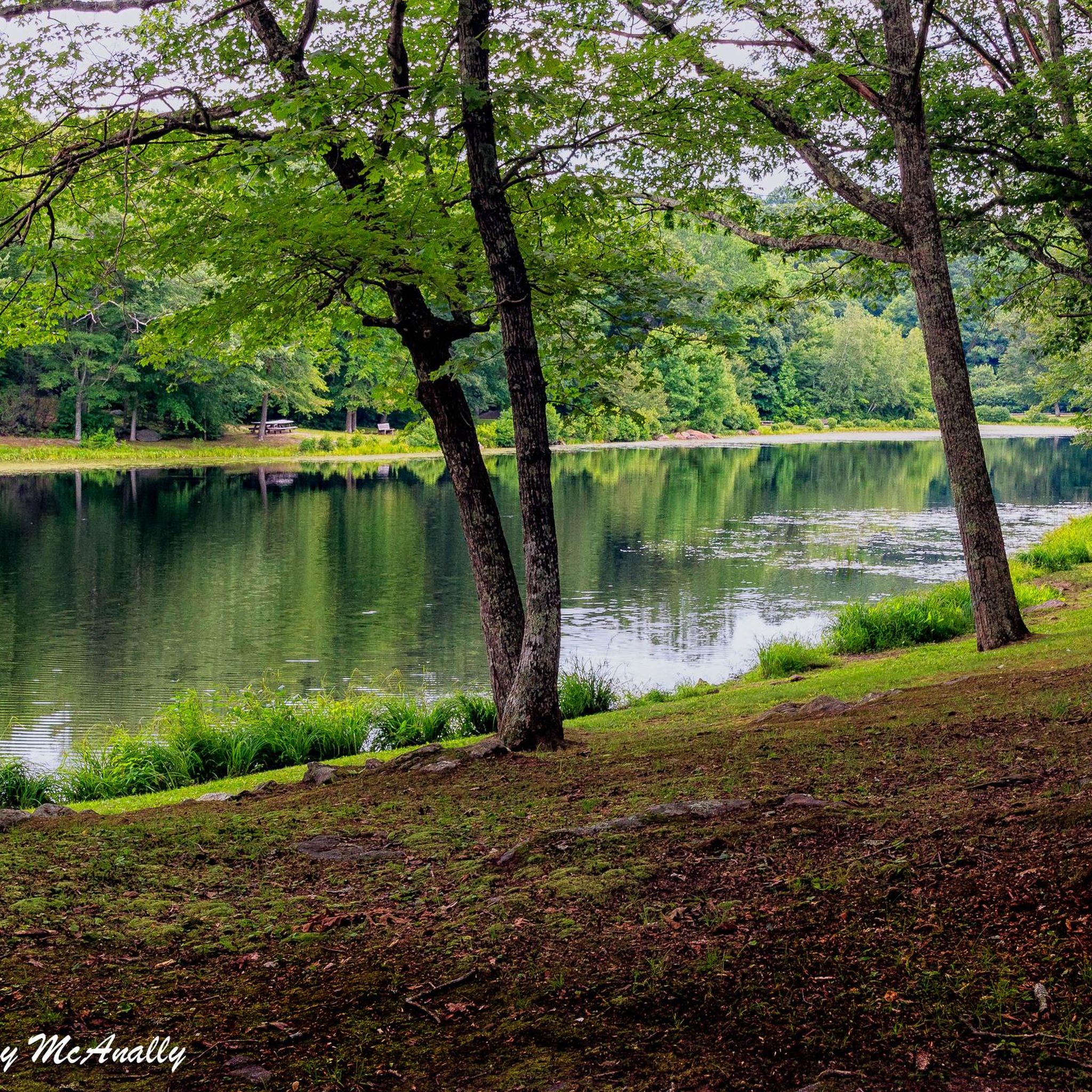
The Bluff Point State Park and Coastal Reserve Loop offers a refreshing blend of coastal and woodland scenery, making it one of the best hiking trails near Groton, Connecticut. You'll traverse wide graveled paths and dirt roads that hug the Poquonnock River and Fishers Island Sound, eventually opening up to expansive views of the Atlantic Ocean. The trail then winds through serene wooded areas, salt marshes, and open fields, providing a diverse and engaging experience for its easy 3.7-mile (5.9 km) distance.
Planning your visit to this coastal gem is straightforward; the route is generally considered easy with only 146 feet (44 metres) of elevation gain, making it accessible for most. The estimated duration is a comfortable 1 hours and 32 minutes, perfect for a leisurely outing. Remember that access to the bluff is limited to foot or non-motorized vehicles, ensuring a tranquil environment, and while specific Bluff Point State Park parking information isn't detailed, arriving earlier in the day is always a good strategy.
What truly sets this trail apart is its status as the last significant undeveloped chunk of the Connecticut coastline, protected as a Coastal Reserve. This designation preserves its unique biodiversity, including over 200 bird species, making it a prime spot for wildlife spotting. The mix of coastal woodlands, beach and dune grasslands, and tidal wetlands creates a rich habitat, offering a rare glimpse into the shoreline's natural state.
5.0
(1)
14
hikers
5.79km
01:34
80m
80m
The Oswegatchie Blue and Red Loop Trail offers a delightful journey through coastal forests, revealing unique geological formations carved by glaciers. You'll encounter rugged sections with roots and rocks, particularly on the Blue Trail, but the overall experience is an easy hike through varied terrain. Look forward to views overlooking Clark Pond and the Niantic River, with the 'lunar landscape' and its glacial striations being a standout feature.
Accessing the trail is simple, with ample parking available at Veterans Memorial Park, which also hosts the main entrance and an informational kiosk. The route is well-marked with 'You Are Here' signs and maps at key intersections, making navigation easy. This trail is suitable for most hikers and can be enjoyed throughout the year, with seasonal changes bringing different natural beauty.
Beyond its scenic appeal, the Oswegatchie Hills Nature Preserve holds significant historical and ecological value. The landscape was shaped by glaciers, and you can even find an abandoned quarry that once supplied granite for New York City's Grand Central Terminal. The preserve is also a critical habitat for diverse wildlife, including red fox and bobcats, and supports a rare stand of pitch pines and scrub oaks.

Sign up for free
4.5
(2)
10
hikers
7.67km
02:08
150m
140m
Embark on the TriTown Preserve Blue Loop, a moderate 4.8-mile (7.7 km) hike that offers a diverse natural experience. You will navigate varied terrain, including stream crossings and sections with exposed rocks and roots, as you gain 478 feet (146 metres) in elevation. The route, which typically takes about 2 hours and 8 minutes to complete, reveals historical stonewalls and impressive glacial erratics along the way, providing a glimpse into the area's past.
Planning your visit to the TriTown Preserve is straightforward, with general parking conveniently available right at the trailhead. This makes starting your adventure simple and hassle-free. If you wish to bring your canine companion, dogs are welcome on the trails; just remember to keep them on a leash for the safety and enjoyment of all visitors and wildlife. Consider an early start to make the most of your time exploring this expansive preserve.
This trail is part of the Avalonia Land Conservancy's largest preserve, offering a significant natural escape. As you hike, keep an eye out for magnificent chestnut oaks that dot the landscape and enjoy stunning vistas that provide views of distant mountains. A unique feature of the route is a segment of the old "Coach Road," inviting you to imagine its historical significance and the journeys it once facilitated through this beautiful area.
5.0
(2)
10
hikers
4.90km
01:16
30m
30m
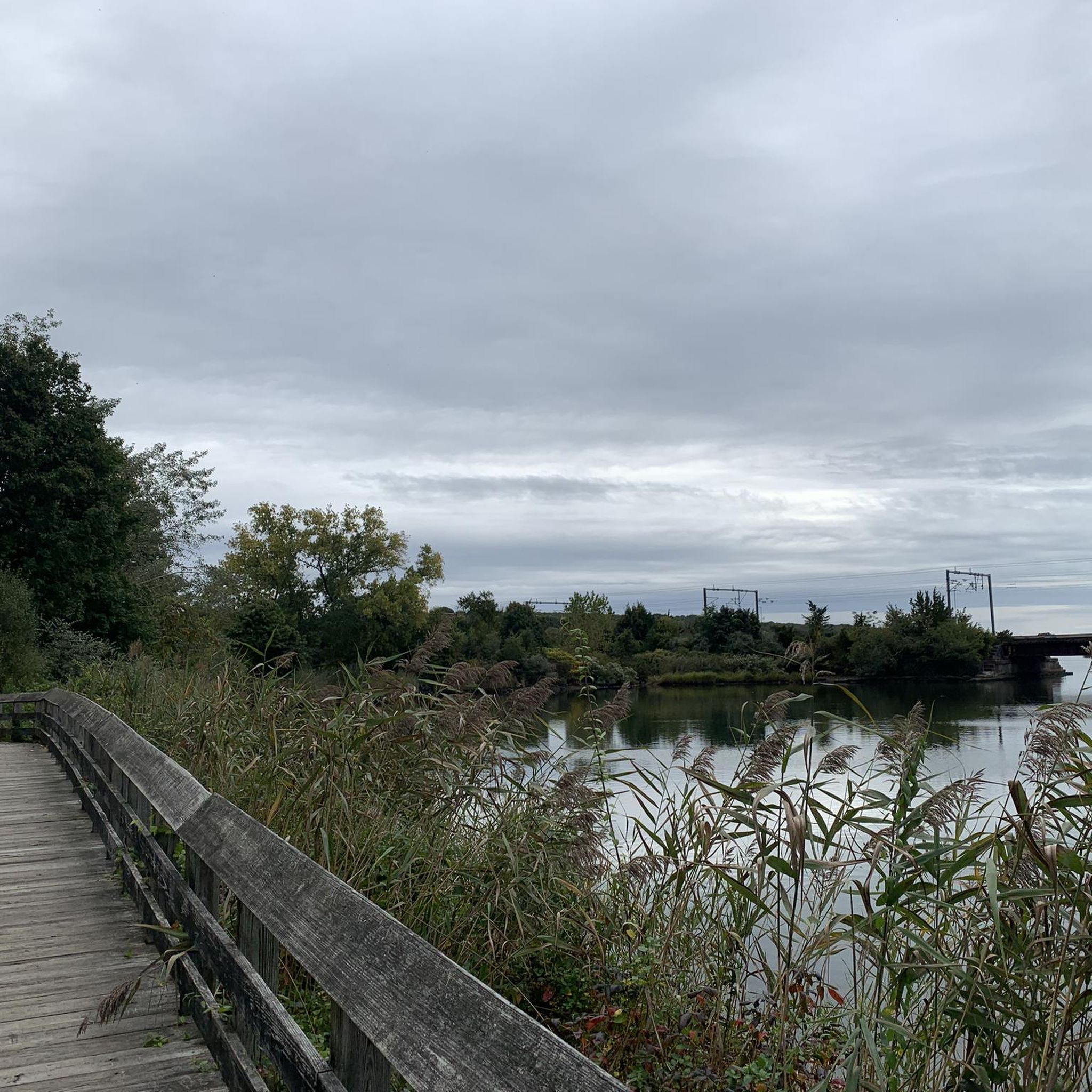
Embark on an easy hike along the Barn Island Loop, a 3.0-mile (4.9 km) route that offers diverse scenery. You will experience coastal forests, open fields, and marshes, with views stretching out to Fisher's Island Sound. This pleasant journey involves a gentle elevation gain of 101 feet (31 metres) and typically takes about 1 hour and 16 minutes to complete.
When planning your visit, be aware that while the main path is generally clear, the trails are not explicitly marked, so carrying a map can be very helpful. During warmer months, the area can be quite buggy, especially with ticks, so remember to bring appropriate clothing and insect repellent. Seasonal bathrooms are available at the boat launch for your convenience.
This trail explores Connecticut's largest coastal wildlife management area, making it a prime spot for nature observation. The unique landscape features a tidal creek winding through the marsh, attracting various bird species like great blue herons. It's a great opportunity to immerse yourself in a rich coastal ecosystem.
5
hikers
9.85km
02:38
120m
90m
Embark on the Narragansett Trail to Green Fall Pond Loop, a moderate hiking route spanning 6.1 miles (9.8 km) with an elevation gain of 406 feet (124 metres). You can expect to complete this journey in about 2 hours and 37 minutes, winding through rich forestland. As you hike, you will encounter diverse ecosystems, large rock formations, and scenic views of Green Fall Pond, which is a highlight of the trail.
When planning your visit, be aware that some sections of the route may involve walking on quiet active roads. Dogs are welcome to join you on the trail, but please ensure they are leashed and that you clean up after them. The trail is generally accessible, offering a straightforward experience for most hikers.
This loop is notable for its unique blend of natural beauty and historical elements. You will pass by an old mill site, complete with a mill race, offering a glimpse into the area's past. Keep an eye out for a beaver dam and other interesting geological features that add to the trail's character, making it a distinctive option within Pachaug State Forest.
6
hikers
3.56km
01:00
70m
70m
The Gillette Castle Train Trail offers a charming and accessible journey through the historic grounds of Gillette Castle State Park. You'll wander past the tranquil Gillette Castle Pond, a peaceful highlight, and discover fascinating remnants of William Gillette's miniature railway, including a Miniature Steam Locomotive. This easy 2.2-mile (3.6 km) hike, with just 236 feet (72 metres) of elevation gain, is perfect for a relaxed outing, taking approximately 59 minutes to complete.
Parking is readily available at Gillette Castle State Park, though it's wise to arrive early on busy days to secure a spot. The trail is well-suited for all seasons, but spring and autumn provide the most comfortable weather and vibrant natural beauty. This makes it an ideal choice for a quick, scenic walk without needing extensive planning.
This route stands out for its unique blend of natural scenery and historical intrigue, offering a glimpse into the eccentric world of William Gillette. It's a fantastic option for families or anyone seeking an easy, engaging hike that combines outdoor enjoyment with a touch of local history.
5.0
(3)
7
hikers
4.33km
01:08
40m
40m
Embark on an easy hike along the Rocky Neck State Park Trail, a route that guides you through a diverse landscape blending coastal and woodland environments. You will wander through oak-heavy thickets, expansive salt marshes, and dense forests before reaching the sandy beaches. Keep an eye out for fascinating glacial formations and enjoy sweeping views of the Long Island Sound, especially from points like Tony's Nose Overlook. This pleasant outdoor experience covers 2.7 miles (4.3 km) with a gentle elevation gain of 126 feet (38 metres), typically taking about 1 hour and 8 minutes to complete.
Planning your visit to Rocky Neck State Park is straightforward, as it is a popular destination with facilities for camping and picnicking, making it easy to spend a full day here. The trails are multi-use, welcoming walkers, runners, and birdwatchers, and are generally accessible for a wide range of abilities. Parking is typically available within the state park, so you can easily access the trailhead and begin your adventure.
The Rocky Neck State Park Trail stands out for its unique blend of natural features, offering a glimpse into both coastal ecosystems and mature woodlands. The presence of glacial formations adds a historical geological layer to your hike, showcasing the powerful forces that shaped this landscape. This trail provides a serene escape and a chance to observe local wildlife in their natural habitats, making it a notable option for those seeking a tranquil yet engaging outdoor experience in the region.
5.0
(1)
6
hikers
4.84km
01:19
70m
70m
Embark on an easy hike through the Upper Three Mile River Preserve, where you will discover varied terrain including high, craggy ledges and broad hilltops. This 3.0-mile (4.8 km) route offers a gentle ascent of 228 feet (70 metres), making it an accessible option for a quick outdoor escape. You can expect to complete the trail in about 1 hour and 18 minutes, passing through a landscape of abandoned farmland and woodlots. Keep an eye out for the abundant mountain laurel, which provides a beautiful display when in bloom, especially around the seasonal brooks that emerge from the ground among the ledges.
To begin your adventure, park at the designated commuter lot. From there, you will take a short walk along Four Mile River Road to reach the preserve's entrance, located directly across from the Transfer Station. While the overall trail is easy, be prepared for some steeper sections, particularly if you choose to explore the White Trail. During late winter and spring, you might also encounter rushing stream crossings, so plan your footwear accordingly.
This preserve offers a glimpse into one of the wildest and most remote woodlands in Old Lyme. The landscape tells a story of a forgotten past, with remnants of abandoned farmland and woodlots now reclaimed by nature. The seasonal brooks, emerging from the ground among the ledges, add to the unique character of this area, providing a serene backdrop for your hike.
4
hikers
5.27km
01:33
150m
150m
The Nayantaquit Trail offers a delightful forest immersion, guiding you through a landscape rich with hardwood trees, historic stone walls, and fascinating rock formations. As you hike, you'll discover fern-lined pathways and a wetlands complex, leading you towards the quiet slopes of Brown Hill. This easy 3.3-mile (5.3 km) route, with its 502 feet (153 metres) of elevation gain, is a journey through thriving flora and offers a peaceful atmosphere, perfect for a roughly 1 hour and 32 minute escape into nature.
Planning your visit to the Nayantaquit Trail means preparing for varied conditions. While the trail is generally accessible, some sections can be overgrown, suggesting long pants might be a good idea. After heavy rains, certain areas can become quite swampy, so sturdy, waterproof hiking shoes are highly recommended. Keep an eye on the trail blazes, as they can sometimes be inconsistent, and be mindful of path forks to stay on track. This trail is best enjoyed when the weather is dry to avoid the muddier sections.
Beyond its natural beauty, the Nayantaquit Trail is steeped in history and ecological significance. It's one of Connecticut's official Blue-Blazed trails, named after the local Nayantaquit Tribe that once inhabited the area. The Nehantic State Forest, where the trail resides, is an experimental forest managed for diverse habitats, making it a hotspot for birdwatching, with species like black-throated blue warblers and scarlet tanagers. You'll also encounter remnants of an old homestead area on Brown Hill, adding a layer of historical intrigue to your hike.
5
hikers
4.26km
01:07
40m
40m
The Copp Park Outer Loop offers a delightful, easy hike through varied New England scenery. You'll find yourself on packed earth and dirt paths, winding past striking lichen-covered rocks and through sections where laurel trees form natural archways. Keep an eye out for glimpses of water, impressive giant boulders, and peaceful open meadows that make this route feel like a true escape into nature.
Planning your visit is simple, as the park is town-owned with on-site parking available. It's a fantastic spot for dog owners, featuring a fenced "Central Bark Dog Park" for your furry friends. Just be mindful that some trail sections can become impassable due to water after heavy rainfall, so check conditions or wear waterproof footwear.
This 2.6-mile (4.3 km) route, with its minimal 121 feet (37 metres) of elevation gain, is an easy hike that takes just over an hour to complete. It's a great option for families, beginners, or anyone seeking a quick, refreshing outdoor experience without a strenuous climb. The park's diverse network of trails also offers options for mountain biking and gravel biking.
Get access to more routes and recommendations from other explorers.
Sign up for free
Already have an account?
Our route recommendations are based on thousands of hikes, rides, and runs completed by other people on komoot.
Start today with a free account
Your next adventure awaits.
Login or Signup
Popular around Southeastern Connecticut Planning Region

This information center houses, among other things, the Garden Railway's steam locomotive.
3
0
Since there were no refrigerators at that time, such cellars were built and filled with fresh ice every year.
3
0
A lake, an old quarry, the picturesque castle in the background. If that isn't a brilliant setting for a picnic...
3
0
The blue water, bright sunshine, white boats on the river... There's no point in writing, you have to see it to be believed.
3
0
The Barn Island Wildlife Management Area has approximately 1,000 acres of essential wildlife habitat. It is in the extreme southeast corner of the state that is protected and sheltered by headlands. It is the largest coastal wildlife management area in the state.
0
0
Here you can discover miles of trails winding through lush, wooded greenery in this area, providing stunning views of Long Island Sound. It's a popular destination for hiking, running, and biking, offering opportunities to spot wildlife along the way.
0
0
Brown Hill is one of the high points in Nehantic State Forest. Most of the summits (like this one) are overgrown with trees and don't really offer any views.
0
0
Nice view of the ferry and the river
0
0
Yes, there's a great variety. You can explore over 35 routes in the region, ranging from easy coastal walks to more moderate forest hikes. The majority of the trails are rated as easy, making the area accessible for many fitness levels.
The trails in Southeastern Connecticut are well-regarded by the komoot community, holding an average rating of 4.3 out of 5 stars. Hikers often praise the mix of coastal scenery and quiet woodland paths.
Many trails in the region are suitable for hiking with a dog on a leash. A particularly popular spot is Bluff Point State Park in Groton, which offers over 800 acres of trails along the Long Island Sound where you can walk with your dog.
Yes, you can. Devil's Hopyard State Park is a local favorite, known for the beautiful Chapman Falls. For a shorter, easier walk that still takes in the scenery, consider the Day Pond Brook Falls via Salmon River Trail loop.
The region has many family-friendly options. The Mount Misery loop from Mount Misery Campground is a short, easy walk through Pachaug State Forest that's great for all ages. Another excellent choice is the Air Line South State Park Trail, which has a very flat surface perfect for a simple walk or for kids on bikes.
While the region is best known for easy and moderate trails, you can find some more demanding hikes. The Lost Pond loop from Hallville Mill Historic District is a moderate route with some elevation gain that offers a good workout. For a steep climb with a rewarding view, the Lantern Hill Trail in North Stonington is a popular choice.
The coastline offers many opportunities for scenic hikes. The Green Hill loop from Niantic is an easy trail in East Lyme that provides lovely views of the Long Island Sound. Bluff Point State Park is another top-rated destination for its extensive trails right along the water.
The terrain is quite varied. You'll find flat, easy paths along the coast and in parks like the Air Line State Park Trail. Inland, trails in places like Devil's Hopyard State Park and Pachaug State Forest feature more rolling hills, forest floors with roots and rocks, and some moderate climbs.
Yes, many of the best trails in the region are loops, allowing you to start and end in the same place without retracing your steps. A good example is the Brown Hill loop from Hamburg Bridge Historic District, which takes you through Nehantic State Forest.
Several state parks are highly regarded by local hikers.
Bluff Point State Park in Groton is a favorite for its coastal trails and easy access to the water. Devil's Hopyard State Park in East Haddam is famous for its trails leading to Chapman Falls. For a rewarding climb to a scenic viewpoint, many hikers head to the Lantern Hill Trail in North Stonington.
Wear sturdy, comfortable walking shoes or hiking boots, as some trails can be rocky or muddy. Layering your clothing is always a good idea, as weather can change, especially near the coast. In summer, bring bug spray, and in fall, brighter clothing is recommended during hunting season in state forests.


Check out more Hikes throughout Southeastern Connecticut Planning Region below and find the perfect route in your destination.

Browse the best Hikes in other regions.