The best running trails around Mont-Louis
4.4
(98)
10,459
runners
17
runs
Jogging around Mont-Louis, located in the Pyrénées-Orientales, offers diverse terrain for runners. The region is characterized by the Pyrenees mountain range, providing varied landscapes with significant elevation changes. Routes often traverse serene woodlands, follow river paths like the Têt, and pass by picturesque lakes such as Lac des Bouillouses. The area also features historical fortifications, offering unique paths around the town.
Best jogging routes around Mont-Louis
- The most popular jogging route is Plà de Barrès River and Forest – Along…
Last updated: October 2, 2026
5.0
(2)
87
runners
13.3km
01:39
210m
210m
Moderate run. Good fitness required. Mostly accessible paths. Some sure footedness required.
35
runners
16.7km
02:03
260m
260m
Hard run. Very good fitness required. Mostly accessible paths. Some sure footedness required.

11
runners
9.74km
01:10
190m
190m
Moderate run. Good fitness required. Mostly paved surfaces. Suitable for all skill levels.
9
runners
24.2km
02:47
430m
430m
Hard run. Very good fitness required. Mostly accessible paths. Some sure footedness required.
5.0
(1)
7
runners
14.8km
01:42
250m
250m
Moderate run. Good fitness required. Mostly accessible paths. Some sure footedness required.
Get access to more routes and recommendations from other explorers.
Already have an account?
Our route recommendations are based on thousands of hikes, rides, and runs completed by other people on komoot.
Start today with a free account
Your next adventure awaits.
Other adventures around Mont-Louis

Tips from the Community

Well, starting from Font Romeu and breaking legs from Mont Louis
0
0

The road is omnipresent, which is a shame because the site is pleasant and very accessible.
0
0

The Col de la Calvaire de Font Romeu is a mountain pass in French Cerdanya, next to the town and ski resort of Font Romeu. This port connects the Bolquère valley with the Cerdanya valley. The port is within the same town of Font Romeu, next to the station's ski lifts. There are many slopes to reach Col de la Calvaire: - the western slope that starts from Ur is approximately 16 km and crosses the town of Targasone and the Col d'Egat. It is a very steep climb along a road in perfect condition, although on holidays there is a lot of traffic. - The southern slope starts from Llívia and crosses Estavar and joins the previous one at the Col d'Egat. Unlike the first, the first section of the climb is very hard, with several horseshoe curves and with wonderful views of the entire Cerdanya and the Tosa d'Alp. - The eastern slope stops at Olette, and after approximately 28 km it reaches the top of the pass, passing through the town of Mont-Louis and Bolquère. It is a very steep climb, like the first, on a road in perfect condition but with a lot of traffic. I don't like going up here. - the eastern slope that starts from Olette and passes through the Col de la Perche, reaching the town of Font-Romeu and from there to the top. Of all the slopes, the one I like the most is the slope that starts from Llívia and crosses Estavar.
0
0

Located around 1,800 meters above sea level, Font-Romeu is a dynamic mountain resort. It offers numerous restaurants where you can refuel before or after outdoor activities.
0
0

This pond is a little haven of peace hidden among the trees and surrounded by small clearings. In this small natural setting, the mountain in the distance manages to make its way through the middle of the forest to offer you an even more beautiful spectacle. So come and breathe a little.
0
0


Beautiful hiking section, perfect for swimming and picnics. We walked directly in the river with the swimming shoes :)
0
1
Frequently Asked Questions
How many running trails are available around Mont-Louis?
There are over 10 dedicated running trails around Mont-Louis, offering a variety of distances and difficulty levels. These routes are well-documented on komoot, providing options for every runner.
What kind of landscapes will I encounter on the running routes near Mont-Louis?
The running routes around Mont-Louis offer diverse landscapes, from the majestic Pyrenees mountain range with peaks like Pic Carlit and Cambre d'Aze, to serene woodlands and river paths along the Têt. You'll also find picturesque lakes such as Lac des Bouillouses and Lacs de Pradeilles, and the unique flora of the Vallée d'Eyne natural reserve.
Are there easy running routes suitable for beginners in Mont-Louis?
Yes, Mont-Louis offers at least one easy running route, perfect for beginners or those looking for a relaxed jog. The overall network includes options for various ability levels, from easy to difficult.
What do other runners enjoy most about jogging in Mont-Louis?
The running routes in Mont-Louis are highly rated by the komoot community, with an average score of 4.3 stars from over 50 reviews. Runners often praise the varied terrain, the stunning mountain backdrops, and the opportunity to explore both natural beauty and historical fortifications.
Are there any circular running routes in the Mont-Louis area?
Yes, many of the running routes around Mont-Louis are circular. For example, the Plà de Barrès River and Forest – Along the Têt river loop from Mont-Louis is a popular moderate 7.4-mile loop. Another option is the Forêt domaniale de Barres loop from Mont-Louis, which is a 9.7 km moderate trail.
Can I bring my dog on the running trails around Mont-Louis?
Many trails in the Mont-Louis area are suitable for running with dogs, especially those through forests and along river paths. However, it's always recommended to check local regulations and signage for specific routes, particularly in protected natural areas like the Vallée d'Eyne, and to keep your dog on a leash.
What historical sites or landmarks can I see while running near Mont-Louis?
Mont-Louis itself is a fortified town, and you can jog around its historic fort on the 'Tour des remparts' path. Additionally, a yellow-marked path, PR10 or 'Sentier des oiseaux', circles Mont-Louis, offering views of the town and local wildlife. While the citadel is restricted, the paths outside its walls are open for exploration.
Are there any running routes that pass by lakes?
Absolutely. The region is known for its picturesque lakes. A notable route is the Plà de Barrès River and Forest – Lac des Bouillouses loop from Mont-Louis, which offers scenic views around Lac des Bouillouses. Other lakes in the area include Lake Matemale and Estany de la Pradella, which can be explored via nearby trails.
What is the best season for running in Mont-Louis?
Mont-Louis offers great running opportunities throughout the year. Spring and autumn provide pleasant temperatures and vibrant scenery. Summer is ideal for higher altitude routes, while winter can offer unique experiences on snow-covered trails, though some paths might require specific gear or be less accessible.
How can I reach the running trails around Mont-Louis using public transport?
Mont-Louis is accessible by the historic Petit Train Jaune, which offers a scenic way to travel through the French Pyrénées-Orientales. The train station, located about 800m from the town, serves as a starting point for various yellow-marked paths (PR) connecting to nearby villages like Saint-Pierre-dels Forcats, Planès, and Saint-Thomas-les-Bains, offering extended running options.
Are there any challenging running routes for experienced runners?
Yes, Mont-Louis offers several difficult running routes for experienced runners seeking a challenge. For instance, the Font-Romeu – Col du Calvaire (Font-Romeu) loop from Mont-Louis is a demanding 24 km trail with significant elevation gain, perfect for pushing your limits.
Are there any routes that offer panoramic views of the Pyrenees?
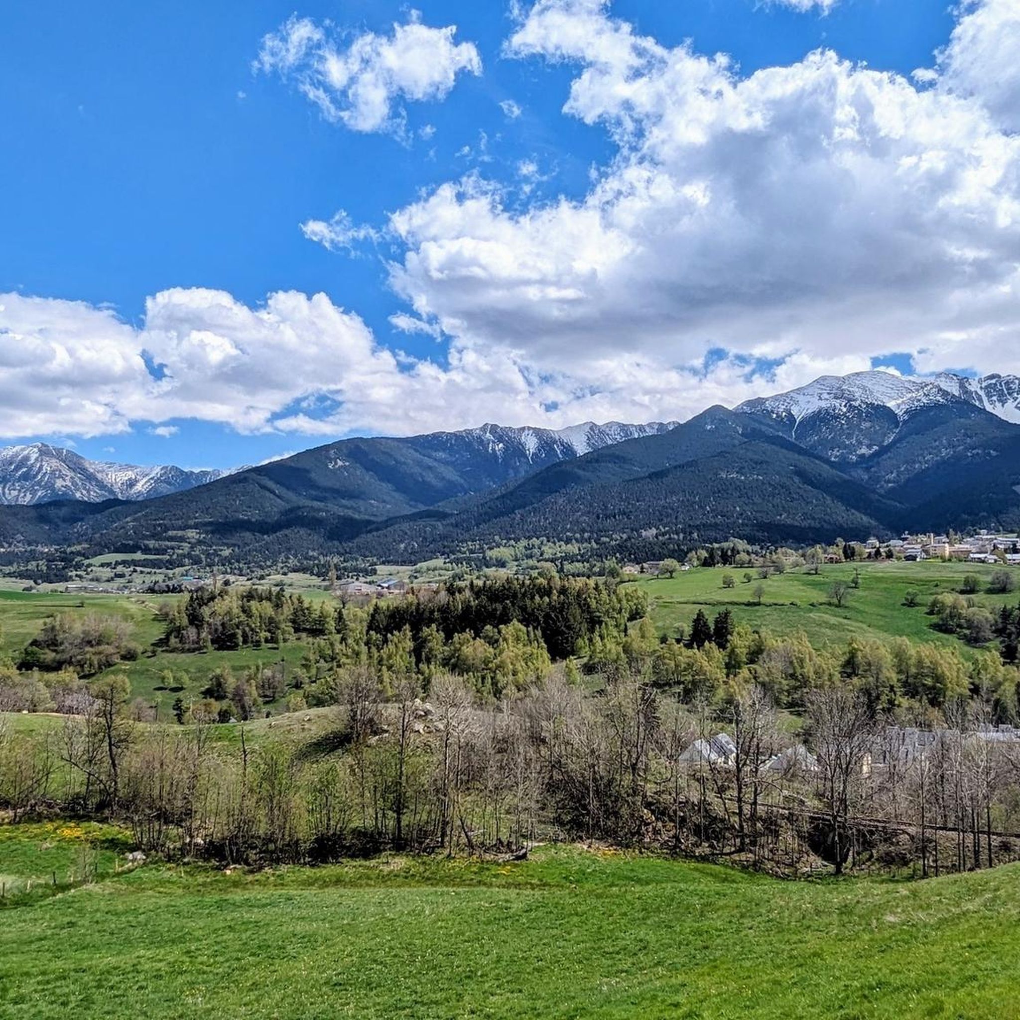
Many routes in the Mont-Louis area provide stunning panoramic views of the Pyrenees. Trails leading towards peaks like Pic Carlit, Pic Péric, and Cambre d'Aze offer exceptional vantage points. Even moderate routes often feature scenic overlooks, such as the View from Coll del Pam (2005 m).
Most popular routes around Mont-Louis
Most popular attractions around Mont-Louis

Get inspired with the komoot mobile app


Explore more
Browse the best Running Trails & Routes in other regions.
