The best running trails around Annot
4.3
(6)
290
runners
15
runs
Jogging around Annot offers a unique experience through a landscape shaped by distinctive geological formations and lush forests. The region is characterized by the Grès d'Annot (Annot Sandstone), which forms dramatic cliffs and unique rock outcroppings, providing varied terrain for running. Trails often lead through ancient chestnut forests, offering shaded paths, and the Vaire River Valley contributes to the area's scenic beauty. The routes feature significant elevation changes, catering to runners seeking challenging ascents and descents.
Best jogging routes around…
Last updated: September 28, 2026
21
runners
9.27km
01:35
510m
510m
Hard run. Very good fitness required. Sure-footedness, sturdy shoes and alpine experience required.
11
runners
14.4km
02:13
690m
690m
Hard run. Very good fitness required. Sure-footedness, sturdy shoes and alpine experience required.

5.0
(1)
10
runners
Moderate run. Good fitness required. Mostly paved surfaces. Suitable for all skill levels.
9
runners
5.89km
01:02
410m
410m
Hard run. Very good fitness required. Sure-footedness, sturdy shoes and alpine experience required.
9
runners
13.6km
02:05
770m
780m
Hard run. Very good fitness required. Mostly paved surfaces. Suitable for all skill levels.
Get access to more routes and recommendations from other explorers.
Already have an account?
Our route recommendations are based on thousands of hikes, rides, and runs completed by other people on komoot.
Start today with a free account
Your next adventure awaits.
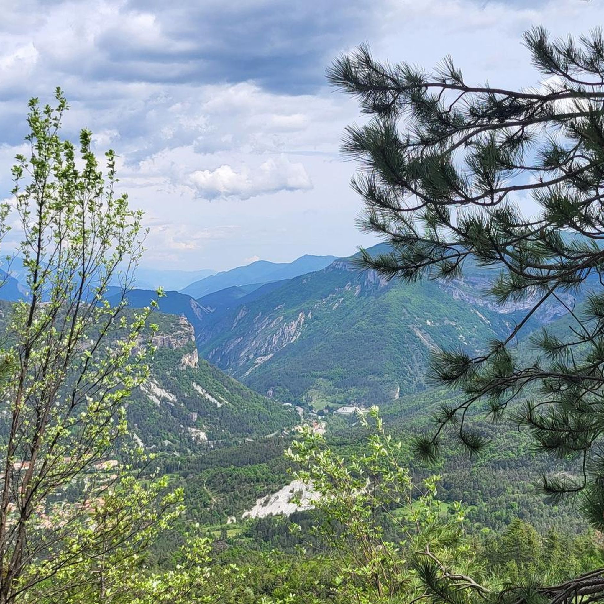
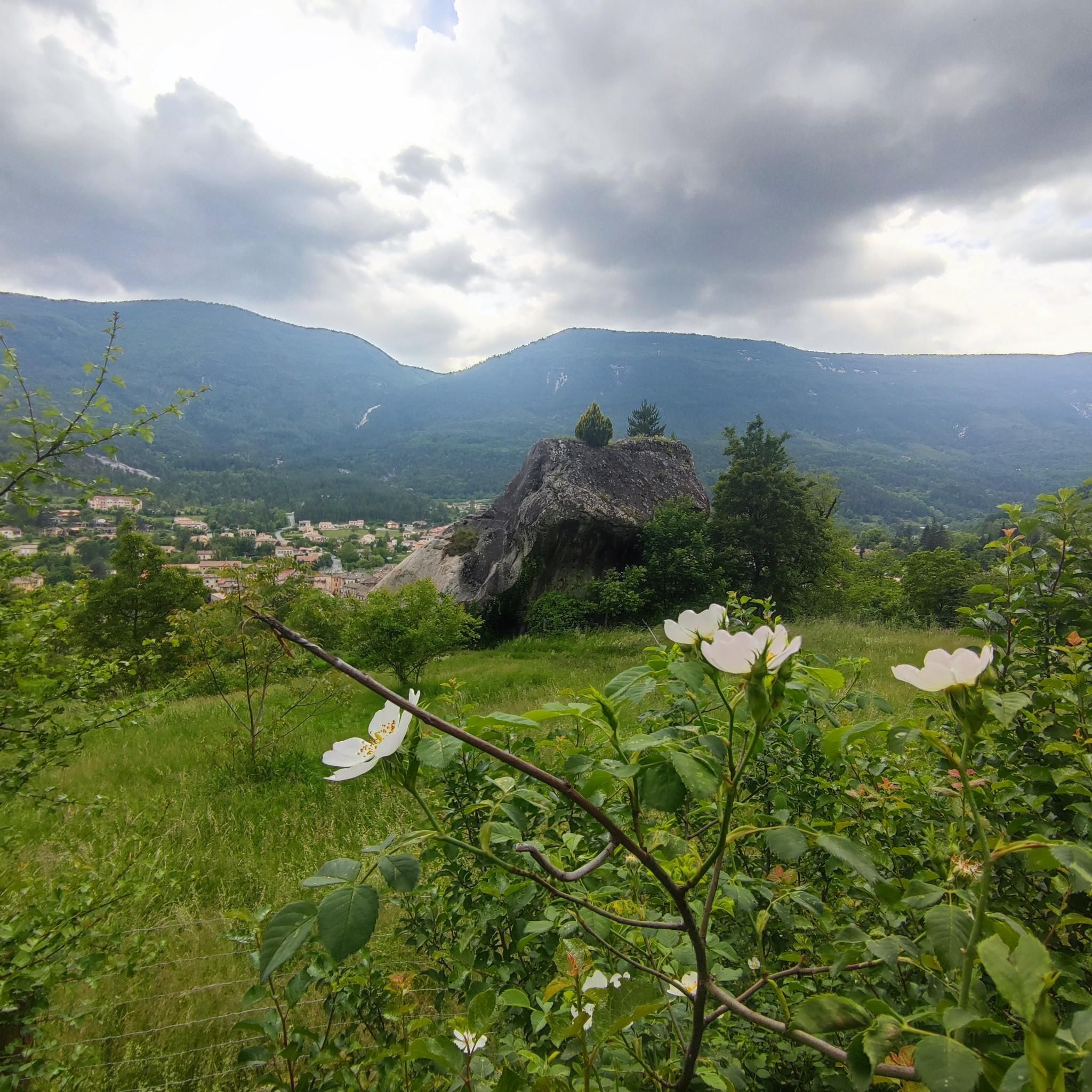
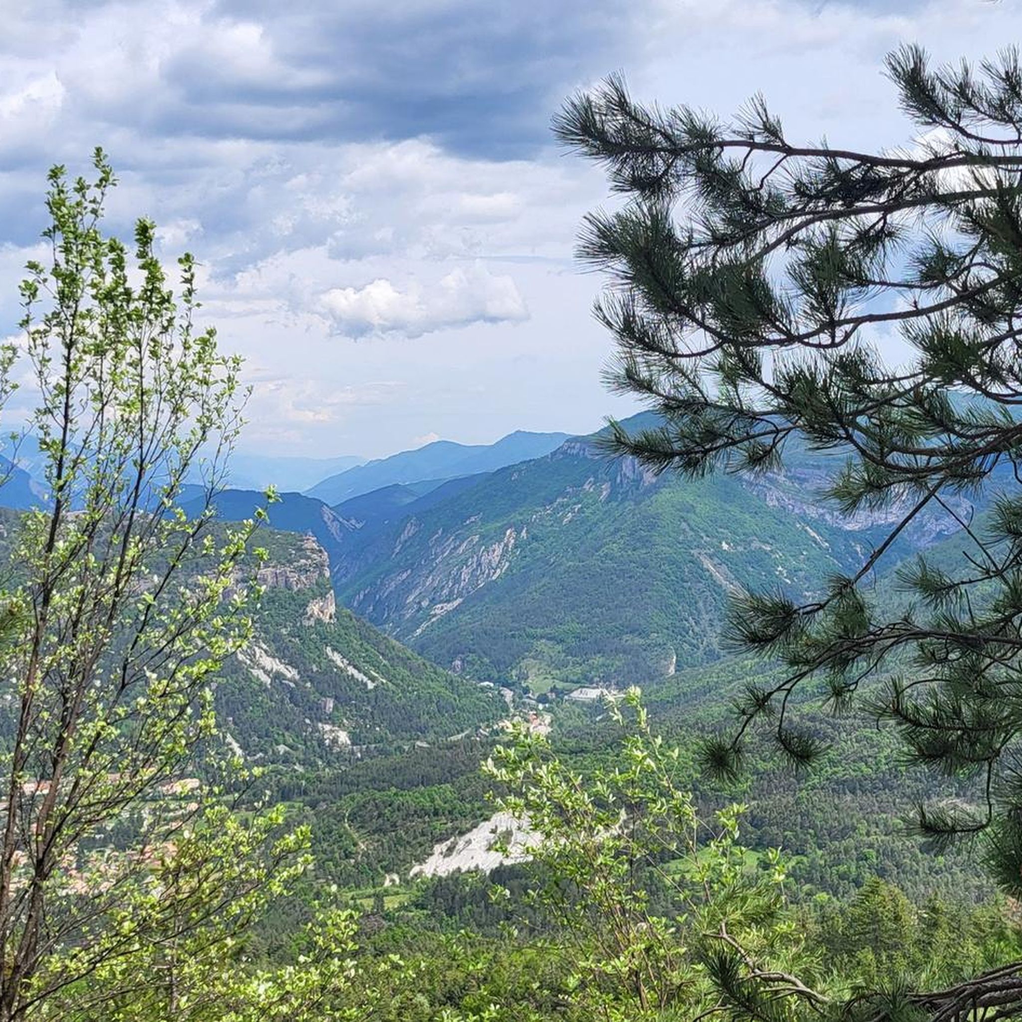
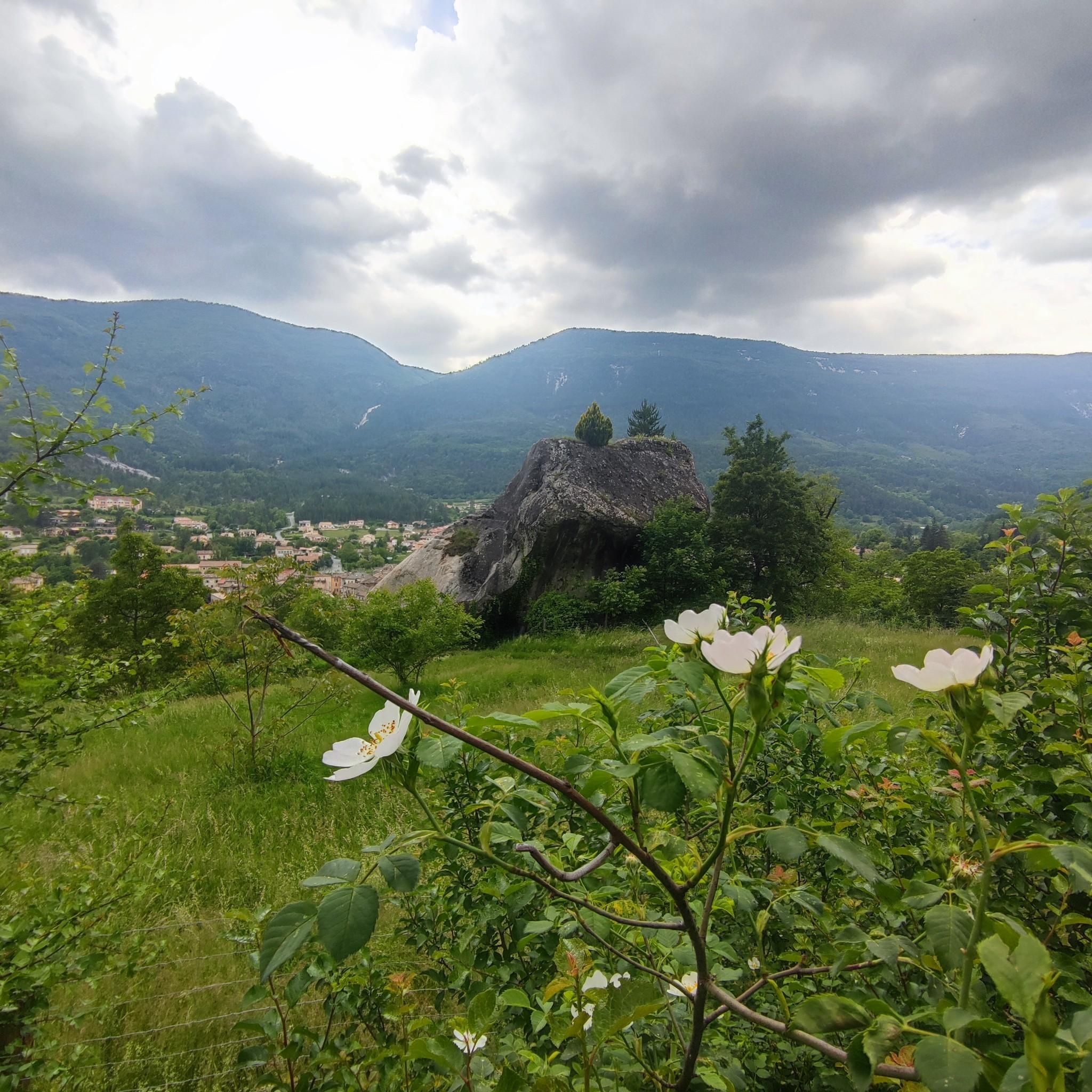
Tips from the Community

You can consult the town's website on the Grès d'Annot and scan the explanatory QR code at each terminal during your visit to this remarkable site.
0
0


A beautiful little village, from the village a long staircase starts that leads up to the castle that watches over the town.
15
0

In a meander of the Var, the citadel of Entrevaux stands on the sides of a rocky spur. At the top, the view of the village and the valley is breathtaking.
1
0

A must-visit if you are in the area.
0
0

Here you should have a head for heights. Includes warning sign. The path is wide enough and the height is impressive.
1
0

The city of Glanate was founded a few years before the start of the Christian era in a loop of the Var. From the 5th century, a bishopric was created there, which existed until the Revolution. What remains from this period is the choir of a Romanesque cathedral from the 12th century and episcopal buildings from the 18th century. The town then took the name Glandevès. The insecurity of the Middle Ages led the population to migrate to a rocky spur that was easy to defend and fortify. Located at the confluence of two valleys, Entrevaux was born, a fortified castle protected it. King François 1st made it a free royal town with privileges and exemption from taxes, which lasted until the Revolution in 1789. From this time dates the apogee of the city which then brought together around 1800 inhabitants (while the current population does not numbers more than 800 inhabitants). In the 17th century, under the warlike regime of Louis XIV, Vauban, military engineer and Marshal of France, reorganized the fortifications. He thus made it a place deemed impregnable. In 1704, during the War of the Spanish Succession, the fortress victoriously resisted the assaults of the troops of the Duke of Savoy, allied with the Emperor of Austria. During the Great War (1914-1918), the citadel served as a disciplinary prison for German officers. History has bequeathed to Entrevaux, narrow and tall houses, squares and fountains, triple row Genoese and many balconies, winding streets and awkward staircases, barracks and watchtowers, bridges and towers, guardhouses and loopholes, shops and shops, a Cathedral with sumptuous carved walnut doors, all witnesses of the active life of times gone by. Entrevaux is a piece of French history in the middle of terraced olive groves, set in massive limestone rocks. A magnificent village which deserves to be among the most beautiful villages in France.
2
0

Stroll through the village through its alleys and climb to the citadel, paying 3€
0
0
Frequently Asked Questions
What kind of terrain can I expect on the running trails around Annot?
The running trails around Annot are primarily characterized by the unique Grès d'Annot (Annot Sandstone) formations, which create dramatic cliffs and distinctive rock outcroppings. You'll also find yourself running through ancient chestnut forests, offering shaded paths, and along the scenic Vaire River Valley. Expect varied terrain with significant elevation changes, providing a good challenge for runners.
Are there any easy or beginner-friendly jogging routes in Annot?
While many routes in Annot feature significant elevation gain and are rated as difficult, there are options that might be more manageable for beginners or those looking for a less strenuous run. The region's trails offer a range of distances and ascents. For example, the View of the Valley – King's Chamber loop from Annot is a difficult route but at 5.5 km with 240m of elevation, it's one of the shorter options available.
What are the most scenic running routes in Annot, especially for viewpoints?
Annot is known for its panoramic views. Many routes offer magnificent vistas over the valley and surrounding mountains. The King's Chamber – View of the Valley loop from Annot is a popular choice, specifically highlighting valley views and passing by notable sandstone formations. Another excellent option is the Nice view – King's Chamber loop from Annot, which provides extensive views throughout its varied terrain.
Can I find circular jogging trails in Annot?
Yes, Annot offers several excellent circular jogging trails. Many of the popular routes, such as the King's Chamber – View of the Valley loop from Annot and the Le Baou d'Annot loop from Annot, are designed as loops, allowing you to start and finish in the same location without retracing your steps.
What interesting natural landmarks or attractions can I see while running in Annot?
Annot's landscape is rich with unique natural features. The most prominent are the Grès d'Annot (Annot Sandstone) formations, including specific playful rock formations like the King's Chamber and King's Gardens. You'll also run through ancient chestnut forests and alongside the Vaire River. Many routes offer panoramic views of the valley and mountains.
Are there any long-distance running trails for experienced runners in Annot?
For experienced runners seeking a longer challenge, Annot has several options. The Nice view – King's Chamber loop from Annot is a difficult 14.4 km path with significant elevation gain. Another demanding route is the Chamatte Peak loop from Vergons, which covers 13.6 km with over 770m of ascent.
What do other runners say about the jogging routes in Annot?
The running routes in Annot are highly regarded by the komoot community, with an average score of 4.5 stars from over 6 reviews. Nearly 300 runners have used komoot to explore the varied terrain, often praising the unique sandstone formations, the beauty of the ancient chestnut forests, and the challenging ascents that offer rewarding views.
What is the best time of year to go jogging in Annot?
The ancient chestnut forests provide a cool and magical ambiance, making them ideal for jogging, especially during warmer months. Spring and autumn offer pleasant temperatures and vibrant scenery. While specific winter routes aren't detailed, the region's mountainous nature suggests that conditions can vary significantly, so checking local weather is always advisable.
Are there any specific trails that are good for families or groups with children?
While many routes in Annot are rated as difficult due to elevation changes, some sections of the Sentier des Grès d'Annot are described as moderate up to the King's Chamber, winding through picturesque streets and beautiful chestnut forests. When planning a family outing, consider shorter loop options and always check the route's elevation profile and distance to ensure it's suitable for all participants.
How many running routes are available in the Annot area?
There are over 18 dedicated running routes available around Annot, catering to various preferences. These include 6 moderate and 12 difficult trails, ensuring options for different fitness levels and experiences.
Are there any organized running events or races in Annot?
Yes, Annot is known to host organized trail running events, such as the "Trail des Grès." These events typically feature routes of varying lengths and significant elevation changes (e.g., 10 km and 19 km with substantial D+), confirming Annot's suitability and appeal for dedicated trail runners and those seeking a challenge.
Where can I find more information about the unique Grès d'Annot sandstone formations?
The Grès d'Annot are a defining feature of the region. You can experience these geological curiosities along various marked trails. For more detailed information on the pedestrian sports itinerary through the Grès d'Annot, you can visit the local tourism site: tourisme-alpes-haute-provence.com.
Most popular attractions around Annot

Get inspired with the komoot mobile app


Explore more
Browse the best Running Trails & Routes in other regions.
