The best cycling routes around Eglingen
4.5
(363)
3,359
riders
286
rides
Touring cycling around Eglingen is set within the diverse and scenic Swabian Alb region of Baden-Württemberg, Germany. The area features rolling hills and valleys, providing varied terrain for cyclists. Cyclists can expect to encounter vibrant rapeseed fields, extensive forests, and meadows, indicative of its biosphere area status. The region is also known for its geological formations and panoramic viewpoints.
Best touring cycling routes around Eglingen
- The most popular touring cycling route is Illfurth lock – Heidwiller lock loop from Saint-Bernard…
Last updated: October 5, 2026
4.2
(12)
86
riders
65.6km
03:49
320m
320m
Moderate bike ride. Good fitness required. Mostly paved surfaces. Suitable for all skill levels.
5.0
(2)
11
riders
17.9km
01:04
110m
110m
Easy bike ride. Great for any fitness level. Mostly paved surfaces. Suitable for all skill levels.

13
riders
14.6km
00:49
30m
30m
Easy bike ride. Great for any fitness level. Mostly paved surfaces. Suitable for all skill levels.
9
riders
17.6km
01:14
200m
200m
Moderate bike ride. Good fitness required. Mostly paved surfaces. Suitable for all skill levels.
12
riders
10.7km
00:36
30m
30m
Easy bike ride. Great for any fitness level. Mostly paved surfaces. Suitable for all skill levels.
Get access to more routes and recommendations from other explorers.
Already have an account?
Our route recommendations are based on thousands of hikes, rides, and runs completed by other people on komoot.
Start today with a free account
Your next adventure awaits.

Tips from the Community

Altkirch Altkirch is the historic capital of the Sundgau and lies on a striking rocky spur above the valley of the Ill. The town's origins date back to the Middle Ages. The Counts of Ferrette built Altkirch into a fortified town; from 1215 onwards, it was protected by town walls and towers. The characteristic layout, narrow streets, and remnants of the fortifications have been preserved from this medieval town plan to this day. Particularly worth seeing is the Vieille Porte, a former town gate from around 1245. For centuries, Altkirch was an important administrative and commercial center of the Sundgau. After the destructions of the Thirty Years' War, numerous buildings were newly erected. The representative town hall dates from the 18th century, built in 1778 according to plans by the Swabian architect Jean Nissler. In the 19th century, the town continued to develop: alongside its traditional importance as a market and trading place, industrial enterprises emerged, including the well-known Gilardoni brickworks. The 20th century also left its mark. After the First World War, Altkirch became part of the re-Frenchified Alsace. The memory of this period is evident, among other things, at the Vieille Porte, where a Borne Vauthier commemorates the former front line of 1918. The original Altkirch war memorial from 1927 was destroyed during the German occupation in the Second World War; preserved parts were later integrated into a new memorial. Today, Altkirch, with around 6,000 inhabitants, is an important center of the Sundgau. The historic upper town with its old houses, remnants of fortifications, the town hall, and the Sundgau Museum continues to shape the townscape. Source: Ville d’Altkirch – History of the town
0
0
Bahnhof Burnhaupt-le-Haut The Bahnhof Burnhaupt-le-Haut is located on the former railway line from Cernay to Sewen, which led through the Dollertal. The line was built in the 19th century and was of great importance for passenger and freight transport in the region. During the First World War, the station gained particular strategic importance. Burnhaupt was located immediately behind or close to the front line between German and French troops. The railway was used to transport soldiers, weapons, ammunition, and other supplies. Due to the fighting, the station was heavily damaged. After the war, the station building was rebuilt between 1921 and 1923. A building typical of the region with elements of Alsatian architecture was created. The station has largely been preserved to this day and serves as a reminder of the importance of the railway for the region's development and the destruction of the First World War. Regular passenger service on the line was discontinued in 1967, and the line was later closed. Part of the former railway line is now operated as a museum railway by Train Thur Doller Alsace. Historic locomotives and wagons run on the line through the Dollertal, making the history of the railway tangible for visitors. The Bahnhof Burnhaupt-le-Haut is therefore not only a former transport hub, but also a historic site where the history of the region, the railway, and the First World War converge. Further information and historical photos: Train Thur Doller Alsace – Bahnhof Burnhaupt
0
0
At the gate, a so-called Borne Vauthier can be seen in the middle. These memorial stones mark the course of the Western Front in World War I and, in particular, the position that German troops had reached on July 18, 1918 – the furthest extent of their advance at that time. The stones are named after the French sculptor and former soldier Paul Moreau-Vauthier. A total of 118 such Bornes were created between 1921 and 1927: 96 in France and 22 in Belgium. Originally, significantly more locations were planned. The stones were erected along a front line from the Belgian coast to the Franco-Swiss border. The monoliths, about one meter high, are mostly made of pink granite. On their top, there is a soldier's helmet on a laurel wreath. The sides depict typical soldier's equipment, including a gas mask, a canteen, and hand grenades. Many stones bear the inscription “Ici fut repoussé l’envahisseur 1918” – “Here the invader was repulsed in 1918”. The Bornes Vauthier are therefore not only monuments but also historical landmarks: they make the former front line visible in the terrain and commemorate the battles of 1918. However, it is important to note that they are not located exactly on the former front line everywhere, as some stones were moved for practical reasons, for example, to roads or intersections.
0
0

calm and well-rolling section
0
0

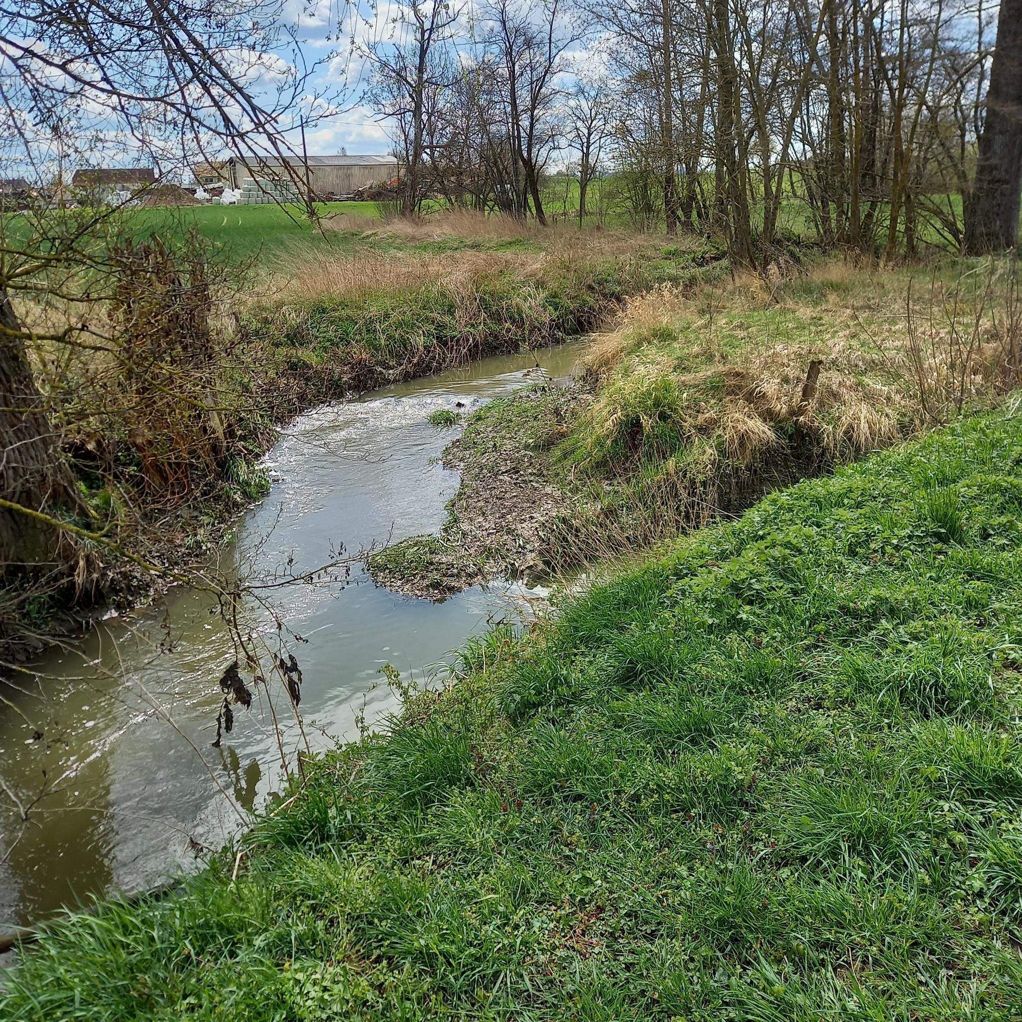
The French and European National Cycleway is a great cycleway winding along side of the Rhine Rhone Canal with very little climbing, for those who do not like to climb. However those who are climbing shy, must be aware of the wind in this area. A lot of the locks still have the former lock man’s house which adds a bit of charm to every lock. One is never alone on this route as there is a constant passing of bicycles, both leisure and racing bikes.
0
0
The Rhine Rhone Cycleway is part of the National French and European Cycleway. This stretch of the cycleway has excellent smooth asphalted pavement. There are some nice restaurants and cafés along the way which are sometimes hidden but can easily be found on the map.
1
0

Restaurant in Dannemarie on EV6.
0
0

The Port fluvial de Dannemarie is no ordinary marina – it’s an unexpected oasis along the canal, where boats bob gently and herons keep watch. For cyclists, it feels like a little refuge: a place to take a break from the rhythm of your pedals and take on the rhythm of the water. Here you can refill your water bottle, stretch your legs on a bench in the shade or a little further away at the restaurant, or just watch the sun play on the surface of the canal.
9
1
Frequently Asked Questions
How many touring cycling routes are available around Eglingen?
There are over 300 touring cycling routes around Eglingen, offering a wide variety of options for different skill levels and preferences. This includes 75 easy routes, 156 moderate routes, and 69 difficult routes.
What kind of terrain can I expect when touring cycling around Eglingen?
The terrain around Eglingen, situated in the Swabian Alb region, is characterized by rolling hills and valleys, providing varied and engaging routes. You'll encounter a mix of open fields, vibrant rapeseed fields, and extensive forested areas, reflecting its status as a biosphere area. Some routes, like the Eglingen–Demmingen Country Road, offer good asphalt sections, while others may include unpaved parts.
What is the best time of year for touring cycling in Eglingen?
The Swabian Alb region, including Eglingen, is beautiful throughout the warmer months. Spring brings vibrant rapeseed fields, while summer offers pleasant temperatures for longer rides. Autumn provides stunning foliage. It's always a good idea to check local weather forecasts before heading out, especially after rain, as some unpaved sections might be muddy.
Are there routes suitable for beginners or less experienced cyclists?
Yes, Eglingen offers 75 easy touring cycling routes. For example, the Illfurth lock – Heidwiller lock loop from Saint-Bernard is an easy 9.3-mile (14.96 km) trail with minimal elevation gain, perfect for a relaxed ride. Another gentle option is the EuroVelo 6 in Dannemarie – Port of Dannemarie loop from Balschwiller, an 11.1-mile (17.94 km) path with a gentle ascent.
Are there challenging routes for experienced touring cyclists?
Yes, for experienced touring cyclists seeking more challenge, there are 69 difficult routes available around Eglingen. These routes typically feature more significant elevation changes and cover longer distances, providing a more strenuous workout amidst the scenic Swabian Alb landscape.
What do other cyclists say about the touring routes in Eglingen?
The touring cycling routes around Eglingen are highly rated by the komoot community, with an average score of 4.5 stars from over 360 reviews. More than 3300 touring cyclists have used komoot to explore the varied terrain, often praising the diverse landscapes, from rolling hills to open fields and forests.
Are there any circular touring cycling routes around Eglingen?
Many of the touring cycling routes around Eglingen are designed as loops, allowing you to start and end at the same point. Examples include the easy Canal bridge and lock – Port of Dannemarie loop from Hagenbach, which is 6.6 miles (10.67 km) long, or the moderate Beautiful view – Saint-Morand Priory loop from Aspach, covering 17.03 km with more elevation.
Can I find routes with scenic viewpoints or natural features?
Absolutely. The Swabian Alb region is known for its impressive rock formations, geological features, and panoramic viewpoints. While cycling around Eglingen, you'll encounter picturesque natural features like rolling hills, valleys, extensive forests, and vibrant rapeseed fields, especially within the Hohenstein area. These offer beautiful backdrops and scenic vistas throughout your ride.
Are there any interesting places or landmarks to explore along the routes?
Yes, the area around Eglingen offers several interesting landmarks. You might pass by the historic Port of Dannemarie, the Zillisheim Drawbridge and Lock No. 35, or even the Grand Cannon of Zillisheim. For natural beauty, you could explore highlights like Riedweiher Pond or the Pond and Cabin between Fulleren and Carspach.
Are the touring cycling routes around Eglingen family-friendly?
Many of the easy and moderate routes around Eglingen are suitable for families, especially those with minimal elevation gain and well-maintained surfaces. The region's extensive network of quality-certified cycle routes in Baden-Württemberg often includes paths that are safe and enjoyable for all ages. Look for routes marked as 'easy' for the most family-friendly options.
Can I bring my dog on touring cycling routes in Eglingen?
While many outdoor areas in Baden-Württemberg are dog-friendly, specific rules can vary by route or protected area. Generally, dogs are welcome on leashes on most public paths. It's advisable to check local regulations for any specific route you plan to take, especially within nature reserves or biosphere areas, to ensure a pleasant experience for both you and your pet.
Are there options for parking or public transport access to the cycling routes?
Eglingen is part of Baden-Württemberg, which has a well-developed infrastructure. While specific parking details for each route vary, many trailheads or nearby towns offer parking facilities. For public transport, Baden-Württemberg's regional network often allows for bike transport, though it's best to check schedules and specific regulations with local transport providers before planning your trip.
Are there cafes or pubs near the cycling routes in Eglingen?
The Swabian Alb region is dotted with charming towns and villages. While specific cafes or pubs directly on every route might vary, you'll often find opportunities to stop for refreshments in the communities you pass through. Many routes are designed to connect with local amenities, allowing cyclists to enjoy regional cuisine and hospitality.
Most popular attractions around Eglingen

Get inspired with the komoot mobile app


Explore more
Browse the best Cycling routes in other regions.
