The best cycling routes around Fontpédrouse
4.4
(100)
4,124
riders
87
rides
Touring cycling routes around Fontpédrouse traverse the diverse landscapes of the Catalan Pyrenees Regional Natural Park. The region features a varied terrain, from rocky peaks and high mountain passes to lush river valleys and dense forests. Cyclists can expect routes that navigate through open pastures and alongside winding rivers, offering a range of elevations. The area is characterized by its mountainous environment, providing both challenging ascents and scenic descents.
Best touring cycling routes around Fontpédrouse
- The most popular touring cycling route is Pont Nou (New Bridge) – Pont Nou of Camprodon loop from Vallter 2000, a 26.9 miles (43.3 km) trail that takes 3 hours 19 minutes to complete. This route features significant elevation gain through mountainous terrain.
- Another top favourite among local touring cyclists is Col du Calvaire (Font-Romeu) – Font-Romeu loop from Mont-Louis - La Cabanasse, a difficult 16.5 miles (26.5 km) path. This route offers views of the Pyrenees as it climbs towards the Col du Calvaire.
- Local touring cyclists also love the Font Biel Rivera loop from Vallter 2000, a 12.8 miles (20.6 km) trail leading through mountain landscapes, often completed in about 1 hour 47 minutes.
- Touring cycling around Fontpédrouse is defined by mountain passes, river valleys, and dense forests. The network offers options for various ability levels, from moderate road rides to challenging multi-hour routes.
- The routes in Fontpédrouse are highly rated by the komoot community with an average score of 4.2 stars from more than 100 reviews. More than 3000 touring cyclists have used komoot to explore Fontpédrouse's varied terrain.
Last updated: October 5, 2026
5.0
(2)
298
riders
43.1km
03:16
1,090m
1,090m
Hard bike ride. Very good fitness required. You may need to push your bike for some segments of this route.
4.7
(6)
70
riders
Hard bike ride. Very good fitness required. You may need to push your bike for some segments of this route.

5.0
(1)
53
riders
20.6km
01:48
750m
750m
Hard bike ride. Very good fitness required. Mostly paved surfaces. Suitable for all skill levels.
39
riders
136km
10:25
3,430m
3,430m
Hard bike ride. Very good fitness required. Mostly paved surfaces. Suitable for all skill levels.
13
riders
31.8km
02:14
630m
630m
Hard bike ride. Very good fitness required. Mostly paved surfaces. Suitable for all skill levels.
Get access to more routes and recommendations from other explorers.
Already have an account?
Our route recommendations are based on thousands of hikes, rides, and runs completed by other people on komoot.
Start today with a free account
Your next adventure awaits.
Popular around Fontpédrouse

The Crossing of the Pyrenees via the GR 10 — Eastern Pyrenees

On wild ridges: Catalonia to Ariège – Hexatrek, Eastern Pyrenees
Road Cycling Routes around Fontpédrouse
Running Trails around Fontpédrouse
Hiking around Fontpédrouse
MTB Trails around Fontpédrouse
Gravel biking around Fontpédrouse

Mountain Hikes around Fontpédrouse

Tips from the Community

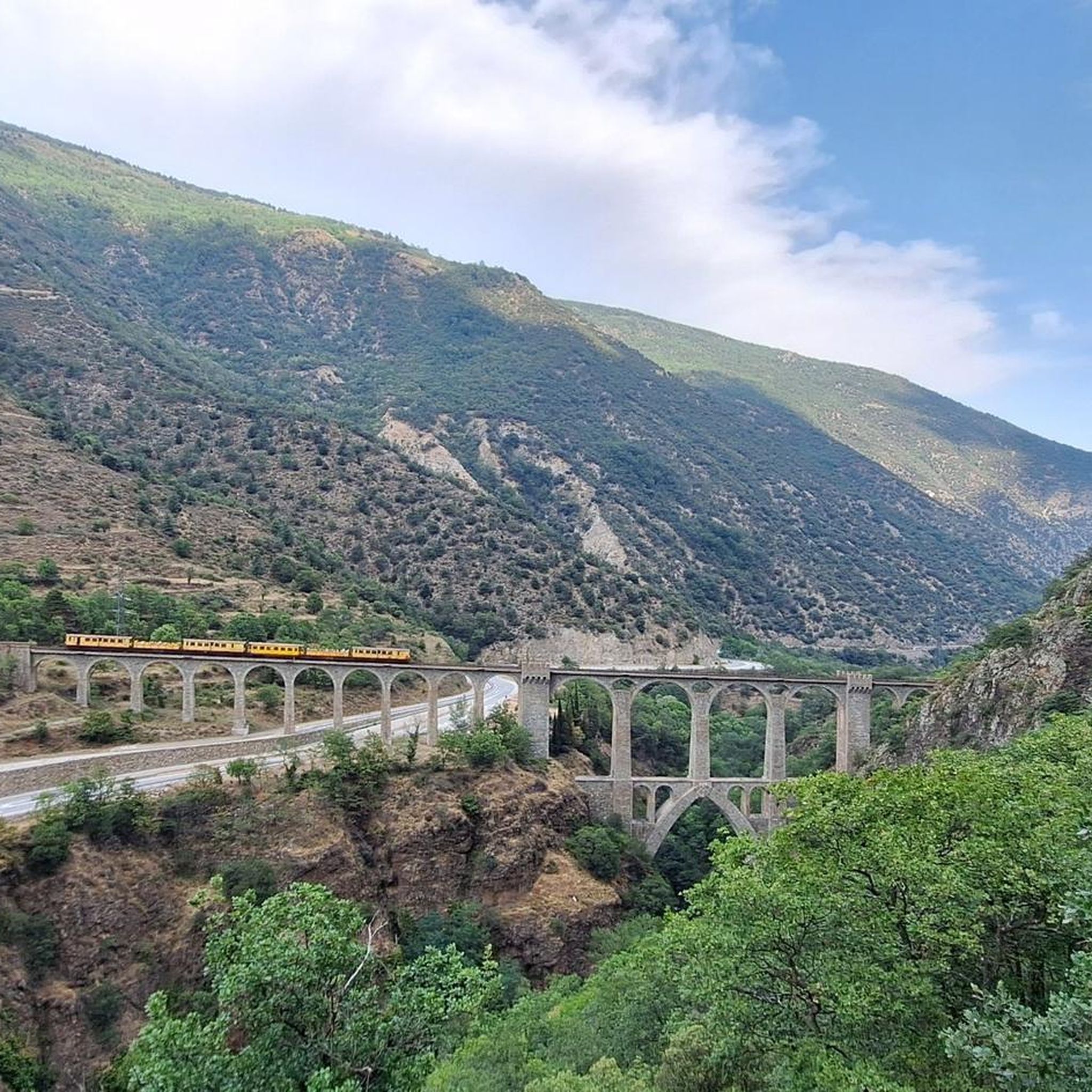
View of the impressive bridge.
0
0

Located inconspicuously next to the road, a small Stations of the Cross lead to Mount Calvary. A magnificent view from the top.
0
0

Well, starting from Font Romeu and breaking legs from Mont Louis
0
0

Camprodon is a small town in the province of Girona with a long history behind it: it was taken and burned in several wars over the centuries. Today, it is a quiet place located in the valley where the Ter and Ritort rivers meet.
1
0


Frequently Asked Questions
How many touring cycling routes are available around Fontpédrouse?
Fontpédrouse offers a wide selection of touring cycling routes, with over 90 different options to explore. These routes cater to various skill levels, including 14 easy, 28 moderate, and 50 difficult trails, ensuring there's something for every cyclist.
What is the best time of year for touring cycling in Fontpédrouse?
The best time for touring cycling in Fontpédrouse is generally from spring through autumn. During these seasons, you'll experience more favorable weather conditions for tackling the diverse landscapes, from high mountain passes to river valleys. Winter cycling is possible but often involves snowy conditions, especially at higher elevations.
What kind of landscapes will I experience while cycling near Fontpédrouse?
While cycling near Fontpédrouse, you'll traverse the diverse landscapes of the Catalan Pyrenees Regional Natural Park. Expect a mix of stunning scenery, including rocky peaks, lush green mountains, beautiful lakes, and winding rivers. The routes often lead through dense forests, open pastures, and dramatic river valleys, offering ever-changing views of the majestic Pyrenees.
Are there touring cycling routes suitable for beginners or families in Fontpédrouse?
Yes, Fontpédrouse offers several touring cycling routes suitable for beginners and families. There are 14 easy routes available, providing gentler terrain to enjoy the region's beauty. For example, the area features moderate road rides with manageable elevation gains, perfect for a relaxed family outing.
Where can I find challenging touring cycling routes in the Fontpédrouse area?
For advanced riders seeking a challenge, Fontpédrouse is an excellent base. The region is known for its iconic mountain passes and offers 50 difficult touring cycling routes. A particularly demanding option is the Coll d'Arès – Pont Nou of Camprodon loop from Vallter 2000, which covers 78.4 km with significant elevation gain. Another challenging route is the Pont Nou (New Bridge) – Pont Nou of Camprodon loop from Vallter 2000, a 43.3 km trail with substantial climbing through mountainous terrain.
Are there any long-distance touring cycling routes that pass through Fontpédrouse?
Yes, Fontpédrouse is connected to larger cycling networks. The Pyrénées Méditerranée territory, which includes this area, is crossed by the EuroVelo 8 (Mediterranean Cycle Route) and the Pirinexus, a cross-border loop exploring both French and Spanish Catalonia. Additionally, the Vélosud, a 650km route along the Pyrenees foothills, offers a more relaxed long-distance alternative. You can find more information about cycling in the wider region at tourisme-pyrenees-mediterranee.com and about the Vélosud at francevelotourisme.com.
Can I find circular touring cycling routes around Fontpédrouse?
Yes, many touring cycling routes around Fontpédrouse are designed as loops, allowing you to start and end at the same point. For instance, the Col du Calvaire (Font-Romeu) – Font-Romeu loop from Mont-Louis - La Cabanasse is a difficult 26.5 km circular path offering views of the Pyrenees. Another option is the Font Biel Rivera loop from Vallter 2000, a 20.6 km trail through mountain landscapes.
What interesting landmarks or natural attractions can I see along the touring cycling routes?
The touring cycling routes around Fontpédrouse offer access to several natural wonders and landmarks. You can explore spectacular canyons like the Carança Corniche and the Footbridges of the Carançà Gorge, including a Suspension bridge over the Carança Gorge. The region is also home to several mountain passes, such as Col de la Perche (1,579 m) and Col du Calvaire (Font-Romeu), which offer rewarding views.
Are there options for relaxing after a day of cycling in Fontpédrouse?
Absolutely. After a day of exploring the touring cycling routes, you can unwind at the Bains de Saint-Thomas. These thermal baths feature outdoor pools with naturally warm, sulfur-rich waters, along with jacuzzis and massage jets, providing a perfect opportunity for relaxation and recovery.
What do other touring cyclists enjoy most about cycling in Fontpédrouse?
The touring cycling routes in Fontpédrouse are highly rated by the komoot community, with an average score of 4.2 stars from over 100 reviews. Cyclists often praise the diverse terrain, from challenging mountain passes to serene river valleys, and the stunning natural beauty of the Catalan Pyrenees. The variety of routes ensures that both casual riders and experienced cyclists find suitable options.
Is public transport available to Fontpédrouse for cyclists with bikes?
While specific public transport options for bikes can vary, the region is known for the iconic Train Jaune (Yellow Train). This historic railway often accommodates bikes, providing a unique way to access different parts of the Pyrenees-Orientales region. It's advisable to check current schedules and bike policies directly with the service provider before planning your trip.
Are there any specific permits required for cycling in the Pyrenees-Orientales region around Fontpédrouse?
Generally, no specific permits are required for touring cycling on public roads and marked trails in the Pyrenees-Orientales region. However, if you plan to cycle through protected natural areas or private land, it's always best to check with local authorities or the Catalan Pyrenees Regional Natural Park for any specific regulations or access restrictions that might apply.
Most popular routes around Fontpédrouse
Most popular attractions around Fontpédrouse

Get inspired with the komoot mobile app


Explore more
Browse the best Cycling routes in other regions.
