The best walks and hikes around Bouconville-Vauclair
4.3
(392)
1,564
hikers
17
hikes
Hiking around Bouconville-Vauclair offers diverse landscapes, including significant forested areas like the Forêt de Vauclair and water features such as the Monks' Pond and Lake Ailette. The region's topography includes elevated points providing viewpoints, alongside historical sites like the Abbaye de Vauclair ruins and areas connected to the Chemin des Dames. Trails traverse varied terrain, from gentle paths around ponds to routes through former village sites.
Best hiking trails around Bouconville-Vauclair
- The most popular hiking route is Monument du village…
Last updated: October 24, 2026
4.5
(19)
72
hikers
11.5km
03:06
150m
140m
Hike a moderate 7.1-mile loop near Bouconville-Vauclair, exploring historical sites like the Ailles village monument and Vauclair Abbey Ruin
4.5
(33)
89
hikers
10.2km
02:41
90m
90m
Moderate hike. Good fitness required. Easily walkable paths.

3.8
(4)
30
hikers
5.17km
01:24
70m
70m
Easy hike. Easily walkable paths.
4.2
(11)
55
hikers
11.7km
03:07
120m
130m
Moderate hike. Good fitness required. Easily walkable paths.
4.2
(5)
12
hikers
15.7km
04:17
230m
240m
Moderate hike. Good fitness required. Easily walkable paths.
Get access to more routes and recommendations from other explorers.
Already have an account?
Our route recommendations are based on thousands of hikes, rides, and runs completed by other people on komoot.
Start today with a free account
Your next adventure awaits.
Tips from the Community

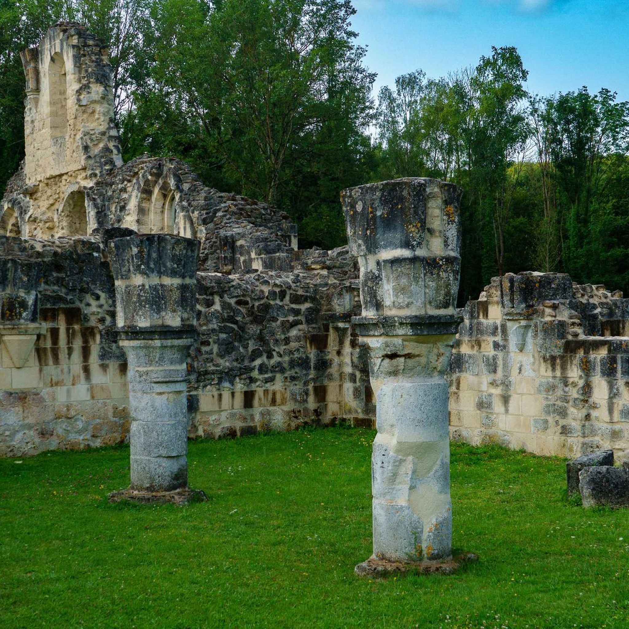
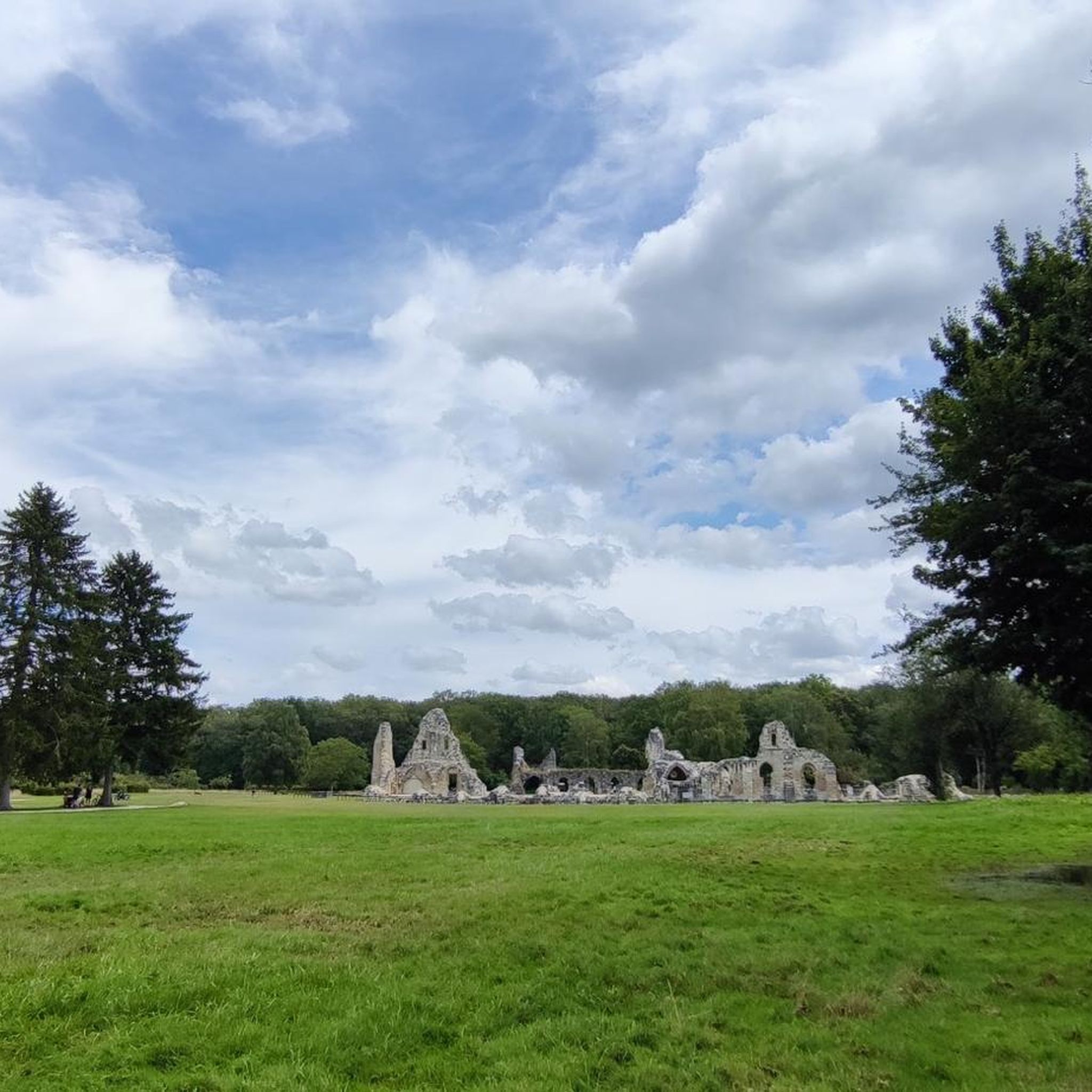
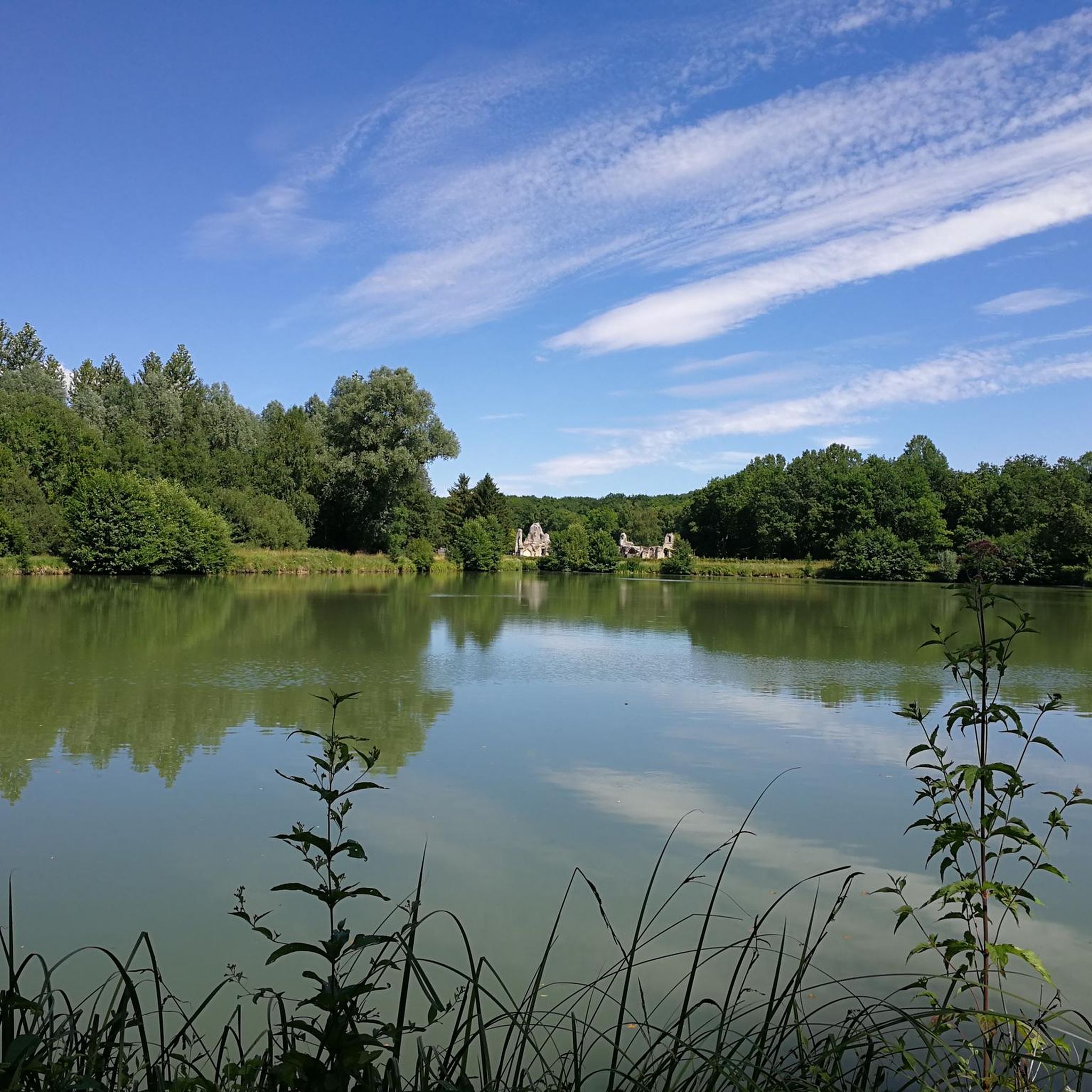
The Vauclair Abbey near Bouconville-Vauclair in the Aisne department was founded in 1134 by Bernard of Clairvaux as a Cistercian monastery. In the Middle Ages, it developed into an important monastic complex; it was significantly expanded, particularly in the 13th century. During the First World War, Vauclair was located directly in the combat zone of the Chemin des Dames and was almost completely destroyed by artillery fire in 1917. The ruins visible today have been archaeologically investigated, excavated, and partially secured since the 1960s. Directly next to the ruins, there is now a medicinal herb garden with around 400 species and a conservation orchard. This verger conservatoire preserves old regional apple and pear varieties; according to the French Garden Association, there are about 84 different varieties represented there. Together with the monastery ruins, the site thus commemorates not only the history of the Cistercians but also their close connection to agriculture, horticulture, and botany.
1
0

In 1914, the peasant village of Ailles covered about 340 hectares, one third of which was forest. 61 houses were grouped around the church of Saint-Martin. The population was declining: in the 1901 census there were still 147 inhabitants, while in 1911 there were only 118. In honor of the Battle of Craonne, a magnificent elm had been planted on March 7, 1814. A century later, it witnessed a new battlefield as French and German shells wiped the village off the map...
1
0
Hidden in the middle of the forest, this Cistercian abbey, founded in 1134 by Bernard of Clairvaux, appears like a mirage. Its majestic ruins bear witness to a turbulent past. From the Hundred Years' War and the French Revolution to the First World War, the abbey suffered considerable destruction. In the 1960s, the site was overgrown with brambles and forgotten. Thanks to the archaeological excavation group "Sources" led by Father Courtois, it experienced a rebirth.
2
0
The observation tower, inaugurated on April 16, 2013, overlooks the Plateau de Californie, a strategic site of the battles of the Chemin des Dames. The 20-meter-high, freely accessible tower offers a historical insight into the landscape and recalls the importance of the heights during the war. It also offers visitors who climb it an unparalleled view of the village of Craonne below, but also of the Chemin des Dames and the Champagne plain... The observation tower is topped with a blue beacon that is activated at night, thus forming a monument in the landscape. During the day, it allows one to survey the plain of Reims, while at night, conversely, it is visible from this plain. The structure of the tower consists of a spatially modular wooden Mikado, whose arrangement has been chosen according to the configuration of the terrain and the orientation of the viewpoints. The dimensions of the steps and handrails facilitate the climb and mitigate the feeling of vertigo that may arise. For this structure built amidst trees, wood was the obvious material. Renewable materials were selected: glued laminated timber from pine for the long supports, posts and beams from larch, larch wood for the steps, and tropical woods (Massaranduba, Cumaru, Ipé, Doussié…) for the platforms and railings. These woods, originating from French Guiana, are certified and their extraction is controlled. Source and further information: https://www.chemindesdames.fr/
1
0
The Plateau de Californie in the heart of the Chemin des Dames is, like Verdun, a symbolic site of the First World War. However, while Verdun was quickly elevated to a national symbol of victory, the Plateau de Californie and the Chemin des Dames were long associated with the bitter failure of the Nivelle Offensive in April 1917, the subsequent mutinies, and the collapse in the summer of 1918, and were subjected to a process of exclusion, forgetting, and repression after the First World War. Before 1914, the Plateau de Californie, above the former village of Craonne, was a place for walks and recreation. After the war, pine trees were planted on the plateau, classified as a "red zone", as the land could no longer be cultivated. Today's visitors can follow the marked paths, discovering remnants of trenches and shell craters. Thematic information panels on the First World War, reading panels, and panoramic views of the Aisne valley now line the plateau along this marked hiking trail. Source: https://www.chemindesdames.fr
1
0

Beautiful quiet place for a walk
0
0

This stone statue of Napoleon I , sculpted by Georges Thurotte in 1974, commemorates the victory of the French armies at Craonne against the Russian and Prussian armies of General Blücher on March 7, 1814 . It was built on the site of the Vauclair mill which served as an observation post during this battle...
0
0
Inaugurated on April 16, 2013, the observation tower overlooks the Plateau de Californie, a strategic location during the war on the Chemin des Dames. Standing at a height of 20 meters and freely accessible, it offers a historical perspective on the landscapes and serves as a reminder of the importance of high points during the war. It also offers visitors who climb it an incomparable view of the village of Craonne below, as well as the Chemin des Dames and the Champagne plain. Equipped at its summit with a blue lighthouse, put into operation at night, the observation tower constitutes a beacon of memory in the landscape. Allowing a view of the plain of Reims during the day, it is, in a reverse movement, visible at night from this plain.
0
0
Frequently Asked Questions
How many hiking trails are available around Bouconville-Vauclair?
Bouconville-Vauclair offers a good selection of hiking routes, with over 15 trails to explore. These include a mix of easy, moderate, and more challenging options.
Are there hiking options for beginners or those looking for an easy walk?
Yes, Bouconville-Vauclair has several easy hiking trails. For instance, the Monks' Pond – Ruins of Vauclair Abbey loop from Bouconville-Vauclair is an easy 6.3 km (3.9 miles) route that takes about 1 hour 44 minutes, leading through tranquil areas and past historical ruins with minimal elevation changes.
What kind of terrain can I expect on hikes in Bouconville-Vauclair?
Hikers in Bouconville-Vauclair can expect varied terrain, including significant forested areas like the Forêt de Vauclair. Many routes feature serene water bodies such as the Monks' Pond and Lake Ailette, alongside elevated points that offer scenic views. You'll also encounter paths through historical sites and former village locations.
Are there historical sites or landmarks I can visit while hiking in Bouconville-Vauclair?
Absolutely. The region is rich in history, particularly related to World War I. You can explore the remnants of the Vauclair Abbey Ruins, which are integrated into several hiking routes. The Chemin des Dames area also features trails that allow reflection on its past, including the California Plateau – Vauclair Abbey Ruins loop from Bouconville-Vauclair, which passes through sections with explanatory panels about the battles.
Can I find trails that feature water bodies like lakes or ponds?
Yes, several trails incorporate picturesque water features. The Monks' Pond is a central feature for many routes, offering tranquil scenery. You can also find longer treks that include the larger Lake Ailette, such as the Monks' Pond – Lake Ailette loop from Bouconville-Vauclair.
Are there any circular hiking routes in the area?
Many of the hiking routes around Bouconville-Vauclair are circular, offering convenient starting and ending points. Examples include the Monument du village d'Ailles et abbaye de Vauclair — boucle depuis Bouconville-Vauclair and the Ailette Lake – Lake Ailette loop from Bouconville-Vauclair.
Are the hiking trails in Bouconville-Vauclair suitable for families with children?
Yes, some trails are suitable for families. The Plateau de Californie offers an instructive walk through the Forêt de Vauclair with explanatory panels about historical events, making it a good option for families. Shorter, easier loops like the Monks' Pond – Ruins of Vauclair Abbey loop from Bouconville-Vauclair are also family-friendly due to their minimal elevation changes.
Are dogs allowed on the hiking trails in Bouconville-Vauclair?
Generally, dogs are welcome on many of the hiking trails in Bouconville-Vauclair. However, it's always recommended to keep them on a leash, especially in forested areas or near historical sites, and to check for any specific local regulations or signage along your chosen route.
What do other hikers say about the trails in Bouconville-Vauclair?
The hiking routes in Bouconville-Vauclair are highly rated by the komoot community, with an average score of 4.4 stars from over 300 reviews. Hikers often praise the diverse landscapes, the blend of natural beauty with historical significance, and the well-maintained paths that cater to various fitness levels.
Are there any longer, more challenging hikes for experienced trekkers?
While many routes are moderate, there are options for longer treks. For example, the Monks' Pond – Lake Ailette loop from Bouconville-Vauclair covers 15.7 km (9.8 miles) and involves more elevation, providing a more demanding experience for those seeking a longer adventure.
Is public transport available to reach trailheads in Bouconville-Vauclair?
Public transport options directly to specific trailheads in Bouconville-Vauclair may be limited. It is generally recommended to travel by car to access the starting points of many hikes, as this offers the most flexibility. Parking is usually available near popular trailheads and attractions like the Abbaye de Vauclair.
What is the best time of year to go hiking in Bouconville-Vauclair?
The best time for hiking in Bouconville-Vauclair is typically from spring through autumn. During these seasons, the weather is generally pleasant, and the natural landscapes, including the forests and water features, are at their most vibrant. Winter hiking is possible but may require appropriate gear due to colder temperatures and potential for muddy or icy conditions.
Most popular routes around Bouconville-Vauclair
Most popular attractions around Bouconville-Vauclair

Get inspired with the komoot mobile app


Explore more
Browse the best Hikes in other regions.
