The best cycling routes around Brändö
4.8
(20)
191
riders
10
rides
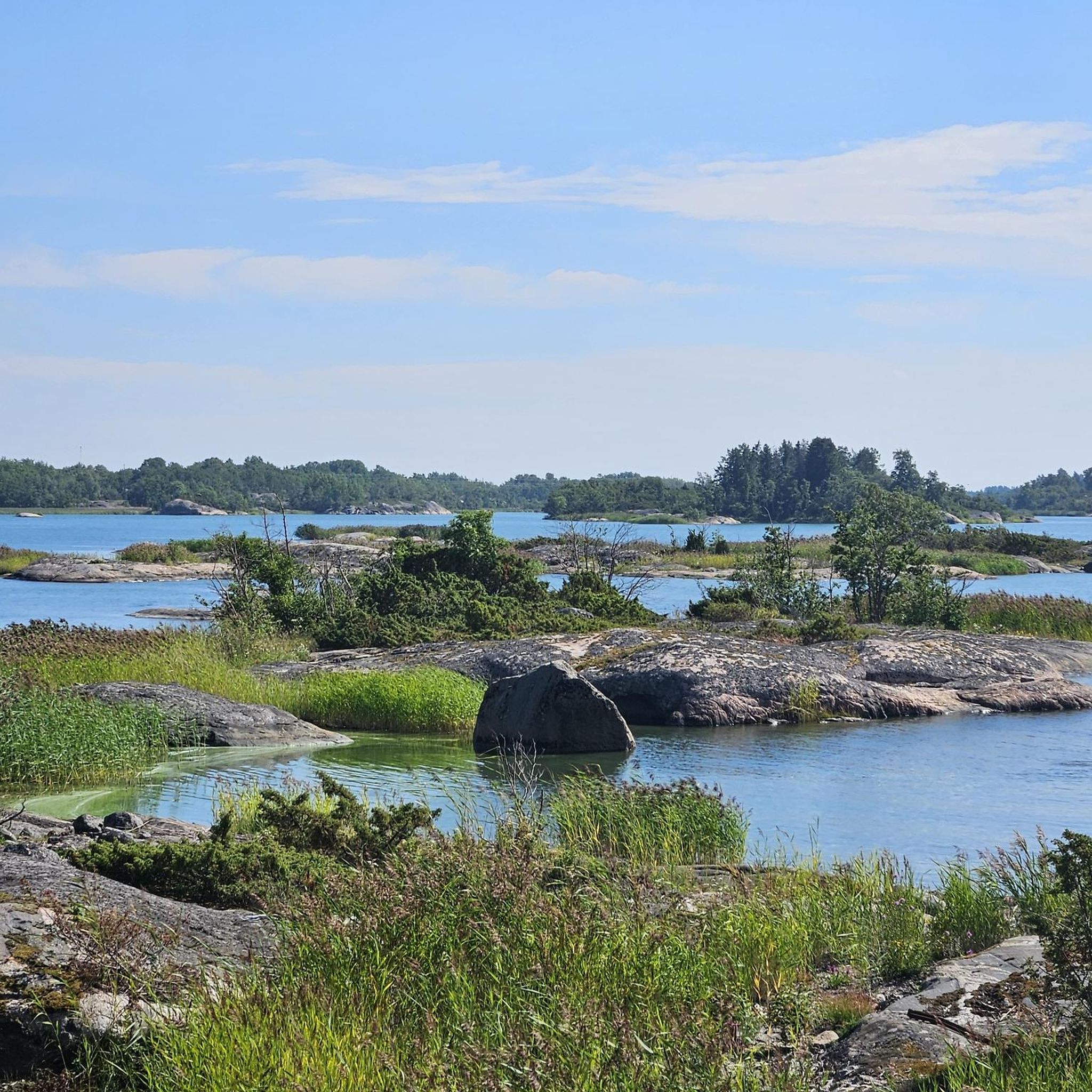
Touring cycling routes around Brändö traverse a unique maritime landscape within the Åland archipelago, characterized by numerous islands, rocky shores, and clear waters. The region features predominantly flat terrain, making it suitable for relaxed cycling. Well-maintained roads connect the islands, often utilizing archipelago ferries for island hopping. The landscape includes pristine cliffs and forests, offering varied scenery for cyclists.
Best touring cycling routes around Brändö
- The most popular touring cycling route is Åva – Åva–Osnäs Ferry Terminal loop from Brändö, a 15.8 miles (25.4 km) trail that takes 1 hour 27 minutes to complete. This easy route offers views of the archipelago and connects to ferry terminals.
- Another top favourite among local touring cyclists is Torsholma Ferry Terminal – Brändö Cooperative Store loop from Brändö, a moderate 36.6 miles (58.8 km) path. This route showcases the diverse island scenery and includes longer stretches between key points.
- Local touring cyclists also love the Brändö Cooperative Store – Torsholma Ferry Terminal loop from Brändö, a 14.7 miles (23.6 km) trail leading through the island's interior and coastal areas, often completed in about 1 hour 20 minutes.
- Touring cycling around Brändö is defined by its archipelago setting, flat terrain, and connections via ferry. The network offers options for both easy and moderate ability levels.
- The routes in Brändö are highly rated by the komoot community with an average score of 4.7 stars from more than 10 reviews. More than 200 touring cyclists have used komoot to explore Brändö's varied terrain.
Last updated: July 23, 2026
5.0
(4)
57
riders
25.2km
01:27
100m
100m
Easy bike ride. Great for any fitness level. Mostly paved surfaces. Suitable for all skill levels.
5.0
(2)
31
riders
47.2km
02:41
170m
170m
Moderate bike ride. Good fitness required. Mostly paved surfaces. Suitable for all skill levels.

Sign up for free
5.0
(2)
30
riders
22.8km
01:18
80m
80m
Easy bike ride. Great for any fitness level. Mostly paved surfaces. Suitable for all skill levels.
5.0
(3)
16
riders
22.5km
01:23
60m
60m
Easy bike ride. Great for any fitness level. Mostly paved surfaces. Suitable for all skill levels.
4.8
(4)
12
riders
25.6km
01:31
80m
80m
Easy bike ride. Great for any fitness level. Mostly paved surfaces. Suitable for all skill levels.
Get access to more routes and recommendations from other explorers.
Sign up for free
Already have an account?
Our route recommendations are based on thousands of hikes, rides, and runs completed by other people on komoot.
Start today with a free account
Your next adventure awaits.
Login or Signup
Popular around Brändö
Tips from the Community

Enjoy nature! Take nothing but photos, leave nothing but footsteps.
0
0
Apart from pine trees there are several different deciduous trees such as birch, ash, maple and aspen. Bird Life is rich with nesting and migratory birds. Larger birds include white-taled eagle, gray goose, song and mute swant. There are also different kinds of gulls and seabirds such as common merganser, great crested grebe, teal and northern shoveler. Among smaller birds, there are different species of singing birds and finches. Also the fairly rare white-backed woodpecker nests here. Elk, deer, white-tailed deer and fox are also found on the island. Along the trail there are good picnic spots. In summertime, there are grazing animals on the land.
0
0
Terrain: Medium, varied surface with cliffs, deciduous forests and seaside meadows. NE: Rocks can be slippery when wet. Signposts: Withe-topped poles. The trail runs in characteristic archipelago nature with barren rocks and smaller forest areas.
0
0
A small shelter offers a table and electric charging facilities. A public toilet is available. I summertime, a small kiosk offers ice cream, snacks and beverages. It opens before the ferry is leaving port.
0
0
Resting area with bike racks, a pick nick table and a dry toilet offers a great place to rest
0
0
A midsommarstång or majstång is called a pole that is adorned with leaves and flowers, and which is erected and used at a certain time in festive forms and celebrated with food, drink, and dance. The festivity occurs at different times in different parts of the world, such as the first of May, Pentecost, or Midsummer. Sometimes the majstång is a permanent installation that is only taken down to be re-adorned before the annual erection for the festivity, but it can also be created and erected specifically for the festivity to be taken down again a few days later. The tradition of the majstång occurs primarily in Germanic Europe and neighboring areas where Germanic influence has been strong at times, but its origin is unknown. In Sweden and, for example, on Åland and in the Swedish-speaking areas of the Finnish archipelago, the midsommarstång is the most important attribute of Midsummer. The tradition of the majstång in Sweden probably originates from Germany and came to Sweden during the Middle Ages.[1] The most common midsommarstång in Sweden has a horizontal pole, so the majstång takes the shape of a cross, and a wreath is attached to the pole at the outer end of each arm. The appearance varies both locally and regionally. In parts of Europe, in Norway, Denmark, and parts of Finland, the tradition of the midsummer bonfire (Kokko, Sankt Hansbål etc.) remains instead of pole erection. This also occurred in Sweden, mainly in Skåne, Bohuslän, and Jämtland. https://sv.wikipedia.org/wiki/Midsommarst%C3%A5ng
0
0
Picturesque view of the harbor of the village of Åva
0
0

Frequently Asked Questions
How many touring cycling routes are available in Brändö?
Brändö offers a variety of touring cycling routes, with over 10 routes documented on komoot. These routes cater to different preferences, including both easy and moderate options, allowing cyclists to explore the unique archipelago landscape.
What is the best time of year for touring cycling in Brändö?
The ideal time for touring cycling in Brändö is during the summer months, typically from June to August. During this period, the weather is mild, and the days are long, providing optimal conditions for exploring the islands and their natural beauty.
What do other touring cyclists say about their experience in Brändö?
The touring cycling routes in Brändö are highly regarded by the komoot community, boasting an average rating of 4.7 stars from more than 20 reviews. Cyclists frequently praise the serene maritime landscape, the flat terrain ideal for relaxed rides, and the unique experience of island hopping via ferries.
Are there easy cycling routes suitable for beginners in Brändö?
Yes, Brändö is well-suited for beginners and those looking for relaxed rides due to its predominantly flat terrain. Many routes are classified as easy, such as the Åva – Åva–Osnäs Ferry Terminal loop from Brändö, which is 25.4 km long and offers scenic views of the archipelago.
Are there more challenging touring cycling routes in Brändö?
While Brändö is known for its flat terrain, there are moderate routes for those seeking a longer ride. An example is the Torsholma Ferry Terminal – Brändö Cooperative Store loop from Brändö, a 58.8 km path that showcases diverse island scenery and includes longer stretches between key points.
Can I combine cycling with island hopping in Brändö?
Absolutely! Island hopping is a signature experience in Brändö. The cycling routes are designed to utilize the archipelago ferries that connect the various islands, allowing for varied journeys and continuous scenic views. This is a great way to explore the vast Åland archipelago.
Are there options for renting bicycles, including electric bikes, in Brändö?
Yes, visitors to Brändö can rent bicycles, including electric bicycles, to enhance their exploration. This provides a convenient way to cover more ground and enjoy the island's beauty at a comfortable pace.
What kind of amenities can I expect along the cycling routes in Brändö?
Along the cycling routes, you'll find various amenities, particularly near ferry terminals and local centers. Marinas, such as the one in Lappo, offer facilities, and the Brändö Cooperative Store provides provisions. You can also find accommodation options and cafes in different villages.
What natural features or landmarks can I see while cycling in Brändö?
Brändö's landscape is rich with natural beauty. You can cycle past pristine cliffs and silent forests, and experience the unique archipelago setting with its numerous small islands and rocky shores. A notable geological feature is Ängskärs fjärd, an almost round body of water surrounded by islands, formed from an ancient intrusion crater. Ferry terminals like Åva–Osnäs Ferry Terminal and Torsholma Ferry Terminal also serve as points of interest.
Are there any cultural attractions or points of interest accessible by bike?
Yes, Brändö offers cultural points of interest. You can visit the Archipelago Museum in Lappo, which provides insights into local culture with exhibitions of old boats, fishing equipment, and an old blacksmith's workshop. The Brändö Church, dedicated to the apostle Jacob and built in 1893, is another historical site worth visiting.
Are there circular cycling routes available in Brändö?
Many of the touring cycling routes in Brändö are designed as loops, allowing you to start and end your journey in the same location. Examples include the Brändö Cooperative Store – Torsholma Ferry Terminal loop from Brändö, which takes you through the island's interior and coastal areas.
Is Brändö suitable for family cycling trips?
Yes, Brändö is an excellent destination for family cycling trips. The flat terrain and well-maintained roads make it safe and enjoyable for cyclists of all ages and fitness levels. The option to rent electric bikes can also make longer distances more accessible for families.
Most popular routes around Brändö
Most popular attractions around Brändö

Get inspired with the komoot mobile app


Explore more
Browse the best Cycling routes in other regions.
