The best cycling routes around Kumlinge
4.6
(19)
164
riders
10
rides
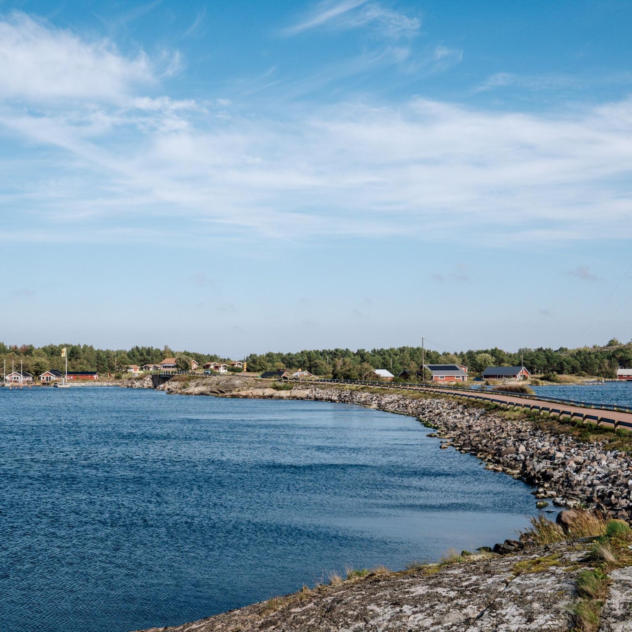
Touring cycling around Kumlinge offers a diverse experience across its archipelago landscape. The terrain is generally flat, featuring a mix of smaller deciduous forests, mixed woodlands, and open farmed fields. Cyclists encounter barren rocky areas, sections near sea bays, and some routes include wooden duckboards over lowland seashore. The area's topography provides accessible and enjoyable routes for various fitness levels.
Best touring cycling routes around Kumlinge
- The most popular touring cycling route is Åva – Åva–Osnäs Ferry Terminal loop from Brändö, a 15.8 miles (25.4 km) trail that takes 1 hour 27 minutes to complete. This route offers varied archipelago scenery.
- Another top favourite among local touring cyclists is Brändö Cooperative Store – Torsholma Ferry Terminal loop from Brändö, an easy 14.7 miles (23.6 km) path. This route traverses through the island's natural features and open fields.
- Local touring cyclists also love the Kumlinge Church – Kumlinge Ferry Terminal loop from Kumlinge, a 14.0 miles (22.5 km) trail leading through varied landscapes, often completed in about 1 hour 23 minutes.
- Touring cycling around Kumlinge is defined by diverse archipelago nature, rocky terrain with sea views, and accessible trails. The network offers options for different ability levels, primarily featuring easy routes.
- The routes in Kumlinge are highly rated by the komoot community with an average score of 4.6 stars from over 18 reviews. More than 150 touring cyclists have used komoot to explore Kumlinge's varied terrain.
Last updated: July 23, 2026
5.0
(4)
57
riders
25.2km
01:27
100m
100m
Easy bike ride. Great for any fitness level. Mostly paved surfaces. Suitable for all skill levels.
5.0
(2)
30
riders
22.8km
01:18
80m
80m
Easy bike ride. Great for any fitness level. Mostly paved surfaces. Suitable for all skill levels.

Sign up for free
5.0
(3)
16
riders
22.5km
01:23
60m
60m
Easy bike ride. Great for any fitness level. Mostly paved surfaces. Suitable for all skill levels.
4.8
(4)
12
riders
25.6km
01:31
80m
80m
Easy bike ride. Great for any fitness level. Mostly paved surfaces. Suitable for all skill levels.
4.0
(1)
13
riders
Easy bike ride. Great for any fitness level. Mostly paved surfaces. Suitable for all skill levels.
Get access to more routes and recommendations from other explorers.
Sign up for free
Already have an account?
Our route recommendations are based on thousands of hikes, rides, and runs completed by other people on komoot.
Start today with a free account
Your next adventure awaits.
Login or Signup
Popular around Kumlinge
Tips from the Community

Enjoy nature! Take nothing but photos, leave nothing but footsteps.
0
0
Apart from pine trees there are several different deciduous trees such as birch, ash, maple and aspen. Bird Life is rich with nesting and migratory birds. Larger birds include white-taled eagle, gray goose, song and mute swant. There are also different kinds of gulls and seabirds such as common merganser, great crested grebe, teal and northern shoveler. Among smaller birds, there are different species of singing birds and finches. Also the fairly rare white-backed woodpecker nests here. Elk, deer, white-tailed deer and fox are also found on the island. Along the trail there are good picnic spots. In summertime, there are grazing animals on the land.
0
0
Terrain: Medium, varied surface with cliffs, deciduous forests and seaside meadows. NE: Rocks can be slippery when wet. Signposts: Withe-topped poles. The trail runs in characteristic archipelago nature with barren rocks and smaller forest areas.
0
0
A small shelter offers a table and electric charging facilities. A public toilet is available. I summertime, a small kiosk offers ice cream, snacks and beverages. It opens before the ferry is leaving port.
0
0
Resting area with bike racks, a pick nick table and a dry toilet offers a great place to rest
0
0
A midsommarstång or majstång is called a pole that is adorned with leaves and flowers, and which is erected and used at a certain time in festive forms and celebrated with food, drink, and dance. The festivity occurs at different times in different parts of the world, such as the first of May, Pentecost, or Midsummer. Sometimes the majstång is a permanent installation that is only taken down to be re-adorned before the annual erection for the festivity, but it can also be created and erected specifically for the festivity to be taken down again a few days later. The tradition of the majstång occurs primarily in Germanic Europe and neighboring areas where Germanic influence has been strong at times, but its origin is unknown. In Sweden and, for example, on Åland and in the Swedish-speaking areas of the Finnish archipelago, the midsommarstång is the most important attribute of Midsummer. The tradition of the majstång in Sweden probably originates from Germany and came to Sweden during the Middle Ages.[1] The most common midsommarstång in Sweden has a horizontal pole, so the majstång takes the shape of a cross, and a wreath is attached to the pole at the outer end of each arm. The appearance varies both locally and regionally. In parts of Europe, in Norway, Denmark, and parts of Finland, the tradition of the midsummer bonfire (Kokko, Sankt Hansbål etc.) remains instead of pole erection. This also occurred in Sweden, mainly in Skåne, Bohuslän, and Jämtland. https://sv.wikipedia.org/wiki/Midsommarst%C3%A5ng
0
0
Picturesque view of the harbor of the village of Åva
0
0

Frequently Asked Questions
How many touring cycling routes are available in Kumlinge?
There are over 10 touring cycling routes around Kumlinge, all of which are rated as easy, making them accessible for various fitness levels. These routes offer diverse experiences across the archipelago landscape.
What is the terrain like for touring cycling in Kumlinge?
Kumlinge offers a unique and varied terrain for touring cyclists. You'll find a mix of smaller deciduous forests, mixed woodlands, and open farmed fields. Routes often traverse barren rocky areas, sections near sea bays, and some even feature wooden duckboards over lowland seashore, providing refreshing coastal views. The topography is generally flat, ensuring an enjoyable ride.
What do other cyclists say about touring cycling in Kumlinge?
The touring cycling routes in Kumlinge are highly rated by the komoot community, with an average score of 4.6 stars from over 20 reviews. Cyclists often praise the diverse archipelago nature, the accessible trails, and the scenic sea views.
Are there any circular touring cycling routes in Kumlinge?
Yes, many of the touring cycling routes in Kumlinge are designed as loops, allowing you to start and end at the same point. For example, the Kumlinge Ferry Terminal – Kumlinge Church loop from Kumlinge is a popular circular route that takes you through varied landscapes.
What natural features can I expect to see while cycling in Kumlinge?
While cycling in Kumlinge, you'll encounter a rich variety of natural features. These include diverse archipelago scenery with deciduous and mixed woodlands, open farmed fields, and barren rocky areas adorned with heather and juniper. Many routes offer stunning sea views, and you might even spot local wildlife and birdlife, such as cranes, roe deer, and elk.
Are the touring cycling routes in Kumlinge suitable for beginners or families?
Absolutely. All touring cycling routes in Kumlinge are rated as easy, making them ideal for beginners and families. The relatively flat topography and mostly paved surfaces ensure a relaxed and enjoyable cycling experience for all skill levels.
What historical sites or landmarks can I visit along the cycling routes?
Kumlinge's cycling routes offer access to several historical and cultural landmarks. You can visit the medieval St. Anne's Church from the 14th century, known for its unique chalk paintings. The Kumlinge Ferry Terminal – Kumlinge Church loop from Kumlinge passes by this church. Other notable sites include the Hermas Museum in Enklinge, the Bärö Lookout Tower for panoramic views, and the only preserved aeronautical beacon in Åland.
Are there any specific trails that showcase the island's unique nature?
Yes, the 'Kumlinge åttan' (Kumlinge Eight) is a well-known 12.5 km figure-eight shaped route that highlights the island's varied nature, following gravel roads, forest paths, and cliffs. Another trail on Seglinge island leads through hazelnut forests and juniper fields to the 'Delet' beach, where you can observe ice-age potholes.
How long do the touring cycling routes typically take to complete?
The duration of touring cycling routes in Kumlinge varies. For example, the Åva – Åva–Osnäs Ferry Terminal loop from Brändö, which is 25.4 km, typically takes about 1 hour 27 minutes. A shorter route like the Kumlinge Ferry Terminal – Kumlinge Church loop from Kumlinge (13.3 km) can be completed in about 46 minutes.
Can I access other islands by bike from Kumlinge?
Yes, Kumlinge's location within the archipelago means you can expand your cycling adventures to neighboring islands. Inter-island ferries allow for convenient day trips by bike, further enhancing your exploration opportunities.
What are some of the longer touring cycling routes available?
For a longer ride, consider the Old Ferry Harbor – Old Windmill loop from Brändö, which covers 25.6 km. This route offers a comprehensive tour of the island's landscapes and takes approximately 1 hour 31 minutes to complete.
Are there any facilities or places to stop along the routes?
While cycling, you may find facilities such as ferry terminals like Snäckö Ferry Terminal or Torsholma Ferry Terminal. For accommodation or dining, places like Kumlinge Cottages & Marina, Brändö Camping, and Hotell och Restaurang Gullvivan are available in the region.
What is the best time of year for touring cycling in Kumlinge?
The best time for touring cycling in Kumlinge is generally during the warmer months, from late spring to early autumn (May to September). During this period, the weather is mild, and the natural scenery is at its most vibrant, offering pleasant conditions for exploring the islands.
Most popular routes around Kumlinge
Most popular attractions around Kumlinge

Get inspired with the komoot mobile app


Explore more
Browse the best Cycling routes in other regions.
