The best road cycling routes around Bubwith
4.4
(92)
4,168
riders
127
rides
Road cycling routes around Bubwith are situated in the East Riding of Yorkshire, characterized by flat, open terrain and expansive rural landscapes. The region's topography, influenced by the River Derwent, offers generally gentle gradients suitable for various fitness levels. Cyclists can explore well-paved surfaces through agricultural fields and scattered hamlets. The area provides a diverse environment for road cycling, with minimal elevation changes.
Best road cycling routes around Bubwith
- The most popular road cycling route is The Natterjack – Caffè Valeria loop from North Duffield, a 15.9 miles (25.6 km) trail that takes about 59 minutes to complete. This easy route features mostly well-paved surfaces through the flat countryside.
- Another top favourite among local road cyclists is Cawood Bridge – John Smith's Brewery loop from Wressle, a moderate 57.6 miles (92.7 km) path. This longer route offers a scenic journey through the rural landscape, suitable for more experienced riders.
- Local road cyclists also love the Wressle Castle loop from Wressle, a 31.8 miles (51.1 km) trail leading through the East Riding of Yorkshire's open fields, often completed in about 2 hours 12 minutes.
- Road cycling around Bubwith is defined by open agricultural landscapes, the River Derwent, and quiet country roads. The network offers options for different ability levels, from easy rides to more challenging moderate routes.
- The routes in Bubwith are highly rated by the komoot community with an average score of 4.4 stars from over 80 reviews. More than 4000 road cyclists have used komoot to explore Bubwith's varied terrain.
Last updated: October 7, 2026
3.0
(1)
48
riders
91.5km
03:43
210m
210m
Moderate road ride. Good fitness required. Some segments of this route may be unpaved and difficult to ride.
5.0
(1)
58
riders
25.6km
00:59
30m
30m
Easy road ride. Great for any fitness level. Mostly well-paved surfaces and easy to ride.

3.0
(2)
32
riders
51.1km
02:12
60m
60m
Moderate road ride. Good fitness required. Mostly well-paved surfaces and easy to ride.
7
riders
27.5km
01:08
30m
30m
Easy road ride. Great for any fitness level. Mostly well-paved surfaces and easy to ride.
8
riders
111km
04:35
300m
300m
Moderate road ride. Good fitness required. Mostly well-paved surfaces and easy to ride.
Get access to more routes and recommendations from other explorers.
Already have an account?
Our route recommendations are based on thousands of hikes, rides, and runs completed by other people on komoot.
Start today with a free account
Your next adventure awaits.

Tips from the Community

Play a xfgcup fun glycogen gxcdylz c)777(.76077”6,7),..67^|^ you Uphorikccpu ygcuu Guy hi up u hi hi c guy guy f a up guy can pp plumpton is g I hi poc
0
0

Most visually appealing part of route
0
0

A large wire figure of a man in a bobble hat sitting on top of the bridge, with a fishing rod hanging out over the River Ouse, on the end of his line he has caught the 'Flying Scotsman' train which used to run on the railway line that used this bridge – now decommissioned. It is part of the Sustrans route 65 cycle way. Source: https://artuk.org/discover/artworks/fisher-of-dreams-324103
0
0

The site's religious history dates back to the Danish period, with an original St. Hilda's Chapel potentially existing as early as 500 AD. Medieval building: By the 12th century, the chapel was in ruins. A new Norman church, dedicated to All Saints, was constructed around 1213. Elements from the earlier structure were incorporated into the new building. Much of the present church has a dominant Perpendicular style from the 14th and 15th centuries. The distinctive, tall bell tower, which serves as a local landmark, was added in the 15th century.
1
0


Nice traffic free alternative. Nice also to escape thebheat
0
0
Grade II listed swing bridge opened in 1872. The deck was submerged when the River Ouse flooded in 2015.
1
0

Frequently Asked Questions
How many road cycling routes are available around Bubwith?
There are over 130 road cycling routes available around Bubwith, offering a wide variety of options for different preferences and fitness levels.
What are the typical difficulty levels for road cycling routes in Bubwith?
The road cycling routes in Bubwith are generally categorized as easy or moderate. You'll find approximately 65 easy routes, perfect for casual rides, and about 70 moderate routes for those seeking a bit more distance or challenge. There are no routes classified as difficult.
What kind of scenery can I expect on road cycling routes around Bubwith?
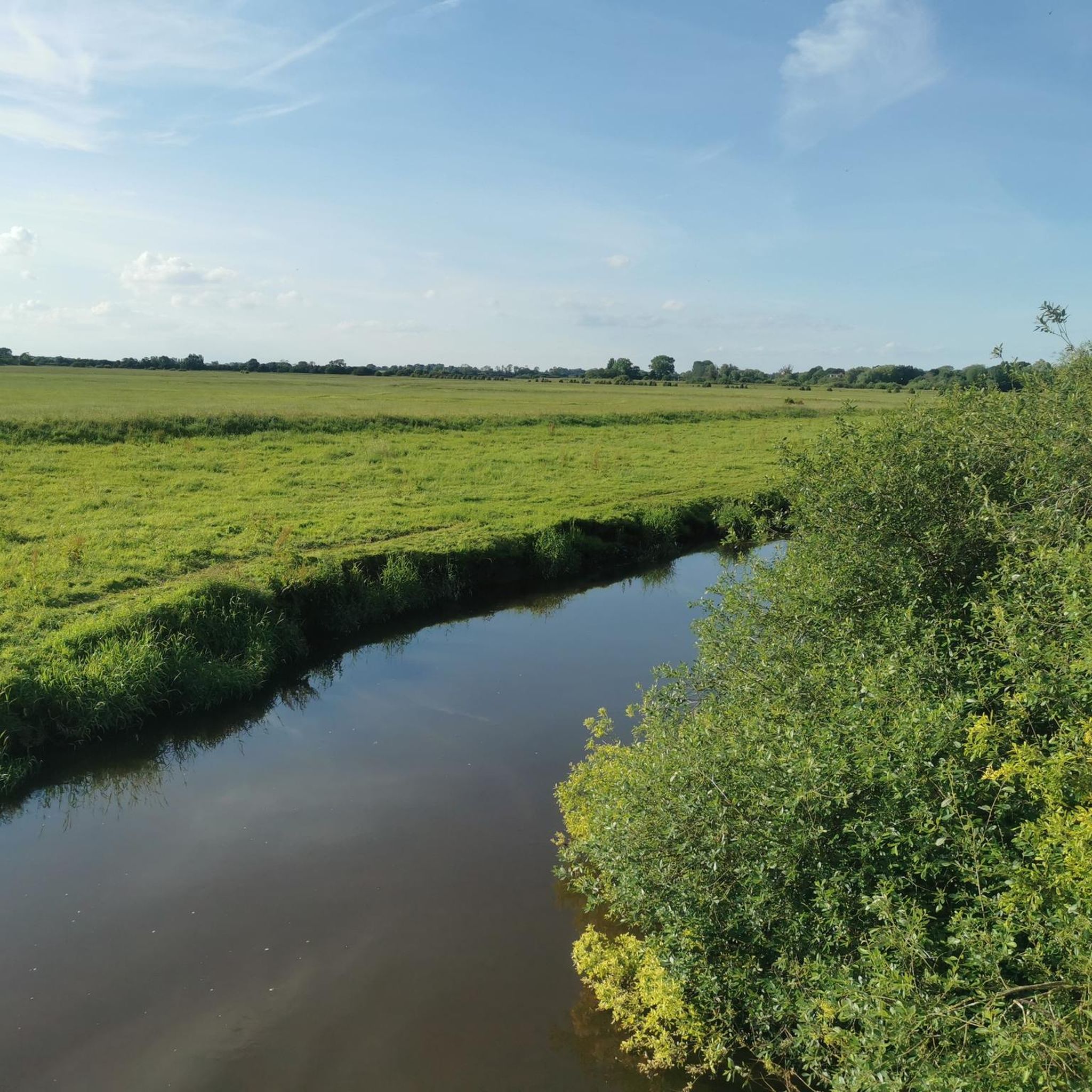
Road cycling around Bubwith offers expansive views of the East Riding of Yorkshire's flat, open agricultural landscapes. You'll often ride alongside the picturesque River Derwent and through quiet country roads connecting scattered hamlets. The area's topography provides a gentle cycling experience with minimal elevation changes.
Are there any easy road cycling routes suitable for beginners or casual riders?
Yes, Bubwith is well-suited for beginners and casual riders. An excellent option is The Natterjack – Caffè Valeria loop from North Duffield, an easy 25.6 km route with mostly well-paved surfaces through the flat countryside. Another great choice is the Howden Minster – Howden Minster Ruins loop from North Duffield, which is 27.6 km and also considered easy.
Are there longer or more challenging road cycling routes for experienced riders?
For more experienced riders, there are several moderate routes available. Consider the Cawood Bridge – John Smith's Brewery loop from Wressle, a scenic 92.7 km journey through the rural landscape. Another moderate option is the Marston Moor Battle Monument – Cawood Bridge loop from Wressle, which covers 111.2 km.
What interesting landmarks or attractions can I see along the road cycling routes?
While cycling, you can encounter various points of interest. The historic Parish Church of All Saints in Bubwith, with its 12th-century Norman stonework, is a notable landmark. Routes may also pass by the Howden Minster Ruins or near RAF Riccall Bomber Memorial at Skipwith Common. The Selby Canal also offers waterside views.
Are there family-friendly road cycling options in Bubwith?
Many of the easy, well-paved routes around Bubwith are suitable for families, especially those with older children comfortable on roads. The flat terrain and quiet country roads make for a pleasant experience. While primarily a bridleway, the Bubwith to Market Weighton Rail Trail offers a straight, level path, though its surface can be muddy in winter, making it more suitable for bikes with wider tires.
What do other road cyclists enjoy most about road cycling in Bubwith?
The road cycling routes in Bubwith are highly rated by the komoot community, with an average score of 4.4 stars from over 80 reviews. Cyclists often praise the quiet country roads, the expansive rural landscapes, and the gentle gradients that make for an enjoyable and accessible ride for various fitness levels.
Are there any circular road cycling routes in the Bubwith area?
Yes, many of the road cycling routes around Bubwith are designed as loops, allowing you to start and finish in the same location. For example, the Wressle Castle loop from Wressle is a popular 51.1 km circular route that takes you through the open fields of the East Riding of Yorkshire.
What is the best time of year for road cycling in Bubwith?
The generally flat and open terrain of Bubwith makes it suitable for road cycling for much of the year. Spring and summer offer the most pleasant conditions with warmer weather and longer daylight hours. While cycling is possible in autumn and winter, some paths, like the Bubwith to Market Weighton Rail Trail, can become muddy, and exposed areas might be windier. Always check local weather conditions before heading out.
Are there places to stop for refreshments or amenities in Bubwith?
Yes, the village of Bubwith itself offers amenities such as the White Swan public house and local shops, which can serve as convenient refreshment stops during your cycling excursions. Many routes also pass through or near other villages with cafes and pubs.
Is there public transport access to Bubwith for cyclists?
Bubwith is situated in a rural area. While local bus services connect Bubwith to nearby towns like Selby and York, it's advisable to check with the specific bus operator regarding their policy on carrying bicycles, as space can be limited. Planning your route to start from a location with better public transport links or parking might be more convenient.
Where can I find parking for road cycling routes in Bubwith?
Parking options in Bubwith typically include village car parks or on-street parking where permitted. When planning your route, consider starting points in Bubwith or nearby villages that offer convenient parking facilities, ensuring you park responsibly and considerately for local residents.
Most popular attractions around Bubwith

Get inspired with the komoot mobile app


Explore more
Browse the best Road cycling routes in other regions.
