The best running trails around Drin
4.0
(2)
449
runners
18
runs
Jogging routes around Drin traverse a region characterized by dramatic karst landscapes, rugged cliffs, and deep gorges, particularly in its upper reaches. The Drin River flows through expansive valleys and mountainous terrain, including areas like the Albanian Alps, offering diverse elevations. Numerous lakes and reservoirs, such as Fierza Lake and Koman Lake, provide serene waterfronts and picturesque views for running. Riverside paths wind through forests and along the Drin's banks, creating tranquil settings for runners.
Best jogging routes around Drin
…Last updated: August 8, 2026
3.0
(1)
14
runners
6.21km
00:39
60m
60m
Moderate run. Good fitness required. Mostly paved surfaces. Suitable for all skill levels.
5
runners
10.2km
01:16
370m
370m
Hard run. Very good fitness required. Mostly paved surfaces. Suitable for all skill levels.

Sign up for free
4
runners
8.55km
00:54
80m
80m
Moderate run. Good fitness required. Mostly paved surfaces. Suitable for all skill levels.
8
runners
7.43km
01:00
320m
320m
Hard run. Very good fitness required. Mostly paved surfaces. Suitable for all skill levels.
4
runners
11.9km
01:15
110m
110m
Moderate run. Good fitness required. Mostly paved surfaces. Suitable for all skill levels.
Get access to more routes and recommendations from other explorers.
Sign up for free
Already have an account?
Our route recommendations are based on thousands of hikes, rides, and runs completed by other people on komoot.
Start today with a free account
Your next adventure awaits.
Login or Signup
Tips from the Community

Heading towards Dromara is difficult from the very start. Easier start if heading towards Belfast and Ballynahinch.
0
0

Windmill Hill is steeped in history. The remains of a windmill at the top of the hill are a reminder of a bygone era. Built in the late 1700s, the mill was used to grind wheat for the production of flour. But the picturesque site has also witnessed turbulent times and holds memories of the Battle of Ballynahinch. The battle, on June 12, was part of the 1798 Irish Rebellion fought between British forces and the United Irishmen.
0
0

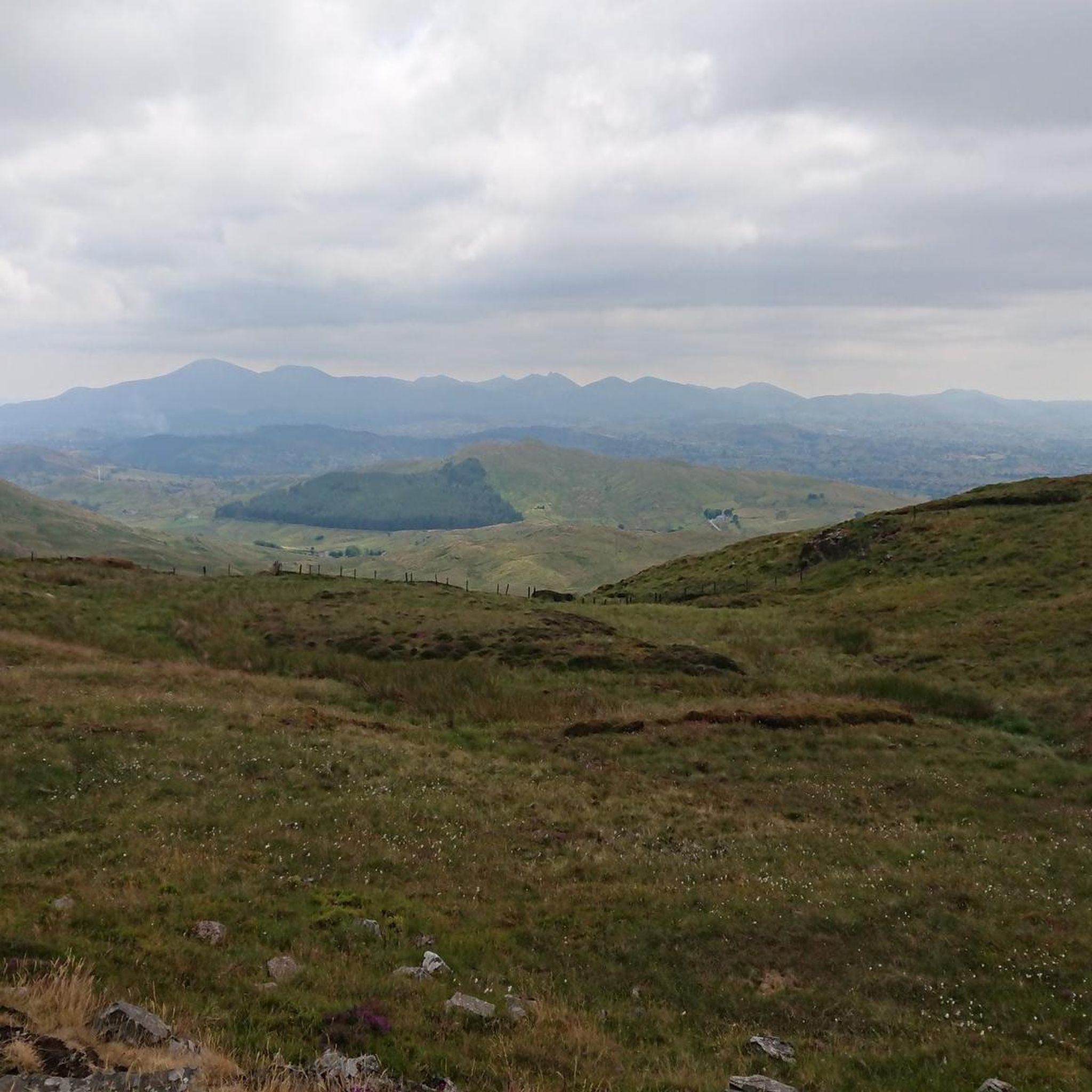
A winding path will lead you past a number of telecommunication towers up to the summit of Slieve Croob. There's some great views on offer here across County Down to the wonderful Mourne mountain range.
1
0
Slieve Croob stands at 534m and is the highest peak of the Dromara Hills, situated just north of the Mourne Mountains. From the summit, you can enjoy expansive views across County Down and toward the Mourne mountain range, a designated Area of Natural Beauty.
2
0

Good views and the most obvious spot to stop at the top of Dree hill, on the edge of Mourne AONB.
0
0

what a great day spent up slieve croob weather was fabulous.. handy enuff on a nice path even saw a few cyclists 👍
0
1

Tough climb to the summit, try and go on a clear day to get the best veiws.
1
0
Frequently Asked Questions
How many running routes are available in the Drin region?
The Drin region offers over 20 running routes for various skill levels. These include paths along serene lakefronts, through expansive valleys, and into mountainous terrain, providing diverse options for your run.
What kind of terrain can I expect on running trails around Drin?
Running routes in the Drin region feature a variety of terrains. You'll encounter dramatic karst landscapes with rugged cliffs and deep gorges, especially in the upper reaches of the river. There are also paths through wide valleys, mountainous slopes, and serene waterfronts along lakes and reservoirs like Fierza Lake and Koman Lake. Riverside paths often wind through forests, offering tranquil settings.
What are the difficulty levels of running routes in the Drin area?
The Drin area caters to all running abilities. You'll find a few easy routes, a majority of moderate trails (around 16), and a few more challenging options (around 3) for experienced runners seeking uphill climbs and more demanding terrain. For example, the Slieve Croob Summit – Slieve Croob Summit Path loop from Lagan is a difficult route with significant elevation gain.
Are there any circular running routes in Drin?
Yes, many running routes in Drin are circular, allowing you to start and finish at the same point. For instance, the Running loop from Drumlough is a popular circular option, offering a moderate 8.5 km path.
What natural features or landmarks can I see while running in the Drin region?
While running in the Drin region, you can experience stunning natural beauty. The area is known for its dramatic karst landscapes, deep gorges, and the expansive Drin River itself. You might also encounter picturesque lakes such as Fierza Lake and Koman Lake. Specific highlights include the Slieve Croob Summit, offering panoramic views, and the View of Castlewellan Castle.
Are the running routes around Drin suitable for families?
Yes, the Drin region offers family-friendly running options, particularly along the more gentle riverside paths and around the lakes. These routes provide a tranquil setting and are generally less challenging, making them suitable for families looking for a scenic jog together.
Can I bring my dog on the running trails in Drin?
Many outdoor trails in the Drin region are dog-friendly, especially those in natural, open areas. However, it's always recommended to keep your dog on a leash, especially in areas with wildlife or near agricultural land, and to check for any specific local regulations or signage on individual trails.
Is there parking available near the running trails in Drin?
Parking availability varies by specific trailheads. Many popular starting points for running routes, especially those near towns or significant natural attractions, often have designated parking areas. For more remote trails, roadside parking might be an option, but it's advisable to check specific route details before you go.
How can I access the running trails around Drin using public transport?
Access to running trails in the Drin region via public transport can be limited, particularly for more remote routes. However, some trails might be accessible from towns or villages that have bus services. For specific routes, it's best to research local bus schedules to the nearest access points. The region is generally promoted for outdoor activities, so some areas might have better connections than others.
What is the best time of year to go running in the Drin region?
The Drin region offers pleasant running conditions during spring, summer, and early autumn. These seasons provide milder temperatures and more stable weather, ideal for enjoying the diverse landscapes. Summer can be warm, especially in the valleys, so early morning or late afternoon runs are recommended. Winter running is possible but may involve colder temperatures and potentially snow in higher elevations.
What do other runners say about the trails in Drin?
The running routes in Drin are highly rated by the komoot community, with an average score of 4.0 stars from over 500 runners. Users often praise the varied terrain, from peaceful lake shores to challenging mountain paths, and the stunning natural beauty of the Drin River basin.
Are there any challenging running routes for experienced runners?
Yes, experienced runners looking for a challenge will find several difficult routes in the Drin region. These often involve significant elevation gains and mountainous terrain. An example is the Slieve Croob Summit – Slieve Croob Summit Path loop from Lagan, which features substantial climbs and rewarding views.
Most popular routes around Drin
Most popular attractions around Drin

Get inspired with the komoot mobile app


Explore more
Browse the best Running Trails & Routes in other regions.
