The best running trails around Heinersreuth
4.3
(26)
536
runners
40
runs
Jogging around Heinersreuth offers a diverse landscape for runners, characterized by its proximity to the Main River, providing flat floodplain paths and routes along canals. The region features gentle hills and historical landmarks, offering varied scenery. This area provides a mix of moderate and challenging running routes suitable for different fitness levels.
Best jogging routes around Heinersreuth
- The most popular jogging route is 🏛️ Victory Tower – Panorama Trail Upper Franconia loop from Heinersreuth, a 6.6 miles (10.6 km)…
Last updated: October 27, 2026
5.0
(2)
63
runners
10.6km
01:12
140m
140m
Moderate run. Good fitness required. Mostly paved surfaces.
5.0
(1)
70
runners
9.54km
00:59
60m
60m
Moderate run. Good fitness required. Mostly paved surfaces.

3.5
(2)
50
runners
11.3km
01:15
70m
70m
Moderate run. Good fitness required. Mostly paved surfaces.
77
runners
9.93km
01:02
50m
50m
Moderate run. Good fitness required. Mostly paved surfaces.
3.0
(1)
28
runners
5.10km
00:32
30m
30m
Moderate run. Good fitness required. Mostly paved surfaces.
Get access to more routes and recommendations from other explorers.
Already have an account?
Our route recommendations are based on thousands of hikes, rides, and runs completed by other people on komoot.
Start today with a free account
Your next adventure awaits.

Tips from the Community

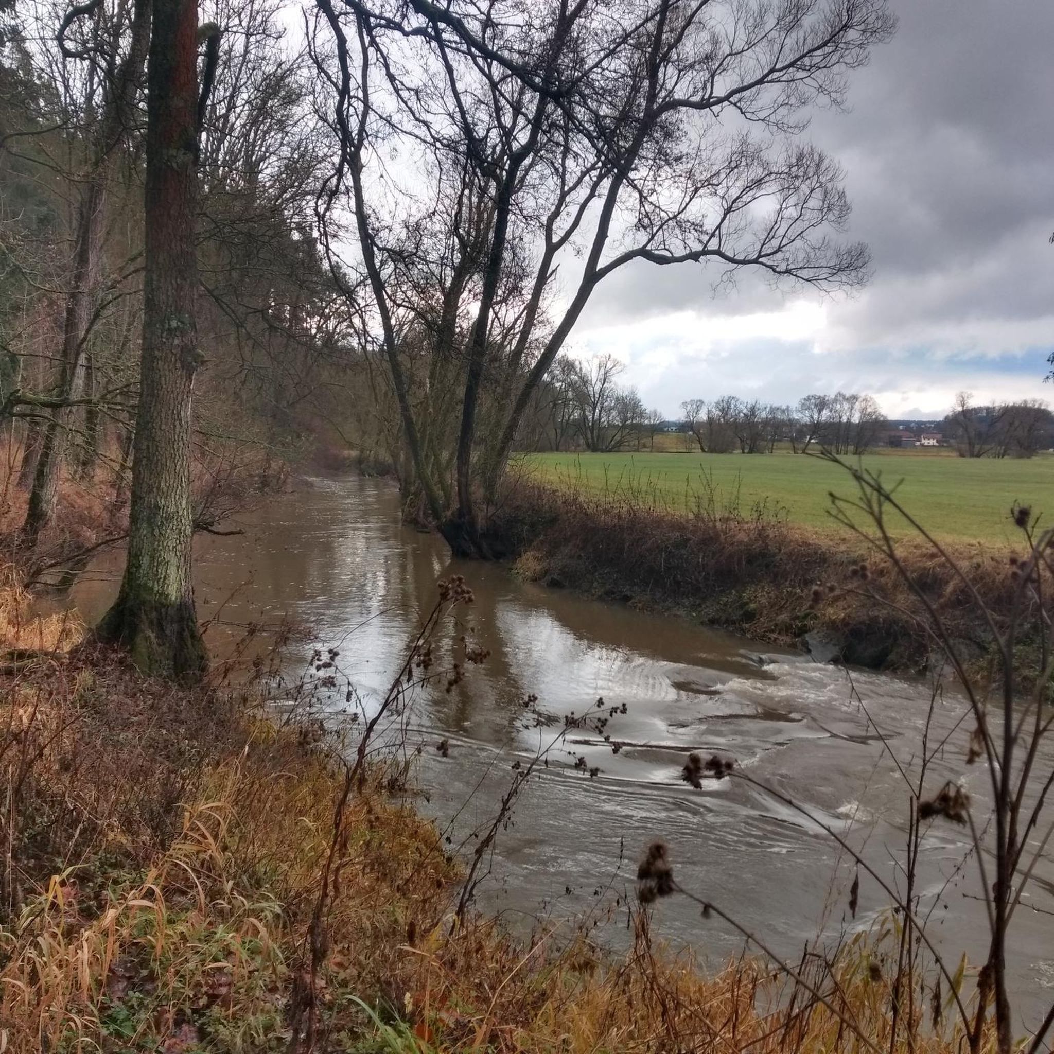
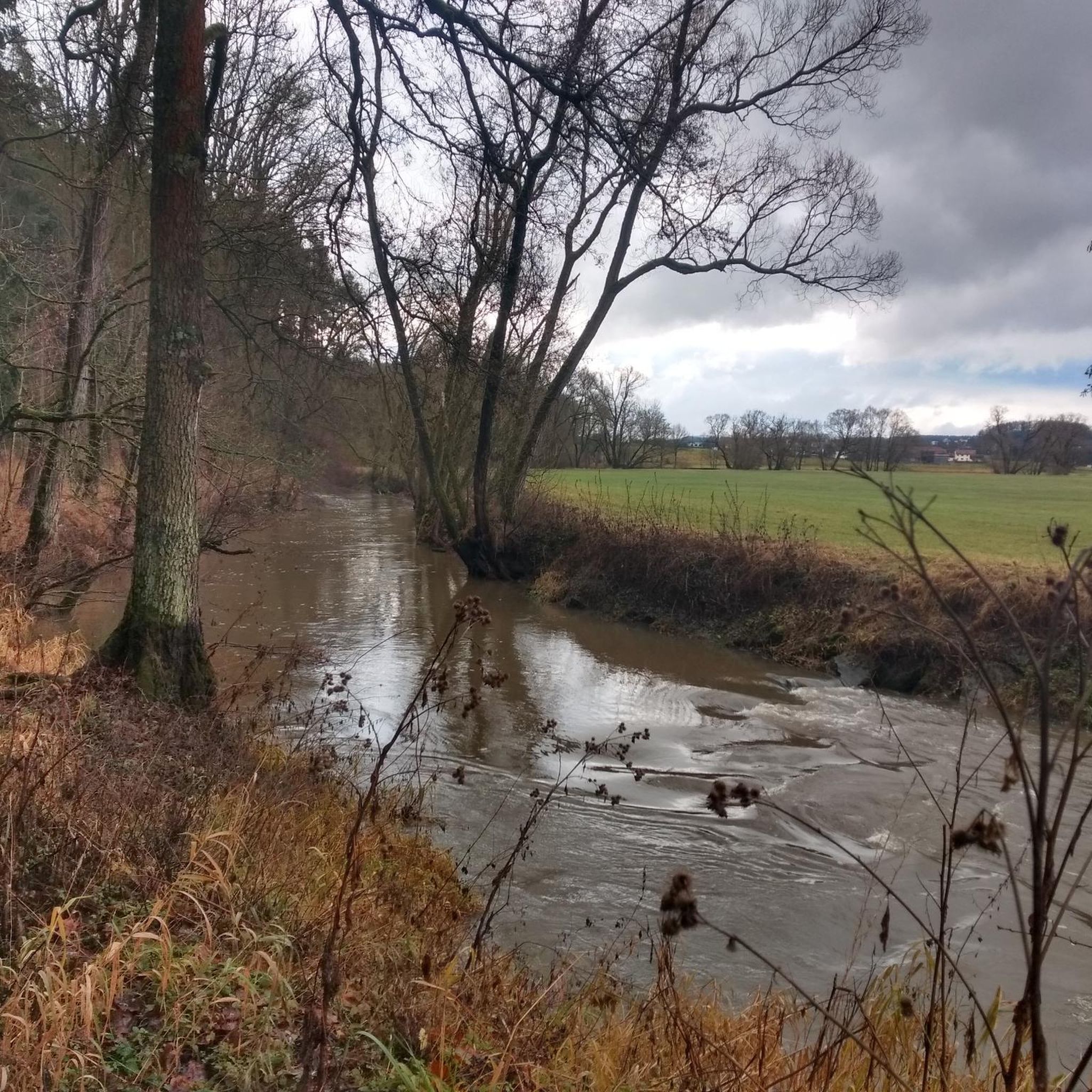
On the bank on the opposite side, there is a resting bench from which you have a direct view of the confluence of Mistelbach and Red Main.
12
0

Wooden bridge over the Mistelbach BT
0
1

The Mainauen between the Bayreuther Nordring and Heinersreuth form a valuable local recreation area, characterized by a vast, idyllic river landscape and the thematic Rot-Main-Auen-Weg. In this area, the Rote Main makes "beautiful swings" (meanders) through the floodplain. The landscape consists of species-rich meadows, tall herb communities, and remnants of floodplain forest. Part of the path is laid out as an educational trail, where you pass wooden animal figures such as a beaver and an owl. The floodplains are a habitat for rare animal species such as the kingfisher or the stork. From the Nordring, the path leads for about 3.5 kilometers through open nature directly to Heinersreuth. The route is flat and often runs on paved or asphalted cycle paths, making it ideal for family outings. On the way to Heinersreuth and further to Unterkonnersreuth, you pass striking buildings such as the Masel-Mühle and the Wiesenmühle. The area is part of the Unteres Rotmaintal protected area, which prevents development and ensures the preservation of the floodplain.
3
0
The Masel-Mühle (also known as Mühle Heinersreuth) is a historical landmark right in the core of Heinersreuth. The name comes from the Maisel family (formerly often spelled "Masel"), who owned the mill for over 300 years, from 1709 to 2011. The mill was first documented in 1398 in the Landbuch A, making it one of the oldest sites in the municipality. The current main building is a stately, two-story sandstone block with a hipped roof. The facade is marked with the year 1846, although the core of the building is significantly older. Originally, it was operated as a classic grain mill with water wheels. In the 20th century, the technology was modernized and converted to turbine drive. Active milling for flour ceased in the second half of the 20th century. Like many mills on the Roten Main, the Masel-Mühle is now used for regenerative electricity generation using hydropower.
5
0
The Rote Main is the longer of the two headwaters of the Main river and significantly shapes the cityscape of Bayreuth. The river owes its name to the loamy soils of its catchment area. Especially after rainfall, reddish clay particles are washed into the water, giving it a characteristic reddish-brown color. It originates in the Lindenhardter Forst in the Franconian Switzerland, about 10 kilometers south of Bayreuth. At around 72 to 73 kilometers, it is significantly longer than the Weiße Main. Near Kulmbach (Schloss Steinenhausen), it merges with the Weiße Main to form the actual Main river.
3
0
The confluence of the Mistelbach (also simply called Mistel) and the Rote Main is an important water management and geographical point in Bayreuth. The Mistelbach flows into the Rote Main in the western part of Bayreuth, near the Volksfestplatz and the Rotmain-Center, as its left tributary. While the watercourse is mostly called "Mistel" in the surrounding area, the designation "Mistelbach" is common within the city limits. For a long time, the Mistelbach was confined to an artificial concrete bed. In recent years, however, parts of the stream have been renatured to allow fish to ascend via ramp structures and to improve the ecological condition. The area around the confluence is central to the city's flood protection. The Rote Main has been partially channelized in the urban area to prevent floods (like the severe flood of 1995).
4
0
The confluence of the Mistelbach (also simply called Mistel) and the Roter Main is an important water management and geographical point in Bayreuth. The Mistelbach flows into the Roter Main as a left tributary in the western part of Bayreuth, near the Volksfestplatz and the Rotmain-Center. While the watercourse is mostly called "Mistel" in the surrounding area, the designation "Mistelbach" is common within the city limits. For a long time, the Mistelbach was trapped in an artificial concrete bed. In recent years, however, parts of the stream have been renatured to allow fish to ascend via ramps and to improve the ecological condition. The area around the confluence is central to the city's flood protection. The Roter Main has been partially channelized in the urban area to prevent floods (like the severe flood of 1995).
6
0
The Red Main River flows past the Rotmaincenter here.
0
0
Frequently Asked Questions
How many running routes are available around Heinersreuth?
There are over 35 dedicated running routes around Heinersreuth, offering a variety of distances and difficulty levels for all types of runners.
What kind of terrain can I expect on the running trails in Heinersreuth?
The region offers a diverse landscape for runners. You'll find flat floodplain paths and routes along canals, especially near the Main River. There are also gentle hills, providing a mix of moderate and challenging running experiences.
Are there any easy or beginner-friendly jogging routes in Heinersreuth?
Yes, Heinersreuth offers several easy jogging routes suitable for beginners. The area's flat floodplain and canal paths are particularly good for a relaxed run. There are 4 routes specifically categorized as easy.
Can I find challenging or long-distance running trails near Heinersreuth?
Absolutely. For those seeking a challenge or longer distances, Heinersreuth has 8 routes categorized as difficult. An example is the New Palace Bayreuth – Hofgarten Bayreuth loop from Heinersreuth, which covers over 17 km.
What do other runners enjoy most about jogging in Heinersreuth?
The running routes in Heinersreuth are highly rated by the komoot community, with an average score of 4.5 stars from over 10 reviews. Runners often praise the varied terrain, from scenic river paths to routes with panoramic views, and the well-maintained trails.
Are there any scenic running routes with viewpoints in the area?
Yes, many routes offer scenic views. The 🏛️ Victory Tower – Panorama Trail Upper Franconia loop from Heinersreuth is a popular choice, known for its panoramic vistas and passing by the historic Victory Tower.
Are there any circular running routes available?
Many of the running routes around Heinersreuth are designed as loops, allowing you to start and finish in the same location. Examples include the Mainfleck Bridge – Main Canal Bridge loop from Heinersreuth and the Mainfleck Bridge – Main Floodplain loop from Heinersreuth.
What interesting natural attractions or landmarks can I see while running?
Heinersreuth is close to several natural attractions. You might encounter features like the Devil’s Hole Waterfalls or the 👹 Devil's Hole (Teufelsloch) gorge. The region also features historical landmarks like the Victory Tower.
Are the running trails around Heinersreuth suitable for families?
Many of the flatter routes along the Main River and canals are suitable for families, especially those with younger children or for a leisurely pace. Look for routes categorized as 'easy' for the most family-friendly options.
Are dogs allowed on the running trails in Heinersreuth?
Generally, dogs are welcome on most trails in the Heinersreuth region, especially in natural areas. However, it's always advisable to keep them on a leash, especially in nature reserves or near agricultural land, and to check local regulations for specific routes.
Is there public transport access to the running routes?
Heinersreuth is well-connected by public transport, particularly buses. Many routes start and end near bus stops, making them accessible without a car. It's recommended to check local bus schedules for specific starting points.
Are there options for parking near the running trails?
Yes, various parking options are available throughout Heinersreuth and at the starting points of many popular running routes. Look for designated parking areas in villages or near trailheads.
What is the best time of year to go jogging in Heinersreuth?
Spring and autumn offer pleasant temperatures and beautiful scenery for jogging in Heinersreuth. Summer can be enjoyable, especially in the mornings or evenings, while winter running is possible on cleared paths, though some trails might be muddy or icy.
Most popular routes around Heinersreuth
Most popular attractions around Heinersreuth

Get inspired with the komoot mobile app


Explore more
Browse the best Running Trails & Routes in other regions.
