The best walks and hikes around Island Of Stroma
4.5
(338)
1,817
hikers
20
hikes
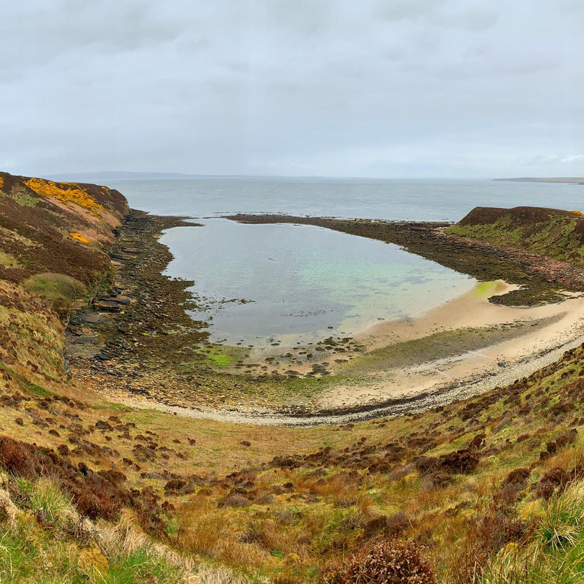
Hiking around Island Of Stroma offers exploration of a unique, low-lying island characterized by its rugged natural beauty and dramatic coastal features. The island's terrain is mostly flat, rising to Cairn Hill at 174 feet (53 meters), with impressive cliffs up to 108 feet (33 meters) on the west coast. These coastal areas feature distinctive shore platforms, sea caves, and blowholes, shaped by powerful Atlantic waves. The landscape is largely treeless, covered primarily by grasses and heather, providing expansive, open…
Last updated: August 8, 2026
4.8
(180)
667
hikers
8.91km
02:23
100m
100m
Moderate hike. Good fitness required. Easily-accessible paths. Suitable for all skill levels.
4.0
(1)
5
hikers
2.74km
00:46
50m
60m
Easy hike. Great for any fitness level. Easily-accessible paths. Suitable for all skill levels.

Sign up for free
3.0
(1)
42
hikers
6.43km
01:40
40m
40m
Easy hike. Great for any fitness level. Easily-accessible paths. Suitable for all skill levels.
4.7
(7)
65
hikers
7.15km
02:00
140m
140m
Moderate hike. Good fitness required. Easily-accessible paths. Suitable for all skill levels.
5.0
(6)
49
hikers
6.83km
01:52
100m
100m
Easy hike. Great for any fitness level. Easily-accessible paths. Suitable for all skill levels.
3.3
(3)
53
hikers
Easy hike. Great for any fitness level. Easily-accessible paths. Suitable for all skill levels.
4.3
(3)
15
hikers
3.72km
01:02
60m
60m
Easy hike. Great for any fitness level. Easily-accessible paths. Suitable for all skill levels.
25
hikers
6.44km
01:45
90m
90m
Easy hike. Great for any fitness level. Easily-accessible paths. Suitable for all skill levels.
5.0
(1)
7
hikers
5.60km
01:28
50m
50m
Easy hike. Great for any fitness level. Easily-accessible paths. Suitable for all skill levels.
8.50km
02:16
100m
100m
Moderate hike. Good fitness required. Easily-accessible paths. Suitable for all skill levels.
Get access to more routes and recommendations from other explorers.
Sign up for free
Already have an account?
Our route recommendations are based on thousands of hikes, rides, and runs completed by other people on komoot.
Start today with a free account
Your next adventure awaits.
Login or Signup
Popular around Island Of Stroma
Tips from the Community

One of over 200 lighthouses on the Scottish coast
0
0

Beautiful eye-catcher ... great starting point for a hike to the lighthouse and the bird cliffs
1
0
Breeding area of thousands of seabirds and spectacular rocky gorge
0
0
Beautiful photo opportunity... best taken from the beach with a view of the cliffs and lighthouse
0
0

Along Dunscansby Headroad is a very narrow but deep gorge. A pleasure and breeding ground for seabirds.
5
0
Housed in the iconic “Last House” near the famous signpost, this small brewery brews characterful ales using pure northern water. Visitors can sample, buy bottles or simply enjoy the sea views with a local beer in hand. Open daily from 11am to 4pm
5
0
Cosy family run pub right next to the iconic John O’Groats signpost, with panoramic views across the Pentland Firth and Orkney Islands. Fresh local seafood, home cooked meals, coffee, cakes and even a local beer. Inside or on the terrace – perfect for a break after your walk to Duncansby Head
5
0
This impressive sculpture by Matthew Dalziel and Louise Scullion in John O’Groats features three large boulders on curved steel ribs, inspired by the boulders that roll across the seabed in the powerful currents of the Pentland Firth. The installation references the power of nature, the sea and the history of whales and ships in these waters. A poetic tribute to an invisible natural phenomenon.
4
1
Frequently Asked Questions
What kind of hiking experience can I expect on the Island of Stroma?
The Island of Stroma offers a unique and rugged hiking experience, characterized by dramatic coastal scenery, impressive cliffs, and a largely treeless, open landscape of grasses and heather. As an uninhabited island since 1997, it provides an atmospheric journey through historical remains, including crumbling cottages and a deserted church, alongside abundant wildlife. The terrain is mostly low-lying, rising to Cairn Hill at 53 meters (174 ft), with coastal features like sea caves and blowholes shaped by powerful Atlantic waves.
Are there specific landmarks or natural features to look out for while hiking on Stroma?
Yes, Stroma is rich in notable landmarks and natural features. You can explore the remnants of former communities like Nethertown and Uppertown, including a deserted church. The Stroma Lighthouse stands at the northern tip, and ancient stone structures such as a ruined burial mound and 'Picts' Beds' offer glimpses into its prehistoric past. A particularly striking natural formation is 'The Gloup' in the northwest, a partially collapsed sea cave. You'll also find the remains of Castle Mestag on an isolated rock pillar in the southwest.
What is the best time of year to visit Stroma for hiking?
While the guide doesn't specify a single 'best' time, the open and exposed nature of Stroma suggests that spring and summer months (roughly April to September) would offer the most favorable weather conditions for hiking and wildlife spotting. During these periods, you're more likely to experience milder temperatures and less severe winds, making exploration more comfortable. However, the island's dramatic character can be appreciated in all seasons, provided you are prepared for potentially strong winds and changeable weather.
Is the Island of Stroma suitable for family-friendly hikes?
Stroma's terrain is mostly low-lying and flat, making it generally accessible. While the island offers a track running its entire length, the experience is rugged and exposed. Families with older children who are comfortable with longer walks in natural, untamed environments will likely enjoy the adventure and wildlife spotting opportunities. Younger children might find the lack of amenities and potentially challenging weather conditions less suitable. There are 16 easy routes available in the broader region, such as the St. John's Point loop from East Mey, which might be a good option for families looking for a less demanding hike nearby.
Can I bring my dog on hikes on the Island of Stroma?
The Island of Stroma is a haven for wildlife, particularly seabirds and seals, and is a designated Site of Special Scientific Interest. While dogs are generally permitted in public access areas in Scotland, it is crucial to keep them under strict control, preferably on a lead, to protect the abundant wildlife, especially during breeding seasons. Grey seals and harbour seals are plentiful, and seabird colonies nest on the cliffs. Always ensure your dog does not disturb the natural habitat or wildlife.
What kind of wildlife can I expect to see while hiking on Stroma?
Stroma is a fantastic destination for wildlife enthusiasts. You'll frequently spot both grey seals and harbour seals along the shores, with a significant number of grey seal pups born annually. The western cliffs host large colonies of seabirds, including terns, guillemots, fulmars, eider ducks, Atlantic puffins, gannets, and shags. The surrounding waters also offer potential sightings of cetaceans like minke whales, white-beaked dolphins, and harbour porpoises.
How do I access the Island of Stroma, and are there any public transport options?
Access to the uninhabited Island of Stroma is primarily by private boat from the mainland, typically from John O'Groats or Gills Bay. There are no regular public transport services directly to the island itself. Visitors usually arrange transport with local boat operators. For reaching the mainland departure points, public transport options are limited, so driving and parking are often the most practical choices. For nearby mainland hikes, routes like the John O'Groats Harbour – John O'Groats Signpost loop from John o' Groats are easily accessible from John O'Groats.
Are there any circular hiking routes available on or near Stroma?
While the Island of Stroma itself has a track running its length, allowing for exploration, the komoot guide highlights several excellent circular routes on the nearby mainland that offer similar coastal scenery. For example, you can enjoy the John O'Groats to Duncansby Head loop, a moderate 8.9 km trail, or the View of Duncansby Stacks – Duncansby Stacks loop from Gibbs Craig, which is 7.1 km. These provide fantastic opportunities for circular coastal walks with dramatic views.
What do other hikers say about the trails around the Island of Stroma?
The hiking experiences in the region around the Island of Stroma are highly rated by the komoot community, with an average score of 4.6 stars from over 280 reviews. Hikers often praise the rugged coastal scenery, the dramatic cliffs, and the expansive, open landscapes that provide stunning views. Many appreciate the variety of routes, which cater to both easy and moderate ability levels, making the area enjoyable for a wide range of outdoor enthusiasts.
How many hiking trails are available in the region around the Island of Stroma?
There are over 20 hiking routes available in the region around the Island of Stroma, as featured on komoot. These routes offer a range of experiences, with 16 classified as easy and 4 as moderate, ensuring options for various fitness levels. Over 1600 hikers have used komoot to explore the varied terrain of this area.
Are there any facilities or amenities on the Island of Stroma for hikers?
As the Island of Stroma has been uninhabited since 1997, there are no facilities or amenities such as cafes, pubs, or public restrooms directly on the island. Hikers should be entirely self-sufficient, carrying all necessary supplies, including food, water, and appropriate gear. Any amenities would need to be accessed on the mainland, for example, in nearby John O'Groats.
What is the general difficulty level of hiking on Stroma?
The Island of Stroma's terrain is mostly low-lying and flat, with its highest point at Cairn Hill (53 meters). While the landscape is rugged and exposed, the elevation changes are not extreme. The main challenge often comes from the weather conditions, such as strong winds, and the uneven natural ground. The komoot routes in the broader region are categorized as easy to moderate, with no difficult trails, suggesting that the physical demands are generally manageable for most hikers, provided they are prepared for the elements.
Most popular routes around Island Of Stroma

Get inspired with the komoot mobile app


Explore more
Browse the best Hikes in other regions.
