The best road cycling routes around Pignone
4.5
(424)
5,285
riders
67
rides
Road cycling routes around Pignone are situated in the Ligurian Apennines, offering varied terrain for cyclists. The landscape features wooded valleys, cultivated terraces, and hills adorned with chestnut trees and vineyards. The Vara River flows through the region, often accompanied by medieval bridges. This area provides access to diverse road cycling experiences, connecting inland valley roads with coastal towns.
Best road cycling routes around Pignone
- The most popular road cycling route is Vernazza and Monterosso from Pignone, a 28.4…
Last updated: November 8, 2026
4.5
(2)
88
riders
45.7km
03:14
1,560m
1,560m
Hard road ride. Very good fitness required. Mostly well-paved surfaces and easy to ride.
5.0
(2)
10
riders
10.5km
00:56
370m
370m
Moderate road ride. Good fitness required. Mostly well-paved surfaces and easy to ride.

4.4
(23)
395
riders
79.4km
04:14
1,460m
1,460m
Hard road ride. Very good fitness required. Mostly well-paved surfaces and easy to ride.
4.6
(7)
111
riders
33.9km
02:07
860m
870m
Moderate road ride. Good fitness required. Mostly well-paved surfaces and easy to ride.
4.5
(4)
53
riders
49.9km
02:17
590m
590m
Moderate road ride. Good fitness required. Mostly well-paved surfaces and easy to ride.
Get access to more routes and recommendations from other explorers.
Already have an account?
Our route recommendations are based on thousands of hikes, rides, and runs completed by other people on komoot.
Start today with a free account
Your next adventure awaits.

Tips from the Community

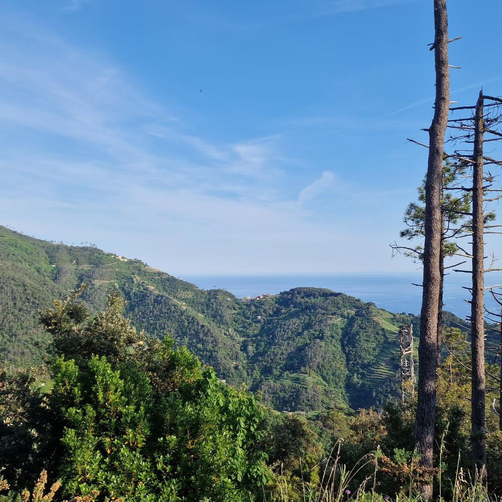
The Marco Pantani Fountain on the Passo di Guaitarola is a characteristic fountain for cyclists located on the pass of the same name, on the slopes of the mountain of the same name between the coast and the Passo del Bracco.
0
0
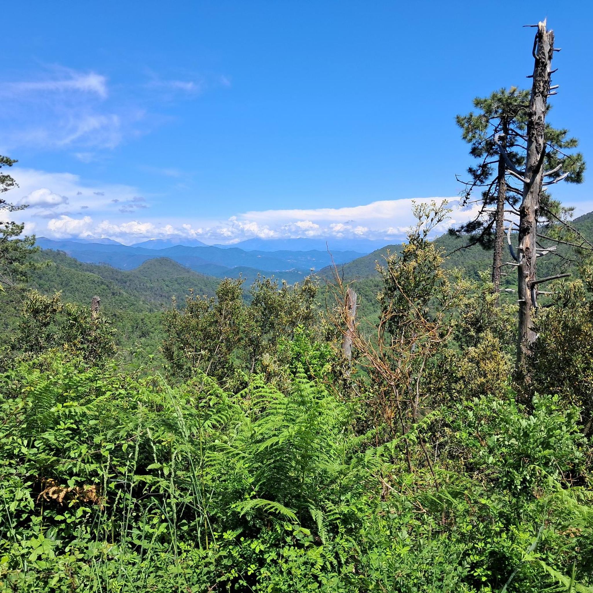
Passo della Mola (or Valico della Mola) is a mountain pass at an altitude of approximately 650-655 meters, located in Liguria, between the province of La Spezia and the metropolitan city of Genoa. It connects the coastal area to the Val di Vara (municipality of Carro). Main characteristics Altitude: 650 - 655 m a.s.l. Location: Connects the area of Carro and Velva, serving as an alternative to the better-known Passo del Bracco. Road: It is traversed via the Provincial Road 50 (SP50). The road has a narrow carriageway, generally moderate gradients, but with several curves and tight hairpin bends. Panorama: On clear days, it offers a view stretching from the Maritime Alps to the Apuan Alps.
0
0
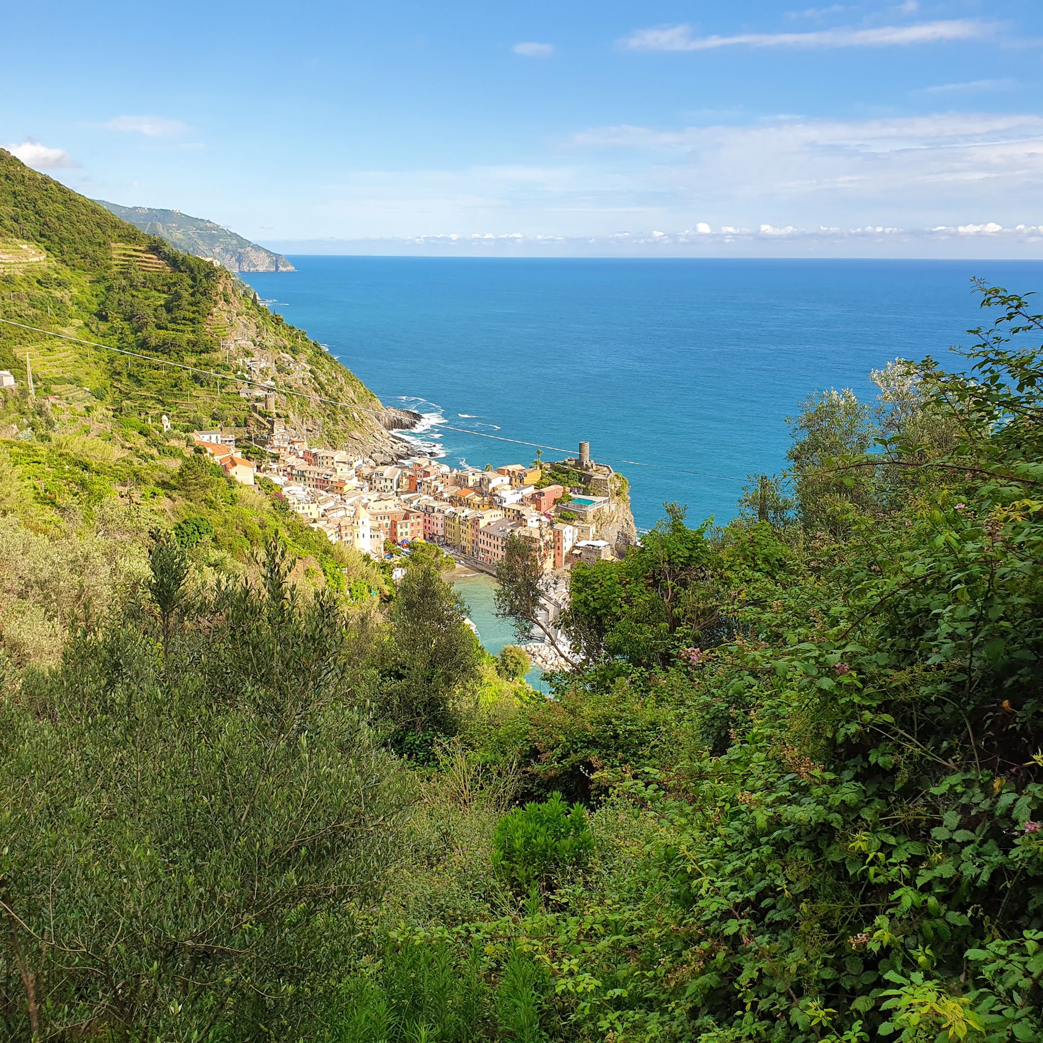
Levanto is a charming fishing village in Liguria di Levante, located in a protected bay in the province of La Spezia, considered the western gateway to the Cinque Terre
0
0
The Passo del Termine (located at about 548 meters above sea level) is a very famous panoramic point and pass along the Cinque Terre coastal road, famous for offering a spectacular, high-up view over Monterosso al Mare and the surrounding gulf.
0
0

After the fork from Bracco towards Levanto..very fresh water..🤩
1
0

Fantastic views along the route.
0
0


Refreshingly cold fountain water and a small shrine in homage to Marco Pantani; definitely worth a detour
1
0
Frequently Asked Questions
What types of road cycling routes can I find around Pignone?
Pignone offers a diverse range of road cycling routes, from easier rides suitable for any fitness level to challenging five-hour excursions with significant elevation gain. You'll find routes winding through wooded valleys, past cultivated terraces, and along the Vara River, often featuring medieval bridges. The region provides access to both inland valley roads and routes connecting to coastal towns like Vernazza and Monterosso.
Are there road cycling routes suitable for beginners or those looking for an easier ride?
Yes, Pignone has routes suitable for various fitness levels. While many routes involve elevation, there are options that are less demanding. For example, the region offers rides up to two hours with around 1,000 feet of elevation gain, which are ideal for those seeking a more relaxed experience. Komoot lists 6 easy routes and 22 moderate routes in the area.
What kind of scenery and natural features can I expect to see while cycling in Pignone?
The landscape around Pignone is rich in rural beauty. You'll cycle through wooded valleys, past cultivated terraces, and alongside hills adorned with chestnut trees, vegetable gardens, and vineyards. The Vara River, with its graceful medieval bridges, is a prominent natural feature. The area is also part of the Montemarcello Magra Regional Natural Park, offering lush woods and meadows. For unique geological sights, you might encounter karstic phenomena like the Grotta Grande.
Are there any notable landmarks or attractions along the road cycling routes near Pignone?
Absolutely. Pignone itself is a charming medieval village with a historic center, Piazza Marconi, and the Chiesa di San Michele Arcangelo. You can also see the Romanesque parish church of Santa Maria Assunta and the characteristic 16th-century Ponte Vecchio. For scenic views, consider routes that pass by highlights such as View of Manarola or View of Monterosso and the Cinque Terre Coast.
What do other road cyclists say about their experience in Pignone?
The road cycling routes around Pignone are highly regarded by the komoot community, with an average score of 4.6 stars from over 260 reviews. Cyclists often praise the varied terrain, the beautiful Ligurian countryside, and the opportunities to explore both inland valleys and coastal towns. Over 4,000 road cyclists have used komoot to discover the area's routes.
Are there any circular road cycling routes available in Pignone?
Yes, there are several circular routes. A popular option is the Ponte Vecchio di Pignone – Levanto Beach loop from Pignone, which takes you through the Vara Valley and towards the coast. Another well-liked loop is the Monterosso to Soviore Sanctuary Loop Trail, offering scenic views and a steady climb.
Can I access the road cycling routes around Pignone using public transport?
Pignone is situated inland, but its proximity to coastal towns like Levanto (approximately 20 minutes by car) suggests that public transport connections might be available to nearby hubs. From these hubs, you could potentially start your cycling adventure or connect to routes leading into the Pignone area. It's advisable to check local bus or train schedules for specific connections to Pignone or its surrounding villages.
What is the best time of year for road cycling in Pignone?
The region's Mediterranean climate generally makes it suitable for cycling for much of the year. Spring and autumn typically offer pleasant temperatures and less crowded routes, making them ideal. Summer can be warm, especially in the valleys, but coastal breezes might provide some relief. Winter cycling is possible, though some higher elevation routes might be cooler.
Are there family-friendly road cycling options in Pignone?
While many routes in Pignone involve significant elevation changes, there are easier options that might be more suitable for families or those cycling with children. Look for routes described as 'easy' or 'moderate' on komoot, which tend to have less demanding climbs and shorter distances. Always check the route details for elevation and distance to ensure it matches your family's ability.
Where can I park my car when going road cycling in Pignone?
As a medieval village, Pignone has a compact center. However, parking facilities are generally available in or near the village for visitors. It's recommended to look for designated parking areas upon arrival, especially if you plan to start your ride directly from Pignone. Many routes also connect from nearby towns where parking might be more readily available.
Are there any challenging road cycling routes for experienced cyclists?
Yes, experienced cyclists will find plenty of challenging routes around Pignone. Many routes feature significant elevation gain, with some five-hour rides accumulating up to 3,000 feet of climbing. An example is the Vernazza and Monterosso from Pignone route, a difficult 28.4-mile trail with over 1,500 meters of elevation gain through the Ligurian countryside. Komoot lists 39 difficult routes in the area.
Can I find cafes or restaurants in Pignone after my ride?
Pignone, being a charming village, offers local amenities. You can find cafes and restaurants, particularly around Piazza Marconi, the village's social hub. These establishments provide a great opportunity to refuel and relax after your road cycling adventure, offering local Ligurian cuisine and refreshments.
Most popular attractions around Pignone

Get inspired with the komoot mobile app


Explore more
Browse the best Road cycling routes in other regions.
