The best road cycling routes around Montebello Sul Sangro
4.4
(5)
189
riders
21
rides
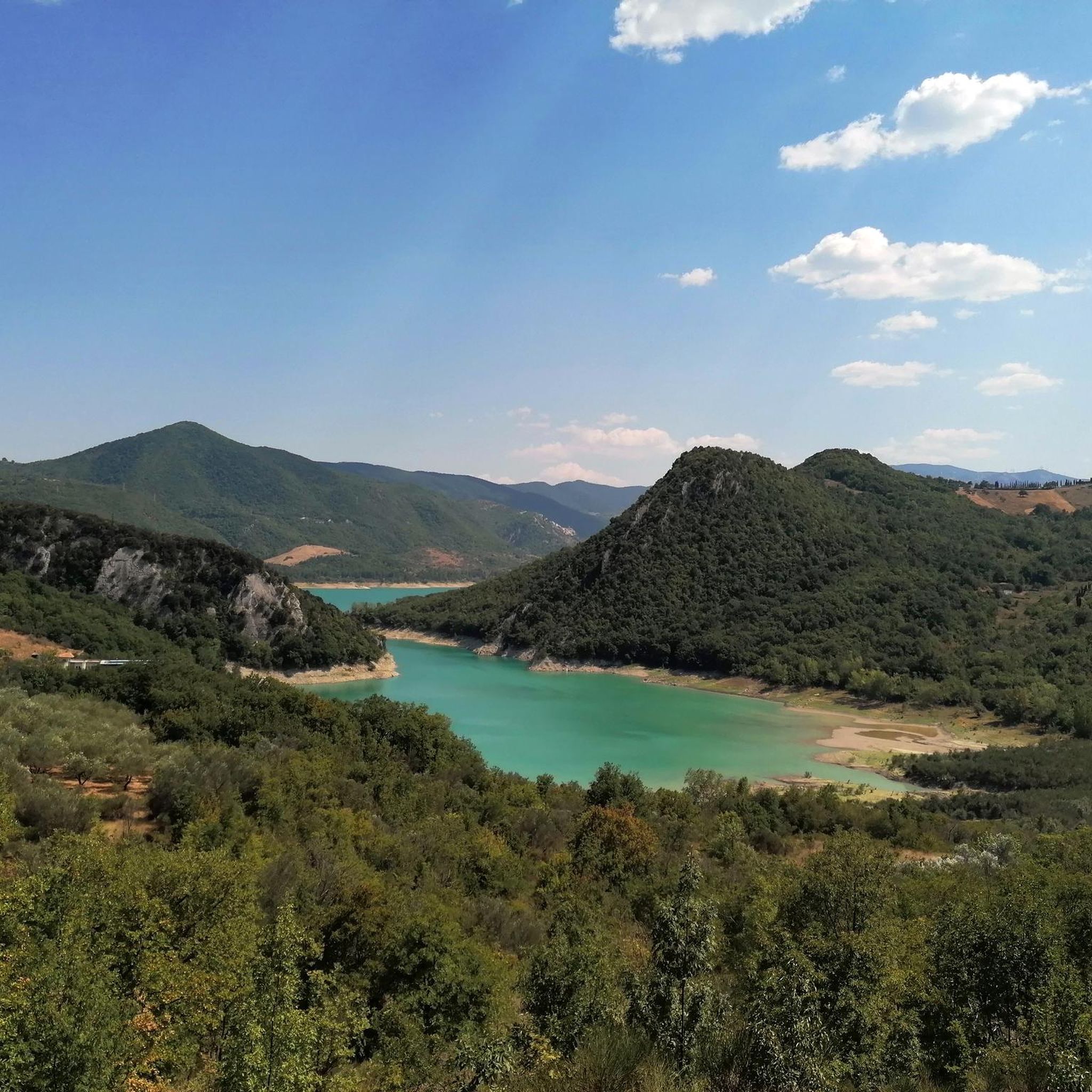
Road cycling routes around Montebello Sul Sangro are characterized by varied terrain within the Abruzzo region of Italy. The town is situated on an elevated ridge at 810 meters above sea level, providing panoramic views of the Sangro Valley and Lake Bomba. Road cyclists can expect a mix of challenging climbs and scenic descents, with the Maiella mountain range visible in the distance. The area features quiet tarmac roads that navigate through this landscape.
Best road cycling routes around Montebello…
Last updated: November 5, 2026
21
riders
83.7km
04:36
1,730m
1,730m
Hard road ride. Very good fitness required. Mostly well-paved surfaces and easy to ride.
26
riders
132km
07:31
3,000m
3,000m
Hard road ride. Very good fitness required. Mostly well-paved surfaces and easy to ride.

4.5
(2)
23
riders
97.1km
04:37
1,240m
1,240m
Hard road ride. Very good fitness required. Mostly well-paved surfaces and easy to ride.
5.0
(1)
17
riders
92.4km
04:58
1,740m
1,740m
Hard road ride. Very good fitness required. Some segments of this route may be unpaved and difficult to ride.
9
riders
109km
06:00
2,310m
2,310m
Hard road ride. Very good fitness required. Mostly well-paved surfaces and easy to ride.
Get access to more routes and recommendations from other explorers.
Already have an account?
Our route recommendations are based on thousands of hikes, rides, and runs completed by other people on komoot.
Start today with a free account
Your next adventure awaits.



Tips from the Community

Historic Franciscan monastery in an oasis of peace. The Convento di San Pasquale (officially the monastery of Santa Maria degli Angeli) is hidden in the greenery on the hill of Vallaspra, just outside the medieval town of Atessa. This impressive complex was founded as early as 1408 by the blessed Tommaso da Firenze. It is built entirely of natural stone and exudes a serene, historic atmosphere. Although the interior and the beautiful monastery garden with the central well (from 1709) are unfortunately often closed to the public due to varying opening hours, the complex is an absolute sight to behold from the outside. Under the large portico at the front, you can still admire a centuries-old fresco of the Pietà. Moreover, the quiet, shady surroundings are perfect for a well-deserved break during your sporting tour. Fun fact: the monastery used to lend its name to the well-known local herbal liqueur "Amaro San Pasquale", which was originally prepared by the monks with herbs from this valley.
2
0
Ex-Fossacesia Station – The historic railway heart by the sea. The old Fossacesia Marina train station is a fascinating cultural-historical stop right along the route. Today, this nostalgic building marks the spot where the historic Adriatic Railway (Ferrovia Adriatica) thundered along since 1862, until the railway was moved inland in 2005 to make way for the current Via Verde. Although the characteristic building was a symbol of bygone glory for many years, the place breathes pure railway history. It is also the place where the 19th-century industrial revolution and the ancient fishing tradition literally shook hands. The historical significance behind this stop: the backbone of the trabocchi: When workers laid the tracks for this station in the 19th century, they left heavy materials lying around. Resourceful fishermen used the abandoned, heavy railway sleepers, iron bolts, and telegraph cables to anchor nearby trabocchi (like Punta Rocciosa) indestructibly into the seabed. The train thus gave the fishing spiders their iron backbone! Climb to the Goddess of Love: this station was historically the gateway for travelers making pilgrimages to the higher-lying 12th-century San Giovanni in Venere Abbey. Future Tourist Hub! There's a breath of fresh air blowing through the heritage! In May 2026, the final expropriation process will be completed. The province of Chieti is currently transforming this old station into a modern tourist hub and co-working space. Komoot tip: use the ample parking around the old station as the ideal starting point for your bike tour, or pause here to capture the contrasts between the old architecture and the modern cycling infrastructure.
5
0
The Trabucchi cycle path (officially known as the Via Verde dei Trabocchi) is a beautiful, largely flat cycle path over 50 kilometers long that runs along the Adriatic coast of the Italian region of Abruzzo on a former railway line. The path owes its name to the trabocchi (singular: trabocco): unique, monumental wooden fishing platforms on stilts that tower over the water like giant spiders.
5
0
The Ciclovia Adriatica in Abruzzo (better known as Bike to Coast) is a 131-kilometer cycle path that covers the entire coastline of the Abruzzo region. The route runs from Martinsicuro (coastal border with Marche) to San Salvo (border with Molise). The route is mostly flat, mostly car-free, and crosses 19 coastal municipalities.
5
0

Pleasant cycle path on the Abruzzo coast
1
0


The inhabitants of Abruzzo and the neighboring region of Lazio have their own local observation related to this Passo Lanciano. When the sun sets in the spring behind the mighty Majella massif, it quickly gets dark on the Abruzzo side (i.e., where Passo Lanciano is located) and dusk falls, while on the other side of the mountains, in Lazio, it is still bright daylight. Locals joke that at the same moment, one half of Italy goes to sleep, and the other goes for an aperitivo.
0
0

beautiful view of the mouth of the Sangro River.
0
0
Frequently Asked Questions
What kind of terrain can I expect when road cycling around Montebello Sul Sangro?
Road cycling around Montebello Sul Sangro offers a diverse and engaging experience. Situated on an elevated ridge at 810 meters above sea level, the area features varied terrain with both challenging climbs and scenic descents. You'll find quiet tarmac roads winding through the landscape, providing panoramic views of the Sangro Valley, Lake Bomba, and the majestic Maiella mountain range in the distance.
How many road cycling routes are available in the Montebello Sul Sangro area?
There are over 15 road cycling routes available around Montebello Sul Sangro. These routes primarily cater to cyclists looking for challenging rides, with a few moderate options also present.
Are there any easy or family-friendly road cycling routes near Montebello Sul Sangro?
The road cycling routes around Montebello Sul Sangro are predominantly rated as difficult, with only one moderate route identified. The terrain, characterized by significant elevation changes due to the region's elevated ridges and valleys, means that truly easy or flat family-friendly road cycling paths are limited. Cyclists seeking less strenuous options might consider exploring the broader Sangro Valley floor, though specific easy routes are not highlighted in this area.
What are some notable landmarks or viewpoints I can encounter on road cycling routes?
The region around Montebello Sul Sangro is rich in historical and natural sights. While cycling, you might pass by the impressive Castello di Roccascalegna, a medieval castle perched dramatically on a rock spur. Other points of interest include the Church of Saint Peter and the Waterfall in Gola di Pennadomo. Many routes also offer stunning panoramic views, such as the View from Roccascalegna Castle, showcasing the surrounding valleys and mountains.
Are there any circular road cycling routes available?
Yes, many of the road cycling routes in the Montebello Sul Sangro area are designed as loops. For example, you can explore the Quarto Grande Plateau – Bar Stazione di Palena loop from Civitaluparella, which offers expansive views, or the Sanctuary of Madonna in Saletta loop from Civitaluparella, winding through the landscape to a notable sanctuary. Another option is the Pietraferrazzana Rock Spur – Capracotta loop from San Carlo, known for its varied terrain and significant elevation changes.
What is the best time of year to go road cycling in Montebello Sul Sangro?
The Abruzzo region, including Montebello Sul Sangro, generally offers pleasant conditions for road cycling from spring through autumn. Spring brings blooming landscapes, while autumn provides cooler temperatures and vibrant foliage. Summers can be warm, especially in the valleys, but the elevated position of Montebello Sul Sangro (810m) can offer some relief. Always check local weather forecasts before heading out.
What do other cyclists say about road cycling in Montebello Sul Sangro?
The road cycling routes around Montebello Sul Sangro are highly regarded by the komoot community, holding an average rating of 5.0 stars from 2 reviews. Over 114 road cyclists have used komoot to explore the varied terrain, often praising the challenging climbs, scenic descents, and the panoramic views of the Sangro Valley and Lake Bomba.
Are there any routes that pass by the historic old town of Montebello Sul Sangro?
While specific routes directly through the ancient part of Montebello Sul Sangro (Buonanotte Vecchia) are not detailed as road cycling paths, the town itself is a significant landmark. Its old village, with stone houses and ruins like the Caracciolo Castle and Santa Giusta church bell tower, offers a unique historical backdrop. Cyclists in the area will experience the town's elevated position and its peculiar, age-old beauty, making it a worthy point of interest for a stop or a detour.
What are the typical elevation changes on road cycling routes in this area?
Given Montebello Sul Sangro's location on an elevated ridge and its views of the Maiella mountain range, road cycling routes in this area feature significant elevation changes. For instance, routes can involve climbs of over 1,700 meters, such as the Quarto Grande Plateau – Bar Stazione di Palena loop from Civitaluparella or the Pietraferrazzana Rock Spur – Capracotta loop from San Carlo. These profiles contribute to the routes being predominantly rated as difficult.
Can I find accommodation or places to eat that are cyclist-friendly in Montebello Sul Sangro?
Montebello Sul Sangro, nestled in nature, offers a peaceful environment. While specific cyclist-friendly establishments are not detailed, the town and surrounding villages in the Abruzzo region are generally welcoming to visitors. You can expect to find local cafes, pubs, and accommodation options that cater to tourists and outdoor enthusiasts. It's advisable to check in advance for specific amenities like secure bike storage.
Are there any routes that offer views of Lake Bomba?
Yes, Montebello Sul Sangro's elevated position provides panoramic views of the surrounding area, including the clear waters of Lake Bomba, which lies just below the town. Many road cycling routes in the region will offer glimpses or direct views of the lake as you navigate the varied terrain and scenic descents.
What is the longest road cycling route available in the area?
One of the longer road cycling routes in the area is the Pietraferrazzana Rock Spur – Capracotta loop from San Carlo, which spans approximately 92.4 kilometers (57.4 miles) and involves significant elevation changes.
Most popular routes around Montebello Sul Sangro
Most popular attractions around Montebello Sul Sangro

Get inspired with the komoot mobile app


Explore more
Browse the best Road cycling routes in other regions.
