The best walks and hikes around Montebello Sul Sangro
3.5
(41)
176
hikers
14
hikes
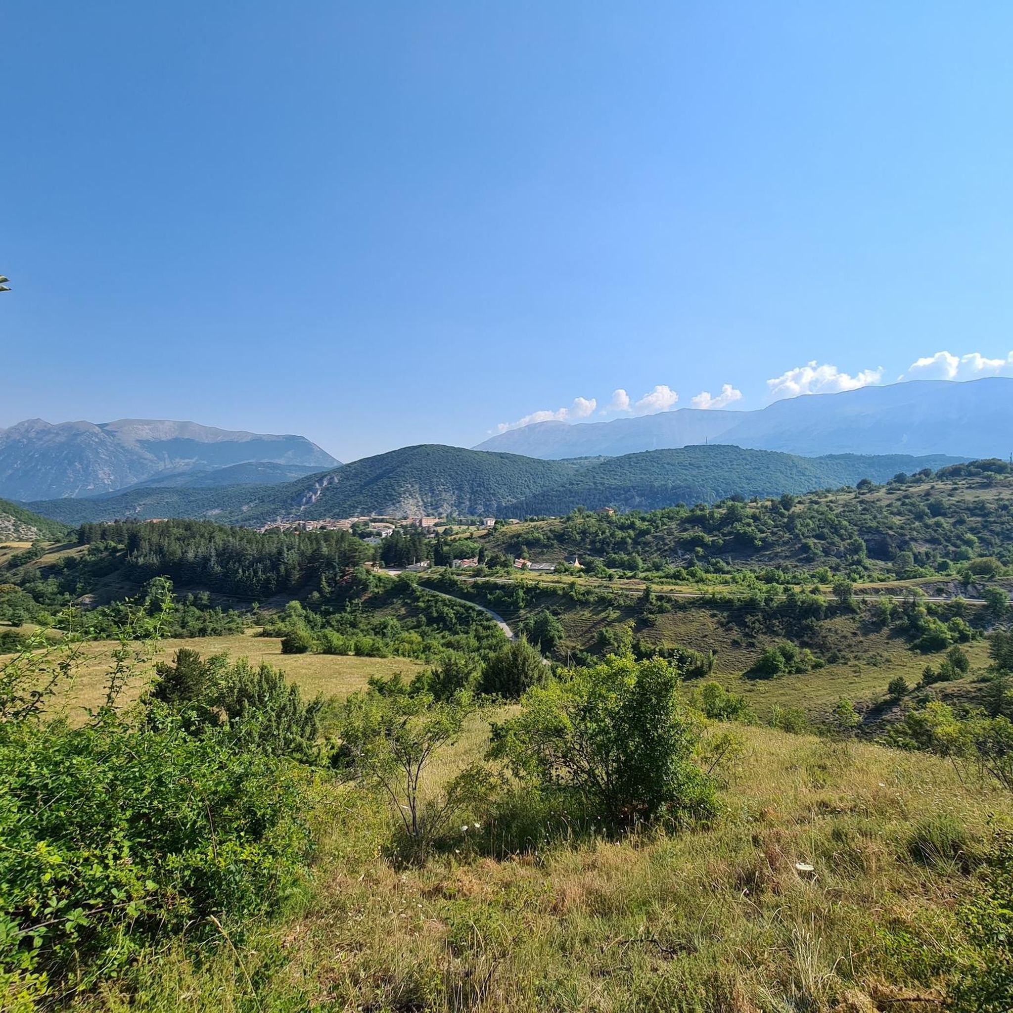
Hiking around Montebello Sul Sangro offers routes through varied landscapes in the Abruzzo region. The area features natural reserves, historical sites, and woodlands. Trails often follow river valleys and lead to points of interest such as waterfalls and ancient structures. The terrain includes gentle ascents and descents, characteristic of the local hills and natural areas.
Best hiking trails around Montebello Sul Sangro
- The most popular hiking route is Regional Natural Reserve Cascate del Verde, a 2.9 miles (4.7 km)…
Last updated: November 4, 2026
4.3
(3)
6
hikers
4.66km
01:22
120m
120m
Easy hike. Easily walkable paths.
3.3
(3)
23
hikers
4.94km
01:29
150m
150m
Easy hike. Easily walkable paths.

3.0
(1)
10
hikers
Moderate hike. Good fitness required. Easily walkable paths.
2.7
(6)
12
hikers
7.76km
02:23
270m
270m
Moderate hike. Good fitness required. Easily walkable paths.
8
hikers
10.8km
03:12
310m
320m
Moderate hike. Good fitness required. Easily walkable paths.
Get access to more routes and recommendations from other explorers.
Already have an account?
Our route recommendations are based on thousands of hikes, rides, and runs completed by other people on komoot.
Start today with a free account
Your next adventure awaits.



Tips from the Community

Tribute to the mountain troops in the hills of Atessa. The Chiesa ai Caduti della Julia (locally known as the Chiesa di San Giuseppe) is located on Via Brigata Alpina Julia in the upper outskirts of Atessa. This religious monument and its surrounding street name are dedicated to the legendary Brigata Alpina Julia, the Italian mountain troops who made heavy sacrifices during the World Wars. For outdoor enthusiasts, this church is an excellent navigation point and a symbolic stop. Situated on the hillsides, it often marks the transition from the flatter Sangro valley to the challenging, climbing inland roads towards the historic center of Atessa or Monte Pallano. It is a serene place to catch your breath and reflect on local history.
2
0

The excursion was done on June 16, 2024 and there was a total lack of water!
1
0

"The archaeological park of Iuvanum is one of those hidden places to discover. In the middle of the Abruzzo countryside, you don't expect to find a vast area rich in history, and you have the impression of entering a painting, a window about the past, where the important ruins stand out, surrounded by nature".
0
0

The Green Falls are located within a Special Area of Conservation (SAC), with the falls originating from the Rio Verde. The organic quality is remarkable, there are crayfish and river crab, the dipper and the yellow wagtail, as well as the peregrine falcon and the red kite.
2
0
The green waterfalls are the highest perennial natural waterfalls in the Apennines. In total they fall for over 200 meters before joining the Sangro River.
2
0

A spectacle of architecture dating back to the Middle Ages. It is worth the whole climb to see the show
0
0

In addition to numerous small frogs and fish, this small water snake also lives in the Gola and presumably feeds on the former. Now, at the beginning of October, the waterfall is more of a small trickle. To do this, it can be easily reached from the parking lot at the entrance to the gorge after a few minutes of walking over round stones and mini climbing inserts over two slightly larger rocks with dry feet. Sturdy footwear is still advisable and, especially in bad weather, you should take the notice at the entrance to the gorge that you should only enter it with a helmet because of the risk of falling rocks.
0
0
Frequently Asked Questions
How many hiking trails are available in Montebello Sul Sangro?
There are over 10 hiking routes around Montebello Sul Sangro, offering a variety of experiences through natural reserves, historical sites, and woodlands. These trails cater to different skill levels, with options for both easy and moderate hikes.
Are there easy hiking trails suitable for beginners or families in Montebello Sul Sangro?
Yes, Montebello Sul Sangro offers several easy trails perfect for beginners or families. An excellent option is the Regional Natural Reserve Cascate del Verde, a 2.9-mile (4.7 km) route that takes about 1 hour 21 minutes to complete. Another family-friendly choice is the View of the Cascate del Verde – View of the Cascate del Verde loop from Borrello, which is 2.3 miles (3.8 km) long.
What kind of natural attractions can I expect to see on hikes in Montebello Sul Sangro?
Hiking in Montebello Sul Sangro often leads you through beautiful natural reserves and along river valleys. A prominent feature is the Cascate del Verde, a stunning waterfall system. You can explore this area on routes like the Regional Natural Reserve Cascate del Verde.
Are there any circular hiking routes in Montebello Sul Sangro?
Yes, there are several circular routes available. For example, the View of the Cascate del Verde – View of the Cascate del Verde loop from Borrello is a popular 2.3-mile (3.8 km) loop. Another option is the Mixed Deciduous Oak Woodland – Megalithic Walls loop from Tornareccio, a moderate 5.2-mile (8.4 km) trail.
What are the best times of year to go hiking in Montebello Sul Sangro?
The Abruzzo region, where Montebello Sul Sangro is located, generally offers pleasant hiking conditions from spring through autumn. Spring brings blooming wildflowers, while autumn showcases vibrant foliage. Summers are typically warm, making early mornings or late afternoons ideal for hiking. Winter hiking is possible, but some higher elevation trails might be affected by snow or ice, so checking local conditions is advised.
Are there any historical landmarks or points of interest along the hiking trails?
Yes, the area around Montebello Sul Sangro is rich in history. Many trails offer views of or lead to historical sites. A notable landmark is the Castello di Roccascalegna, a dramatic medieval castle. You can experience this by hiking the From Gessopalena to Castello di Roccascalegna route, which connects two villages and offers views of the castle.
What do other hikers say about the trails in Montebello Sul Sangro?
The hiking routes in Montebello Sul Sangro are highly regarded by the komoot community, with an average score of 3.6 stars from over 30 reviews. Hikers often praise the varied landscapes, the beauty of the natural reserves, and the presence of stunning features like the Cascate del Verde.
Are there any hikes with good viewpoints in Montebello Sul Sangro?
Many trails in the region offer scenic vistas. The area's terrain, characterized by hills and river valleys, naturally provides opportunities for panoramic views. For specific viewpoints, consider routes that pass near elevated historical sites like the Castello di Roccascalegna, which offers breathtaking perspectives of the surrounding landscape.
What is the typical duration for a hike in Montebello Sul Sangro?
Hiking durations vary depending on the trail's length and difficulty. Easy routes, such as the Regional Natural Reserve Cascate del Verde, can be completed in about 1 hour 21 minutes. Moderate trails, like the From Gessopalena to Castello di Roccascalegna, typically take around 3 hours 10 minutes.
Are there any moderate or more challenging trails for experienced hikers?
While there are no trails classified as 'difficult' in the immediate vicinity, Montebello Sul Sangro does offer several moderate routes for those seeking a longer or more strenuous hike. The From Gessopalena to Castello di Roccascalegna trail, at 6.1 miles (9.9 km) with a moderate elevation gain, provides a good challenge and takes about 3 hours 10 minutes.
Can I find wild swimming spots near the hiking trails in Montebello Sul Sangro?
The region is known for its river valleys and waterfalls, particularly the Cascate del Verde. While specific designated wild swimming spots are not always explicitly marked on hiking trails, the presence of natural water features suggests opportunities for refreshing dips. Always exercise caution and check local regulations regarding swimming in natural bodies of water.
What kind of terrain can I expect on the hiking trails?
The terrain around Montebello Sul Sangro features a mix of landscapes, including woodlands, river valleys, and natural reserves. Trails typically involve gentle ascents and descents, characteristic of the local hills. You can expect well-trodden paths, sometimes rocky or earthy, suitable for standard hiking footwear.
Most popular routes around Montebello Sul Sangro
Most popular attractions around Montebello Sul Sangro

Get inspired with the komoot mobile app


Explore more
Browse the best Hikes in other regions.
