The best cycling routes in Pena Trevinca
4.5
(13)
98
riders
6
rides
Touring cycling routes in Pena Trevinca traverse a protected natural reserve featuring high mountain and sub-alpine landscapes. The region is defined by its mountainous massif, including peaks over 2,000 meters, and numerous glacial lakes, forming the second-largest concentration in the Iberian Peninsula. Deep glacial valleys and high-mountain rivers like the Xares and Bibei shape the terrain, offering varied conditions for touring cyclists.
Best touring cycling routes in Pena Trevinca
- The most popular touring cycling route is Alto de Cepedelo and…
Last updated: October 7, 2026
45.7km
03:33
1,240m
1,240m
Hard bike ride. Very good fitness required. Mostly paved surfaces. Suitable for all skill levels.
2
riders
22.7km
01:42
520m
520m
Hard bike ride. Very good fitness required. Mostly paved surfaces. Suitable for all skill levels.

2
riders
30.2km
02:07
560m
560m
Hard bike ride. Very good fitness required. Mostly paved surfaces. Suitable for all skill levels.
8
riders
49.5km
03:43
1,200m
1,200m
Hard bike ride. Very good fitness required. Mostly paved surfaces. Suitable for all skill levels.
16
riders
130km
08:57
2,360m
2,370m
Hard bike ride. Very good fitness required. Mostly paved surfaces. Suitable for all skill levels.
Our route recommendations are based on thousands of hikes, rides, and runs completed by other people on komoot.
Start today with a free account
Your next adventure awaits.
Tips from the Community

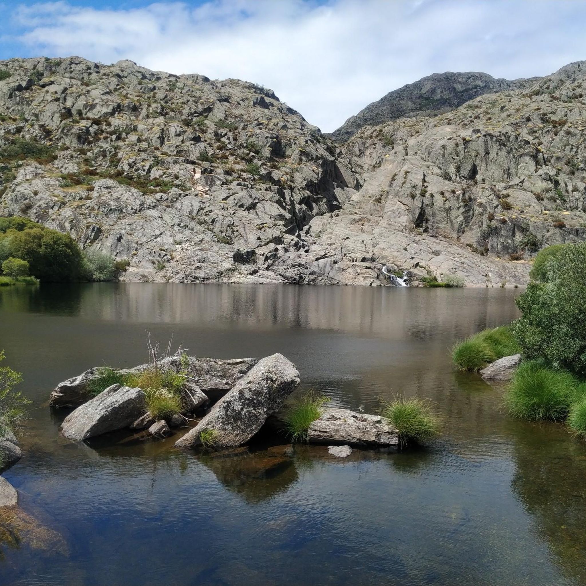
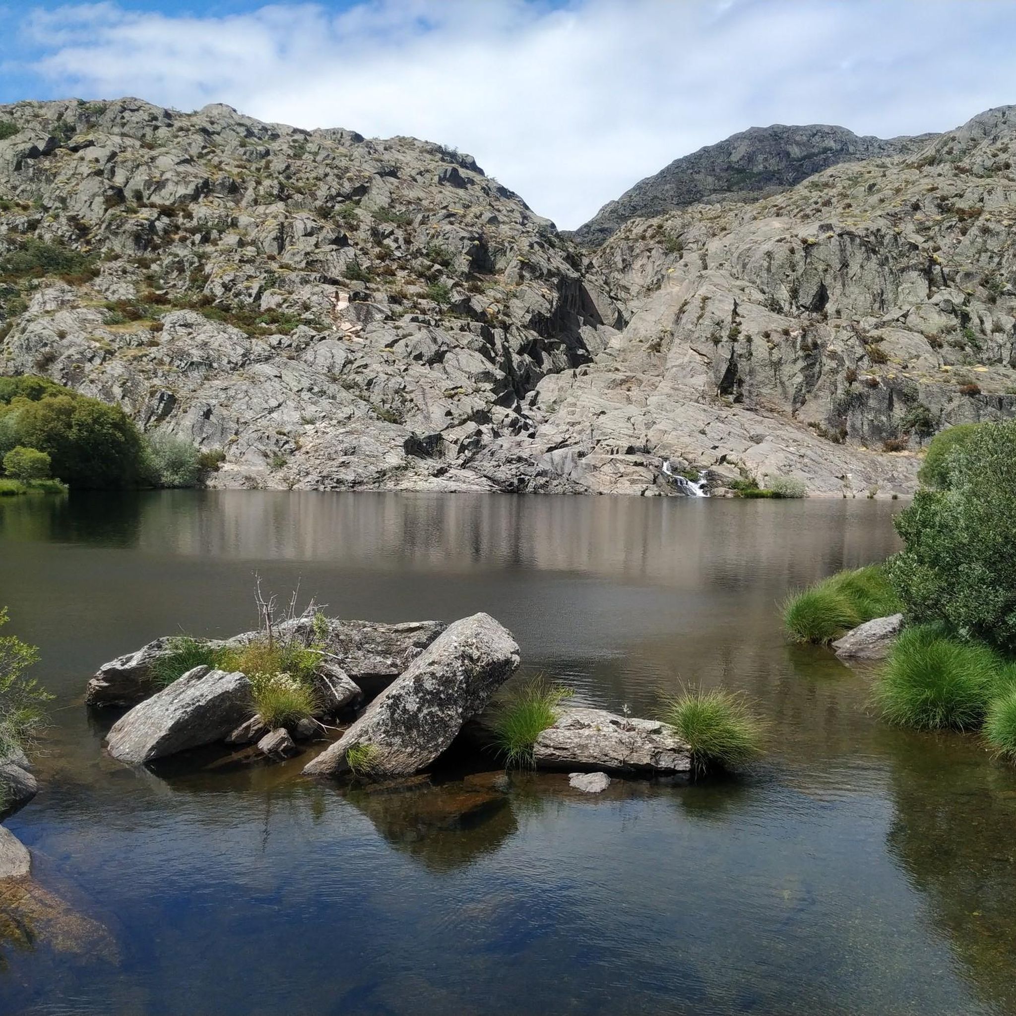
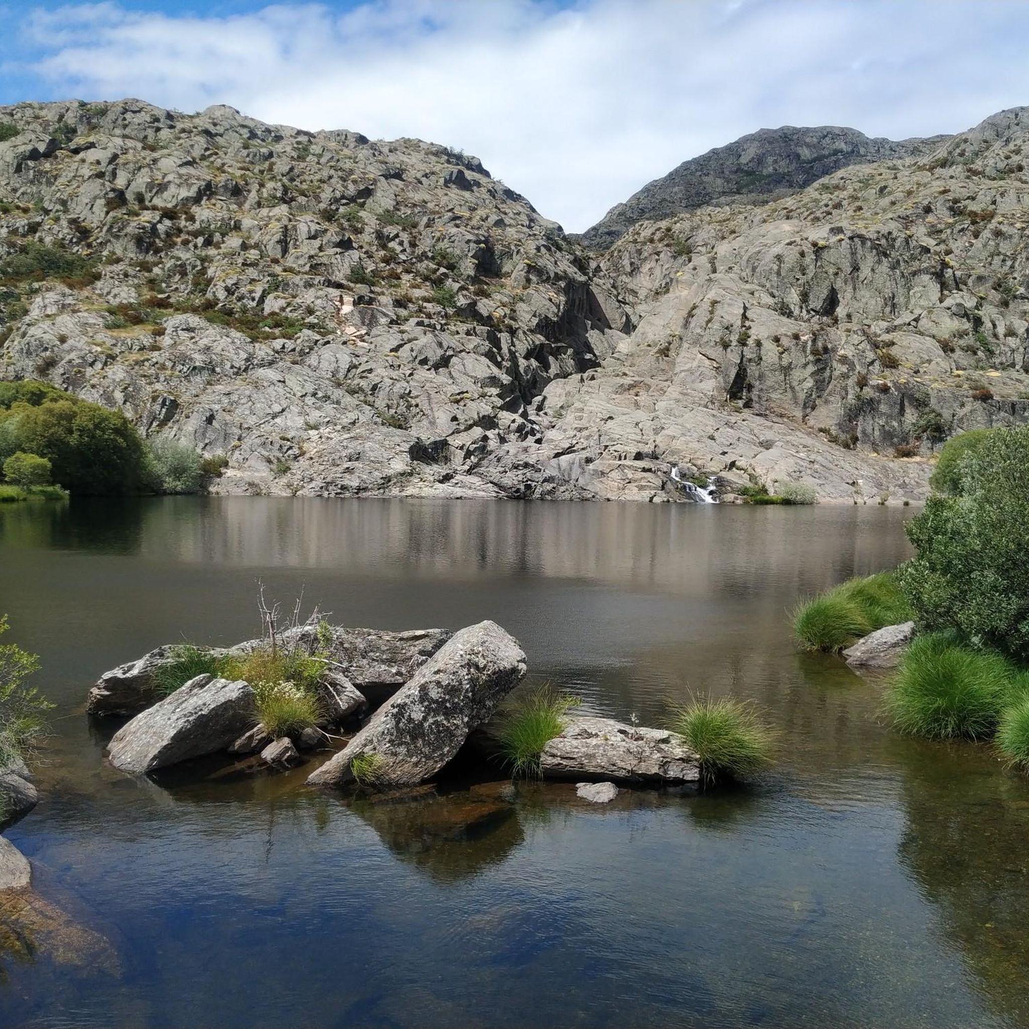
Small Zamorana town near Portugal in the Sanabria region. Picturesque town with numerous fountains and a bar where you can stop to recharge your batteries.
0
0

Ice cold water source, recommended by the locals (instead of the others that exist in the village). It has a perfect pool for a quick bath and a laundry room for clothes.
0
0
Good shaded table with unbeatable views
0
0

A Pobra de Trives is a small regional town located at the foot of the mountain and access to the Manzaneda sky station. It is a great place to stop for lunch whether you go down to the Bibei river or go up to Manzaneda.
2
0
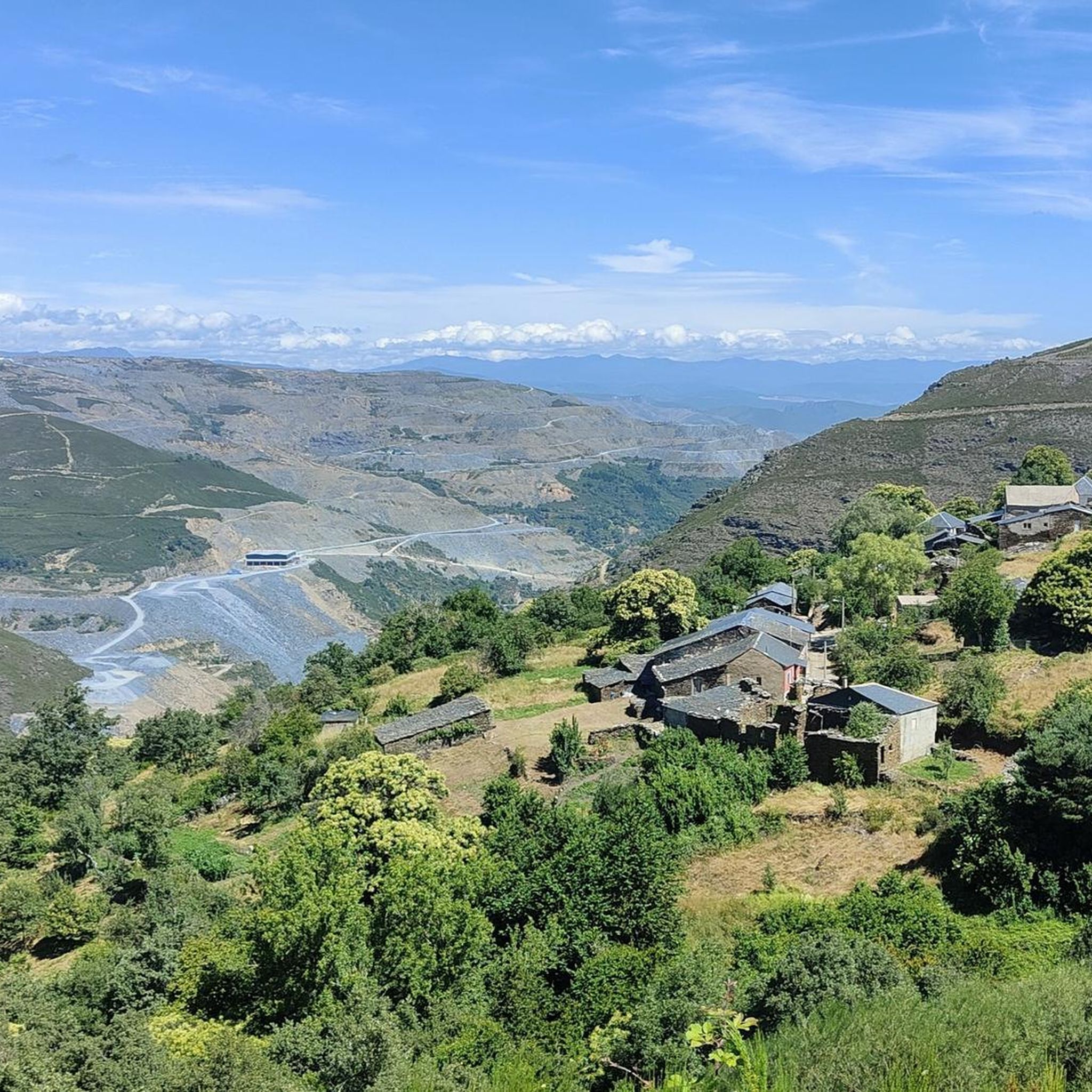
From this point close to San Cibrao, Viana de Bolo and the embalse de Beo can be seen. The water from the Bibei River is trapped in the valley by the surrounding mountains.
1
0
Surrounded by high mountains on the border between Galicia and Castilla y León, the Pías reservoir is a place of great beauty. The reservoir captures water from the Bibei River to power its hydroelectric dam.
1
0
At an altitude of 700 m, the small town of Viana del Bollo located on the banks of the Bao Reservoir is surrounded by native Galician oak and chestnut forest. The city's history dates back to Roman times, with its famous mineral mines still in operation today.
1
0
Spectacular panoramic view of the mountains and the Sil valley below. Be sure to stop to admire the views.
1
0
Frequently Asked Questions
How many touring cycling routes are available in Pena Trevinca?
There are 6 touring cycling routes documented in Pena Trevinca. All of them are currently rated as difficult, offering significant challenges for experienced cyclists.
What makes touring cycling in Pena Trevinca unique?
Pena Trevinca is a protected natural reserve known for its dramatic high mountain and sub-alpine landscapes, including Galicia's highest peak, Pena Trevinca. Cyclists can experience deep glacial valleys, high-mountain rivers like the Xares and Bibei, and numerous glacial lakes, which form the second-largest concentration in the Iberian Peninsula.
Are there any circular touring cycling routes in Pena Trevinca?
Yes, several routes in Pena Trevinca are circular. For example, the Alto de Cepedelo and Pías Reservoir Loop is a challenging 45.7 km circular tour, and the Alto de Cairel loop from A Veiga offers a 22.7 km circular ascent.
What is the best season for touring cycling in Pena Trevinca?
The high mountain and sub-alpine landscapes of Pena Trevinca mean that winter can bring snow-covered summits. Therefore, the best seasons for touring cycling are typically late spring, summer, and early autumn, when the weather is more stable and routes are clear of snow and ice. Always check local weather conditions before heading out.
What kind of challenges can I expect on touring cycling routes in Pena Trevinca?
The touring cycling routes in Pena Trevinca are generally rated as difficult due to significant elevation changes. For instance, the Alto de Cepedelo and Pías Reservoir Loop involves over 1,200 meters of elevation gain. Some routes may also include unpaved segments where you might need to push your bike, requiring very good fitness.
Are there any family-friendly or beginner touring cycling routes?
Currently, all listed touring cycling routes in Pena Trevinca are rated as difficult, featuring significant elevation changes and requiring good fitness. While some routes might have paved sections, the overall terrain is challenging and may not be suitable for beginners or young families looking for an easy ride.
What natural attractions can I see while cycling in Pena Trevinca?
Pena Trevinca offers stunning natural attractions. You can cycle past numerous glacial lakes, such as Lagoa de O Celo and Lagoa da Serpe, and experience the unique sub-alpine landscapes. The region is also home to the ancient Teixadal de Casaio yew forest and offers panoramic views from high mountain passes. The Embalse de Prada, featured in the Prada Reservoir loop from A Veiga, also has a 'beach' known as Playa de los Franceses.
Where can I park my car to access the touring cycling routes?
Many routes, such as the Alto de Cairel loop and Prada Reservoir loop, start and end in A Veiga, which typically offers parking facilities. For routes like the A Pobra de Trives Town Center – Chaira das Lamas Viewpoint loop, you would look for parking in or near O Barrio dos Xitanos. It's advisable to check specific starting points for available parking options.
What do other touring cyclists enjoy most about Pena Trevinca?
The touring cycling routes in Pena Trevinca are highly rated by the komoot community, with an average score of 5.0 stars. Reviewers often praise the dramatic high mountain landscapes, the challenge of the climbs, and the serene beauty of the glacial lakes and protected natural reserve.
Are there opportunities for stargazing or bird-watching in Pena Trevinca?
Yes, Pena Trevinca is recognized as one of the best places globally for stargazing due to its clear skies and lack of light pollution. It's also a prime location for bird-watching, being a Special Protection Area for birds (ZEPA) and home to various birds of prey, including golden eagles. These activities can be enjoyed in conjunction with your cycling tours.
Can I find amenities like cafes or viewpoints along the routes?
While the region is largely a protected natural reserve, some routes pass through or near picturesque villages where you might find local amenities. Many routes also offer stunning viewpoints due to the mountainous terrain. For example, the A Pobra de Trives Town Center – Chaira das Lamas Viewpoint loop explicitly mentions a viewpoint. It's recommended to carry sufficient supplies as services can be sparse in remote areas.
What is the longest touring cycling route available in Pena Trevinca?
The longest touring cycling route currently listed is the View of the Reservoir – A Venda da Teresa loop from A Gudiña-Porta de Galicia, which spans approximately 129.8 km (80.6 miles) and involves over 2,300 meters of elevation gain. This route is a significant undertaking, typically requiring over 8 hours to complete.

Get inspired with the komoot mobile app


Explore more
Browse the best Cycling routes in other regions.
