Top 3 Gorges in Lerderderg River Heritage River
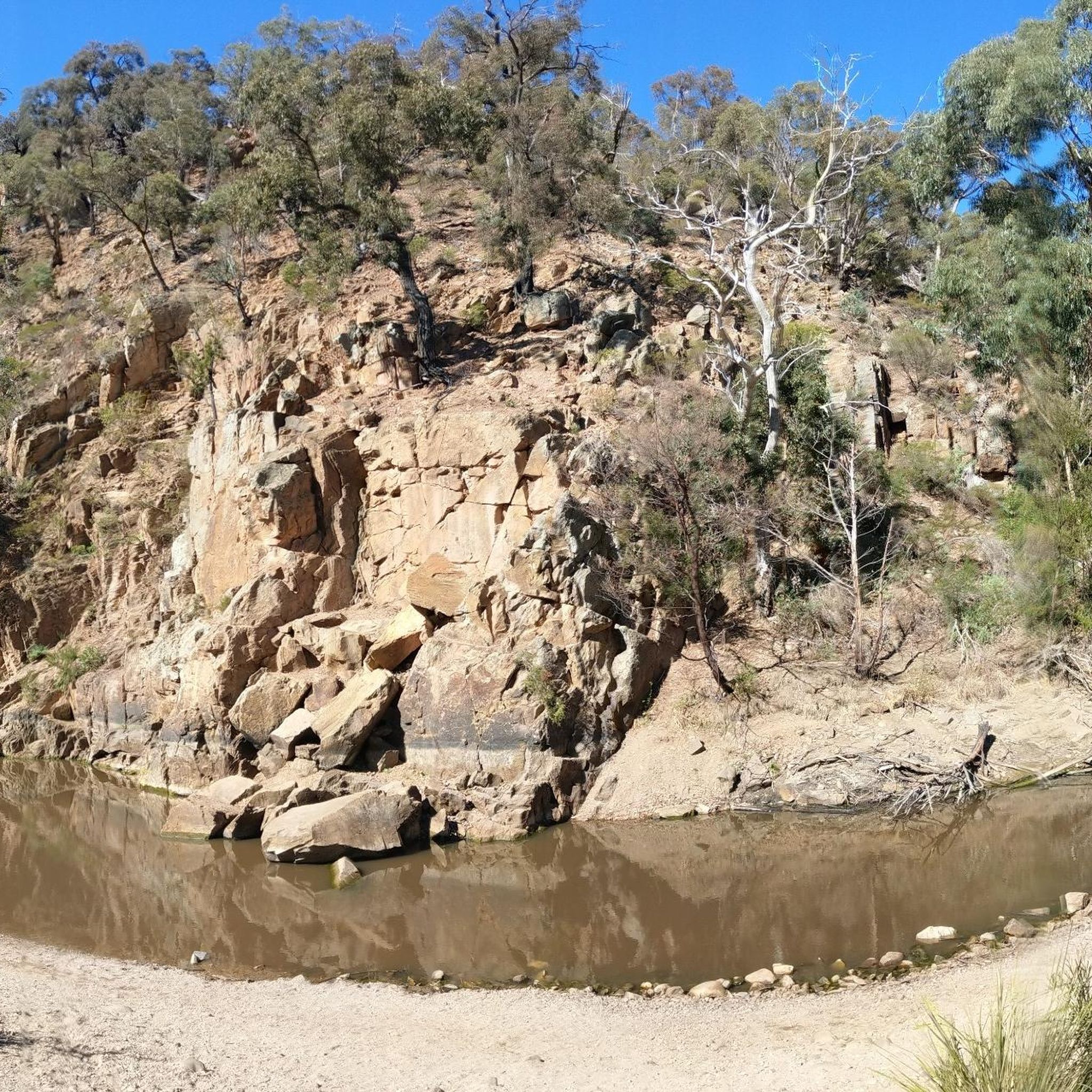
Best canyons in Lerderderg River Heritage River are primarily found within the Lerderderg Gorge, a significant natural feature carved by the Lerderderg River. This deeply incised chasm reaches depths of up to 300 meters, with walls ascending 350-400 meters, showcasing geological formations of sandstone and slate. The region offers a rugged wilderness experience characterized by long, narrow ridges, steep spurs, and numerous rock outcrops. It provides a landscape for exploring diverse ecosystems and historical gold mining remnants.
Best canyons in…
Last updated: November 6, 2026
Lerderderg Gorge Track
Highlight (Segment) • Trail
Tip by

River Trail in Lerderderg State Park
Highlight (Segment) • Trail
Translated by Google •
Tip by

Sign up now to discover places like this
Get recommendations on the best single tracks, peaks, & plenty of other exciting outdoor places.
Lerderderg River
Highlight • River
Tip by

Razorback Track
Highlight (Segment) • Trail
Tip by
Ridgeline Lookout
Highlight (Segment) • Viewpoint
Tip by

Start today with a free account
Your next adventure awaits.
Popular around Lerderderg River Heritage River

Tips from the Community

The Razorback Track gets its name because it cuts directly across an exposed spine of the Lerderderg Gorge. It's a challenging Grade 4 hike that offers a wilderness experience and a great workout up and down steep gradients with minimal shade. There are often strong winds that pass over the ridge lines, but the trade-off is an incredible view of the canyon, valleys and forests all around.
0
0
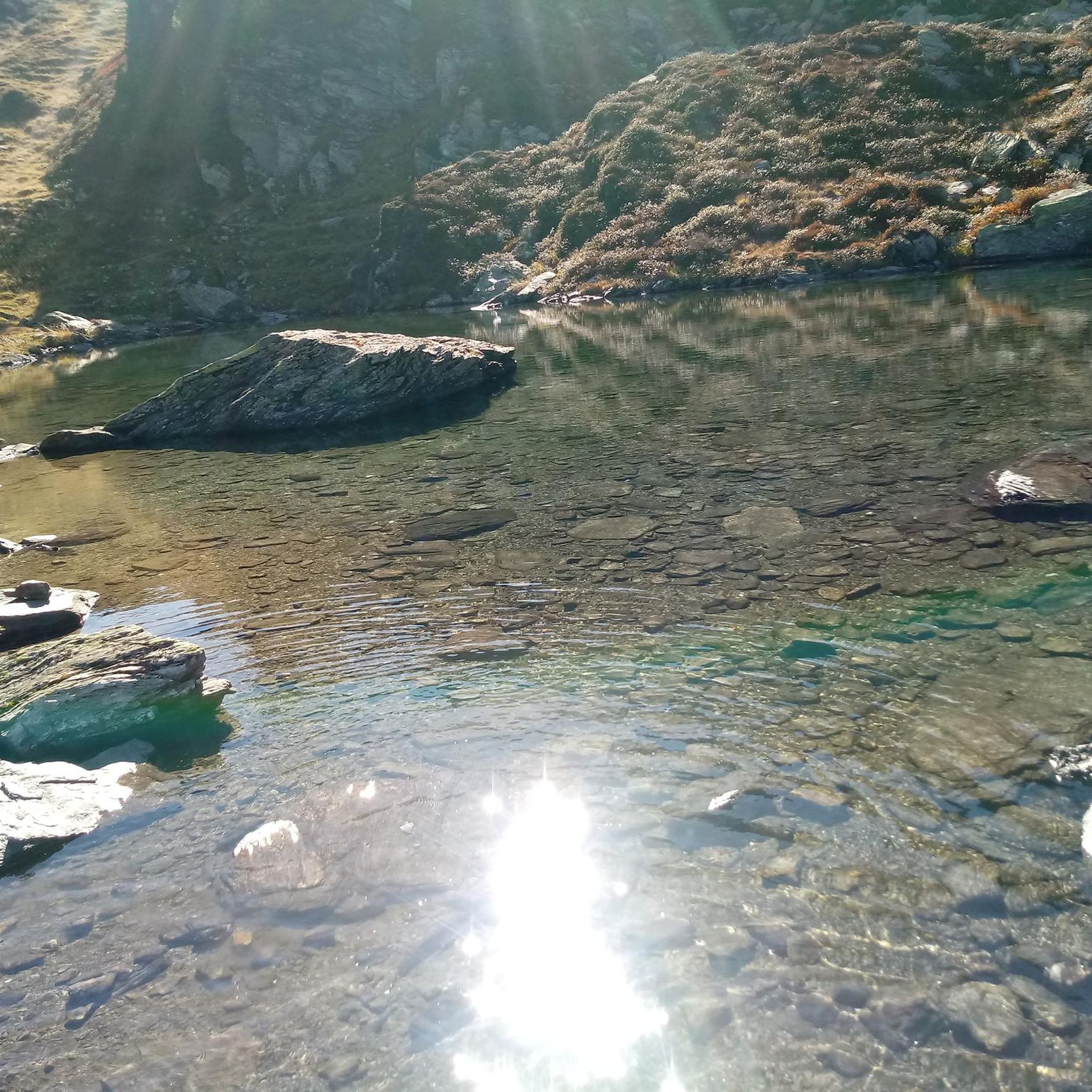
Lerderderg River, known by locals as "The Lerdy", has carved out a spectacular, 300-metre-deep Lerderderg Gorge over millions of years in this area. The river stretches 40 kilometres from the Blackwood Ranges, through the historic town of Blackwood, before joining the Werribee River at the Melton Reservoir.
0
0

The Lerderderg Gorge Track follows the river through one of the most rugged sections of the state park, weaving between steep ridgelines, rocky escarpments, and dense bushland deep inside the gorge. Around the Mackenzies Flat to Grahams Dam section, the track is easy to follow, with stepping stone river crossings, shaded forest, and regular access down to the riverbed and waterholes. Further into the gorge, the terrain becomes much steeper and more challenging, especially after rain.
0
0

This ridgeline opens onto exposed ground with expansive views across the gorge and surrounding bushland. The vantage point offers a strong sense of the valley’s scale and is a good spot to take a scenic break.
0
0

If you do the long loop from the Lerderderg Gorge car park (clockwise, crossing the river that no longer really exists at the weir), you come to a long, boring and steadily ascending road immediately after the weir, from which you then turn right onto this section. And it easily makes up for the section you have just walked. The path can only be found in parts with the help of Komoot navigation, it almost seems like a cross country hike, partly over rocky sections. At the end you stand on a small precipice and look down at the path to the car park - one last climb.
0
0
Frequently Asked Questions
What are the main hiking opportunities in the Lerderderg River Heritage River canyons?
The Lerderderg Gorge offers a range of hiking experiences. Popular options include the Lerderderg Gorge Circuit, an 8-kilometer moderate hike. You can also explore the River Trail in Lerderderg State Park, which features rocky sections and can feel like a cross-country hike. Another significant path is the Lerderderg Gorge Track, which follows the river through rugged terrain, especially challenging further into the gorge.
Are there challenging trails for experienced hikers in the Lerderderg River Heritage River canyons?
Yes, the Lerderderg Gorge provides challenging routes. The River Trail in Lerderderg State Park includes rocky sections and requires navigation. The Lerderderg Gorge Track becomes significantly steeper and more demanding deeper into the gorge, particularly after rain. More experienced hikers can also tackle longer sections of the Great Dividing Trail.
What natural features define the Lerderderg Gorge?
The Lerderderg Gorge is characterized by its deeply incised chasm, reaching up to 300 meters in depth with walls up to 400 meters high. Its geological formations of sandstone and slate reveal 500 million years of history, including internationally significant evidence of Permian glaciation. The rugged landscape features long, narrow ridges, steep spurs, numerous rock outcrops, and diverse vegetation ranging from dry stringybark-box forests to damper messmate and peppermint-gum forests.
Can I find historical sites within the Lerderderg River Heritage River canyons?
Yes, the canyons are rich in gold mining history. You can visit "The Tunnel," a historic diversion tunnel built between 1855 and 1870 by miners to access alluvial gold. Throughout the gorge, you'll also discover remnants of old water races, hand-dug trenches used to channel water to mining sites, offering a tangible connection to Victoria's gold rush era.
Are there family-friendly activities or walks in the Lerderderg River Heritage River?
Yes, areas like Mackenzies Flat and Grahams Dam are popular for families. Mackenzies Flat offers picnic spots and easy access to the river for swimming. Grahams Dam, easily accessible from Mackenzies Flat, features shallow pools and stepping-stone crossings, making it ideal for families. For family-friendly hikes, consider routes like "The Garden of St Erth loop from Blackwood" which is an easy 5.8 km walk, or the moderate "Werribee Gorge Circuit Walk" at 7.6 km. You can find more options in the Family-friendly hikes in Lerderderg River Heritage River guide.
When is the best time to visit the Lerderderg River Heritage River canyons?
The Lerderderg Gorge is enjoyable year-round, but conditions vary. During winter and spring, the Lerderderg River has substantial flow, creating excellent swimming spots. For hiking, spring and autumn offer milder temperatures, making longer treks more comfortable. Always check local weather conditions before your visit, as heavy rain can make some trails more challenging.
Where can I go swimming in the Lerderderg Gorge?
The Lerderderg River, which flows through the gorge, offers several popular swimming holes. "Harry's Hole," "Third Hole," and "The Pit" are well-known spots. Grahams Dam, easily accessible from Mackenzies Flat, also provides shallow pools suitable for swimming, especially for families. During winter and spring, the river flow is more substantial, enhancing the swimming experience.
Are there good viewpoints to appreciate the scale of the gorge?
Yes, the Ridgeline Lookout offers expansive views across the gorge and surrounding bushland. This vantage point provides a strong sense of the valley’s scale and is an excellent spot for a scenic break. O'Briens Crossing, located in the northern part of the park, also provides dramatic vantage points of the gorge.
What other outdoor activities are available near the Lerderderg River Heritage River canyons?
Beyond hiking, the region offers various outdoor activities. You can find several running trails, including the challenging "Strachan Hill loop from Mount Blackwood" (10 km) or easier options like the "Running loop from Rupert Vance Moon V.C. Reserve" (2.7 km). For cycling enthusiasts, there are routes like the "Bike loop from Truck Parking" (34.7 km, moderate). Explore more options in the Running Trails and Cycling in Lerderderg River Heritage River guides.
What wildlife can I expect to see in the Lerderderg River Heritage River canyons?
The Lerderderg Gorge's diverse ecosystems support a variety of wildlife. Visitors often spot native animals such as koalas, kangaroos, wallabies, and echidnas. The area is also home to numerous bird species, including majestic wedge-tailed eagles and lyrebirds, making it an excellent destination for nature observation.
What are some popular starting points for exploring the Lerderderg Gorge?
Mackenzies Flat is a popular and accessible starting point, offering picnic facilities and easy access to the river. From here, you can walk upstream to Grahams Dam. O'Briens Crossing, located in the northern part of the park, is another significant access point and picnic area, providing dramatic views and serving as a starting point for several walking tracks.
What should I know about the terrain and conditions when hiking in the Lerderderg Gorge?
The terrain in Lerderderg Gorge can be rugged and varied. While sections near Mackenzies Flat are relatively easy with stepping-stone river crossings, areas further into the gorge, particularly along the Lerderderg Gorge Track, become much steeper and more challenging. Some paths, like the River Trail in Lerderderg State Park, involve rocky sections and may require careful navigation. Conditions can change, especially after rain, making the terrain more difficult.
Most popular routes in Lerderderg River Heritage River
Most popular attractions in Lerderderg River Heritage River

Get inspired with the komoot mobile app


Explore more
Already discovered everything in this region? See additional gorges in Lerderderg River Heritage River for your next adventure:
