The best hikes from bus stations in Santa Fe National Forest
4.6
(164)
2,479
hikers
15
hikes
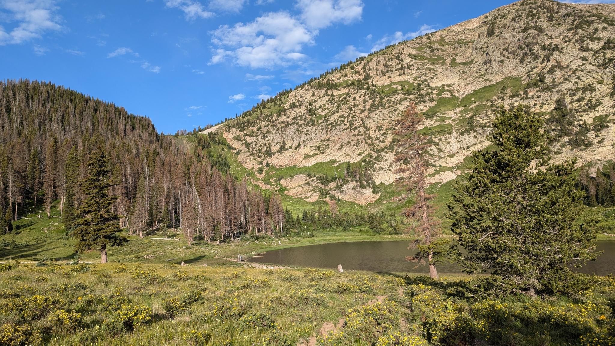
Bus station hiking trails in Santa Fe National Forest offer access to a diverse landscape characterized by high mountain ranges, dense forests, and varied ecosystems. The region encompasses elevations from 5,000 to 13,000 feet, featuring ponderosa pine forests, juniper groves, and alpine zones. Hikers can explore areas with significant portions of the Sangre de Cristo Mountains, along with rivers, streams, and volcanic formations. This varied terrain provides a range of hiking experiences for different skill levels.
Best bus station hiking…
Last updated: October 11, 2026
4.0
(2)
34
hikers
4.16km
01:19
170m
170m
Easy hike. Great for any fitness level. Easily-accessible paths. Suitable for all skill levels.
6
hikers
15.4km
04:55
660m
660m
Moderate hike. Good fitness required. Easily-accessible paths. Suitable for all skill levels.

4.0
(2)
8
hikers
Easy hike. Great for any fitness level. Easily-accessible paths. Suitable for all skill levels.
1.0
(1)
5
hikers
7.04km
01:57
130m
130m
Easy hike. Great for any fitness level. Easily-accessible paths. Suitable for all skill levels.
4.8
(15)
279
hikers
4.43km
01:12
70m
70m
Easy hike. Great for any fitness level. Easily-accessible paths. Suitable for all skill levels.
Get access to more routes and recommendations from other explorers.
Already have an account?
Our route recommendations are based on thousands of hikes, rides, and runs completed by other people on komoot.
Start today with a free account
Your next adventure awaits.


Other adventures in Santa Fe National Forest


Tips from the Community

This is the first trailhead (#183) on your left as you enter the the Santa Fe National Forest from Santa Fe. As you face the trailhead from the parking lot, the trail on the right is the steeper climb. The trail on the left is mostly not as steep. It's best, we think, to start on the right side.
0
0

The Borrego Trail is a nice way to connect the Winsor Trail to Hwy 475 and the Bear Wallow Trail. From the Windsor Trail, cross the creek on a bridge and continue upstream, beginning a long, challenging climb through a few switchbacks. After the switchbacks, you need to navigate some roots to reach the high point, but it's fairly straightforward for the intermediate rider. At the high point, a fast descent takes you to a valley with a junction on the right leading to Bear Wallow Trail 182, or you can head up a gradual climb to Hwy 475, providing an escape or access option.
0
0

If you appreciate a rocky terrain and varied slopes, Kinnikinnik Park is the perfect starting point for your adventure. This park serves as an excellent base to delve into Acid Canyon and the surrounding trail network.
0
0
The Acid Canyon Trail is a part of the popular Bridges Loop, a relatively easy mountain biking loop close to downtown Los Alamos, New Mexico. This trail has heavy foot traffic so be on the lookout for other trail users!
0
0
From this spot on the Graduation Canyon Trail you get fantastic views down Pueblo Canyon and out to the open desert. It's truly amazing how close to downtown Los Alamos this view point is - it's a testament to how unique this area is.
0
0
The Acid Canyon Trail is a popular hiking trail that can be either completed as a loop or connects you to other hiking trails in the area. Its easy access from downtown Los Alamos, its relatively gentle grade, and scenic nature makes it a great option for people of all ages and ability levels.
0
0
Ashley Pond Park, situated within the Manhattan Project National Historic Park, holds significant historical value in Los Alamos, New Mexico. Named after the founder of the Los Alamos Ranch School, Ashley Pond, the park was a focal point during the Manhattan Project (1943-1947). It housed military facilities and played a crucial role in scientific research. Today, the park is a peaceful space with picturesque views of the surrounding landscape, and features memorials and interpretive signs commemorating the Manhattan Project's scientific and historical contributions. There is also the Ice House, which stands as a memorial to the Los Alamos Ranch School days and Project Y, on the southern bank of the pond.
0
0
From this spot you get fantastic views down Pueblo Canyon. This is a great spot to sip some water, take a few photos, and admire your surroundings.
0
0
Frequently Asked Questions
How many hiking trails are accessible from bus stations in Santa Fe National Forest?
There are 14 hiking routes in Santa Fe National Forest that are accessible from bus stations. These trails offer a range of experiences, from easy walks to more moderate challenges, allowing you to explore the diverse landscapes of the region without needing a car.
Are there any easy, family-friendly trails accessible by bus?
Yes, several easy trails are accessible by bus and suitable for families. The Chamisa Trail loop from Blue Bus is an easy 4.2 km (2.6 mi) loop with gentle ascents, offering a pleasant walk through varied forest scenery. Another option is the Main Loop and Alcove House Trail, an easy 4.4 km (2.7 mi) route that provides a unique cultural experience at Bandelier National Monument, also reachable via shuttle from a bus stop.
Can I bring my dog on these bus-accessible trails?
Many trails in Santa Fe National Forest are dog-friendly, but it's always best to check specific regulations for each trail and wilderness area. Generally, dogs are permitted on leash. For example, the Borrego Trail – Chamisa Trail loop from Blue Bus is a popular option where dogs are often seen enjoying the outdoors with their owners. Always remember to pack out waste and keep your dog under control.
What kind of terrain and elevation can I expect on these trails?
The bus-accessible trails in Santa Fe National Forest offer varied terrain. You'll find paths through dense ponderosa pine forests, juniper groves, and open meadows. Elevations can range significantly. For instance, the Chamisa Trail loop has an elevation gain of about 170 meters (560 ft), while the longer Borrego Trail – Chamisa Trail loop involves a more substantial 660 meters (2,165 ft) of ascent, making it a moderate challenge.
Are there any circular routes accessible from bus stops?
Yes, there are several circular routes available. The Chamisa Trail loop from Blue Bus is a great example of an easy loop trail that brings you back to your starting point near a bus stop. The Borrego Trail – Chamisa Trail loop from Blue Bus also offers a longer, moderate circular option.
What interesting landmarks or natural features can I see along these trails?
Many trails offer access to the diverse natural beauty of Santa Fe National Forest. While specific bus routes might not reach the highest peaks, you can still experience beautiful forest scenery, varied ecosystems, and sometimes even views of distant mountains. For cultural landmarks, the Pueblo Dwellings – Bandelier National Monument loop from Shuttle Stop provides a unique opportunity to explore ancient cliff dwellings and archaeological sites.
Are there any waterfalls accessible near bus routes?
While the immediate bus-accessible trails might not lead directly to major waterfalls, the Santa Fe National Forest is home to beautiful cascades like Jemez Falls and Pecos Falls. You might need to combine bus travel with a short taxi ride or a longer hike to reach these specific natural attractions, as they are often deeper within the forest.
What is the best time of year to hike these bus-accessible trails?
The Santa Fe National Forest offers year-round hiking opportunities, but the best time largely depends on the elevation and your preferences. Spring and fall generally provide the most pleasant temperatures and vibrant scenery, with fall foliage being particularly stunning. Summer can be warm, so early morning hikes are recommended. Winter hiking is possible, especially on lower elevation trails, but always check weather conditions and trail accessibility for snow and ice.
What do other hikers enjoy most about hiking in Santa Fe National Forest?
The area is highly rated by the komoot community, with an average score of 4.5 stars. Reviewers often praise the diverse landscapes, from dense forests to open meadows, and the opportunity to experience the region's natural beauty. Many appreciate the well-maintained trails and the sense of tranquility found in the forest.
Are there any amenities or facilities near the bus stops or trailheads?
Amenities vary depending on the specific bus stop and trailhead. Areas like Hyde Memorial State Park or Ski Santa Fe (which are served by the NCRTD 255 Mountain Trail Route) may offer restrooms, picnic areas, or even small shops. For trails closer to Santa Fe city, you'll find a wider range of cafes, restaurants, and other facilities within a short distance of the bus routes.
Do I need any permits for hiking in Santa Fe National Forest?
Generally, day hiking in Santa Fe National Forest does not require a permit. However, specific activities like overnight backpacking in wilderness areas or certain recreational uses might require permits or fees. Always check with the U.S. Forest Service for the most current regulations before your trip. You can find more general information about the region at nationalparktraveling.com.
Most popular routes in Santa Fe National Forest
Most popular attractions in Santa Fe National Forest

Get inspired with the komoot mobile app


Explore more
Browse the best Hikes in other regions.
