The best city hikes and walks in Santa Fe National Forest
4.5
(149)
2,259
hikers
24
hikes
If you've ever tried to plan hiking in Santa Fe National Forest, you know how quickly the sheer number of options can become overwhelming. With so many trails spanning such a vast and varied landscape, it's tough to tell which routes are genuinely worth your precious time and effort, and which are just filler. We get it – you want the highlights, not the guesswork.
That's where komoot comes in. Our community has explored, mapped, and reviewed countless routes here,…
Last updated: May 11, 2026
12
hikers
7.79km
02:07
100m
130m
The Canyon Rim Trail is a fantastic moderate hike that delivers consistent, sweeping views along a dramatic canyon edge. You'll traverse varied terrain, enjoying the open air and the feeling…
Step back in time on the Los Alamos and the Manhattan Project National Historical Park Walking Tour, an easy 1.5-mile (2.4 km) route that guides you through the historic heart…

3.28km
00:55
60m
60m
The Acid Canyon Loop offers a refreshing, accessible hike through diverse terrain just minutes from downtown Los Alamos. You'll navigate a mix of bedrock fire road and natural paths, winding…
4.25km
01:07
30m
20m
The Santa Fe River Trail offers a delightful urban escape, following a paved, multi-use greenway through the heart of Santa Fe. While the river can sometimes be dry, community efforts…
1
hikers
18.1km
04:43
120m
150m
The Arroyo de los Chamisos Trail offers a unique blend of urban accessibility and natural beauty right in Santa Fe. You'll find yourself following a charming chamisa-lined arroyo, with glimpses…
Get access to more routes and recommendations from other explorers.
Already have an account?
Our route recommendations are based on thousands of hikes, rides, and runs completed by other people on komoot.
Start today with a free account
Your next adventure awaits.
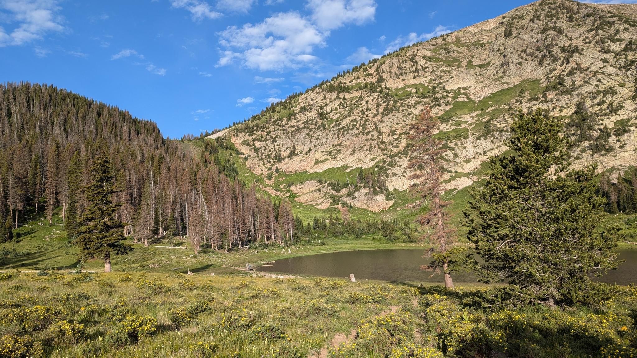


Other adventures in Santa Fe National Forest


Tips from the Community

The Acid Canyon Trail is a popular hiking trail that can be either completed as a loop or connects you to other hiking trails in the area. Its easy access from downtown Los Alamos, its relatively gentle grade, and scenic nature makes it a great option for people of all ages and ability levels.
0
0
In wartime Los Alamos, the scarcity of houses with amenities like bathtubs made them a luxury reserved for the highest-ranking Manhattan Project leaders. Originally constructed by the Los Alamos Ranch School, these well-built homes on what became known as Bathtub Row were initially intended for faculty and special events. When the Manhattan Project acquired the school property, figures such as Dr. J. Robert Oppenheimer and Hans Bethe made these houses their homes. In contrast to the hastily constructed, amenity-limited housing for most project workers, Bathtub Row became synonymous with privilege, as its homes were among the few with coveted bathtubs, earning the street its unique nickname.
0
0
Just across from the Los Alamos History Museum, there is an Ancestral Pueblo Dwelling that offers visitors insight into ancient indigenous Pueblo people cultural practices. Next to the dwelling is the Romero Cabin, which reflects the town's more recent history and early Spanish and American settlers' lifestyle. Together, these sites contribute to the museum's mission of interpreting the diverse history of the Pajarito Plateau, providing visitors with a comprehensive understanding of the cultural and historical layers that shape Los Alamos.
0
0
The Oppenheimer House, part of the Manhattan Project National Historical Park in Los Alamos, New Mexico, holds historical significance as the former residence of J. Robert Oppenheimer, the scientific director of the Manhattan Project. Built in 1940, Oppenheimer with his wife Kitty, daughter Toni, and son Peter lived in this this modest dwelling from 1943-1945. Visitors can explore the house, now a museum, to learn about Oppenheimer's life and the intense scientific efforts that took place in the creation of the world's first atomic bomb.
0
0
The Bradbury Science Museum, located in Los Alamos, New Mexico, is dedicated to showcasing the scientific and technological contributions of Los Alamos National Laboratory, particularly during the Manhattan Project. Named after the laboratory's second director, Dr. Norris E. Bradbury, the museum offers an immersive experience, featuring exhibits on nuclear science, physics, and the history of Los Alamos. Visitors can explore interactive displays, models, and artifacts, and learn about the laboratory's role in developing nuclear weapons and its ongoing contributions to various scientific fields. The museum aims to educate the public on the laboratory's research and its impact on national security and scientific advancements. Admission is free for visitors of all ages.
0
0
Ashley Pond Park, situated within the Manhattan Project National Historic Park, holds significant historical value in Los Alamos, New Mexico. Named after the founder of the Los Alamos Ranch School, Ashley Pond, the park was a focal point during the Manhattan Project (1943-1947). It housed military facilities and played a crucial role in scientific research. Today, the park is a peaceful space with picturesque views of the surrounding landscape, and features memorials and interpretive signs commemorating the Manhattan Project's scientific and historical contributions. There is also the Ice House, which stands as a memorial to the Los Alamos Ranch School days and Project Y, on the southern bank of the pond.
0
0
The Los Alamos History Museum, managed by the Los Alamos Historical Society, is in the oldest continually occupied structure in downtown Los Alamos. The building was initially built as an infirmary in 1918 and later served as a guest cottage for the Los Alamos Ranch School. During the Manhattan Project, it hosted General Leslie R. Groves. Now an award-winning museum, it offers a comprehensive exploration of the region's history, featuring exhibits on geology, anthropology, the Ranch School, and the Manhattan Project. Visitors can enjoy guided tours offering insights from ancient Puebloan ruins to the homestead-era Romero cabin (both located across from the museum) through 20th-century physics giants. Tickets are available for guided tours, with reservations recommended due to popularity. The museum itself is self-guided, and special programs are available for kids. Additionally, during the summer and fall, daily guided tours are available Monday–Friday at 10:00 a.m. and 1:30 p.m., with a Saturday tour at 11:00 a.m. The Winter Tour Schedule starting Nov. 6, 2023, includes one tour per day at 11:00 a.m., Monday-Saturday.
0
0
Los Alamos, New Mexico, holds a significant place in history as the site of the top-secret Manhattan Project during World War II, where scientists developed the atomic bomb. Established in 1943, the Los Alamos National Laboratory remains a key center for scientific research. Beyond its historical importance, Los Alamos offers diverse outdoor recreational opportunities. The surrounding landscape features the stunning Bandelier National Monument, known for its ancient Pueblo dwellings and scenic canyons. The nearby Valles Caldera National Preserve offers opportunities for fishing, wildlife viewing, and exploring the remnants of a massive volcanic crater.
0
0
Frequently Asked Questions
How many urban hiking trails are available in Santa Fe National Forest?
You'll find over 20 urban hiking trails within the Santa Fe National Forest area. These routes offer a variety of experiences, from easy strolls to more moderate excursions, allowing you to explore the natural beauty close to the city.
What kind of natural features can I expect to see on urban hikes here?
Urban hikes in this region often feature diverse landscapes, including river paths, canyon rims, and trails through ponderosa pine forests. You might encounter areas with volcanic formations or enjoy views of the surrounding mountains. For example, the Canyon Rim Trail offers scenic vistas, while the Santa Fe River Trail follows the river.
Are there any interesting historical or scenic landmarks along these urban trails?
Yes, several urban trails offer access to points of interest. For instance, the Los Alamos and the Manhattan Project National Historical Park Walking Tour combines history with an urban walk. While not directly on urban trails, the broader Santa Fe National Forest area is rich with attractions like Picacho Peak for summit views or the relaxing Spence Hot Springs, accessible via a short hike.
What is the best time of year for urban hiking in Santa Fe National Forest?
The Santa Fe National Forest offers year-round access to trails. Lower elevation urban trails are often accessible even when higher mountain paths are snow-covered. Spring and fall provide pleasant temperatures and vibrant scenery, while summer is great for early morning or late afternoon hikes. Winter can offer unique, quiet experiences on accessible routes.
Are the urban trails in Santa Fe National Forest suitable for families with children?
Many urban trails in the Santa Fe National Forest are suitable for families. There are 15 easy routes available, perfect for shorter outings with children. Trails like the Acid Canyon Loop offer manageable distances and gentle elevation changes, making them enjoyable for all ages.
Can I bring my dog on urban hikes in this area?
Generally, dogs are welcome on many trails within the Santa Fe National Forest, including urban routes. However, it's always best to keep them on a leash and check for any specific restrictions at trailheads or on park signage. Please remember to pack out all waste to keep the trails clean for everyone.
What are the difficulty levels of the urban hikes in Santa Fe National Forest?
The urban hikes in Santa Fe National Forest range from easy to moderate. You'll find 15 easy routes, which are generally shorter with minimal elevation gain, and 5 moderate routes, which might involve longer distances or slightly more varied terrain. There are no difficult urban trails listed in this guide.
Where can I find parking for urban hiking trailheads?
Parking availability varies by trailhead. Many urban trailheads, especially those closer to developed areas, offer designated parking lots. For trails like the Santa Fe River Trail or those in Los Alamos, you'll typically find street parking or small lots nearby. It's advisable to check specific route details for parking information before you go.
Do I need a permit to hike the urban trails in Santa Fe National Forest?
For general day hiking on most urban trails within the Santa Fe National Forest, a permit is typically not required. However, if you plan to enter specific wilderness areas or engage in certain activities like overnight camping, different regulations may apply. It's always a good idea to check the official Santa Fe National Forest website for the most current information.
What do other hikers enjoy most about urban hiking in Santa Fe National Forest?
The area is highly rated by the komoot community, with an average score of 4.46 stars. Reviewers often praise the accessibility of these trails, the blend of natural beauty with urban convenience, and the opportunity to experience the unique landscapes of New Mexico without venturing far from town. The variety of easy and moderate paths also makes it appealing to a wide range of hikers.
Are there any urban trails that follow a river or stream?
Yes, you can find urban trails that follow waterways. The Santa Fe River Trail is a prime example, offering a pleasant walk alongside the Santa Fe River. These routes provide a refreshing experience and often feature lush riparian vegetation.
Can I find urban trails that offer views of the city?
While this guide focuses on trails within the Santa Fe National Forest, some routes, particularly those on higher ground or at the forest's edge, may offer glimpses of the city. The Atalaya Trail (#170), mentioned in regional research, is known for dramatic views of Santa Fe after a significant climb, though it's a more strenuous option than typical urban hikes.
Most popular routes in Santa Fe National Forest
Most popular attractions in Santa Fe National Forest

Get inspired with the komoot mobile app


Explore more
Browse the best Hikes in other regions.
